El Camino Real | |
---|---|
The Royal Road | |
Location | |
Country | United States |
State | California |
Counties |
|
Highway system | |
Reference no. | 784 [1] [2] |
El Camino Real (Spanish; literally The Royal Road, often translated as The King's Highway) is a 600-mile (965-kilometer) commemorative route connecting the 21 Spanish missions in California (formerly the region Alta California in the Spanish Empire), along with a number of sub-missions, four presidios, and three pueblos. Historically associated with the Calle Real which terminates in Mexico City, as the former capital of New Spain and the seat of royal power for Las Californias (hence "Real"), its southern end in the modern U.S. state of California is at Mission San Diego de Alcalá and its northern terminus is at Mission San Francisco Solano.
The name was revived in the American era in connection with the boosterism associated with the Mission Revival movement of the early 20th century. Streets throughout California bear the "El Camino Real" name. The route has been continually upgraded and is decorated with Commemorative bell markers.
In earlier Spanish colonial times, any road under the direct jurisdiction of the Spanish crown and its viceroys was considered to be a camino real. Examples of such roads ran between principal settlements throughout Spain and its colonies such as New Spain. [3] Most caminos reales had names apart from the appended camino real. The original route begins in Baja California Sur, Mexico, at the site of Misión de Nuestra Señora de Loreto Conchó, present day Loreto, (the first mission successfully established in Las Californias). [4] [ citation needed ]
The Portolá expedition of 1769 included Franciscan missionaries, led by Junípero Serra. Starting from Loreto, Serra established the first of the 21 missions at San Diego. Serra stayed at San Diego and Juan Crespí continued the rest of the way with Gaspar de Portolá. Proceeding north, Portolá followed the coastline (today's California State Route 1), except where forced inland by coastal cliffs.
Eventually, the expedition was prevented from going farther north by the entrance to San Francisco Bay, the Golden Gate. Crespí identified several future mission sites which were not developed until later. On the return trip to San Diego, Gaspar de Portolá found a shorter detour around one stretch of coastal cliffs via Conejo Valley.[ citation needed ]
Portolá journeyed again from San Diego to Monterey in 1770, where Junipero Serra (who traveled by ship) founded the second mission (later moved a short distance south to Carmel). Carmel became Serra's Alta California mission headquarters.
The Juan Bautista de Anza expedition of (1775–76) entered Alta California from the southeast (crossing the Colorado River near today's Yuma, Arizona), and picked up Portolá's trail at Mission San Gabriel. De Anza's scouts found easier traveling in several inland valleys, rather than staying on the rugged coast. On his journey north, de Anza traveled the San Fernando Valley and Salinas Valley. After detouring to the coast to visit the Presidio of Monterey, de Anza went inland again, following the Santa Clara Valley to the southern end of San Francisco Bay and on up the east side of the San Francisco Peninsula.
Between 1683 and 1835, Jesuit and Franciscan missionaries established a series of religious outposts from today's Baja California and Baja California Sur into present-day California. Heavy freight and long-distance passenger movement was practical only via ships by a coastal water route. [4]
To facilitate overland travel, mission settlements were approximately 30 miles (48 kilometers) apart, so that they were separated by one long day's ride[ citation needed ] on horseback along the 600-mile (966-kilometer) long El Camino Real (Spanish for "The Royal Highway," though often referred to in the later embellished English translation, "The King's Highway"), and also known as the California Mission Trail. Tradition has it that the padres sprinkled mustard seeds along the trail to mark the windings of the trail's northward progress with bright yellow flowers, creating a golden trail stretching from San Diego to Sonoma. [5] [6]
Valuable seeds were brought to California also marking the Camino Real de Tierra Adentro with trees for different uses. For example, ash trees were the marker for where a spring was to be found, as seen to this day at the church of Nuestra Señora del Tránsito in Fresnillo, Zacatecas.[ citation needed ]
By the mid-nineteenth century, when California became a state, the route had been improved in certain sections, but was wholly inadequate for large stagecoaches and freight wagons. [7] : 52 In 1892, Anna Pitcher of Pasadena, California initiated an effort to establish a commemorate route which was adopted by the California Federation of Women's Clubs in 1902. [8] In the early twentieth century, organizations and government agencies became interested in creating official designations or commemorations of roads and highways. Given the lack of standardized highway signs at the time, it was decided to place distinctive bells along the route, hung on supports in the form of an 11-foot (3.4 m) high shepherd's crook, also described as "a Franciscan walking stick". The bells were designed by Mrs ASC Forbes, who also owned the California Bell Company where they were cast. [9] [10] The first of 450 bells were unveiled on August 15, 1906, at the Plaza Church in the Pueblo near Olvera Street in Los Angeles. [11]
A 1915 map produced by the Automobile Club of Southern California traced the route that connected the missions for motorists to follow. [3] The club and associated groups cared for the bells from the mid-1920s through 1931 after the original organization which installed the bells fragmented. Distinctive route markers were added to U.S. Route 101 and other national auto trails when the joint board of state highway officials adopted the United States Numbered Highway System in 1926. [12] The state highways forming El Camino Real were identified as Highway 1, U.S. Route 101 and Highway 82 on the San Francisco Peninsula in a 1959 law. [13] Most of the bells eventually disappeared due to vandalism, theft or simple loss due to the relocation or rerouting of highways and roads. [14] The State took over bell maintenance in 1933. [15] After a reduction in the number of bells to around 80, the State began replacing them, at first with concrete, and later with iron. [16] Justin Kramer took over the production of the bells in 1959. [15] The California Department of Transportation (Caltrans) began a restoration effort in 1996.
Keith Robinson, Principal Landscape Architect at Caltrans developed an El Camino Real restoration program which resulted in the installation of 555 El Camino Real Bell Markers in 2005. The Bell Marker consists of a 460 mm diameter cast metal bell set atop a 75 mm diameter Schedule 40 pipe column that is attached to a concrete foundation using anchor rods. The original 1906 bell molds were used to fabricate the replacement bells. [17] The bells are most typically marked 1769 & 1906, and include a designer's copyright notice. [11] The two dates represent the date of the founding of the first Alta-California mission in San Diego, and the date of the setting of the first commemorative bell-marker, respectively. [18] In 1997, the California Federation of Women's Clubs, in conjunction with California State Automobile Association, developed a restoration project as part of CalTrans "Adopt-a-Highway" program. [15] Permits issued by Caltrans for installations along state routes have detailed specifications on how the bell should be set up for safety and legal considerations. [13]
For some indigenous populations, the bells are painful symbols of the dehumanization of their ancestors, together with the domination and erasure of their culture. [19] The Amah Mutsun tribal band shared with local authorities how the bells represent historical injustices and oppression of their people. [20] In response, a bell at the University of California, Santa Cruz was removed by campus officials in June 2019. [21] The issue was also present when the statues of Junípero Serra were damaged and/or removed in 2020 during the George Floyd protests which expanded to include monuments of individuals associated with the controversy over the genocide of indigenous peoples in the Americas. The historical preservation commission of Santa Cruz reported to the city council in November 2020 that the bells represent a painful history for the indigenous people of the city, and noted that a bell in Mission Park Plaza had been stolen in 1999 and not replaced. [22] Santa Cruz scheduled the removal of the last bell in the city, at the intersection of Soquel and Dakota avenues, for August 28, 2021, but the bell was stolen the night before it was to be removed. The Tribal Band, an organization of local tribes, led a ceremony to mark the occasion in spite of the theft. [23]
Several modern highways include parts of the commemorative route, though large sections are on city streets (for instance, most of the stretch between San Jose and San Francisco). The full route as defined by the California State Legislature is as follows: [24] [25] [ better source needed ]
Destinations | Notes |
---|---|
Interstate 5 | U.S.-Mexico border to Anaheim |
Anaheim Boulevard, Harbor Boulevard, State Route 72 and Whittier Boulevard | Anaheim to Whittier |
| Whittier to Los Angeles |
U.S. Route 101 | Los Angeles to San Jose |
State Route 87 | within San Jose |
State Route 82 | San Jose to San Francisco |
Interstate 280 | San Francisco |
U.S. Route 101 | San Francisco to Novato |
State Route 37 | Novato to Sears Point |
State Route 121 | Sears Point to Sonoma |
State Route 12 | Sonoma |
Destinations | Notes |
---|---|
State Route 87 | within San Jose |
State Route 92 | San Jose to Fremont |
State Route 238 | Fremont to Hayward |
State Route 185 | Hayward to Oakland |
State Route 123 | Oakland to San Pablo (continued to Martinez) |
Some older local roads that parallel these routes also have the name. Mission Street in San Francisco does correspond to the commemorative route. An unpaved stretch of the old road has been preserved just east of Mission San Juan Bautista; this section of road runs parallel to the San Andreas Fault, which can be clearly seen where the ground drops several feet.[ citation needed ] Many streets throughout California bear the name of the road, often with scant relation to the original.
A section of the old mission road, El Camino Real fronts the Rios-Caledonia Adobe in San Miguel. This road served stagecoaches and then was paved as part of the original US 101 highway.[ citation needed ]
The route through San Mateo and Santa Clara counties is designated as State Route 82, [26] and some stretches of it are named El Camino Real. The old road is part of the de Anza route, located a few miles east of Route 101.[ citation needed ]
El Camino Real is designated as California Historical Landmark #784. There are two state historical markers honoring the road: one located near Mission San Diego de Alcalá in San Diego [1] and the other one near Mission San Francisco de Asís in San Francisco. [2]
Juan Bautista de Anza Bezerra Nieto was an expeditionary leader, military officer, and politician primarily in California and New Mexico under the Spanish Empire. He is credited as one of the founding fathers of Spanish California and served as an official within New Spain as Governor of the province of New Mexico.
Mission San Antonio de Padua is a Spanish mission established by the Franciscan order in present-day Monterey County, California, near the present-day town of Jolon. Founded on July 14, 1771, it was the third mission founded in Alta California by Father Presidente Junípero Serra. The mission was the first use of fired tile roofing in Upper California. Today the mission is a parish church of the Diocese of Monterey and is no longer active in the mission work which it was set up to provide.
Gaspar de Portolá y Rovira was a Spanish military officer, best known for leading the Portolá expedition into California and for serving as the first Governor of the Californias. His expedition laid the foundations of important Californian cities like San Diego and Monterey, and bestowed names to geographic features throughout California, many of which are still in use.
El Camino Real may refer to:
State Route 82 is a state highway in the U.S. state of California that runs from Interstate 880 (I-880) in San Jose to I-280 in San Francisco following the San Francisco Peninsula. It is the spinal arterial road of the peninsula and runs parallel to the nearby Caltrain line along much of the route. For much of its length, the highway is named El Camino Real and formed part of the historic El Camino Real mission trail. It passes through and near the historic downtowns of many Peninsula cities, including Burlingame, San Mateo, Redwood City, Menlo Park, Palo Alto, Mountain View, and Sunnyvale, and through some of the most walkable and transit-oriented neighborhoods in the region.
Francisco Hermenegildo Tomás GarcésO.F.M. was a Spanish Franciscan friar who served as a missionary and explorer in the colonial Viceroyalty of New Spain. He explored much of the southwestern region of North America, including present day Sonora and Baja California in Mexico, and the U.S. states of Arizona and California. He was killed along with his companion friars during an uprising by the Native American population, and they have been declared martyrs for the faith by the Catholic Church. The cause for his canonization was opened by the Church.
Pedro Fages (1734–1794) was a Spanish soldier, explorer, first Lieutenant Governor of the province of the Californias under Gaspar de Portolá. Fages claimed the governorship after Portolá's departure, acting as governor in opposition to the official governor Felipe de Barri, and later served officially as fifth (1782–91) Governor of the Californias.
The Portolá expedition was a Spanish voyage of exploration in 1769–1770 that was the first recorded European exploration of the interior of the present-day California. It was led by Gaspar de Portolá, governor of Las Californias, the Spanish colonial province that included California, Baja California, and other parts of present-day Mexico and the United States. The expedition led to the founding of Alta California and contributed to the solidification of Spanish territorial claims in the disputed and unexplored regions along the Pacific coast of North America.
U.S. Route 101 (US 101) is a major north–south United States Numbered Highway, stretching from Los Angeles, California, to Tumwater, Washington. The California portion of US 101 is one of the last remaining and longest U.S. Routes still active in the state, and the longest highway of any kind in California. US 101 was also one of the original national routes established in 1926. Significant portions of US 101 between the Los Angeles area and the San Francisco Bay Area follow El Camino Real, the commemorative route connecting the former Alta California's 21 missions.
Sierra Highway or El Camino Sierra is a road in Southern California, United States. El Camino Sierra refers to the full length of a trail formed in the 19th century, rebuilt as highways in the early 20th century, that ran from Los Angeles to Lake Tahoe following parts of modern State Route 14, U.S. Route 395 and State Route 89. Two portions of this road are currently signed as Sierra Highway. The first is an old alignment of SR 14/U.S. Route 6 from Los Angeles to Mojave. This road is also signed with the unusual designation of State Route 14U through the city of Santa Clarita. The second part signed as Sierra Highway is a portion of US 395 in Bishop.
Fernando Javier Rivera y Moncada was a Mexican-born soldier of the Spanish Empire who served in The Californias, the far north-western frontier of New Spain. He participated in several early overland explorations and later served as third Governor of The Californias, from 1774 to 1777.
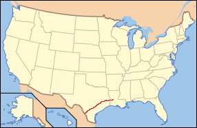
The El Camino Real de los Tejas National Historic Trail is a national historic trail covering the U.S. section of El Camino Real de Los Tejas, a thoroughfare from the 18th-century Spanish colonial era in Spanish Texas, instrumental in the settlement, development, and history of Texas. The National Park Service designated El Camino Real de los Tejas National Historic Trail as a unit in the National Trails System in 2004.
There are 34 routes assigned to the "S" zone of the California Route Marker Program, which designates county routes in California. The "S" zone includes county highways in Imperial, Orange, Riverside, San Diego, and Santa Barbara counties.
Southern Emigrant Trail, also known as the Gila Trail, the Kearny Trail, Southern Trail and the Butterfield Stage Trail, was a major land route for immigration into California from the eastern United States that followed the Santa Fe Trail to New Mexico during the California Gold Rush. Unlike the more northern routes, pioneer wagons could travel year round, mountain passes not being blocked by snows; however, it had the disadvantage of summer heat and lack of water in the desert regions through which it passed in New Mexico Territory and the Colorado Desert of California. Subsequently, it was a route of travel and commerce between the eastern United States and California. Many herds of cattle and sheep were driven along this route and it was followed by the San Antonio-San Diego Mail Line in 1857–1858 and then the Butterfield Overland Mail from 1858 to 1861.
This timeline of the Portolá expedition tracks the progress during 1769 and 1770 of the first European exploration-by-land of north-western coastal areas in what became Las Californias, a province of Spanish colonial New Spain. Later, the region was administratively-split into Baja and Alta. The first section of the march was on the Baja California peninsula, and the northern section of the expedition's trail was in today's US state of California.
The Portolá Trail Campsite or Portolá Trail Campsite No. 1 is the spot of the first Europeans to travel and camp overnight in what is now Central Los Angeles, California. The Portolá expedition camped at the site on August 2, 1769. The Portolá Trail Campsite No. 1 was designated a California Historic Landmark (No.655) on Sept. 26, 1958. The Portolá Trail Campsite is located in what is now the Elysian Park entrance, at the NW corner of North Broadway and Elysian Park Drive in the City of Los Angeles in Los Angeles County. The campsite is near the Los Angeles River, which they used as their water supply for the camp. Military officer Gaspar de Portolá was the commander of the expedition for the Spanish Empire with the goal of the Spanish colonization of the Americas. The expedition led to the founding of the first mission in the Los Angeles Basin, the Mission Vieja, on September 8, 1771, and of Alta California. The expedition arrived at Portolá Trail Campsite No. 1 from the San Gabriel Valley, were the Mission San Gabriel would be built later in 1776. As they depart Portolá Trail Campsite No. 1 they traveled west towards Santa Monica Bay, stopping at Portolá Trail Campsite 2, which is in present-day Beverly Hills. Portolá Trail Campsite 2 is also a California Historic Landmark (No.665). At San Monica Bay the expedition turned and traveled north to were the future Mission San Fernando would be built in 1797. Form San Fernando the expedition turned west to Ventura, the site of the future Mission San Buenaventura built in 1782.
The Portolá Trail Campsite 2 or Portolá Trail Campsite No. 2 is the spot of the first Europeans to travel and camp overnight in what is now Beverly Hills, California. The Portolá expedition camped at the site on August 3, 1769. The Portolá Trail Campsite No. 2 was designated a California Historic Landmark (No.665) on Nov. 5, 1958. The Portolá Trail Campsite is located in what is now 325 South La Cienega Boulevard between Olympic Boulevard and Gregory, in Beverly Hills. in Los Angeles County. Military officer Gaspar de Portolá was the commander of the expedition for the Spanish Empire with the goal of the Spanish colonization of the Americas. The expedition led to the founding of the first mission in the Los Angeles Basin, the Mission Vieja, on September 8, 1771, and of Alta California. The expedition arrived at Portolá Trail Campsite No. 2 from the Portolá Trail Campsite No. 1 in what is now Elysian Park. They came to camp site 1 from the San Gabriel Valley, were the Mission San Gabriel would be built later in 1776. As they depart Portolá Trail Campsite No. 2 they traveled west towards Santa Monica Bay. At San Monica Bay the expedition turned and traveled north to were the future Mission San Fernando would be built in 1797. Form San Fernando the expedition turned west to Ventura, the site of the future Mission San Buenaventura built in 1782.
Cuesta Pass or La Cuesta Pass, colloquially referred to as simply the grade, is a low mountain pass in San Luis Obispo County on California's Central Coast. It crosses the southern Santa Lucia Range at an altitude of 1,522 feet (464 m), and connects San Luis Obispo, roughly 5 miles (8.0 km) to the south, with Atascadero, Paso Robles, and the Salinas Valley to the north. It is traversed by U.S. Route 101 and the Coast Line of the Union Pacific Railroad, and is better known for the long slope up to the pass from San Luis Obispo, in the canyon of San Luis Obispo Creek, which is redundantly named the "Cuesta Grade".
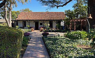
The Santa Clara Women's Club Adobe, also known as the Santa Clara Woman's Club, is a historic adobe structure in Santa Clara, California, dating back to 1880. Its construction can be attributed to the efforts of Franciscan padres from Mission Santa Clara de Asís. This adobe house, one of the oldest in the Santa Clara Valley, was part of a series of homes built between 1792 and 1800 to provide housing for Native American families associated with Mission Santa Clara. In 1913, the Santa Clara Woman's Club purchased the adobe structure. California Historical Landmark plaque #249 now marks the location of the Santa Clara Women's Club Adobe.
Original and current manufacturer of the El Camino Real bells