Englewood, Ohio

Last updated

Englewood, Ohio
Englewoodgov.JPG
City Hall
Montgomery County Ohio incorporated and unincorporated areas Englewood highlighted.svg
Location in Montgomery County and the state of Ohio.
Coordinates: 39°52′20″N84°18′32″W / 39.87222°N 84.30889°W / 39.87222; -84.30889
Country United States
State Ohio
County Montgomery
FoundedMay 6, 1841 (as Harrisburg)
Named"Iamton" February 8, 1870
"Englewood" July 11, 1899
IncorporatedMay 15, 1914
Government
  TypeCouncil-Mayor
   Mayor Thomas Franz (D) (Elected in 2019)
Area
[1]
  Total6.60 sq mi (17.10 km2)
  Land6.56 sq mi (16.99 km2)
  Water0.04 sq mi (0.11 km2)
Elevation
[2]
958 ft (292 m)
Population
 (2020)
  Total13,463
  Density2,052.29/sq mi (792.36/km2)
Time zone UTC-5 (EST)
  Summer (DST) UTC-4 (EDT)
ZIP codes
45315, 45322
Area code(s) 937, 326
FIPS code 39-25396 [3]
GNIS feature ID2394692 [2]
Website www.englewood.oh.us

Englewood is a city in Montgomery County, Ohio, United States. The population was 13,463 at the 2020 census. A northern suburb of Dayton, it is part of the Dayton metropolitan area.

Contents

History

Although Englewood was not actually founded until 1841, many early settlers began to come to the area known as Randolph Township around 1800. Earliest settlers were the families of David Hoover, David Mast, Daniel Hoover, Robert Ewing, John and Abraham McClintock, John Rench, Martin Sheets, Jacob Smith, Daniel and Peter Fetters. Also among the early settlers were the families of the Ellers, Fouts, Frantzs, Wertzs and the Brumbaughs. [4]

The early settlers made their living basically from agriculture. They shipped grain and bacon down the Stillwater River on flat bottom boats to Dayton and as far south as New Orleans. There was also a considerable amount of industry, including saw mills, gun smithing, wine distilling and pottery manufacturing. [4]

There were many Native Americans in the area in the early days that traded with the settlers. There was also an abundance of wildlife which afforded good hunting for the settlers’ food requirements.[ citation needed ]

Following primarily the path traced through this area by the Stillwater River, a group of settlers founded what is now the City of Englewood on May 6, 1841. These pioneers included Mathias Gish, Daniel Rasor and Samuel Herr. Some of these settlers came from the area around Harrisburg, Pennsylvania, and thus named the community Harrisburg. Other residents came from Randolph County, North Carolina, and named this township accordingly. [4]

Harrisburg's first post office was opened on February 8, 1870, and discontinued on February 6, 1871. The post office was re-established on May 8, 1874, and the first postmaster was Harvey Iams. The town was then renamed Iamton. However, at that time the capital letters I and J were the same in the alphabet and the town became known as Jamton. [4]

In 1898, the local businessmen conducted a contest to choose a new name for the town. The name Englewood was chosen as the winner of that contest and the town of Jamton was renamed Englewood. The Village of Englewood was incorporated on May 15, 1914, and Jacob Hoover was the first mayor. The population had risen to 415 by 1930 and over 600 by 1940. [4] Englewood became a city in 1971.

Natural gas was made available to the area in 1934, the first water works was built in 1936 and the original sewer system was completed in 1940.

Geography

The city is situated along the Stillwater River, bordering the cities of Clayton, Union, and Butler Township. Interstate 70 and the National Road (U.S. Route 40) intersect Ohio State Route 48 within Englewood's boundaries.

According to the United States Census Bureau, the city has a total area of 6.59 square miles (17.07 km2), of which 6.55 square miles (16.96 km2) is land and 0.04 square miles (0.10 km2) is water. [5]

Demographics

Historical population
CensusPop.Note
1920 351
1930 41518.2%
1940 53128.0%
1950 67827.7%
1960 1,515123.5%
1970 7,885420.5%
1980 11,32943.7%
1990 11,4320.9%
2000 12,2357.0%
2010 13,46510.1%
2020 13,4630.0%
2021 (est.)13,396−0.5%
Sources: [3] [6] [7] [8] [9]

2010 census

As of the census [10] of 2010, there were 13,465 people, 5,555 households, and 3,687 families living in the city. The population density was 2,055.7 inhabitants per square mile (793.7/km2). There were 5,898 housing units at an average density of 900.5 per square mile (347.7/km2). The racial makeup of the city was 82.3% White, 12.9% African American, 0.2% Native American, 1.6% Asian, 0.1% Pacific Islander, 0.6% from other races, and 2.3% from two or more races. Hispanic or Latino of any race were 1.1% of the population.

There were 5,555 households, of which 31.0% had children under the age of 18 living with them, 50.6% were married couples living together, 12.0% had a female householder with no husband present, 3.8% had a male householder with no wife present, and 33.6% were non-families. 29.4% of all households were made up of individuals, and 12.6% had someone living alone who was 65 years of age or older. The average household size was 2.37 and the average family size was 2.93.

The median age in the city was 42.1 years. 23% of residents were under the age of 18; 6.9% were between the ages of 18 and 24; 23.7% were from 25 to 44; 27.1% were from 45 to 64; and 19.2% were 65 years of age or older. The gender makeup of the city was 46.6% male and 53.4% female.

2000 census

As of the census [3] of 2000, there were 12,235 people, 5,062 households, and 3,442 families living in the city. The population density was 1,865.1 inhabitants per square mile (720.1/km2). There were 5,310 housing units at an average density of 809.4 per square mile (312.5/km2). The racial makeup of the city was 92.51% White, 4.61% African American, 0.21% Native American, 1.30% Asian, 0.02% Pacific Islander, 0.38% from other races, and 0.98% from two or more races. Hispanic or Latino of any race were 0.87% of the population.

There were 5,062 households, out of which 31.0% had children under the age of 18 living with them, 55.0% were married couples living together, 9.6% had a female householder with no husband present, and 32.0% were non-families. 27.7% of all households were made up of individuals, and 11.9% had someone living alone who was 65 years of age or older. The average household size was 2.38 and the average family size was 2.91.

In the city the population was spread out, with 24.1% under the age of 18, 7.0% from 18 to 24, 27.6% from 25 to 44, 24.8% from 45 to 64, and 16.5% who were 65 years of age or older. The median age was 39 years. For every 100 females, there were 89.3 males. For every 100 females age 18 and over, there were 86.0 males.

The median income for a household in the city was $46,920, and the median income for a family was $60,978. Males had a median income of $41,312 versus $31,647 for females. The per capita income for the city was $22,792. About 2.3% of families and 5.1% of the population were below the poverty line, including 5.9% of those under age 18 and 5.2% of those age 65 or over.

Education

Englewood is served by the Northmont City School District of Montgomery County, Ohio. The schools include:

Government

The City of Englewood is a Mayor-Council type government. The current City Council of Englewood is made up of 6 part-time members.

Northmont City Schools also serve the communities of Clayton, Union, and Phillipsburg.

Englewood is also home to a satellite campus of Sinclair Community College.

Englewood has a public library, a branch of the Dayton Metro Library. [11]

Related Research Articles

<span class="mw-page-title-main">Utica, Michigan</span> City in Michigan, United States

Utica is a city in Macomb County in the U.S. state of Michigan. The population was 5,245 at the 2020 census, up from 4,757 in 2010.

<span class="mw-page-title-main">Park Layne, Ohio</span> Census-designated place in Ohio, United States

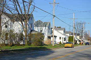
Park Layne is a census-designated place (CDP) in Bethel Township, Clark County, Ohio, United States. The population of the CDP was 4,248 at the 2020 census. It is part of the Springfield, Ohio Metropolitan Statistical Area. Park Layne became a CDP in the 1980 United States Census.

<span class="mw-page-title-main">Covington, Ohio</span> Village in Ohio, United States

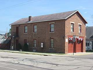
Covington is a village in Miami County, Ohio, United States. The population was 2,548 at the 2020 census. It is part of the Dayton Metropolitan Statistical Area. The village was incorporated as Covington in 1835 on the site of the 1793 Fort Rowdy.

<span class="mw-page-title-main">Ludlow Falls, Ohio</span> Village in Ohio, United States

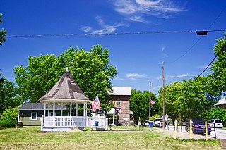
Ludlow Falls is a village in Miami County, Ohio, United States. The population was 175 at the 2020 census. It is part of the Dayton Metropolitan Statistical Area. Ludlow Falls is named after surveyor Israel Ludlow.

<span class="mw-page-title-main">Brookville, Ohio</span> City in Ohio, United States

Brookville is a small city in northwestern Montgomery County, Ohio, United States. It is a suburb of Dayton. The population was 5,989 at the 2020 census.

<span class="mw-page-title-main">Centerville, Ohio</span> City in Ohio, United States

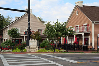
Centerville is a city in Montgomery County, Ohio, United States. A core suburb of Metro Dayton, its population was 24,240 as of the 2020 census.

<span class="mw-page-title-main">Clayton, Ohio</span> City in Ohio, United States

Clayton is a city in Montgomery County, Ohio, United States. The population was 13,310 at the 2020 census. A suburb of Dayton, it is part of the Dayton metropolitan area.

<span class="mw-page-title-main">New Lebanon, Ohio</span> Village in Ohio, United States

New Lebanon is a village in Montgomery County, Ohio, United States. The population was 3,796 at the 2020 census. It is part of the Dayton Metropolitan Statistical Area.

<span class="mw-page-title-main">Phillipsburg, Ohio</span> Village in Ohio, United States

Phillipsburg is a village in Montgomery County, Ohio, United States. The population was 498 at the 2020 census. It is part of the Dayton Metropolitan Statistical Area.

<span class="mw-page-title-main">Riverside, Ohio</span> City in Ohio, United States

Riverside is a city in Montgomery County, Ohio, United States. The population was 24,474 at the 2020 census. A suburb of Dayton, it is part of the Dayton metropolitan area.

<span class="mw-page-title-main">Trotwood, Ohio</span> City in Ohio, United States

Trotwood is a city in Montgomery County, Ohio, United States. The population was 23,070 at the 2020 census. A suburb of Dayton, it is part of the Dayton metropolitan area. The city is served by the Trotwood-Madison City School District.

<span class="mw-page-title-main">Vandalia, Ohio</span> City in Ohio, United States

Vandalia is a city in Montgomery County, Ohio, United States, and a suburb of Dayton. Its population was 15,209 during the 2020 census. In addition to being the city closest to Dayton International Airport, Vandalia lies at the crossroads of I-75 and I-70.

<span class="mw-page-title-main">West Carrollton, Ohio</span> City in Ohio, United States

West Carrollton is a city in Montgomery County, Ohio, United States. A suburb of Dayton, its population was 13,129 at the 2020 census. It is part of the Dayton Metropolitan Statistical Area. The Great Miami River runs through the town and forms most of its northern border.

<span class="mw-page-title-main">West Elkton, Ohio</span> Village in Ohio, United States

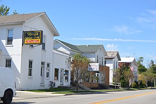
West Elkton is a village in Preble County, Ohio, United States. The population was 164 at the 2020 census. It is part of the Dayton Metropolitan Statistical Area.

<span class="mw-page-title-main">Hubbard, Ohio</span> City in Ohio, United States

Hubbard is a city in southeastern Trumbull County, Ohio, United States. It is formed from part of Hubbard Township, which was formed from the Connecticut Western Reserve. The population was 7,636 at the 2020 census. It is a suburb of the Youngstown–Warren metropolitan area.

<span class="mw-page-title-main">Stone Creek, Ohio</span> Village in Ohio, United States

Stone Creek is a village in Tuscarawas County, Ohio, United States. The population was 153 at the 2020 census.

<span class="mw-page-title-main">St. Albans, West Virginia</span> City in West Virginia, United States

St. Albans is a city in western Kanawha County, West Virginia, United States, at the confluence of the Kanawha and Coal rivers. The population was 10,861 at the 2020 census. It is part of the Charleston metropolitan area.

<span class="mw-page-title-main">Sharonville, Ohio</span> City in Ohio, United States

Sharonville is a city largely in Hamilton County in the U.S. state of Ohio. The population was 14,117 at the 2020 census.

<span class="mw-page-title-main">Union, Ohio</span> City in Ohio, United States

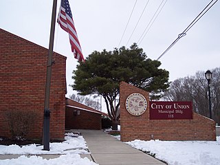
Union is a city in Montgomery and Miami Counties in the U.S. state of Ohio. The population was 6,859 at the time of the 2020 census. It is part of the Dayton Metropolitan Statistical Area.

<span class="mw-page-title-main">Carlisle, Ohio</span> City in Ohio, United States

Carlisle is a city in northwestern Warren and southern Montgomery counties in the southwestern part of the U.S. state of Ohio. The city is in Franklin Township, Warren County, Ohio and German Township, Montgomery County, Ohio.

References

  1. "ArcGIS REST Services Directory". United States Census Bureau. Retrieved September 20, 2022.
  2. 1 2 U.S. Geological Survey Geographic Names Information System: Englewood, Ohio
  3. 1 2 3 "U.S. Census website". United States Census Bureau . Retrieved January 31, 2008.
  4. 1 2 3 4 5 Heck, Earl (1969). The History of Englewood and Randolph Township Montgomery County, Ohio. Foreword by John W. Waymire. Archived (PDF) from the original on January 15, 2016. Retrieved April 21, 2023.
  5. "US Gazetteer files 2010". United States Census Bureau. Archived from the original on January 25, 2012. Retrieved January 6, 2013.
  6. "Population: Ohio" (PDF). 1930 US Census. U.S. Census Bureau. Retrieved November 28, 2013.
  7. "Number of Inhabitants: Ohio" (PDF). 18th Census of the United States. U.S. Census Bureau. 1960. Retrieved April 24, 2020.
  8. "Ohio: Population and Housing Unit Counts" (PDF). U.S. Census Bureau. Retrieved November 22, 2013.
  9. "Englewood city, Ohio". census.gov. Retrieved June 29, 2022.
  10. "U.S. Census website". United States Census Bureau . Retrieved January 6, 2013.
  11. "Locations". Dayton Metro Library. Retrieved March 1, 2018.