Goldsby, Oklahoma

Last updated

Goldsby, Oklahoma
OKMap-doton-Goldsby.PNG
Location of Goldsby, Oklahoma
Coordinates: 35°07′51″N97°28′42″W / 35.13083°N 97.47833°W / 35.13083; -97.47833
Country United States
State Oklahoma
County McClain
Area
[1]
  Total26.49 sq mi (68.61 km2)
  Land26.23 sq mi (67.93 km2)
  Water0.26 sq mi (0.68 km2)
Elevation
[2]
1,161 ft (354 m)
Population
 (2020)
  Total2,694
  Density102.71/sq mi (39.66/km2)
Time zone UTC-6 (Central (CST))
  Summer (DST) UTC-5 (CDT)
ZIP code
73093
Area code 405
FIPS code 40-29850 [3]
GNIS feature ID2412689 [2]

Goldsby is a town in McClain County, Oklahoma, United States. It lies within the Washington public school district and is home to the second largest casino in Oklahoma. As of the 2020 Census, the estimated population was 2,694, a 66 percent increase since 2010.

Contents

Geography

According to the United States Census Bureau, the town has a total area of 19.3 square miles (50 km2), of which 19.2 square miles (50 km2) is land and 0.04 square miles (0.10 km2) (0.10%) is water.

Goldsby is closely tied to its neighbor to the south, Washington. As Goldsby has no post office, mail is processed through the Washington post office (zip 73093). Goldsby falls within the boundaries of the Washington public school district. However, Goldsby provides Washington with other resources such as fire department and water services.

Features

The second largest casino in Oklahoma (Riverwind Casino) is located in Goldsby on State Highway 9.

The Town of Goldsby maintains one airport for general aviation usage, David Jay Perry Airport, as well as several private landing fields. Goldsby is also the home of the Albert Engstrom Forest Regeneration Center. [4]

The town includes several small businesses. Goldsby also has a state tag agency, community center, and a veterans' memorial. [5]

Demographics

Historical population
CensusPop.Note
1970 298
1980 603102.3%
1990 81635.3%
2000 1,20447.5%
2010 1,80149.6%
2020 2,69449.6%
U.S. Decennial Census [6]

As of the 2012 United States Census estimate, there were 1,891 people living in the city, a 57 percent increase since 2000. The population density was 98 inhabitants per square mile (38/km2). As of 2009, there were 516 housing units at an average density of 27 per square mile (10/km2). As of 2009, 1,579 residents (74%) self-identified as white, 341 (16%) self-identified as Hispanic or Latino, 117 (5.5%) self-identified as Native American, and 93 (4.4%) self-identified as of two or more races.

As of 2009, there were 1,209 households, out of which 1,108 (92%) were families, 258 (21%) were married couples with children, 45 (3.7%) were single-parent households, and 101 (8.4%) were single individuals living alone. As of 2000, the average household size was 2.63 and the average family size was 3.01.

As of 2000, the population was spread out, with 26.2% under the age of 18, 9.8% from 18 to 24, 30.1% from 25 to 44, 24.5% from 45 to 64, and 9.4% who were 65 years of age or older. As of 2011, the median age was 39.3 years and the population was 52.1% female and 47.9% male.

As of the 2011 United States Census estimate, the median income for a household in the town was $53,847 and the per capita income was 25,358. As of 2009, the median income for a family was $56,717. As of 2000, males had a median income of $33,281 versus $23,750 and about 6.7 percent of families and 8 percent of the population were below the poverty line, including 5.1% of those under age 18 and 8.3% of those age 65 or over.

Related Research Articles

<span class="mw-page-title-main">McClain County, Oklahoma</span> County in Oklahoma, United States

McClain County is a county located in south central Oklahoma. As of the 2020 census, the population was 41,662. Its county seat is Purcell. The county was named for Charles M. McClain, an Oklahoma constitutional convention attendee.

<span class="mw-page-title-main">Grant County, Oklahoma</span> County in Oklahoma, United States

Grant County is a county located on the northern border of the U.S. state of Oklahoma. As of the 2020 census, the population was 4,169. Its county seat is Medford. Originally designated as part of the Cherokee Outlet, it was named County L in Oklahoma Territory at the time of its opening to non-Indian settlement. A county election renamed it for U.S. President Ulysses S. Grant.

Achille is a town in Bryan County, Oklahoma, United States. As of the 2010 census, the town population was 492, a 2.8 percent decrease from the figure of 506 recorded in 2000. The town's name is derived from a Cherokee word, atsila, meaning fire.

<span class="mw-page-title-main">Bokchito, Oklahoma</span> Town in Oklahoma, United States

Bokchito is a town in Bryan County, Oklahoma, United States. The population was 632 at the 2010 census, an increase of 12.1 percent over the figure of 564 recorded in 2000. In the Choctaw language, "bok" means river, and "chito" means big or large, literally translating into "big creek".

<span class="mw-page-title-main">Hinton, Oklahoma</span> Town in Oklahoma, United States

Hinton is a town in Caddo County, Oklahoma, United States. The population was 3,196 as of the 2010 census, up from 2,175 in 2000. It is approximately 50 miles (80 km) west of Oklahoma City.

<span class="mw-page-title-main">Calumet, Oklahoma</span> Town in Oklahoma, United States

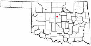
Calumet is a town in Canadian County, Oklahoma, United States. It is part of the Oklahoma City Metropolitan Area. The population was 507 at the 2010 census, a 5.23 percent decrease since 2000.

<span class="mw-page-title-main">Ketchum, Oklahoma</span> Town in Oklahoma, United States

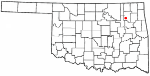
Ketchum is a town in Craig and Mayes counties, Oklahoma, United States. The population was 442 at the 2010 census, a 27 percent gain from 286 at the 2000 census.

<span class="mw-page-title-main">Lawrence Creek, Oklahoma</span> Town in Oklahoma, United States

Lawrence Creek is a town in Creek County, Oklahoma, United States. Incorporated March 15, 1983, it is primarily a bedroom community whose employed residents work in Sapulpa and Tulsa. The population was 149 at the 2010 census, a gain of 25.2 percent over the figure of 119 recorded in 2000.

Cayuga Springs is an unincorporated community and census-designated place (CDP) in Delaware County, Oklahoma, United States. The population was 140 at the 2010 census, a 33.3 percent increase over the figure of 105 recorded in 2000.

<span class="mw-page-title-main">West Siloam Springs, Oklahoma</span> Town in Oklahoma, United States

West Siloam Springs is a town in Delaware County, Oklahoma, United States. The population was 1,000 at the 2020 census, an 18.2 percent increase from the figure of 846 recorded in 2010. A bedroom community for Siloam Springs, Arkansas, it is notable for its Cherokee casino, and is the closest town to Natural Falls State Park.

<span class="mw-page-title-main">Hunter, Oklahoma</span> Town in Oklahoma, United States

Hunter is a town in Garfield County, Oklahoma, United States. The population was 165 at the 2010 census, a 4.6 percent decline from the figure of 173 in 2000.

<span class="mw-page-title-main">Waukomis, Oklahoma</span> Town in Oklahoma, United States

Waukomis is a town in Garfield County, Oklahoma, United States. The population was 1,286 at the 2010 census, an increase of 2.0 percent from 1,261 in 2000.

<span class="mw-page-title-main">Erin Springs, Oklahoma</span> Town in Oklahoma, United States

Erin Springs is a town in Garvin County, Oklahoma, United States. The population was 87 at the 2010 census, a decline of 23.7 percent from the figure of 114 in 2000.

<span class="mw-page-title-main">Howe, Oklahoma</span> Town in Oklahoma, United States

Howe is a town in Le Flore County, Oklahoma, United States. It is part of the Fort Smith, Arkansas-Oklahoma Metropolitan Statistical Area. The population was 802 at the 2010 census, a gain of 15.1 percent over the figure of 697 recorded in 2000. The town was once noted for producing coal and coke, but today is chiefly supported by agriculture.

<span class="mw-page-title-main">Cedar Valley, Oklahoma</span> City in Oklahoma, United States

Cedar Valley is a city in Logan County, Oklahoma, United States. The population was 405 as of the 2020 United States census, up about 40.6% from the 288 reported at the 2010 census, and up nearly seven times the figure of 58 reported in 2000. It is part of the Oklahoma City Metropolitan Statistical Area. It is primarily a bedroom community, since more than 90 percent of the employed inhabitants commute to work in other towns. The main attraction is Cedar Valley Golf Club, which is by far the largest business in town.

<span class="mw-page-title-main">Westport, Oklahoma</span> Town in Oklahoma, United States

Westport is a town in Pawnee County, Oklahoma, United States. The population was 298 at the 2010 census, a gain of 12.9 percent over the figure of 264 in 2000.

<span class="mw-page-title-main">Johnson, Oklahoma</span> Town in Oklahoma, United States

Johnson is a town in north-central Pottawatomie County, Oklahoma, United States. The population was 247 at the 2010 census, a 10.8 percent increase from the figure of 223 in 2000.

<span class="mw-page-title-main">Valley Park, Oklahoma</span> Town in Oklahoma, United States

Valley Park is a town in Rogers County, Oklahoma, United States. The population was 77 at the 2010 census, up 221 percent from the figure of 24 recorded in 2000.

<span class="mw-page-title-main">Roland, Oklahoma</span> Town in Oklahoma, United States

Roland is a town in Sequoyah County, Oklahoma, United States. It is part of the Fort Smith, Arkansas-Oklahoma Metropolitan Statistical Area. The population was 3,169 at the 2010 census, compared to the figure of 2,842 recorded in 2000.

<span class="mw-page-title-main">Oklahoma, Pennsylvania</span> Borough in Pennsylvania, United States

Oklahoma is a borough in Westmoreland County, Pennsylvania, United States. The population was 809 at the time of the 2010 census.

References

  1. "ArcGIS REST Services Directory". United States Census Bureau. Retrieved September 20, 2022.
  2. 1 2 U.S. Geological Survey Geographic Names Information System: Goldsby, Oklahoma
  3. "U.S. Census website". United States Census Bureau . Retrieved January 31, 2008.
  4. "FRC Location | Oklahoma Forestry Services".
  5. "Veterans Memorial". Under Construction. Retrieved May 4, 2023.
  6. "Census of Population and Housing". Census.gov. Retrieved June 4, 2015.