McClain County, Oklahoma

Last updated

McClain County
McClain County Courthouse.JPG
Map of Oklahoma highlighting McClain County.svg
Location within the U.S. state of Oklahoma
Oklahoma in United States.svg
Oklahoma's location within the U.S.
Coordinates: 35°00′N97°26′W / 35°N 97.44°W / 35; -97.44
CountryFlag of the United States.svg United States
StateFlag of Oklahoma.svg  Oklahoma
Founded1907
Seat Purcell
Largest city Newcastle
Area
  Total580 sq mi (1,500 km2)
  Land571 sq mi (1,480 km2)
  Water9.6 sq mi (25 km2)  1.6%
Population
 (2020)
  Total41,662
  Density72/sq mi (28/km2)
Time zone UTC−6 (Central)
  Summer (DST) UTC−5 (CDT)
Congressional district 4th
Website mcclain-co-ok.us

McClain County is a county located in south central Oklahoma. As of the 2020 census, the population was 41,662. [1] Its county seat is Purcell. [2] The county was named for Charles M. McClain, an Oklahoma constitutional convention attendee. [3]

Contents

McClain County is part of the Oklahoma City, OK metropolitan statistical area.

History

The Chickasaw tribe began moving into this area in 1837, when the land had already been assigned to the Choctaws by the U.S. government. In 1855, the area became part of the Chickasaw Nation, after the two tribes officially separated. The present McClain County became part of Pontotoc County, Chickasaw Nation and remained so until Oklahoma attained statehood. Few Chickasaws lived here because of hostilities with western tribes (e.g., Kiowa). Major Richard Mason established Camp Holmes (also called Camp Mason) in 1835, near the present city of Lexington, while negotiating a treaty between the western tribes and the newly arrived Choctaws. Federal troops abandoned the camp in August 1835, after the Treaty of Camp Holmes was signed. [3]

Auguste Pierre Chouteau built a trading post at the Camp Holmes site, but it closed after Chouteau died in 1838. Randolph Marcy is credited with bringing the California Road through this area in 1849. The U.S. Army built Camp Arbuckle in 1850 to protect the road, but the troops were withdrawn to what is now Garvin County, Oklahoma in the following year. [3]

Jesse Chisholm also operated a trading post in this area around 1850. A group of Delaware Indians occupied the former camp, then known as Beaversville, but left before the outbreak of the Civil War. [3]

Montford T. Johnson, a rancher, moved to this area after the Civil War. He and Jesse Chisholm, who acted as the negotiator, obtained an agreement with the Chickasaw leaders to allow ranching on their land, provided no whites were employed. Thereafter, Johnson built a ranch and hired a Chickasaw freedman to operate it. He then established other ranches and hired another freedman to run those. [3]

The Southern Kansas Railway built a line south from Kansas to present McClain County in 1886–7, and the Gulf, Colorado and Santa Fe Railway (both of which were controlled by the Atchison, Topeka and Santa Fe Railway, AT&SF) built a line north from Texas, meeting at and founding the town of Purcell. Eastern Oklahoma Railroad (later acquired by the AT&SF) laid tracks in 1900-04 from Newkirk to Pauls Valley, passing through eastern McClain County. In 1906 the Oklahoma Central Railway (sold to AT&SF in 1914) built a line that traversed McClain County from the southeast to the northwest. It ran through Byars and Purcell, and established Washington, Cole, and Blanchard. [3]

Purcell was a starting point for the Land Run of 1889. It also was at the dividing line between Indian Territory, where alcohol could not be sold, and Oklahoma Territory, where alcohol sale was legal. The town of Lexington, across the river from Purcell, had numerous saloons. In 1899, the Purcell Bridge Company built a toll bridge across the river, profiting from the alcohol trade. [3]

Geography

Map of McClain County McClain County, Okla.svg
Map of McClain County

According to the U.S. Census Bureau, the county has a total area of 580 square miles (1,500 km2), of which 571 square miles (1,480 km2) is land and 9.6 square miles (25 km2) (1.6%) is water. [4] The county lies largely in the Red Bed Plains region of the Osage Plains. The western part of the county is hilly and covered with black jack oak trees, while the eastern part is level lowlands. The South Canadian River forms the northern border, The Washita River flows through the southwestern corner, and is fed by several McClain County creeks. [3]

Adjacent counties

Demographics

Historical population
CensusPop.Note
1910 15,659
1920 19,32623.4%
1930 21,57511.6%
1940 19,205−11.0%
1950 14,681−23.6%
1960 12,740−13.2%
1970 14,15711.1%
1980 20,29143.3%
1990 22,79512.3%
2000 27,74021.7%
2010 34,50624.4%
2020 41,66220.7%
2023 (est.)47,072 [5] 13.0%
U.S. Decennial Census [6]
1790-1960 [7] 1900-1990 [8]
1990-2000 [9] 2010-2019 [10]
Age pyramid for McClain County, Oklahoma, based on census 2000 data. USA McClain County, Oklahoma age pyramid.svg
Age pyramid for McClain County, Oklahoma, based on census 2000 data.

As of the 2010 United States census, there were 34,506 people, 12,891 households, and 9,785 families residing in the county. The population density was 59.5 people per square mile (23.0 people/km2). There were 13,996 housing units at an average density of 24 units per square mile (9.3/km2). The racial makeup of the county was 84.5% white, 0.7% black or African American, 6.4% Native American, 0.4% Asian, less than 0.1% Pacific Islander, 2.7% from other races, and 5.3% from two or more races. Seven percent of the population were Hispanic or Latino of any race. By 2020, its population was 41,662. [1]

There were 12,891 households, out of which 37.4% included children under the age of 18, 61.3% were married couples living together, 9.9% had a female householder with no husband present, 4.7% had a male householder with no wife present, and 24.1% were non-families. Individuals living alone accounted for 20.1% of households and individuals 65 years of age or older living alone accounted for 8.1%. The average household size was 2.66 and the average family size was 3.06.

In the county, the population was spread out, with 26.6% under the age of 18, 6.9% from 18 to 24, 25.7% from 25 to 44, 27.6% from 45 to 64, and 13.2% who were 65 years of age or older. The median age was 38.2 years. For every 100 females, there were 98.5 males. For every 100 females age 18 and over, there were 95.4 males.

The median income for a household in the county was $56,126, and the median income for a family was $67,948. Males had a median income of $42,262 versus $32,821 for females. The per capita income for the county was $24,898. About 8% of families and 12% of the population were below the poverty line, including 11% of those under age 18 and 8% of those age 65 or over.

Politics

Voter Registration and Party Enrollment as of June 30, 2023 [11]
PartyNumber of VotersPercentage
Republican 17,63164.84%
Democratic 5,24019.27%
Libertarian 2290.84%
Unaffiliated4,09015.04%
Total27,190100%
United States presidential election results for McClain County, Oklahoma [12]
Year Republican Democratic Third party
No.%No.%No.%
2020 15,29579.51%3,58218.62%3591.87%
2016 13,16978.12%2,89417.17%7954.72%
2012 11,11277.67%3,19422.33%00.00%
2008 11,19375.92%3,55124.08%00.00%
2004 10,04172.85%3,74227.15%00.00%
2000 6,75064.05%3,67934.91%1101.04%
1996 4,36346.22%3,75339.76%1,32314.02%
1992 4,37740.62%3,37831.35%3,02128.03%
1988 4,77156.44%3,59442.52%881.04%
1984 6,05669.83%2,54929.39%670.77%
1980 4,28456.87%2,99039.69%2593.44%
1976 2,44437.19%4,04861.59%801.22%
1972 4,24173.16%1,35023.29%2063.55%
1968 2,04736.98%1,84233.27%1,64729.75%
1964 1,63831.05%3,63868.95%00.00%
1960 2,54751.85%2,36548.15%00.00%
1956 2,08141.11%2,98158.89%00.00%
1952 2,32642.08%3,20157.92%00.00%
1948 90820.83%3,45179.17%00.00%
1944 1,49231.08%3,30168.76%80.17%
1940 1,86233.01%3,76866.80%110.20%
1936 1,19122.47%4,09277.21%170.32%
1932 81813.85%5,08786.15%00.00%
1928 2,39955.07%1,91343.92%441.01%
1924 1,23330.74%2,51962.80%2596.46%
1920 1,73340.32%2,31553.86%2505.82%
1916 68025.04%1,54156.74%49518.23%
1912 58325.63%1,27355.96%41918.42%

Economy

The county economy has been based primarily on agriculture and cattle raising. Each town had its own cotton gin early in the 1900s. Purcell had a flour mill. Otherwise, there was little industrial activity. Many county residents commute to work in the Oklahoma City area. Mid-America Area Vo-Tech opened in 1971 to provide vocational education to students. Duke Energy North America built a power plant (which it sold to NRG Energy, Inc., that year) near Newcastle in 2001. The Chickasaw Nation operated a gaming casino at Newcastle. [3]

Education

K-12 schools

School districts include (all full K-12): [13]

Libraries

Pioneer Library System operates branch libraries in nine cities in Cleveland, McClain and Pottawatomie counties. [14] The Purcell Public Library at 919 N. 9th Street in Purcell is the only library in McClain County that is part of the Pioneer System.

Transportation

Major highways

The busiest highway in the county is Interstate 35, which enters the county on the north at Goldsby on the McCall Bridge. It then parallels the Canadian River through the county seat, Purcell. It eventually turns southward and leaves the county at its border with Garvin County.

Another important interstate highway is Interstate 44, which runs through the northwestern part of the county. The H.E. Bailey Turnpike Norman Spur connects this highway to the US-62/US-277/SH-9 intersection.

SH-9 enters McClain County via the McCall bridge, duplexed with I-35, and immediately turns due west, running along the northern edge of Goldsby until its intersection with U.S. Highway 62/U.S. Highway 277, south of Newcastle, Oklahoma. From this intersection the three highways continue southwest towards Blanchard and further on to Chickasha in Grady County.

County roads

Like many counties, McClain County contains an extensive network of county-maintained roads. They form a grid with parallel roads generally placed 1 mile apart.

To dispel confusion and assist the small cities introducing new 9-1-1 systems, the county road system was recently renamed and signed throughout the county. East–west roads are numbered, with 100th Street located along the southern edge of the county, and the numbers gradually increasing toward the northern tip of the county. North–south streets are named, generally indicating the name of the road in the Oklahoma City grid that the county road best aligns with. (e.g. Pennsylvania Avenue would, if extended northward, eventually connect with the street of the same name in Oklahoma City.)

Controversy

Contaminated water supply

In 2010, the EPA ordered local water utilities to begin the first nationwide tests for hexavalent chromium 6 (AKA The Erin Brockovich Chemical). From 2013 to 2015, utilities took more than 60,000 samples of drinking water and found chromium-6 in more than 75 percent of them. [15] The Purcell water supply tested positive for an average of 11.53ppb, 577 times the original recommendation from the scientists at the respected and influential California Office of Environmental Health Hazard Assessment of 0.02ppb. [16]

Communities

Local landmarks

The following sites in McClain County are listed on the National Register of Historic Places:

Related Research Articles

<span class="mw-page-title-main">Pontotoc County, Oklahoma</span> County in Oklahoma, United States

Pontotoc County is in the south central part of Oklahoma. As of the 2020 census, the population was 38,065. Its county seat is Ada. The county was created at statehood from part of the Chickasaw Nation in Indian Territory. It was named for a historic Chickasaw tribal area in Mississippi. According to the Encyclopedia of Oklahoma History and Culture, Pontotoc is usually translated "cattail prairie" or "land of hanging grapes."

<span class="mw-page-title-main">Murray County, Oklahoma</span> County in Oklahoma, United States

Murray County is a county located in the southern part of the U.S. state of Oklahoma. As of the 2020 census, the population was 13,904. The county seat is Sulphur. The county was named for William H. Murray, a member and president of the Oklahoma Constitutional Convention and later a Governor of Oklahoma.

<span class="mw-page-title-main">Grady County, Oklahoma</span> County in Oklahoma, United States

Grady County is a county located in the U.S. state of Oklahoma. As of the 2020 census, the population was 54,795. Its county seat is Chickasha. It was named for Henry W. Grady, an editor of the Atlanta Constitution and southern orator.

<span class="mw-page-title-main">Garvin County, Oklahoma</span> County in Oklahoma, United States

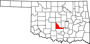
Garvin County is a county in south-central Oklahoma, United States. As of the 2020 census, the population was 25,656. Its county seat is Pauls Valley. In 1906, delegates to Constitution Convention formed Garvin County from part of the Chickasaw Nation, Indian Territory. The county was named for Samuel J. Garvin, a local Chickasaw rancher, merchant and banker. Its economy is largely based on farming, ranching and oil production.

<span class="mw-page-title-main">Cleveland County, Oklahoma</span> County in Oklahoma, United States

Cleveland County is a county in the central part of the U.S. state of Oklahoma. The population was 295,528 at the 2020 United States census, making it the third-most populous county in Oklahoma. Its county seat is Norman. The county was named for U.S. President Grover Cleveland.

<span class="mw-page-title-main">Lexington, Oklahoma</span> City in Oklahoma, United States

Lexington is a city in Cleveland County, Oklahoma, United States. The city population was 2,010 at the 2020 census, a 6.6% decrease from 2010.

<span class="mw-page-title-main">Lindsay, Oklahoma</span> City in Oklahoma, United States

Lindsay is a city in Garvin County, Oklahoma, United States. The population was 2,840 at the 2010 census. It once promoted itself as "The Broomcorn Capital of the World" but no longer uses that slogan, as broomcorn is no longer raised in the area.

<span class="mw-page-title-main">Maysville, Oklahoma</span> Town in Oklahoma, United States

Maysville is a town in Garvin and McClain counties, Oklahoma, United States. The population was 1,232 at the 2010 census, down from 1,313 in 2000.

<span class="mw-page-title-main">Paoli, Oklahoma</span> Town in Oklahoma, United States

Paoli is a town in Garvin County, Oklahoma, United States. The population was 610 at the 2010 census. It was named after Paoli, Pennsylvania, an unincorporated community near Philadelphia from which many of the railroad workers who built the town came.

<span class="mw-page-title-main">Wynnewood, Oklahoma</span> City in Oklahoma, United States

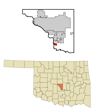
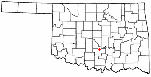
Wynnewood is a city in Garvin County, Oklahoma, United States. It is 67 miles (108 km) south of Oklahoma City. The population was 1,927 at the time of the 2020 census. Located in what was then the Chickasaw Nation of Indian Territory, it began as a village called "Walner" in 1886, on the proposed route of the Gulf, Colorado and Santa Fe Railway. Railroad workers from Pennsylvania named the community for Wynnewood, a community outside of Philadelphia. The name became official on April 6, 1887.

<span class="mw-page-title-main">Dibble, Oklahoma</span> Town in Oklahoma, United States

Dibble is a town in McClain County, Oklahoma, United States. The population within city limits was 867 at the 2020 census, down from 878 at the 2010 census. The community has 8,868 residents in its 73031 zipcode, according to Sperling's Best Places. Dibble is in the outer suburban area west of Purcell and southwest of Norman, in the Oklahoma City Metropolitan Area, according to the U.S. Census.

<span class="mw-page-title-main">Newcastle, Oklahoma</span> City in Oklahoma, United States

Newcastle is a city in McClain County, Oklahoma, United States, and part of the Oklahoma City Metropolitan Area. The population was 10,984 at the 2020 census.

<span class="mw-page-title-main">Purcell, Oklahoma</span> City in Oklahoma, United States

Purcell is a city in and the county seat of McClain County, Oklahoma, United States. As of the 2020 census, the city population was 6,651, a 13% increase from 2010.

<span class="mw-page-title-main">Blanchard, Oklahoma</span> City in Oklahoma, United States

Blanchard is a city in McClain and Grady counties in the U.S. state of Oklahoma. The population was 8,879 at the 2020 census, up from 7,670 at the 2010 census. Blanchard is part of a rapidly growing area of northern McClain and Grady counties known as the "Tri-City Area" with Newcastle and Tuttle.

<span class="mw-page-title-main">Oklahoma State Highway 9</span> Highway in Oklahoma

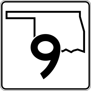
State Highway 9, abbreviated as SH-9, OK-9, or simply Highway 9, is a major east–west highway in the U.S. state of Oklahoma. Spanning across the central part of the state, SH-9 begins at the Texas state line west of Vinson, Oklahoma, and ends at the Arkansas state line near Fort Smith, Arkansas. State Highway 9 is a major highway around the Norman area. At 348.1 miles (560.2 km), SH-9 is Oklahoma's second-longest state highway.

<span class="mw-page-title-main">Oklahoma State Highway 24</span> State highway in Oklahoma, United States

State Highway 24 (SH-24) is a highway maintained by the U.S. state of Oklahoma. It runs for 21.1 miles (34.0 km) through central Oklahoma, almost entirely within McClain County. It is signed north–south and has no lettered spur routes.

<span class="mw-page-title-main">Oklahoma State Highway 145</span> State highway in Oklahoma, United States

State Highway 145, abbreviated as SH-145 or OK-145, is a short, 2.88 miles (4.63 km) highway in Garvin County, Oklahoma. It connects Interstate 35 at its west end to US-77 in Paoli at its east end. It does not have any spur routes.

Bridge Creek is a town in Grady County, Oklahoma, United States. As of the 2020 census, the town population was 336, a 0% change from 2010.

<span class="mw-page-title-main">Interstate 35 in Oklahoma</span> Section of Interstate Highway in Oklahoma, United States

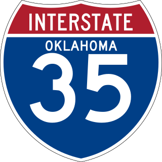
Interstate 35 (I-35), in the US State of Oklahoma, runs from the Red River at the Texas border to the Kansas state line near Braman for a length of 236 miles (380 km). I-35 has one auxiliary route in the state, I-235, in the inner city of Oklahoma City. A second auxiliary route, I-335, is planned as the designation for the Kickapoo Turnpike, although it will not meet I-35 until the southern extension of the turnpike to a junction with I-35 in Purcell is built. Excluding the Panhandle, I-35 forms the informal bisector for central Oklahoma, and along with US 81/US 283 in western Oklahoma and US 69/US 75 in the eastern portion, it provides one of the main north-south corridors through the state.

<span class="mw-page-title-main">James C. Nance</span> American politician

James Clark "Jim" Nance was a leader for 40 years in the Oklahoma Legislature in the U.S. state of Oklahoma and was community newspaper chain publisher 66 years. Nance served as Speaker of the Oklahoma House of Representatives and President pro tempore of the Oklahoma Senate. During his legislative career, Nance wrote the "Honest Mistake" law which became a model for other states. Nance then became a key sponsor and Legislative Chairman of the U.S. Uniform Law Commission (ULC), sponsored by the National Conference of Commissioners on Uniform State Laws, a non-partisan advisory panel which drafted uniform acts and uniform state commerce laws. Nance became known as a legislative expert in a 40-year legislative career as one of two Oklahomans to hold the top posts in both chambers of the Oklahoma Legislature. The state's largest newspaper, The Daily Oklahoman wrote he was the "longest serving Oklahoma Legislator" and "A Legislator's Legislator." Nance, a Democrat, is the only Oklahoma House Speaker elected through a bipartisan coalition of Democrats and Republicans. Fiercely independent, Nance considered public policy work to be a service and did not ever accept a salary or pension for any of his 40 years in the legislature and 24 years on the Uniform Law Commission. Nance refused to work as a lobbyist, although he had many offers after leaving office.

References

  1. 1 2 "U.S. Census Bureau QuickFacts: McClain County, Oklahoma; United States". www.census.gov. Retrieved August 6, 2022.
  2. "Find a County". National Association of Counties. Archived from the original on May 31, 2011. Retrieved June 7, 2011.
  3. 1 2 3 4 5 6 7 8 9 O'Dell, Larry. "McClain County," Encyclopedia of Oklahoma History and Culture, Oklahoma Historical Society, 2009. Accessed April 4, 2015.
  4. "2010 Census Gazetteer Files". United States Census Bureau. August 22, 2012. Retrieved February 21, 2015.
  5. "U.S. Census Bureau QuickFacts". United States Census Bureau. Retrieved May 10, 2024.
  6. "U.S. Decennial Census". United States Census Bureau. Archived from the original on April 26, 2015. Retrieved February 21, 2015.
  7. "Historical Census Browser". University of Virginia Library. Retrieved February 21, 2015.
  8. Forstall, Richard L., ed. (March 27, 1995). "Population of Counties by Decennial Census: 1900 to 1990". United States Census Bureau. Retrieved February 21, 2015.
  9. "Census 2000 PHC-T-4. Ranking Tables for Counties: 1990 and 2000" (PDF). United States Census Bureau. April 2, 2001. Archived (PDF) from the original on October 9, 2022. Retrieved February 21, 2015.
  10. "State & County QuickFacts". United States Census Bureau. Archived from the original on June 6, 2011. Retrieved November 9, 2013.
  11. "Current Registration Statistics by County" (PDF). ok.gov. February 28, 2022. Archived (PDF) from the original on October 9, 2022. Retrieved August 6, 2022.
  12. Leip, David. "Dave Leip's Atlas of U.S. Presidential Elections". uselectionatlas.org. Retrieved March 29, 2018.
  13. "2020 CENSUS - SCHOOL DISTRICT REFERENCE MAP: McClain County, OK" (PDF). U.S. Census Bureau. Archived (PDF) from the original on October 9, 2022. Retrieved July 23, 2022. - Text list
  14. "Pioneer Library System to buy Borders bookstore building in Norman". NewsOK. The Oklahoman. September 27, 2011. Retrieved October 25, 2011.
  15. "Occurrence data unregulated contaminant monitoring rule #3".
  16. "U.S. EPA, Occurrence Data for the Unregulated Contaminant Monitoring Rule. April 2016".

35°00′N97°26′W / 35.00°N 97.44°W / 35.00; -97.44