Okmulgee County, Oklahoma

Last updated

Okmulgee County
Muscogee (Creek) Nation Council House.jpg
Map of Oklahoma highlighting Okmulgee County.svg
Location within the U.S. state of Oklahoma
Oklahoma in United States.svg
Oklahoma's location within the U.S.
Coordinates: 35°38′N95°58′W / 35.64°N 95.97°W / 35.64; -95.97
CountryFlag of the United States.svg United States
StateFlag of Oklahoma.svg  Oklahoma
Founded1907
Seat Okmulgee
Largest cityOkmulgee
Area
  Total702 sq mi (1,820 km2)
  Land697 sq mi (1,810 km2)
  Water5.0 sq mi (13 km2)  0.7%
Population
 (2020)
  Total36,706
  Density52/sq mi (20/km2)
Congressional district 2nd

Okmulgee County is a county in the U.S. state of Oklahoma. As of the 2020 census, the population was 36,706. [1] The county seat is Okmulgee. [2] Located within the Muscogee Nation Reservation, the county was created at statehood in 1907. The name Okmulgee is derived from the Hitchita (Lower Creek) word okimulgi, meaning "boiling waters". [3]

Contents

Okmulgee County is included in the Tulsa, OK metropolitan statistical area.

History

The Creek Nation was removed into this part of Indian Territory along the Trail of Tears after signing treaties exchanging their land in Georgia and Alabama in 1826 and 1832. The actual move occurred over the period from 1827 to 1836. The Creek Nation government, led by chief Samuel Checote, revised its constitution in 1867 and designated Okmulgee as its capital in 1868. The U.S. Post Office opened in Okmulgee on April 29, 1869. The Creek Nation built its capitol, a log building, in 1869. The building was rebuilt of stone in 1878. [3]

Okmulgee County was formed on July 16, 1907, from Muskogee land, with a population of 14,362. County government offices were located in the Creek Council House until 1916, when the present Okmulgee County Courthouse was built. The former council building was then repurposed. The county's population was 21,115 in 1910 and increased to a high of 56,558 by 1930. [3]

Railroads came to the area in 1900, when the St. Louis, Oklahoma and Southern Railway (later the St. Louis and San Francisco Railway or Frisco) built a line from Sapulpa, Oklahoma via Okmulgee to a place near the Red River. The Shawnee, Oklahoma and Missouri Coal and Railway (later also acquired by the Frisco) built a line from Muskogee to Okmulgee in 1902–03. It was abandoned in 1973. The Missouri, Oklahoma and Gulf Railway (purchased by the Kansas, Oklahoma and Gulf Railway in 1919) ran through Dewar, Oklahoma beginning in 1909, and the Okmulgee Northern Railway operated between Okmulgee and Deep Fork from 1916 to 1964. [3]

In 1918, the boundary between Okmulgee County and McIntosh County was realigned, moving the towns of Grayson [4] and Hoffman [5] from McIntosh into Okmulgee County.

The Creek Council House still stands today. While ownership of the building changed over the years, the City of Okmulgee in November 2010 sold the building back to the tribe for $3.2 million. [6] The building currently houses the Creek Council House Museum, with artifacts and exhibits about the history of the Muscogee tribe and the arts and crafts of other Native American tribes.

Geography

According to the U.S. Census Bureau, the county has a total area of 702 square miles (1,820 km2), of which 697 square miles (1,810 km2) is land and 5.0 square miles (13 km2) (0.7%) is water. [7] Lake Henryetta, Okmulgee Lake, Nichols Lake, most of Dripping Springs Lake, and the tip of Oklahoma's largest lake, [8] Lake Eufaula, lie within the county. [9] The Deep Fork of the North Canadian River is the principal waterway in the county. [3] The eastern part of the county is within the Eastern Lowlands physiographic region and the western part is in the Osage Plains. Okmulgee Park and Dripping Springs Park lie west and southwest of the city of Okmulgee. Deep Fork National Wildlife Refuge lies within the southern part of the county. [9] The area known as the High Spring Mountains is in the eastern part of the county south of Eram, and extending further south into McIntosh County in the Hitchita vicinity. [10]

Adjacent counties

Demographics

Historical population
CensusPop.Note
1910 21,115
1920 55,072160.8%
1930 56,5582.7%
1940 50,101−11.4%
1950 44,561−11.1%
1960 36,945−17.1%
1970 35,358−4.3%
1980 39,16910.8%
1990 36,490−6.8%
2000 39,6858.8%
2010 40,0691.0%
2020 36,706−8.4%
U.S. Decennial Census [11]
1790-1960 [12] 1900-1990 [13]
1990-2000 [14] 2010 [15]

As of the census [16] of 2000, there were 39,685 people, 15,300 households, and 10,694 families residing in the county. The population density was 22/km2 (57/sq mi). There were 17,316 housing units at an average density of 10/km2 (26/sq mi). The racial makeup of the county was 69.73% White, 10.20% Black or African American, 12.85% Native American, 0.19% Asian, 0.02% Pacific Islander, 0.61% from other races, and 6.40% from two or more races. 1.95% of the population were Hispanic or Latino of any race. As of 2020, its population declined to 36,706. [15]

There were 15,300 households, out of which 32.00% had children under the age of 18 living with them, 52.80% were married couples living together, 13.10% had a female householder with no husband present, and 30.10% were non-families. 27.10% of all households were made up of individuals, and 12.60% had someone living alone who was 65 years of age or older. The average household size was 2.53 and the average family size was 3.06.

In the county, the population was spread out, with 26.90% under the age of 18, 9.50% from 18 to 24, 25.30% from 25 to 44, 23.30% from 45 to 64, and 15.10% who were 65 years of age or older. The median age was 37 years. For every 100 females, there were 95.20 males. For every 100 females age 18 and over, there were 90.80 males.

The median income for a household in the county was $27,652, and the median income for a family was $33,987. Males had a median income of $29,935 versus $20,861 for females. The per capita income for the county was $14,065. About 14.90% of families and 18.90% of the population were below the poverty line, including 24.90% of those under age 18 and 15.50% of those age 65 or over.

Government

Okmulgee County government has three commissioners, one for each of the three Districts. [17] County services, including the District Court, Assessor, County Clerk, Jail, and Sheriff's office, are all located between 6th and 8th St, and Alabama and Seminole Avenues, in the City of Okmulgee. [18]

Politics

Despite a wide Democratic registration advantage as recently as the late 2010s, the county—like every Oklahoma county since 2000—has favored the Republican candidate for president in every election since 2000, with the Republican margin of victory increasing with every election.

Voter Registration and Party Enrollment as of June 30, 2023 [19]
PartyNumber of VotersPercentage
Democratic 7,28235.20%
Republican 9,87047.69%
Others3,54217.12%
Total20,694100%
United States presidential election results for Okmulgee County, Oklahoma [20]
Year Republican Democratic Third party
No.%No.%No.%
2020 9,66867.55%4,35730.44%2882.01%
2016 8,94464.12%4,38531.44%6204.44%
2012 7,73158.73%5,43241.27%00.00%
2008 8,72758.50%6,19141.50%00.00%
2004 8,36353.17%7,36746.83%00.00%
2000 5,79743.99%7,18654.53%1951.48%
1996 4,24631.84%7,55556.65%1,53611.52%
1992 4,58629.74%7,76750.37%3,06819.89%
1988 5,67440.52%8,26259.00%680.49%
1984 8,70453.76%7,38045.59%1050.65%
1980 6,65246.57%7,23650.65%3972.78%
1976 5,33338.19%8,49960.87%1310.94%
1972 8,70663.82%4,49432.94%4423.24%
1968 4,70934.81%6,08945.02%2,72820.17%
1964 4,70431.57%10,19568.43%00.00%
1960 7,10749.46%7,26250.54%00.00%
1956 6,70346.78%7,62653.22%00.00%
1952 6,71739.91%10,11560.09%00.00%
1948 4,36829.44%10,46770.56%00.00%
1944 5,43035.74%9,73764.09%250.16%
1940 6,69637.63%11,01661.90%840.47%
1936 4,97529.11%12,06170.56%570.33%
1932 4,76229.67%11,28770.33%00.00%
1928 9,14960.77%5,83438.75%730.48%
1924 6,01546.85%5,92746.17%8966.98%
1920 5,36751.33%4,49542.99%5935.67%
1916 1,86036.91%2,40647.75%77315.34%
1912 1,14038.68%1,24342.18%56419.14%

Communities

NRHP Sites

The following sites in Okmulgee County are listed on the National Register of Historic Places:

Related Research Articles

<span class="mw-page-title-main">Washington County, Oklahoma</span> County in Oklahoma, United States

Washington County is a county located in the northeastern part of the U.S. state of Oklahoma. As of the 2020 census, the population was 52,455. Its county seat is Bartlesville. Named for President George Washington, it is the smallest county in Oklahoma in total area, adjacent to the largest county in Oklahoma, Osage County.

<span class="mw-page-title-main">Wagoner County, Oklahoma</span> County in Oklahoma, United States

Wagoner County is a county located in the U.S. state of Oklahoma. As of the 2020 census, the population was 80,981. Its county seat is Wagoner.

<span class="mw-page-title-main">Pittsburg County, Oklahoma</span> County in Oklahoma, United States

Pittsburg County is a county located in the U.S. state of Oklahoma. As of the 2020 census, the population was 43,773. Its county seat is McAlester. The county was formed from part of the Choctaw Nation in Indian Territory in 1907. County leaders believed that its coal production compared favorably with Pittsburgh, Pennsylvania at the time of statehood.

<span class="mw-page-title-main">Muskogee County, Oklahoma</span> County in Oklahoma, United States

Muskogee County is a county located in the U.S. state of Oklahoma. As of the 2020 census, the population was 66,339. The county seat is Muskogee. The county and city were named for the Muscogee (Creek) Nation. The official spelling of the name was changed to Muskogee by the post office in 1900.

<span class="mw-page-title-main">McIntosh County, Oklahoma</span> County in Oklahoma, United States

McIntosh County is a county located in the U.S. state of Oklahoma. As of the 2020 census, the population was 18,941. Its county seat is Eufaula. The county is named for an influential Muscogee Creek family, whose members led the migration of the Lower Towns to Indian Territory and served as leaders for generations.

<span class="mw-page-title-main">Creek County, Oklahoma</span> County in Oklahoma, United States

Creek County is a county located in the U.S. state of Oklahoma. As of the 2020 census, the population was 71,754. Its county seat is Sapulpa.

<span class="mw-page-title-main">Cherokee County, Oklahoma</span> County in Oklahoma, United States

Cherokee County is a county located in the U.S. state of Oklahoma. As of the 2020 census, the population was 47,078. Its county seat is Tahlequah, which is also the capital of the Cherokee Nation.

<span class="mw-page-title-main">Mounds, Oklahoma</span> Town in Oklahoma, United States

Mounds is a town in Creek County, Oklahoma, United States. It is located just south of Tulsa; the town's population was 932 at the 2020 census.

<span class="mw-page-title-main">Checotah, Oklahoma</span> Town in Oklahoma, United States

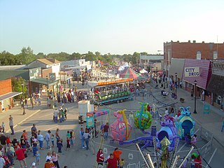
Checotah is a town in McIntosh County, Oklahoma, United States. It was named for Samuel Checote, the first chief of the Creek Nation elected after the Civil War. Its population was 3,481 at the 2000 census. According to Census 2010, the population has decreased to 3,335; a 4.19% loss.

<span class="mw-page-title-main">Eufaula, Oklahoma</span> City in Oklahoma, United States

Eufaula is a city and county seat of McIntosh County, Oklahoma, United States. The population was 2,813 at the 2010 census, an increase of 6.6 percent from 2,639 in 2000. Eufaula is in the southern part of the county, 30 miles (48 km) north of McAlester and 32 miles (51 km) south of Muskogee.

<span class="mw-page-title-main">Hitchita, Oklahoma</span> Town in Oklahoma, United States

Hitchita is a town in McIntosh County, Oklahoma, United States. The Encyclopedia of Oklahoma History and Culture says that the town was named for a band of Muskhogean Indians that had been absorbed into the Creek tribe. The population was 88 at the 2010 census, a decline of 22.1 percent from 113 in 2000.

Shady Grove is a census-designated place (CDP) in McIntosh County, Oklahoma, United States. The population was 199 at the 2010 census, a decrease of 14.4 percent from 229 in 2000. This is not to be confused with the similarly-named Shady Grove in Cherokee County, or the Shady Grove in Pawnee County.

<span class="mw-page-title-main">Dewar, Oklahoma</span> Town in Oklahoma, United States

Dewar is a town in Okmulgee County, Oklahoma, United States. The population was 763 at the 2020 census. Founded in 1909 by workers for the Missouri, Oklahoma and Gulf Railway (MO&G), it was named for William Peter Dewar, a railroad official. It incorporated in 1909.

<span class="mw-page-title-main">Grayson, Oklahoma</span> Town in Oklahoma, United States

Grayson is a town in Okmulgee County, Oklahoma, United States. The population was 127 at the 2020 census.

<span class="mw-page-title-main">Henryetta, Oklahoma</span> City in Oklahoma, United States

Henryetta is a city in Okmulgee County, Oklahoma, United States. The population was 5,640 at the 2020 census.

<span class="mw-page-title-main">Hoffman, Oklahoma</span> Town in Oklahoma, United States

Hoffman is a town in Okmulgee County, Oklahoma, United States. The population was 81 at the 2020 census.

<span class="mw-page-title-main">Morris, Oklahoma</span> City in Oklahoma, United States

Morris is a city in Okmulgee County, Oklahoma, United States. The population was 1,299 at the 2020 census.

<span class="mw-page-title-main">Okmulgee, Oklahoma</span> City in Oklahoma, United States

Okmulgee is a city in, and the county seat of, Okmulgee County, Oklahoma, United States, and is part of the Tulsa Metropolitan Area. The name is from the Mvskoke word okimulgee, which means "boiling waters". The site was chosen because of the nearby rivers and springs. Okmulgee is 38 miles south of Tulsa and 13 miles north of Henryetta via US-75.

<span class="mw-page-title-main">Schulter, Oklahoma</span> Town in Oklahoma, United States

Schulter is a town in Okmulgee County, Oklahoma, United States. The population was 422 at the time of the 2020 census.

<span class="mw-page-title-main">Coweta, Oklahoma</span> City in Oklahoma, United States

Coweta is a city in Wagoner County, Oklahoma, United States, a suburb of Tulsa. As of 2010, its population was 9,943. Part of the Creek Nation in Indian Territory before Oklahoma became a U.S. state, the town was first settled in 1840.

References

  1. "Okmulgee County, Oklahoma". United States Census Bureau . Retrieved May 20, 2023.
  2. "Find a County". National Association of Counties. Archived from the original on May 31, 2011. Retrieved June 7, 2011.
  3. 1 2 3 4 5 Glynnis Coleman. "Okmulgee County" Encyclopedia of Oklahoma History and Culture. Accessed January 4, 2012.
  4. Lynn Marie Townsend, "Grayson." Encyclopedia of Oklahoma History and Culture. Retrieved January 18, 2013.
  5. Lynn Marie Townsend, "Hoffman." Encyclopedia of Oklahoma History and Culture. Retrieved January 18, 2013.
  6. Sara Plummer, "Tribe regains historic Council House", Tulsa World , November 15, 2010.
  7. "2010 Census Gazetteer Files". United States Census Bureau. August 22, 2012. Retrieved February 21, 2015.
  8. "Lake Eufaula". TravelOK.com. Retrieved April 3, 2020.
  9. 1 2 "Okmulgee County, Oklahoma". Google Maps. Retrieved June 30, 2020.
  10. "High Spring Mountains, Oklahoma". Google Maps. Retrieved June 30, 2020.
  11. "U.S. Decennial Census". United States Census Bureau. Retrieved February 21, 2015.
  12. "Historical Census Browser". University of Virginia Library. Retrieved February 21, 2015.
  13. Forstall, Richard L., ed. (March 27, 1995). "Population of Counties by Decennial Census: 1900 to 1990". United States Census Bureau. Retrieved February 21, 2015.
  14. "Census 2000 PHC-T-4. Ranking Tables for Counties: 1990 and 2000" (PDF). United States Census Bureau. April 2, 2001. Archived (PDF) from the original on October 9, 2022. Retrieved February 21, 2015.
  15. 1 2 "State & County QuickFacts". United States Census Bureau. Archived from the original on June 6, 2011. Retrieved November 12, 2013.
  16. "U.S. Census website". United States Census Bureau . Retrieved January 31, 2008.
  17. "Okmulgee County, OK". Local Technical Assistance Program of Oklahoma State University. Retrieved September 23, 2019.
  18. "Okmulgee County". OkmulgeeOnline.com. Retrieved September 23, 2019.
  19. "Oklahoma Registration Statistics by County" (PDF). OK.gov. January 15, 2019. Retrieved February 27, 2019.
  20. Leip, David. "Dave Leip's Atlas of U.S. Presidential Elections". uselectionatlas.org. Retrieved March 29, 2018.

35°38′N95°58′W / 35.64°N 95.97°W / 35.64; -95.97