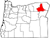
Union County is one of the 36 counties in the U.S. state of Oregon. As of the 2020 census, the population was 26,196. Its county seat is La Grande.

La Grande is a city in Union County, Oregon, United States. La Grande is Union County's largest city, with a population of 13,082 at the time of the 2010 U.S. Census. The La Grande metro population is 25,076. It is the 16th largest metropolitan area in Oregon.

Union is a city in Union County, Oregon, United States, originally platted in 1864, and located 15 miles (24 km) southeast of La Grande. It is the namesake of Union County, which references the Union states, or Northern States, of the American Civil War. The population was 2,152 at the 2020 census. The city is known for the numerous historic Victorian homes that line its Main Street, some of which are registered on the National Register of Historic Places. It is also home to Oregon State University's Eastern Oregon Agricultural Research Center, founded in 1888, which is contemporarily housed in the former Union train station.

Henry Villard was an American journalist and financier who was an early president of the Northern Pacific Railway.
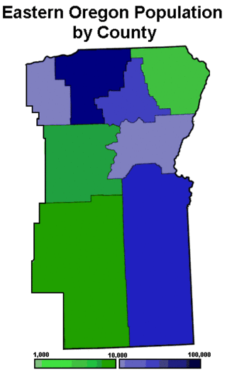
Eastern Oregon is a region of the U.S. state of Oregon. It is not an officially recognized geographic entity; thus, the boundaries of the region vary according to context. It is sometimes understood to include only the eight easternmost counties in the state; in other contexts, it includes the entire area east of the Cascade Range. Cities in the basic eight-county definition include Baker City, Burns, Hermiston, Pendleton, Boardman, John Day, La Grande, and Ontario. Umatilla County is home to the largest population base in Eastern Oregon, accounting for 42% of the region's residents. Hermiston, located in Umatilla County, is the largest city in the region, accounting for 10% of the population. Major industries include transportation/warehousing, timber, agriculture and tourism. The main transportation corridors are I-84, U.S. Route 395, U.S. Route 97, U.S. Route 26, U.S. Route 30, and U.S. Route 20.

The Grande Ronde River is a tributary of the Snake River, 182 miles (293 km) long, in northeastern Oregon and southeastern Washington in the United States. It drains an area southeast of the Blue Mountains and northwest of the Wallowa Mountains, on the Columbia Plateau. It flows through the agricultural Grande Ronde Valley in its middle course and through a series of scenic canyons in its lower course.

The Wallowa River is a tributary of the Grande Ronde River, approximately 55 miles (89 km) long, in northeastern Oregon in the United States. It drains a valley on the Columbia Plateau in the northeast corner of the state north of Wallowa Mountains.
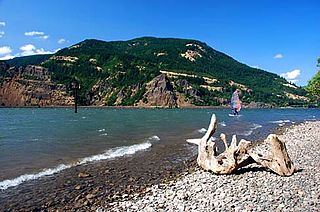
Viento State Park is a state park in north central Hood River County, Oregon, near the city of Hood River. The park, named for the former Viento railroad station located there, is administered by the Oregon Parks and Recreation Department. The park is on the south bank of the Columbia River in the Columbia River Gorge. Interstate 84 and the Union Pacific Railroad pass through the park. It offers a seasonal, full-service campground, access to gorge hiking trails beyond park boundaries, a day-use area and river access for windsurfing and kiteboarding.

Interstate 84 (I-84) in the U.S. state of Oregon is a major Interstate Highway that traverses the state from west to east. It is concurrent with U.S. Route 30 (US 30) for most of its length and runs 376 miles (605 km) from an interchange with I-5 in Portland to the Idaho state line near Ontario. The highway roughly follows the Columbia River and historic Oregon Trail in northeastern Oregon, and is designated as part of Columbia River Highway No. 2 and all of the Old Oregon Trail Highway No. 6; the entire length is also designated as the Vietnam Veterans Memorial Highway. I-84 intersects several of the state's main north–south roads, including US 97, US 197, I-82, and US 395.
Rail transportation is an important element of the transportation network in the U.S. state of Oregon. Rail transportation has existed in Oregon in some form since 1855, and the state was a pioneer in development of electric railway systems. While the automobile has displaced many uses of rail in the state, rail remains a key means of moving passengers and freight, both within the state and to points beyond its borders.
Valley Junction is an unincorporated community in Polk County, Oregon, United States. It is located at the junction of Oregon Route 18 and Oregon Route 22, on the South Yamhill River east of Grand Ronde. A now-abandoned section of the Willamina and Grand Ronde Railway short line passed through Valley Junction. The Fort Yamhill State Heritage Area and Spirit Mountain Casino are nearby.

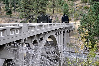
Hilgard Junction State Recreation Area is a state park in Hilgard, Oregon, United States, administered by the Oregon Parks and Recreation Department. Located along the Grande Ronde River next to Interstate 84 at its intersection with Highway 244, the park has Full RV hook-up sites and tent camp sites with flush toilets and showers nearby.
The Grande Ronde Valley is a valley in Union County in northeastern Oregon, United States. It is surrounded by the Blue Mountains, and is drained by the Grande Ronde River. La Grande is its largest community. The valley is 35 miles (56 km) long, north to south, from Pumpkin Ridge to Pyles Canyon, and 15 miles (24 km) wide, east to west, from Cove to the Grande Ronde River's canyon. Its name, fittingly, means, "great circle."
Orodell, also known as Oro Dell, is an unincorporated historic community in Union County, Oregon, United States, on the Grande Ronde River at the northwest edge of La Grande. It is considered a ghost town. Either Charles Fox or Stephen Coffin started the first sawmill in the Grande Ronde Valley there in the summer of 1862, after a joint-stock company between Coffin and other local settlers failed to materialize in 1861.

Dolph is an unincorporated community in Tillamook County, Oregon, United States, near the Yamhill County line. It lies at the junction of Oregon Route 22 and Oregon Route 130 between Grande Ronde and Hebo, on the Little Nestucca River. It is within the Siuslaw National Forest in the Northern Oregon Coast Range.
Nibley is an unincorporated historic community in Union County, Oregon, United States, about 11 miles east of La Grande on Oregon Route 237 in the Grande Ronde Valley.
The history of rail in Oregon predates the transcontinental railroad in 1869.
Perry is an unincorporated community in Union County, Oregon, United States. It is located five miles west of La Grande on the Grande Ronde River and Interstate 84. The town was originally named Stumptown, but was later renamed in honor of an early railroad dispatcher in La Grande.
The transportation system of Oregon is a cooperation of complex systems of infrastructure.