History
On January 2, 1838, the territorial legislature divided the County into two townships: the Town of Milwaukee, encompassing everything north of the present Greenfield Avenue, and the Town of Lake, encompassing everything South of the present Greenfield Avenue; "and the polls of election shall be opened at the house of Elisha Higgins, in said town." On March 8, 1839, a new Town of Kinnikennick was created, encompassing the western part of Lake (later the Towns of Greenfield and Franklin); and on August 13, 1840, the south portion of the Town of Lake was split off to form the town of Oak Creek. As of the 1840 census, the population of the Town of Lake (then including Oak Creek) was 418. [3]
According to the 1855 Wisconsin State Census, the Town of Lake's population was 2,127, with 1,308 of them having foreign birth.
The next diminution of the town took place in 1879 when Bay View incorporated as a village. Milwaukee annexed the north portions of the town soon after, and Bay View voted to allow Milwaukee to annex it in 1887.
Patrick Cudahy bought land in the area in 1892 for his meatpacking business. In 1895, this area was incorporated as the Village of Cudahy. After becoming a city, Cudahy later annexed lands south to the border of South Milwaukee.
In July 1951, the area along Lake Michigan north of Cudahy and south of Milwaukee incorporated as the City of St. Francis in order to prevent annexation from Milwaukee and keep profits from the Lakeside Power Plant in the area.
The City of Milwaukee annexed the remaining portion of the town on April 6, 1954, at which point the town ceased to exist. The City of Milwaukee grew by about 15,000 people overnight.
As part of President Franklin D. Roosevelt's Public Works Administration New Deal, an octagonal tower was built in 1938. It was to be the Lake City Hall and doubled as a water tower. This landmark features Art Deco details such as empire lines on the façade, scallops above the entrance and stair railings with chevron designs in them. No longer needed by the neighboring Department of Water Works treatment plant to equalize water pressure, the internal tank was abandoned and the building updated for use as municipal office space in 2001. [4]
In 1993, the Howard Avenue Water Purification Plant became the source of the Milwaukee Cryptosporidium outbreak, the largest documented waterborne disease outbreak in United States history.

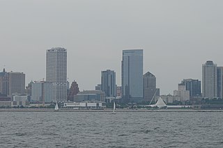
Milwaukee is the most populous city in the U.S. state of Wisconsin and the county seat of Milwaukee County. With a population of 577,222 at the 2020 census, Milwaukee also is the 31st-most populous city in the United States, and the fifth-most populous city in the Midwest. It is the central city of the Milwaukee metropolitan area, the 40th-most populous metro area in the U.S. Milwaukee is categorized as a "Gamma minus" city by the Globalization and World Cities Research Network, with a regional GDP of over $102 billion in 2020.

Milwaukee County is located in the U.S. state of Wisconsin. At the 2020 census, the population was 939,489, down from 947,735 in 2010. It is both the most populous and most densely populated county in Wisconsin, and the 45th most populous county nationwide; Milwaukee, its eponymous county seat, is also the most populous city in the state. The county was created in 1834 as part of Michigan Territory and organized the following year.

Greenfield is a city in the U.S. state of Wisconsin. Located in Milwaukee County, Greenfield is one of many bedroom communities in the Milwaukee metropolitan area. The population was 37,803 as of the 2020 Census.

Oak Creek is a city in the U.S. state of Wisconsin. Located in Milwaukee County, it sits on the southwestern shore of Lake Michigan and is located immediately south of Milwaukee. The city is one of the fastest growing in Milwaukee County and all of Wisconsin. As of the 2020 census, the population was 36,497.

Wauwatosa is a city in Milwaukee County, Wisconsin, United States. The population was 48,387 at the 2020 census. Wauwatosa is located immediately west of Milwaukee, and is a part of the Milwaukee metropolitan area. It is named after the Potawatomi Chief Wauwataesie and the Potawatomi word for firefly.

New Berlin is a city located in eastern Waukesha County in the U.S. state of Wisconsin. The population was 40,451 at the 2020 census, making it the third-largest community in Waukesha County after the cities of Waukesha and Brookfield.

The Milwaukee metropolitan area is a major metropolitan area located in Southeastern Wisconsin, consisting of the city of Milwaukee and some of the surrounding area. There are several definitions of the area, including the Milwaukee–Waukesha–West Allis metropolitan area and the Milwaukee–Racine–Waukesha combined statistical area. It is the largest metropolitan area in Wisconsin, and the 39th largest metropolitan area in the United States.

Granville was a town located in Milwaukee County, Wisconsin, United States. One portion was incorporated as the village of Brown Deer in 1955; the remainder consolidated with the City of Milwaukee in 1956, and became a neighborhood of Milwaukee.
The Town of Milwaukee was a town in Milwaukee County, Wisconsin, United States, created on March 17, 1835. A number of Milwaukee County municipalities, beginning with the City of Milwaukee, were created out of portions of it. After the last portions of the town were annexed, it officially ceased to exist in 1955.

Bay View is a neighborhood in Milwaukee, Wisconsin, United States, North America on the shores of Lake Michigan, south of the downtown area and north of the City of St. Francis. Bay View existed as an independent village for eight years, from 1879 to 1887.

The East Side is a district of Milwaukee, Wisconsin consisting of several neighborhoods encompassing an area just north of Downtown Milwaukee to the village of Shorewood, bordered by the Milwaukee River to the west and Lake Michigan to the east. The area encompasses residences, museums, bars, shops, theaters, live music clubs and the University of Wisconsin–Milwaukee campus.

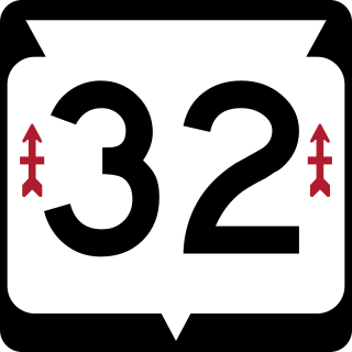
State Trunk Highway 32 is a state highway in the U.S. state of Wisconsin that runs north–south in the eastern part of the state. It runs from the Illinois border north to the Michigan border. It is named the 32nd Division Memorial Highway after the U.S. 32nd Infantry Division, and the highway shields have red arrows—the division's logo—on either side of the number 32. The route of WIS 32 and the Red Arrow marking is set in state statute by the Wisconsin Legislature.

Franklin is a city in Milwaukee County, Wisconsin, United States. It is a suburb of Milwaukee with a population of 36,816 as of the 2020 census.

The neighborhoods of Milwaukee include a number of areas in southeastern Wisconsin within the state's largest city at nearly 600,000 residents.
Milwaukee, Wisconsin's history, which includes over 160 years of immigration, politics, and industry, has given it a distinctive heritage.
Community Newspapers Inc. (CNI) is a subsidiary of Gannett. Based in New Berlin, Wisconsin, it publishes eight weekly newspapers in the Milwaukee metropolitan area. CNI has about 110 full-time employees and about 30 part-time employees.

The Town of Milwaukee Town Hall was built in 1872 in what is now Glendale, Wisconsin. It was the seat of government of the Town of Milwaukee, Wisconsin until the town ceased to exist after portions of it were annexed into different municipalities. The building was added to the National Register of Historic Places in 1986.

In Milwaukee, freeways were constructed in response to an 8.5% increase in population during the 1940s. Road plans were drawn up in the 1950s through the 1970s and several freeways were built. A lack of foresight resulted in several communities experiencing sharp increases in property taxes such as in West Milwaukee, or the complete destruction of vibrant, African-American neighborhoods such as Bronzeville. After a decade of aggressive highway building in the 1960s, support for freeway construction began to wane as neighborhoods started to oppose construction. With the election of John Norquist as mayor in 1988, Milwaukee began to undo some of the damage of its highway construction. The dismantling of the Park East Freeway north of downtown led to a housing and entertainment construction boom and is the location of Fiserv Forum.

Downtown Milwaukee is the central business district of Milwaukee, Wisconsin. The economic and symbolic center of the city and the Milwaukee metropolitan area, it is Milwaukee's oldest district and home to many of region's cultural, financial educational and historical landmarks including Milwaukee City Hall, Fiserv Forum and the Milwaukee Art Museum. The city's modern history began in Downtown Milwaukee in 1795 when fur trader Jacques Vieau (1757–1852) built a post along a bluff on the east side, overlooking the Milwaukee and Menomonee rivers.


