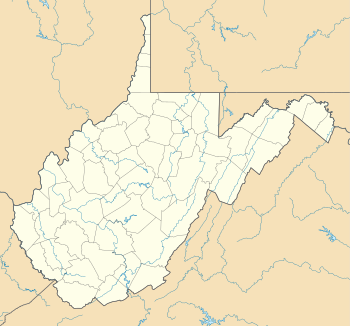
List of National Historic Landmarks in West Virginia

Last updated

This article includes a List of National Historic Landmarks in West Virginia .

Contents

National Historic Landmarks in West Virginia

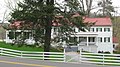
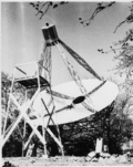
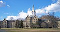
There are 17 National Historic Landmarks in the state. The following is a complete list.

[1] Landmark nameImageDate designated [2] Location CountyDescription
1 Andrews Methodist Episcopal Church
Andrews Methodist Episcopal Church Andrews Methodist Episcopal Church, the International Mother's Day Shrine. Grafton, West Virginia LCCN2015631665.tif
Andrews Methodist Episcopal Church
October 5, 1992
(#70000667)
Grafton
39°20′20″N80°01′07″W / 39.3388548502°N 80.0185436005°W / 39.3388548502; -80.0185436005 (Andrews Methodist Episcopal Church)
Taylor Where the Mother's Day holiday was started.
2 Baltimore and Ohio Railroad Martinsburg Shops
Baltimore and Ohio Railroad Martinsburg Shops Baltimore & Ohio Railroad, Martinsburg West Roundhouse, East End of Race & Martin Streets, Martinsburg (Berkeley County, West Virginia).jpg
Baltimore and Ohio Railroad Martinsburg Shops
July 31, 2003
(#03001045)
Martinsburg
39°27′39″N77°57′34″W / 39.460833°N 77.959444°W / 39.460833; -77.959444 (Baltimore and Ohio Railroad Martinsburg Shops)
Berkeley Architecturally significant railway buildings, also where the Great Railroad Strike of 1877 began.
3 Campbell Mansion
Campbell Mansion Alexander Campbell Mansion.jpg
Campbell Mansion
April 19, 1994
(#70000651)
Bethany
40°12′21″N80°32′51″W / 40.2057321567°N 80.5476076794°W / 40.2057321567; -80.5476076794 (Campbell Mansion)
Brooke Home of Alexander Campbell, founder and president of Bethany College
4 Clover site
Clover site Green Bottom WMA looking toward Clover Site.jpg
Clover site
April 27, 1992
(#92001881)
Lesage
38°35′24″N82°13′54″W / 38.590000°N 82.231667°W / 38.590000; -82.231667 (Clover site)
Cabell Archaeological site.
5 Davis and Elkins Historic District
Davis and Elkins Historic District Davis and Elkins Gate House.jpg
Davis and Elkins Historic District
June 7, 1998
(#96001129)
Elkins
38°55′44″N79°50′57″W / 38.9289808836°N 79.8492664145°W / 38.9289808836; -79.8492664145 (Davis and Elkins Historic District)
Randolph Historic district including Graceland and Halliehurst mansions
6 Elkins Coal and Coke Company Historic District
Elkins Coal and Coke Company Historic District Elkins Coal & Coke Company, Bretz vicinity (Preston County, West Virginia).jpg
Elkins Coal and Coke Company Historic District
May 4, 1983
(#83003249)
Bretz
39°32′42″N79°48′35″W / 39.545000°N 79.809722°W / 39.545000; -79.809722 (Elkins Coal and Coke Company Historic District)
Preston 140 beehive coke ovens, the last operated in the United States.
7 Grave Creek Mound
Grave Creek Mound Grave Creek Mound.jpg
Grave Creek Mound
July 19, 1964
(#66000751)
Moundsville
39°55′00″N80°44′42″W / 39.91676°N 80.744978°W / 39.91676; -80.744978 (Grave Creek Mound)
Marshall The United States' largest cone-shaped burial mound, 62 feet (19 m) tall, 240 feet (73 m) diameter at base.
8 The Greenbrier
The Greenbrier 2008-0831-TheGreenbrier-North.jpg
The Greenbrier
June 21, 1990
(#74002000)
White Sulphur Springs
37°47′07″N80°18′30″W / 37.7854°N 80.3083°W / 37.7854; -80.3083 (The Greenbrier)
Greenbrier Hotel and emergency relocation center for the U.S. congress.
9 Jefferson County Courthouse
Jefferson County Courthouse 2016-09-27 12 32 38 The Jefferson County Court House at the intersection of West Virginia State Route 115 (George Street) and West Virginia State Route 51 (Washington Street) in Charles Town, Jefferson County, West Virginia.jpg
Jefferson County Courthouse
December 11, 2023
(#100009833)
Charles Town
39°17′21″N77°51′37″W / 39.2892°N 77.8603°W / 39.2892; -77.8603 (Jefferson County Courthouse)
Jefferson
10 Matewan Historic District
Matewan Historic District Matewan Historic District; Matewan, West Virginia.JPG
Matewan Historic District
February 18, 1997
(#93000303)
Matewan
37°37′23″N82°09′59″W / 37.623056°N 82.166389°W / 37.623056; -82.166389 (Matewan Historic District)
Mingo Site of bloody 1920 coal miners' strike depicted in John Sayles' film Matewan
11 Old Main, Bethany College
Old Main, Bethany College Old Main at Bethany College, eastern front.jpg
Old Main, Bethany College
June 21, 1990
(#70000652)
Bethany
40°12′14″N80°33′37″W / 40.2038891197°N 80.5603100305°W / 40.2038891197; -80.5603100305 (Old Main, Bethany College)
Brooke Historic main building on Bethany College campus.
12 Reber Radio Telescope
Reber Radio Telescope Grote Antenna Wheaton.gif
Reber Radio Telescope
December 20, 1989
(#72001291)
Green Bank
38°25′42″N79°49′04″W / 38.428307822°N 79.8179043296°W / 38.428307822; -79.8179043296 (Reber Radio Telescope)
Pocahontas First parabolic radio telescope, built by amateur astronomer Grote Reber.
13 Traveller's Rest
Traveller's Rest Traveler's Rest WV1.jpg
Traveller's Rest
November 28, 1972
(#72001288)
Kearneysville
39°23′17″N77°54′03″W / 39.388056°N 77.900833°W / 39.388056; -77.900833 (Traveller's Rest)
Jefferson Homestead of General Horatio Gates and a rare surviving example of Virginia architect John Ariss's work.
14 Alexander Wade House
Alexander Wade House Alexand Wade.JPG
Alexander Wade House
December 21, 1965
(#66000752)
Morgantown
39°37′31″N79°57′30″W / 39.625271°N 79.958328°W / 39.625271; -79.958328 (Alexander Wade House)
Monongalia Home of innovative educator Alexander Wade.
15 West Virginia Independence Hall
West Virginia Independence Hall WVIndependenceHall.jpg
West Virginia Independence Hall
June 20, 1988
(#70000660)
Wheeling
40°03′53″N80°43′20″W / 40.064742°N 80.722142°W / 40.064742; -80.722142 (West Virginia Independence Hall)
Ohio Site of 1861–1863 pro-Union government of Virginia.
16 Weston Hospital
Weston Hospital Weston State Hospital.jpg
Weston Hospital
June 21, 1990
(#78002805)
Weston
39°02′19″N80°28′17″W / 39.03861°N 80.4713889°W / 39.03861; -80.4713889 (Weston Hospital)
Lewis One of the largest hand-cut stone masonry buildings in the United States.
17 Wheeling Suspension Bridge
Wheeling Suspension Bridge WheelingSuspBridge.jpg
Wheeling Suspension Bridge
May 15, 1975
(#70000662)
Wheeling
40°04′06″N80°43′38″W / 40.0682684288°N 80.7273516865°W / 40.0682684288; -80.7273516865 (Wheeling Suspension Bridge)
Ohio World's first long suspension bridge.

See also

Related Research Articles

<span class="mw-page-title-main">National Register of Historic Places listings in Berkeley County, West Virginia</span>

This is a list of the National Register of Historic Places listings in Berkeley County, West Virginia.

<span class="mw-page-title-main">National Register of Historic Places listings in Jefferson County, West Virginia</span>

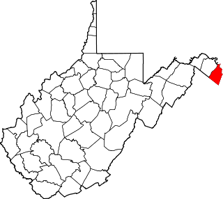
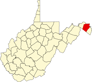
This is a list of the National Register of Historic Places listings in Jefferson County, West Virginia.

<span class="mw-page-title-main">National Register of Historic Places listings in Randolph County, West Virginia</span>

This is a list of the National Register of Historic Places listings in Randolph County, West Virginia.

<span class="mw-page-title-main">National Register of Historic Places listings in Marion County, West Virginia</span>

This is a list of the National Register of Historic Places listings in Marion County, West Virginia.

<span class="mw-page-title-main">National Register of Historic Places listings in Tyler County, West Virginia</span>

This is a list of the National Register of Historic Places listings in Tyler County, West Virginia.

<span class="mw-page-title-main">National Register of Historic Places listings in Doddridge County, West Virginia</span>

This is a list of the National Register of Historic Places listings in Doddridge County, West Virginia.

<span class="mw-page-title-main">National Register of Historic Places listings in Upshur County, West Virginia</span>

This is a list of the National Register of Historic Places listings in Upshur County, West Virginia.

<span class="mw-page-title-main">National Register of Historic Places listings in Calhoun County, West Virginia</span>

This is a list of the National Register of Historic Places listings in Calhoun County, West Virginia.

<span class="mw-page-title-main">National Register of Historic Places listings in Gilmer County, West Virginia</span>

This is a list of the National Register of Historic Places listings in Gilmer County, West Virginia.

<span class="mw-page-title-main">National Register of Historic Places listings in Lincoln County, West Virginia</span>

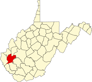
This is a list of the National Register of Historic Places listings in Lincoln County, West Virginia.

<span class="mw-page-title-main">National Register of Historic Places listings in Pleasants County, West Virginia</span>

This is a list of the National Register of Historic Places listings in Pleasants County, West Virginia.

<span class="mw-page-title-main">National Register of Historic Places listings in Putnam County, West Virginia</span>

This is a list of the National Register of Historic Places listings in Putnam County, West Virginia.

<span class="mw-page-title-main">National Register of Historic Places listings in Roane County, West Virginia</span>

This is a list of the National Register of Historic Places listings in Roane County, West Virginia.

<span class="mw-page-title-main">National Register of Historic Places listings in Summers County, West Virginia</span>

This is a list of the National Register of Historic Places listings in Summers County, West Virginia.

<span class="mw-page-title-main">National Register of Historic Places listings in Taylor County, West Virginia</span>

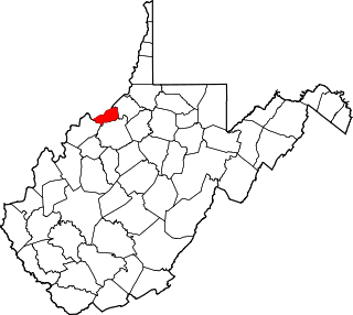
This is a list of the National Register of Historic Places listings in Taylor County, West Virginia.

<span class="mw-page-title-main">National Register of Historic Places listings in Wayne County, West Virginia</span>

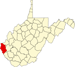
This is a list of the National Register of Historic Places listings in Wayne County, West Virginia.

<span class="mw-page-title-main">National Register of Historic Places listings in Wirt County, West Virginia</span>

This is a list of the National Register of Historic Places listings in Wirt County, West Virginia.

References

  1. Numbers represent an alphabetical ordering by significant words. Various colorings, defined here, differentiate National Historic Landmarks and historic districts from other NRHP buildings, structures, sites or objects.
  2. The eight-digit number below each date is the number assigned to each location in the National Register Information System database, which can be viewed by clicking the number.