West Kalimantan is a province of Indonesia. It is one of five Indonesian provinces comprising Kalimantan, the Indonesian part of the island of Borneo. Its capital and largest city is Pontianak. It is bordered by East Kalimantan and Central Kalimantan to the east, the Malaysian state of Sarawak to the north, and the Pacific Ocean to the west and the Java Sea to the south. The province has an area of 147,037 km2, and had a population of 4,395,983 at the 2010 Census and 5,414,390 at the 2020 Census; the official estimate as at mid 2023 was 5,623,328. Ethnic groups include the Dayak, Malay, Chinese, Javanese, Bugis, and Madurese. The borders of West Kalimantan roughly trace the mountain ranges surrounding the vast watershed of the Kapuas River, which drains most of the province. The province shares land borders with Central Kalimantan to the southeast, East Kalimantan to the east, and the Malaysian territory of Sarawak to the north.

Kapuas Hulu Regency is a regency in West Kalimantan province of Indonesia. Located around Kapuas River, it has a total area of 29,842.03 square kilometres or around 20.26% of West Kalimantan province's area. The regency seat is located in town of Putussibau, where most of its economic and government activities take place. Due to its relatively large area, it is sparsely populated compared to neighbouring regencies around it. The regency had a population of 222,160 at the 2010 Census and 252,609 according to the 2020 Census; the official estimate as at mid 2022 was 254,995.

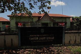
Bulungan Regency is a regency of North Kalimantan Province in Indonesia. It covers an area of 13,181.92 km2 and had a population of 112,663 at the 2010 Census and 151,844 at the 2020 Census; the official estimate as at mid 2022 was 157,593. The administrative centre is at Tanjung Selor.

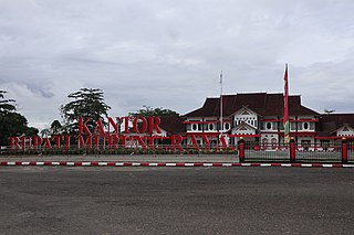
Rokan Hilir is a regency (kabupaten) of Riau Province, on Sumatra island, Indonesia. It was formed on 4 October 1999 from districts which had previously been the northwestern part of Bengkalis Regency. It occupies the lower part of the catchment area of the Rokan River, and has an area of 8,851.59 km2. It had a population of 553,216 at the 2010 census and 637,161 at the 2020 census; the official estimate as at mid 2022 was 638,407. The administrative centre of the Rokan Hilir Regency is located at the town of Bagansiapiapi.

Tabalong Regency is the most northerly of the regencies in the Indonesian province of South Kalimantan, on Borneo Island. It was created on 14 July 1965 by splitting off the northern districts of North Hulu Sungai Regency. It has an area of 3,553.36 km2, and had a population at the 2010 Census of 218,620 and 253,305 at the 2020 Census; the official estimate as of mid-2022 was 261,353. The administrative capital is the town of Tanjung. Motto: "Saraba Kawa" (Banjarese).

Tapin Regency is one of regencies in the Indonesian province of South Kalimantan. The regency was created on 14 July 1965 by splitting off the districts which had until then comprised the southern part of South Hulu Sungai Regency. The regency's motto is "Ruhui Rahayu", and this is also shared by another Indonesian province. It covers an area of 2,174.95 km2 and had a population of 167,877 at the 2010 Census and 189,475 at the 2020 Census; the official estimate as at mid 2022 was 194,628. The administrative centre of the regency is at the town of Rantau.

Bintan Regency is an administrative area in the Riau Islands Province of Indonesia. Bintan Regency includes all of Bintan Island and also includes many outlying islands including the Tambelan Archipelago and Badas Islands situated between Bintan and West Kalimantan.

West Kutai Regency is a regency (kabupaten) in the Indonesian province of East Kalimantan. It previously covered a much greater area, with a population of 165,091 at the 2010 Census, but in December 2012 the five northernmost districts were split off to form a new Mahakam Ulu Regency; the residual area of 20,384.6 km2 had a population of 140,097 at the 2010 Census, and 165,938 at the 2020 Census; the official estimate as at mid 2022 was 172,288. The town of Sendawar is the administrative capital.

Murung Raya Regency is the most northerly of the thirteen regencies (kabupaten) which comprise the province of Central Kalimantan on the island of Borneo, Indonesia. It was created on 10 April 2002 from the former northwestern two-thirds of the North Barito Regency. The capital of the regency is the town of Puruk Cahu. The regency covers an area of 23,700 km2 and had a population of 96,857 inhabitants at the 2010 census and 111,527 at the 2020 census; the official estimate as at mid 2022 was 113,483.

Paser Regency is a regency (kabupaten) within East Kalimantan province in Indonesia, it is the southernmost regency of the East Kalimantan province. Its administrative centre is Tana Paser. It covers an area of 7,730 km2, and it had a population of 230,316 at the 2010 Census and 275,452 at the 2020 Census; the official estimate as at mid-2022 was 280,065 . Before 2007, this regency was formerly named Pasir Regency.

Pasangkayu Regency is one of the six regencies which comprise West Sulawesi Province, Indonesia, on the island of Sulawesi. It covers an area of 3,043.75 km2 and had a population of 134,303 at the 2010 Census and 188,861 at the 2020 Census. The official estimate as at mid 2023 was 204,216. The town of Pasangkayu is the capital and chief town of the regency.

North Barito Regency is one of the thirteen regencies which divide the Central Kalimantan Province on the island of Kalimantan, Indonesia. It originally included much more of the northern part of the province, but on 10 April 2002 the larger northwestern part of the regency was split off to create a new Murung Raya Regency. Muara Teweh is the capital of North Barito Regency, which covers an area of 10,152.25 km2. The population of North Barito Regency was 121,573 at the 2010 Census and 154,812 at the 2020 Census; the official estimate as at mid 2022 was 160,235.

Katingan Regency is one of the thirteen regencies which comprise the Central Kalimantan Province on the island of Kalimantan (Borneo), Indonesia. It was created on 10 April 2002 from what were previously the eastern districts of East Kotawaringin Regency. The town of Kasongan is the capital of the Regency, which covers an area of 17,500 km2. The population of Katingan Regency was 146,439 at the 2010 Census and 162,222 at the 2020 Census; the official estimate as at mid 2022 was 163,989.

West Kotawaringin Regency is one of the thirteen regencies which comprise the Central Kalimantan Province on the island of Kalimantan (Borneo), Indonesia. It originally comprised the whole western part of the province, but on 10 April 2002 the most westerly districts were split off to form the new Lamandau Regency and Sukamara Regency. The population of the residual part of West Kotawaringin Regency was 235,803 at the 2010 Census and 270,388 at the 2020 Census; the official estimate as at mid 2022 was 274,935. The town of Pangkalan Bun in Arut Selatan District is the capital of West Kotawaringin Regency. The regency has an area of about 10,759 km2.

East Kotawaringin Regency is one of the thirteen regencies which comprise the Central Kalimantan Province on the island of Kalimantan (Borneo), Indonesia. It originally covered a much larger part of the province, but on 10 April 2002 several districts in the west of the regency were split off to form the new Seruyan Regency, and several districts in the east of the regency were similarly split off to form the new Katingan Regency. The population of the residual East Kotawaringin Regency was 374,175 at the 2010 Census, and 428,900 at the 2020 Census; the official estimate as at mid 2022 was 436,079. The town of Sampit is the capital of East Kotawaringin Regency.

Seruyan Regency is one of the thirteen regencies which comprise the Central Kalimantan Province on the island of Kalimantan (Borneo), Indonesia. It was created on 10 April 2002 from what were previously the western districts of East Kotawaringin Regency. The town of Kuala Pembuang in Seruyan Hilir District is the capital of Seruyan Regency. The population of the Regency was 139,931 at the 2010 Census and 162,906 at the 2020 census; the official estimate was at mid 2022 was 166,072.

Kubu Raya Regency or Great Kubu Regency is a regency of West Kalimantan, Indonesia. It was created on 17 July 2007 from the (larger) central and southern part of what was at that time the Pontianak Regency. It covers an area of 8,492.10 km2, and it had a population of 500,970 at the 2010 Census and 609,392 at the 2020 Census; the official estimate as at mid 2022 was 622,217. The principal town lies at Sungai Raya, directly adjacent to the City of Pontianak. Despite its close location to Pontianak, the regional capital and economic centre of the West Kalimantan Province, Kubu Raya highly lacks sufficient infrastructure development, which has caused general suspicions regarding the performance of its local government.

Ketapang Regency is a regency in the south of the province of West Kalimantan, on the island of Borneo in Indonesia. Ketapang Regency occupies an area of 31,588 km2, and at the census in 2010 it had 427,460 inhabitants following the splitting off of five districts in the north-west of the regency on 2 January 2007 to form the new North Kayong Regency; the 2020 census revealed a growth in population to 570,657 over the intervening decade; the official estimate as at mid 2023 was 592,521. The principal town lies at Ketapang.

Landak Regency is a regency of West Kalimantan province, Indonesia. It was created on 4 October 1999 from the northeastern part of Pontianak Regency. It covers 9,909.10 km2 and had a population of 329,649 at the 2010 Census and 397,610 at the 2020 Census; the official estimate as at mid 2023 was 413,588. The principal town lies at Ngabang. Landak is also one of the four regencies in West Kalimantan whose population is predominantly Catholic, the others being Sanggau, Sekadau, and Sintang.

Sintang Regency is a regency of West Kalimantan province of Indonesia. It covers an area of 21,638.2 km2, and had a population of 364,759 at the 2010 Census and 421,306 at the 2020 Census; the official estimate as at mid 2022 was 426,416. It is one of the few Indonesian regencies having a land border with other countries. It is also the second largest regency in the province by land area after Landak Regency. The regency was formerly the site of the Sintang Kingdom, a Hindu kingdom that later converted to Islam and which was a regional power in the interior of Borneo Island. The regency seat is located at the large town of Sintang, which is among the biggest settlements in Borneo's interior alongside Putussibau and Puruk Cahu.


