Municipality of the District of Clare

Last updated

Clare
Municipality of the District of Clare
Municipalité du district de Clare
Clare NS seal.png
Clare Municipal District - Nova Scotia.PNG
Location of the Municipality of the District of Clare
Coordinates: 44°20′00″N66°07′00″W / 44.333333°N 66.116667°W / 44.333333; -66.116667
CountryCanada
Province Nova Scotia
County Digby
IncorporatedApril 17, 1879
Electoral Districts      
Federal

West Nova
Provincial Clare
Government
  TypeDistrict of Clare Municipal Council
   County seat Little Brook
  WardenYvon LeBlanc
Area
[1]
  Land851.14 km2 (328.63 sq mi)
Population
 (2021) [2]
  Total7,678
  Density9.0/km2 (23/sq mi)
  Change 2016–21
Decrease2.svg4.2%
Time zone UTC-4 (AST)
  Summer (DST) UTC-3 (ADT)
Area code(s) 902 – 769,837,645,778
Dwellings4,681
Median Income*$41,450 CDN
Website Official website
  • Median household income, 2005 (all households)

Clare, officially named the Municipality of the District of Clare, is a district municipality in western Nova Scotia, Canada. Statistics Canada classifies the district municipality as a municipal district.

Contents

Geography

The Municipality of the District of Clare occupies the western half of Digby County. Most of the municipality's settled areas are located along St. Marys Bay, a sub-basin of the Gulf of Maine.

History

The township was settled in 1768 by Acadian families who had returned to Nova Scotia from exile. [3] Prior to the establishment of Clare the Mi'kmaw knew the area as Wagweiik. The mouth of Salmon River is thought to be a traditional summer settlement of the Mi'kmaw and several artifacts have been found there, as well as at Meteghan, Major's Point and other sites [2]. Place names like Hectanooga, Mitihikan (Meteghan), and Chicaben (Church Point) are found in the area. They also had a principal settlement by River Allen near Cape Sainte-Marie used for fishing and as a canoe route [3]. The Mi'kmaw also used a fishing weir system for catching mackerel and herring that they taught to the new settlers, which they continued to use until well into the 1900s, and fish drying techniques that continue today. They also caught eels, seals, clams, urchins and other sea life, as well as berries, medicinal plants and other coastal resources. As new settlers arrived in the 1760s–1780s, the Mi'kmaw were instrumental in helping the new Acadians survive and become skilled in surviving the harsh winters along the coast. By the 1800s most Mi'kmaw had left the area to live on the Reserve in Bear River, while still returning for fishing, hunting, trade and ceremony throughout the year. It was named "Clare" by then Lieutenant Governor of Nova Scotia, Michael Francklin. The name comes from the County Clare in Ireland. [3]

Present day

The municipality is inhabited by many Acadians and their descendants and conducts its business in both English and French, although the official language is English and both languages are used. The only French university in the province of Nova Scotia, Université Sainte-Anne, is located in Church Point (Pointe-de-l'Église / Chicoben) and 47% of the adult population has a postsecondary education. The area hosts the oldest and largest annual Acadian Festival, as well as Nova Scotia's first Gran Fondo cycling event, which was cancelled in 2020 due to COVID-19.

Demographics

Historical population
YearPop.±%
19819,598    
19869,740+1.5%
19919,654−0.9%
1996 9,298−3.7%
2001 9,067−2.5%
2006 8,813−2.8%
2011 8,319−5.6%
2016 8,018−3.6%
2021 7,678−4.2%
Source: Statistics Canada: [4] [5]

In the 2021 Census of Population conducted by Statistics Canada, the Municipality of the District of Clare had a population of 7,678 living in 3,607 of its 4,393 total private dwellings, a change of

Communities

Access routes

Highways and numbered routes that run through the district municipality, including external routes that start or finish at the municipal boundary: [7]

Culture

Musical groups from the area include:

The song M'en allant par Saulnierville Station written by Denis Comeau and recorded by Suroît is a song about the local community of Saulnierville Station.

Musicians from the area include:

Filmmaker:

See also

Related Research Articles

<span class="mw-page-title-main">Annapolis County, Nova Scotia</span> County in Nova Scotia, Canada

Annapolis County is a county in the Canadian province of Nova Scotia located in the western part of the province located on the Bay of Fundy. The county seat is Annapolis Royal.

<span class="mw-page-title-main">Colchester County</span> County in Nova Scotia, Canada

Colchester County is a county in the Canadian province of Nova Scotia. With a population of 51,476 the county is the fourth largest in Nova Scotia. Colchester County is located in north central Nova Scotia.

<span class="mw-page-title-main">Digby County, Nova Scotia</span> County in Nova Scotia, Canada

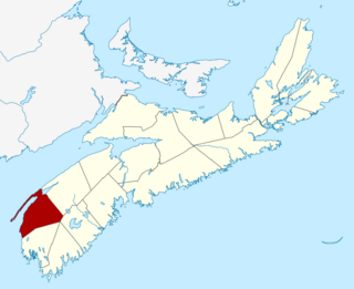
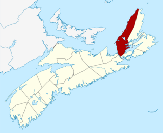
Digby County is a county in the Canadian province of Nova Scotia.

<span class="mw-page-title-main">Kings County, Nova Scotia</span> County in Nova Scotia, Canada

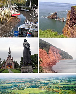
Kings County is a county in the Canadian province of Nova Scotia. With a population of 62,914 in the 2021 Census, Kings County is the third most populous county in the province. It is located in central Nova Scotia on the shore of the Bay of Fundy, with its northeastern part forming the western shore of the Minas Basin.

<span class="mw-page-title-main">Pugwash, Nova Scotia</span> Village in Nova Scotia, Canada

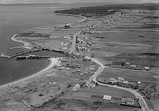
Pugwash is an incorporated village in Cumberland County, Nova Scotia, Canada, located on the Northumberland Strait at the mouth of the Pugwash River. It had a population of 746 as of the 2021 census. The name Pugwash is derived from the Mi'kmaq word, Pakwesk meaning "a shoal", in reference to a reef near the mouth of the harbour.

<span class="mw-page-title-main">Mahone Bay, Nova Scotia</span> Town in Nova Scotia, Canada

Mahone Bay is a town on the northwest shore of Mahone Bay along the South Shore of Nova Scotia in Lunenburg County. A long-standing picturesque tourism destination, the town has recently enjoyed a growing reputation as a haven for entrepreneurs and business startups. The town has the fastest growing population of any municipality in Nova Scotia according to the 2016 census, experiencing 9.9% population growth.

Chéticamp is an unincorporated place on the Cabot Trail on the west coast of Cape Breton Island in Nova Scotia, Canada. It is a local service centre. A majority of the population are Acadians. Together with its smaller neighbour, Saint-Joseph-du-Moine, Chéticamp makes up the largest Francophone enclave on Cape Breton Island. The 2006 population was 3,039 people.

<span class="mw-page-title-main">Shelburne, Nova Scotia</span> Town in Nova Scotia, Canada

Shelburne is a town located in southwestern Nova Scotia, Canada.

<span class="mw-page-title-main">Municipality of the District of Barrington</span> District municipality in Nova Scotia, Canada

Barrington, officially named the Municipality of the District of Barrington, is a district municipality in western Shelburne County, Nova Scotia, Canada. Statistics Canada classifies the district municipality as a municipal district.

Shubenacadie is a village located in Hants County, in central Nova Scotia, Canada. As of 2021, the population was 411.

<span class="mw-page-title-main">Souris, Prince Edward Island</span> Town in Prince Edward Island, Canada

Souris is a town in Kings County, Prince Edward Island, Canada. It is located near the northeastern tip of the province.

<span class="mw-page-title-main">Municipality of the District of Shelburne</span> District municipality in Nova Scotia, Canada

District of Shelburne, officially named the Municipality of the District of Shelburne, is a district municipality comprising the eastern section of Shelburne County, Nova Scotia, Canada, but does not include the Towns of Shelburne or Lockeport. Statistics Canada classifies the district municipality as a municipal district. It is home to the Bowers Meadows Wilderness Area.

<span class="mw-page-title-main">Saulnierville</span>

Meteghan is an Acadian fishing community along the shores of Baie Sainte-Marie in Clare municipality, Digby County, Nova Scotia, Canada. It is 25 miles northeast of Yarmouth.

<span class="mw-page-title-main">St. Marys Bay, Nova Scotia</span> Bay in Nova Scotia, Canada

St. Marys Bay south western Nova Scotia, Canada, is surrounded by the modern municipal districts of Clare Municipal District and Digby.

<span class="mw-page-title-main">Municipality of the District of Digby</span> District municipality in Nova Scotia, Canada

Digby, officially named the Municipality of the District of Digby, is a district municipality in Digby County, Nova Scotia, Canada. Statistics Canada classifies the district municipality as a municipal district.

<span class="mw-page-title-main">Ambroise-Hilaire Comeau</span> Canadian politician

Ambroise-Hilaire Comeau was a merchant and political figure in Nova Scotia, Canada. He represented Digby County in the Nova Scotia House of Assembly from 1890 to 1907 as a Liberal member. He is the first Canadian Senator of Acadian descent from Nova Scotia. His name appears in some sources as Ambrose H. Comeau.

<span class="mw-page-title-main">Belliveau Cove, Nova Scotia</span>

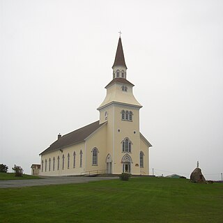
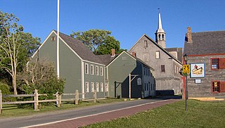
Belliveau Cove is a historical Acadian community in the Canadian province of Nova Scotia, located in the District of Clare in Digby County settled in 1768 on un-ceded Mi'kmaq territory. A major centre of wooden shipbuilding in the 19th and early 20th century, Belliveau Cove built the second largest wooden ship ever constructed in Canada, the County of Yarmouth in 1884. It is now a mixed community of citizens with diverse backgrounds, including Acadians.

<span class="mw-page-title-main">Municipality of the County of Inverness</span> County municipality in Nova Scotia, Canada

The Municipality of the County of Inverness is a county municipality on Cape Breton Island, Nova Scotia, Canada. It provides local government to about 17,000 residents of the historical county of the same name, except for the incorporated town of Port Hawkesbury and the Whycocomagh 2 Miꞌkmaq reserve, both of which are enclaves. Public services are provided in the areas of recreation, tourism, administration, finance, and public works.

References

  1. 1 2 2006 Statistics Canada Community Profile: Clare Municipal District, Nova Scotia
  2. Statistics Canada Census Profile, 2021 Census of Population – 100% data
  3. 1 2 Brown, Thomas J. (1922). Place-names of the Province of Nova Scotia. Halifax, Nova Scotia: Royal Print & Litho. p. 85.
  4. 1996, 2001, 2006 census
  5. 1 2 "Population and dwelling counts: Canada, provinces and territories, census divisions and census subdivisions (municipalities), Nova Scotia". Statistics Canada. February 9, 2022. Retrieved March 12, 2022.
  6. Government of Canada, Statistics Canada (February 8, 2017). "Census Profile, 2016 Census - Clare, Municipal district [Census subdivision], Nova Scotia and Nova Scotia [Province]". www12.statcan.gc.ca.
  7. Atlantic Canada Back Road Atlas ISBN   978-1-55368-618-7 Page 84

44°20′N66°07′W / 44.333°N 66.117°W / 44.333; -66.117