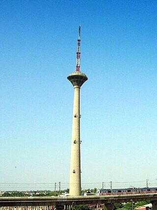
Pitampura is a residential area in North West Delhi district of Delhi, India. It is located adjacent to Rohini. It is a planned neighbourhood developed by the Delhi Development Authority in the 1980s and Pitampura TV Tower, was built in 1988. Dilli Haat Pitampura is also situated near the TV tower. Situated West -part of Delhi, it is an upscale residential, commercial and retail centre. The area is encompassed between Outer and Inner Ring Roads, NH-1 and Rohtak Road. It has two wards, Pitampura and Pitampura North, under the Rohini zone of Municipal Corporation of Delhi.
The Mudrika Seva is one of the most popular bus routes in Delhi, India. It was started by the Delhi Transport Corporation (DTC) in May 1974, and is now operated by both the Corporation and DIMTS' cluster buses. The service runs on Delhi's inner ring road, with major stops at AIIMS, Lajpat Nagar, Sarai Kale Khan, ITO, Delhi Gate, Kashmere Gate, DU North Campus, Model Town, Azadpur market, Shalimar Bagh, Punjabi Bagh, Britannia Factory, Rajouri Garden, Naraina, and DU South Campus.
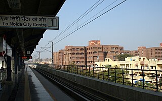
Mayur Vihar is an upmarket residential area in East Delhi close to the Noida-Delhi border, situated just across the Yamuna River, and is divided into three distinct phases. As the name suggests, it has been the dwelling (vihar) of peacocks (mayur). Even today, the area has a closed sanctuary dedicated to the conservation of peacocks.
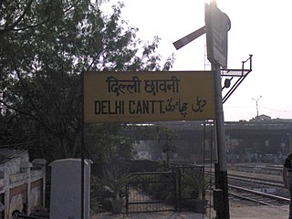
Delhi Cantonment is a Class I Cantonment Board established in 1914. The area of the Cantonment is 10,452 acres (42.30 km2) and the population of the Cantonment as per the 2011 census is 110,351.
Ramakrishna Puram popularly known as R.K. Puram, is a residential colony in Delhi. Named after the saint Sri Ramakrishna, it houses many high-profile corporate houses.

Saket is a residential colony and the administrative headquarters of the South Delhi district of Delhi in India. The neighborhood is named after the city of Ayodhya, also known as Saket, an ancient, religiously significant city in Uttar Pradesh. Saket has four major malls on the Press Enclave Marg. The neighbourhood is home to the first Apple Store, called the Apple Saket, in New Delhi and the second in India, after Apple BKC located in Bandra Kurla Complex of the financial centre of the country, Mumbai.

The Inner Ring Road refers to one of the two main ring roads, the main inner one and an outer one in Delhi, India. The two ring roads have a combined length of 87 km (54 mi). There are two less significant Ring Roads in Delhi apart from the above two, namely the Rural Ring Road, that runs across the rural areas on the fringe of North West Delhi and West Delhi Ring Road, limited only to the West Delhi region.
Patparganj is a locality situated in East Delhi District of the National Capital Territory of Delhi, India, and is located near the border with Uttar Pradesh.
Dwarka is a neighbourhood located in Southwestern edge of Indian Capital New Delhi in South West Delhi & West Delhi districts of the NCT of Delhi. The district court that functions under the Delhi High Court for South West Delhi is located in Dwarka.
Saraswati Vihar is an upscale residential area in North West Delhi near Pitampura. Saraswati Vihar is also one of the three administrative divisions of the North West Delhi district.

West Delhi is one of the 11 administrative districts of the National Capital Territory of Delhi in India. Administratively, the district is divided into three subdivisions, Patel Nagar, Rajouri Garden and Punjabi Bagh.

Okhla, short for Old Kanal Housing and Land Authority, an urban neighbourhood located near the Okhla barrage in the South East Delhi district of Delhi near the border between Delhi and Uttar Pradesh. Okhla has lent its name to the nearby planned township of New Okhla Industrial Development Authority or NOIDA. Okhla is also an assembly constituency.
Inder Puri is a small colony located in the central part of New Delhi. It lies between Naraina and New Rajinder Nagar area; it is located next to the renowned Pusa Institute.
Sarita Vihar is a posh residential colony situated in South East Delhi,National Capital Territory of Delhi ,India. It is near the Kalindi Kunj- Noida Toll bridge or GD Birla Marg-Road 13A which connects the district to Noida.The area is situated close to Uttar pradesh border. It is believed that the site was primarily chosen as the construction site for the Games Village of the 1982 Asian Games, however on the insistence of the late Prime Minister Rajiv Gandhi, the plan was changed to convert it into an upscale residential housing locality. In 2013, it was awarded the "Greenest Colony in Delhi" tag by the then Chief Minister of Delhi, Ms. Sheila Dikshit, credited to the efforts of its RWA members who have aggressively worked towards improving the state of parks and green spots in the locality.

Udyog Nagar is a metro station on the Green Line of the Delhi Metro and is located in the West Delhi district of Delhi. It is an elevated station and was inaugurated on 2 April 2010.
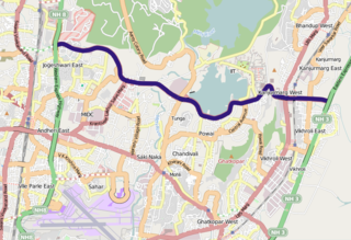
The Jogeshwari–Vikhroli Link Road (JVLR), is a 10.6-kilometre-long (6.6 mi) 6-lane road with a central median in Mumbai which connects the Western Express Highway and Eastern Express Highway providing speedier access from Jogeshwari in the Western Suburbs to Vikhroli in the Eastern Suburbs. It was opened to traffic in 1994, and widened from two to six lanes in 2012 at a cost of ₹221.45 crore. The under-construction Line 6 of the Mumbai Metro is being constructed on this link road.
Paprawat is a village in South West Delhi Tehsil in South West Delhi district of Delhi. It is located 6 km to the west of District headquarters Vasant Vihar. 19 km from State capital Delhi. In 2011, its population was counted 4412, making it the 7th most populous village in Najafgarh's sub districts. PAPRAWAT Paprawat Pin code is 110043 and postal head office is Naraina Industrial Estate.
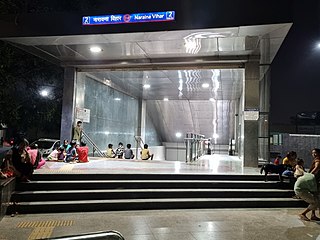
The Naraina Vihar metro station is located on the Pink Line of the Delhi Metro.


