National Register of Historic Places listings in Custer County, South Dakota

Last updated

Location of Custer County in South Dakota Map of South Dakota highlighting Custer County.svg
Location of Custer County in South Dakota
Map all coordinates using: OpenStreetMap

This is a list of the National Register of Historic Places listings in Custer County, South Dakota.

Contents

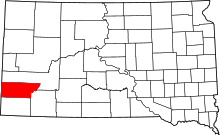
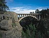
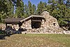
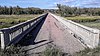
This is intended to be a complete list of the properties and districts on the National Register of Historic Places in Custer County, South Dakota, United States. The locations of National Register properties and districts for which the latitude and longitude coordinates are included below, may be seen in a map. [1]

There are 51 properties and districts listed on the National Register in the county.


    This National Park Service list is complete through NPS recent listings posted February 2, 2024. [2]

Current listings

[3] Name on the Register [4] ImageDate listed [5] Location City or townDescription
1 Archeological Site No. 39CU70
Archeological Site No. 39CU70 Address restricted.PNG
Archeological Site No. 39CU70
October 20, 1993
(#93001039)
Address restricted [6]
Custer
2 Archeological Site No. 39CU890
Archeological Site No. 39CU890 Address restricted.PNG
Archeological Site No. 39CU890
August 6, 1993
(#93000803)
Address restricted [6]
Hermosa
3 Archeological Site No. 39CU1619
Archeological Site No. 39CU1619 Address restricted.PNG
Archeological Site No. 39CU1619
June 3, 1999
(#99000679)
Address restricted [6]
Custer
4 Archeological Site No. 39CU2565
Archeological Site No. 39CU2565 Address restricted.PNG
Archeological Site No. 39CU2565
February 23, 2016
(#16000047)
Address restricted [6]
Dewey vicinity
5 Archeological Site No. 39CU3178
Archeological Site No. 39CU3178 Address restricted.PNG
Archeological Site No. 39CU3178
February 23, 2016
(#16000048)
Address restricted [6]
Dewey vicinity
6 Archeological Site No. 39CU3393
Archeological Site No. 39CU3393 Address restricted.PNG
Archeological Site No. 39CU3393
February 23, 2016
(#16000049)
Address restricted [6]
Dewey vicinity
7 Archeological Site No. 39CU4164
Archeological Site No. 39CU4164 Address restricted.PNG
Archeological Site No. 39CU4164
February 23, 2016
(#16000050)
Address restricted [6]
Dewey vicinity
8 Lonnie and Francis Ayres Ranch January 25, 1991
(#90002209)
2 miles southeast of Fourmile Junction on U.S. Route 16
43°43′01″N103°39′01″W / 43.716944°N 103.650278°W / 43.716944; -103.650278 (Lonnie and Francis Ayres Ranch)
Custer
9 Badger Hole
Badger Hole Badger Hole -- Badger Clark's home.JPG
Badger Hole
March 7, 1973
(#73001740)
1 mile east of Legion Lake on U.S. Route 16A
43°45′27″N103°27′28″W / 43.7575°N 103.457778°W / 43.7575; -103.457778 (Badger Hole)
Custer
10 Maria Bauer Homestead Ranch
Maria Bauer Homestead Ranch CusterCountySD MariaBauerRanch.jpg
Maria Bauer Homestead Ranch
June 9, 1992
(#92000683)
3 miles southeast of Jewel Cave National Monument
43°42′43″N103°46′43″W / 43.711944°N 103.778611°W / 43.711944; -103.778611 (Maria Bauer Homestead Ranch)
Custer
11 Beaver Creek Bridge
Beaver Creek Bridge Beaver Creek Bridge in Wind Cave National Park.jpg
Beaver Creek Bridge
August 8, 1984
(#84003254)
Wind Cave National Park, Highway 87, 0.5 miles north of U.S. Route 385
43°35′04″N103°29′19″W / 43.584444°N 103.488611°W / 43.584444; -103.488611 (Beaver Creek Bridge)
Hot Springs
12 Beaver Creek Rockshelter
Beaver Creek Rockshelter WindCaveNP BeaverCreekRockshelterArea.jpg
Beaver Creek Rockshelter
October 25, 1993
(#93001130)
Southern side of Beaver Creek, northeast of Wind Cave [7]
43°34′54″N103°28′14″W / 43.581667°N 103.470556°W / 43.581667; -103.470556 (Beaver Creek Rockshelter)
Pringle
13 Buffalo Gap Cheyenne River Bridge February 8, 1988
(#88000024)
County Road 656
43°30′07″N103°04′29″W / 43.5020°N 103.0748°W / 43.5020; -103.0748 (Buffalo Gap Cheyenne River Bridge)
Buffalo Gap Replaced in 2014
14 Buffalo Gap Historic Commercial District
Buffalo Gap Historic Commercial District BuffaloGapSD Church.jpg
Buffalo Gap Historic Commercial District
June 30, 1995
(#95000774)
Roughly the area surrounding Main, 2nd, and Walnut Sts.
43°29′31″N103°18′43″W / 43.491944°N 103.311944°W / 43.491944; -103.311944 (Buffalo Gap Historic Commercial District)
Buffalo Gap A boundary decrease was approved January 29, 2024.
15 CCC Camp Custer Officers' Cabin
CCC Camp Custer Officers' Cabin CusterCountySD CCCCampCusterOfficersCabin.jpg
CCC Camp Custer Officers' Cabin
June 9, 1992
(#92000684)
8 miles northwest of Custer on County Road 292
43°48′26″N103°42′59″W / 43.807222°N 103.716389°W / 43.807222; -103.716389 (CCC Camp Custer Officers' Cabin)
Custer
16 Cold Springs Schoolhouse
Cold Springs Schoolhouse CusterCountySD ColdSpringsSchoolhouse.jpg
Cold Springs Schoolhouse
March 7, 1973
(#73001741)
Southeast of Custer off Highway 336 in the Black Hills National Forest
43°37′24″N103°30′24″W / 43.623333°N 103.506667°W / 43.623333; -103.506667 (Cold Springs Schoolhouse)
Custer
17 Custer County Courthouse
Custer County Courthouse Custer County Courthouse, Custer.jpg
Custer County Courthouse
November 27, 1972
(#72001226)
411 Mt. Rushmore Rd.
43°45′59″N103°36′04″W / 43.766389°N 103.601111°W / 43.766389; -103.601111 (Custer County Courthouse)
Custer
18 Custer State Game Lodge
Custer State Game Lodge CUSTER STATE GAME LODGE.jpg
Custer State Game Lodge
March 30, 1983
(#83003007)
East of Custer on U.S. Route 16A
43°45′49″N103°22′51″W / 43.763611°N 103.380833°W / 43.763611; -103.380833 (Custer State Game Lodge)
Custer
19 Custer State Park Museum
Custer State Park Museum Custer SP Museum 1.jpg
Custer State Park Museum
March 30, 1983
(#83003008)
West of Hermosa on U.S. Route 16A
43°45′56″N103°23′02″W / 43.765556°N 103.383889°W / 43.765556; -103.383889 (Custer State Park Museum)
Hermosa
20 Fairburn Historic Commercial District June 30, 1995
(#95000772)
Roughly the area surrounding Main St. between 1st and 2nd Sts.; also Blk. 7, Lots 3-10
43°41′08″N103°12′39″W / 43.685556°N 103.210833°W / 43.685556; -103.210833 (Fairburn Historic Commercial District)
Fairburn The district's boundaries were decreased on 2018-12-28
21 First National Bank Building
First National Bank Building CusterSD FirstNationalBankBuilding.jpg
First National Bank Building
March 5, 1982
(#82003924)
6th St. and Mt. Rushmore Rd.
43°46′04″N103°36′02″W / 43.767778°N 103.600556°W / 43.767778; -103.600556 (First National Bank Building)
Custer
22 Fourmile School No. 21 January 25, 1991
(#90002208)
¼ mile south of Fourmile Junction on U.S. Route 16
43°43′42″N103°40′30″W / 43.728333°N 103.675°W / 43.728333; -103.675 (Fourmile School No. 21)
Custer Possibly demolished or moved.
23 Galena Creek Schoolhouse February 7, 2023
(#100008618)
25151 Badger Clark Rd. (Custer State Park)
43°44′52″N103°25′56″W / 43.7477°N 103.4322°W / 43.7477; -103.4322 (Galena Creek Schoolhouse)
Custer vicinity
24 Garlock Building
Garlock Building CusterSD GarlockBuilding.jpg
Garlock Building
January 28, 2004
(#03001524)
522 Mount Rushmore Rd.
43°46′07″N103°35′59″W / 43.768611°N 103.599722°W / 43.768611; -103.599722 (Garlock Building)
Custer
25 Grace Coolidge Memorial Log Building
Grace Coolidge Memorial Log Building CusterSD GraceCoolidgeMemorialLogBuilding.jpg
Grace Coolidge Memorial Log Building
June 21, 2001
(#01000680)
644 Crook St.
43°46′04″N103°35′52″W / 43.767778°N 103.597778°W / 43.767778; -103.597778 (Grace Coolidge Memorial Log Building)
Custer
26 Hermosa Masonic Lodge
Hermosa Masonic Lodge HermosaSD MasonicLodge.jpg
Hermosa Masonic Lodge
February 17, 2009
(#09000043)
Western side of 2nd St., between Folsom St. and Highway 40
43°50′25″N103°11′29″W / 43.8402°N 103.1913°W / 43.8402; -103.1913 (Hermosa Masonic Lodge)
Hermosa
27 Historic Trail and Cave Entrance
Historic Trail and Cave Entrance JewelCaveNM OriginalEntrance.jpg
Historic Trail and Cave Entrance
April 19, 1995
(#95000337)
From old ranger station HS-1 to the old cave entrance at Jewel Cave National Monument
43°44′00″N103°50′31″W / 43.733333°N 103.841944°W / 43.733333; -103.841944 (Historic Trail and Cave Entrance)
Custer
28 Charles and Ollie Lampert Ranch July 5, 1990
(#90000951)
South of the Elk Mountains north of Dewey
43°37′33″N104°00′48″W / 43.625833°N 104.013333°W / 43.625833; -104.013333 (Charles and Ollie Lampert Ranch)
Custer
29 Irene and Walter Mann Ranch July 5, 1990
(#90000953)
Schenk Canyon area, just off County Road 270
43°39′00″N103°56′00″W / 43.65°N 103.933333°W / 43.65; -103.933333 (Irene and Walter Mann Ranch)
Custer
30 Peter Norbeck Summer House
Peter Norbeck Summer House CusterSP PeterNorbeckSummerHouse.jpg
Peter Norbeck Summer House
September 13, 1977
(#77001241)
Custer State Park
43°48′07″N103°27′03″W / 43.801944°N 103.450833°W / 43.801944; -103.450833 (Peter Norbeck Summer House)
Custer
31 Pig Tail Bridge
Pig Tail Bridge WindCaveNP PigTailBridge2.jpg
Pig Tail Bridge
April 7, 1995
(#95000344)
Highway 87 loop over Highway 87, north of Norbeck Lake at Wind Cave National Park
43°36′04″N103°29′38″W / 43.601111°N 103.493889°W / 43.601111; -103.493889 (Pig Tail Bridge)
Hot Springs
32 Ranger Station
Ranger Station Jewel Cave National Monument 05.jpg
Ranger Station
April 5, 1995
(#95000336)
Old administration area at Jewel Cave National Monument
43°44′00″N103°50′29″W / 43.733333°N 103.841389°W / 43.733333; -103.841389 (Ranger Station)
Custer
33 Red Shirt Bridge
Red Shirt Bridge Red Shirt Bridge, view from the south end, road bed with red gravel.jpg
Red Shirt Bridge
December 9, 1993
(#93001281)
Highway 40 over the Cheyenne River
43°40′03″N102°52′13″W / 43.6675°N 102.870278°W / 43.6675; -102.870278 (Red Shirt Bridge)
Red Shirt
34 Ferdinand and Elizabeth Roetzel Ranch January 25, 1991
(#90002210)
1 mile northwest of junction of Saginaw and Roetzel Rds.
43°50′38″N103°42′39″W / 43.843889°N 103.710833°W / 43.843889; -103.710833 (Ferdinand and Elizabeth Roetzel Ranch)
Custer
35 Site No. 39 Cu 91
Site No. 39 Cu 91 Address restricted.PNG
Site No. 39 Cu 91
May 20, 1982
(#82004759)
Address restricted [6]
City Restricted
36 Site No. 39 Cu 510
Site No. 39 Cu 510 Address restricted.PNG
Site No. 39 Cu 510
May 20, 1982
(#82004752)
Address restricted [6]
City Restricted
37 Site No. 39 Cu 511
Site No. 39 Cu 511 Address restricted.PNG
Site No. 39 Cu 511
May 20, 1982
(#82004754)
Address restricted [6]
City Restricted
38 Site No. 39 Cu 512
Site No. 39 Cu 512 Address restricted.PNG
Site No. 39 Cu 512
May 20, 1982
(#82004753)
Address restricted [6]
City Restricted
39 Site No. 39 Cu 513
Site No. 39 Cu 513 Address restricted.PNG
Site No. 39 Cu 513
May 20, 1982
(#82004755)
Address restricted [6]
City Restricted
40 Site No. 39 Cu 514
Site No. 39 Cu 514 Address restricted.PNG
Site No. 39 Cu 514
May 20, 1982
(#82004756)
Address restricted [6]
City Restricted
41 Site No. 39 Cu 515
Site No. 39 Cu 515 Address restricted.PNG
Site No. 39 Cu 515
May 20, 1982
(#82004757)
Address restricted [6]
City Restricted
42 Site No. 39 Cu 516
Site No. 39 Cu 516 Address restricted.PNG
Site No. 39 Cu 516
May 20, 1982
(#82004758)
Address restricted [6]
City Restricted
43 South Dakota Dept. of Transportation Bridge No. 17-289-107
South Dakota Dept. of Transportation Bridge No. 17-289-107 CusterSP FrenchCreekBridge.jpg
South Dakota Dept. of Transportation Bridge No. 17-289-107
December 9, 1993
(#93001280)
Highway 87 over French Creek at Custer State Park
43°42′56″N103°28′47″W / 43.715556°N 103.479722°W / 43.715556; -103.479722 (South Dakota Dept. of Transportation Bridge No. 17-289-107)
Custer Aka the French Creek Bridge.
44 William Stearns Ranch July 5, 1990
(#90000952)
East of Elk Mountain, off County Highway 769
43°40′09″N103°59′30″W / 43.669284°N 103.991677°W / 43.669284; -103.991677 (William Stearns Ranch)
Custer
45 Norman B. Streeter Homestead
Norman B. Streeter Homestead CusterCountySD NormanStreeterHomestead.jpg
Norman B. Streeter Homestead
June 30, 1995
(#95000765)
Streeter Ranch, near Beaver Creek
43°32′13″N103°22′57″W / 43.536944°N 103.3825°W / 43.536944; -103.3825 (Norman B. Streeter Homestead)
Buffalo Gap
46 Francis Averill (T.A.) and Janet Leach Towner House
Francis Averill (T.A.) and Janet Leach Towner House CusterSD TownerHouse.jpg
Francis Averill (T.A.) and Janet Leach Towner House
June 21, 1990
(#90000959)
218 Crook St.
43°46′30″N103°36′15″W / 43.775°N 103.604167°W / 43.775; -103.604167 (Francis Averill (T.A.) and Janet Leach Towner House)
Custer
47 Newton Seymour Tubbs House
Newton Seymour Tubbs House CusterSD NewtonSeymourTubbsHouse.jpg
Newton Seymour Tubbs House
December 9, 1993
(#93001341)
35 Centennial Dr.
43°45′47″N103°36′46″W / 43.763056°N 103.612778°W / 43.763056; -103.612778 (Newton Seymour Tubbs House)
Custer
48 Elbert and Harriet Ward Ranch July 5, 1990
(#90000950)
East of Elk Mountain, south of U.S. Route 16
43°42′21″N103°58′11″W / 43.705746°N 103.969840°W / 43.705746; -103.969840 (Elbert and Harriet Ward Ranch)
Custer
49 Way Park Museum
Way Park Museum CusterSD WayParkMuseum.jpg
Way Park Museum
March 7, 1973
(#73001739)
4th St. and Rushmore Rd.
43°45′36″N103°36′03″W / 43.76°N 103.600833°W / 43.76; -103.600833 (Way Park Museum)
Custer
50 Wind Cave National Park Administrative and Utility Area Historic District
Wind Cave National Park Administrative and Utility Area Historic District WindCaveNP VisitorCenter.jpg
Wind Cave National Park Administrative and Utility Area Historic District
July 11, 1984
(#84003259)
East of Custer off U.S. Route 385
43°33′23″N103°28′26″W / 43.556389°N 103.473889°W / 43.556389; -103.473889 (Wind Cave National Park Administrative and Utility Area Historic District)
Custer
51 Edna and Ernest Young Ranch July 5, 1990
(#90000949)
Approximately 3 miles south of Dewey, south of Beaver Creek
43°29′11″N104°02′40″W / 43.486389°N 104.044444°W / 43.486389; -104.044444 (Edna and Ernest Young Ranch)
Custer

See also

Related Research Articles

<span class="mw-page-title-main">National Register of Historic Places listings in Brown County, South Dakota</span>

This is a list of the National Register of Historic Places listings in Brown County, South Dakota.

<span class="mw-page-title-main">National Register of Historic Places listings in Fall River County, South Dakota</span>

This is a list of the National Register of Historic Places listings in Fall River County, South Dakota.

<span class="mw-page-title-main">National Register of Historic Places listings in Harding County, South Dakota</span>

This is a list of the National Register of Historic Places listings in Harding County, South Dakota.

<span class="mw-page-title-main">National Register of Historic Places listings in Buffalo County, South Dakota</span>

This is a list of the National Register of Historic Places listings in Buffalo County, South Dakota.

<span class="mw-page-title-main">National Register of Historic Places listings in Campbell County, South Dakota</span>

This is a list of the National Register of Historic Places listings in Campbell County, South Dakota.

<span class="mw-page-title-main">National Register of Historic Places listings in Corson County, South Dakota</span>

This is a list of the National Register of Historic Places listings in Corson County, South Dakota.

<span class="mw-page-title-main">National Register of Historic Places listings in Davison County, South Dakota</span>

This is a list of the National Register of Historic Places listings in Davison County, South Dakota.

<span class="mw-page-title-main">National Register of Historic Places listings in Douglas County, South Dakota</span>

This is a list of the National Register of Historic Places listings in Douglas County, South Dakota.

<span class="mw-page-title-main">National Register of Historic Places listings in Hand County, South Dakota</span>

This is a list of the National Register of Historic Places listings in Hand County, South Dakota.

<span class="mw-page-title-main">National Register of Historic Places listings in Hanson County, South Dakota</span>

This is a list of the National Register of Historic Places listings in Hanson County, South Dakota.

<span class="mw-page-title-main">National Register of Historic Places listings in Hughes County, South Dakota</span>

This is a list of the National Register of Historic Places listings in Hughes County, South Dakota.

<span class="mw-page-title-main">National Register of Historic Places listings in Hutchinson County, South Dakota</span>

This is a list of the National Register of Historic Places listings in Hutchinson County, South Dakota.

<span class="mw-page-title-main">National Register of Historic Places listings in Hyde County, South Dakota</span>

This is a list of the National Register of Historic Places listings in Hyde County, South Dakota.

<span class="mw-page-title-main">National Register of Historic Places listings in Jackson County, South Dakota</span>

This is a list of the National Register of Historic Places listings in Jackson County, South Dakota.

<span class="mw-page-title-main">National Register of Historic Places listings in Lyman County, South Dakota</span>

This is a list of the National Register of Historic Places listings in Lyman County, South Dakota.

<span class="mw-page-title-main">National Register of Historic Places listings in McCook County, South Dakota</span>

This is a list of the National Register of Historic Places listings in McCook County, South Dakota.

<span class="mw-page-title-main">National Register of Historic Places listings in McPherson County, South Dakota</span>

This is a list of the National Register of Historic Places listings in McPherson County, South Dakota.

<span class="mw-page-title-main">National Register of Historic Places listings in Meade County, South Dakota</span>

This is a list of the National Register of Historic Places listings in Meade County, South Dakota.

<span class="mw-page-title-main">National Register of Historic Places listings in Potter County, South Dakota</span>

This is a list of the National Register of Historic Places listings in Potter County, South Dakota.

<span class="mw-page-title-main">National Register of Historic Places listings in Sully County, South Dakota</span>

This is a list of the National Register of Historic Places listings in Sully County, South Dakota.

References

  1. The latitude and longitude information provided in this table was derived originally from the National Register Information System, which has been found to be fairly accurate for about 99% of listings. Some locations in this table may have been corrected to current GPS standards.
  2. National Park Service, United States Department of the Interior, "National Register of Historic Places: Weekly List Actions", retrieved February 2, 2024.
  3. Numbers represent an alphabetical ordering by significant words. Various colorings, defined here, differentiate National Historic Landmarks and historic districts from other NRHP buildings, structures, sites or objects.
  4. "National Register Information System". National Register of Historic Places . National Park Service. April 24, 2008.
  5. The eight-digit number below each date is the number assigned to each location in the National Register Information System database, which can be viewed by clicking the number.
  6. 1 2 3 4 5 6 7 8 9 10 11 12 13 14 15 Federal and state laws and practices restrict general public access to information regarding the specific location of this resource. In some cases, this is to protect archeological sites from vandalism, while in other cases it is restricted at the request of the owner. See: Knoerl, John; Miller, Diane; Shrimpton, Rebecca H. (1990), Guidelines for Restricting Information about Historic and Prehistoric Resources, National Register Bulletin, National Park Service, U.S. Department of the Interior, OCLC   20706997 .
  7. Martin, James E., et al. "The Beaver Creek Shelter (39CU779): A Holocene Succession in the Black Hills of South Dakota". Plains Anthropologist 38.145: 17-36: 18, 22.