National Register of Historic Places listings in Roberts County, South Dakota

Last updated

Location of Roberts County in South Dakota Map of South Dakota highlighting Roberts County.svg
Location of Roberts County in South Dakota

This is a list of the National Register of Historic Places listings in Roberts County, South Dakota.

Contents

This is intended to be a complete list of the properties and districts on the National Register of Historic Places in Roberts County, South Dakota, United States. The locations of National Register properties and districts for which the latitude and longitude coordinates are included below, may be seen in a map. [1]

There are 15 properties and districts listed on the National Register in the county.


    This National Park Service list is complete through NPS recent listings posted February 16, 2024. [2]

Current listings

[3] Name on the Register [4] ImageDate listed [5] Location City or townDescription
1 Brown's Post May 27, 1988
(#88000583)
Address Restricted
Sisseton
2 Hart School No. 3
Hart School No. 3 Hart Township Hall from NE 2.jpg
Hart School No. 3
August 16, 2000
(#00000994)
Route 1
45°45′14″N96°53′47″W / 45.7538°N 96.8963°W / 45.7538; -96.8963 (Hart School No. 3)
Sisseton
3 Knapp Ranch
Knapp Ranch Knapp Ranch, North Barn from NW 1.jpg
Knapp Ranch
April 14, 2005
(#05000282)
13168 450th Avenue
45°28′33″N97°12′18″W / 45.4758°N 97.2049°W / 45.4758; -97.2049 (Knapp Ranch)
Ortley
4 New Effington Hospital
New Effington Hospital New Effington Hospital.jpg
New Effington Hospital
July 13, 1989
(#89000829)
Oddin Avenue
45°51′14″N96°55′05″W / 45.8539°N 96.9181°W / 45.8539; -96.9181 (New Effington Hospital)
New Effington
5 New Effington Rest Stop Tipi
New Effington Rest Stop Tipi Glacial Lakes Rest Area teepee 1.jpg
New Effington Rest Stop Tipi
January 14, 2015
(#14001189)
Mile 250.8 on I-29
45°54′28″N96°51′51″W / 45.9079°N 96.8642°W / 45.9079; -96.8642 (New Effington Rest Stop Tipi)
New Effington
6 Louis Nigg Barn March 1, 2021
(#100006065)
46356 125th St.
45°34′17″N97°02′48″W / 45.5713°N 97.0467°W / 45.5713; -97.0467 (Louis Nigg Barn)
Sisseton
7 Robar Trading Post May 27, 1988
(#88000582)
Hartford Beach State Park
45°24′09″N96°39′13″W / 45.4025°N 96.6536°W / 45.4025; -96.6536 (Robar Trading Post)
Wilmot
8 Roberts County Courthouse
Roberts County Courthouse Roberts County Courthouse.jpg
Roberts County Courthouse
December 12, 1976
(#76001755)
411 Second Avenue East [6]
45°39′47″N97°02′41″W / 45.6631°N 97.0447°W / 45.6631; -97.0447 (Roberts County Courthouse)
Sisseton
9 Sisseton Agency Headquarters & Wacipi Grounds February 1, 2022
(#100007395)
45744 BIA Hwy. 706
45°33′45″N97°04′17″W / 45.5625°N 97.0713°W / 45.5625; -97.0713 (Sisseton Agency Headquarters & Wacipi Grounds)
Agency Village
10 Sisseton Carnegie Library
Sisseton Carnegie Library Sisseton Carnegie library from S 1.jpg
Sisseton Carnegie Library
October 24, 1996
(#96001227)
215 Oak Street, East
45°39′54″N97°02′51″W / 45.6649°N 97.0474°W / 45.6649; -97.0474 (Sisseton Carnegie Library)
Sisseton
11 Sisseton School November 23, 2020
(#100005818)
302 East Maple St.
45°39′49″N97°02′50″W / 45.6637°N 97.0471°W / 45.6637; -97.0471 (Sisseton School)
Sisseton
12 Site 39RO71 June 8, 2005
(#05000588)
Address Restricted
Sisseton Also known as Thunderbird Rock
13 South Dakota Department of Transportation Bridge No. 55-030-418
South Dakota Department of Transportation Bridge No. 55-030-418 452 Ave railroad bridge from S 1.jpg
South Dakota Department of Transportation Bridge No. 55-030-418
December 9, 1999
(#99001437)
State railroad tracks over a local road
45°19′49″N97°09′55″W / 45.3302°N 97.1652°W / 45.3302; -97.1652 (South Dakota Department of Transportation Bridge No. 55-030-418)
Ortley
14 Andrew and Mary Stavig House
Andrew and Mary Stavig House Stavig House Museum from E 1.jpg
Andrew and Mary Stavig House
November 7, 1997
(#97001392)
112 First Avenue, West
45°39′41″N97°03′09″W / 45.6615°N 97.0526°W / 45.6615; -97.0526 (Andrew and Mary Stavig House)
Sisseton
15 Walla Lutheran Church
Walla Lutheran Church Walla Lutheran Church from E 1.jpg
Walla Lutheran Church
May 19, 2004
(#04000470)
46532 105th Street
45°51′56″N96°53′22″W / 45.8656°N 96.8894°W / 45.8656; -96.8894 (Walla Lutheran Church)
New Effington

See also

Related Research Articles

<span class="mw-page-title-main">National Register of Historic Places listings in Lawrence County, South Dakota</span>

This is a list of the National Register of Historic Places listings in Lawrence County, South Dakota.

<span class="mw-page-title-main">National Register of Historic Places listings in Butte County, South Dakota</span>

This is a list of the National Register of Historic Places listings in Butte County, South Dakota.

<span class="mw-page-title-main">National Register of Historic Places listings in Clark County, South Dakota</span>

This is a list of the National Register of Historic Places listings in Clark County, South Dakota.

<span class="mw-page-title-main">National Register of Historic Places listings in Clay County, South Dakota</span>

This is a list of the National Register of Historic Places listings in Clay County, South Dakota.

<span class="mw-page-title-main">National Register of Historic Places listings in Codington County, South Dakota</span>

This is a list of the National Register of Historic Places listings in Codington County, South Dakota.

<span class="mw-page-title-main">National Register of Historic Places listings in Day County, South Dakota</span>

This is a list of the National Register of Historic Places listings in Day County, South Dakota.

<span class="mw-page-title-main">National Register of Historic Places listings in Deuel County, South Dakota</span>

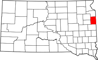
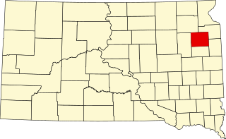
This is a list of the National Register of Historic Places listings in Deuel County, South Dakota.

<span class="mw-page-title-main">National Register of Historic Places listings in Dewey County, South Dakota</span>

This is a list of the National Register of Historic Places listings in Dewey County, South Dakota.

<span class="mw-page-title-main">National Register of Historic Places listings in Faulk County, South Dakota</span>

This is a list of the National Register of Historic Places listings in Faulk County, South Dakota.

<span class="mw-page-title-main">National Register of Historic Places listings in Gregory County, South Dakota</span>

This is a list of the National Register of Historic Places listings in Gregory County, South Dakota.

<span class="mw-page-title-main">National Register of Historic Places listings in Hamlin County, South Dakota</span>

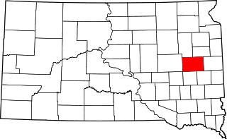
This is a list of the National Register of Historic Places listings in Hamlin County, South Dakota.

<span class="mw-page-title-main">National Register of Historic Places listings in Kingsbury County, South Dakota</span>

This is a list of the National Register of Historic Places listings in Kingsbury County, South Dakota.

<span class="mw-page-title-main">National Register of Historic Places listings in Lincoln County, South Dakota</span>

This is a list of the National Register of Historic Places listings in Lincoln County, South Dakota.

<span class="mw-page-title-main">National Register of Historic Places listings in Marshall County, South Dakota</span>

This is a list of the National Register of Historic Places listings in Marshall County, South Dakota.

<span class="mw-page-title-main">National Register of Historic Places listings in Mellette County, South Dakota</span>

This is a list of the National Register of Historic Places listings in Mellette County, South Dakota.

<span class="mw-page-title-main">National Register of Historic Places listings in Miner County, South Dakota</span>

This is a list of the National Register of Historic Places listings in Miner County, South Dakota.

<span class="mw-page-title-main">National Register of Historic Places listings in Perkins County, South Dakota</span>

This is a list of the National Register of Historic Places listings in Perkins County, South Dakota.

<span class="mw-page-title-main">National Register of Historic Places listings in Todd County, South Dakota</span>

This is a list of the National Register of Historic Places listings in Todd County, South Dakota.

<span class="mw-page-title-main">National Register of Historic Places listings in Tripp County, South Dakota</span>

This is a list of the National Register of Historic Places listings in Tripp County, South Dakota.

<span class="mw-page-title-main">National Register of Historic Places listings in Turner County, South Dakota</span>

This is a list of the National Register of Historic Places listings in Turner County, South Dakota.

References

  1. The latitude and longitude information provided in this table was derived originally from the National Register Information System, which has been found to be fairly accurate for about 99% of listings. Some locations in this table may have been corrected to current GPS standards.
  2. National Park Service, United States Department of the Interior, "National Register of Historic Places: Weekly List Actions", retrieved February 16, 2024.
  3. Numbers represent an alphabetical ordering by significant words. Various colorings, defined here, differentiate National Historic Landmarks and historic districts from other NRHP buildings, structures, sites or objects.
  4. "National Register Information System". National Register of Historic Places . National Park Service. April 24, 2008.
  5. The eight-digit number below each date is the number assigned to each location in the National Register Information System database, which can be viewed by clicking the number.
  6. "Roberts County". South Dakota Unified Judicial System. Retrieved September 15, 2017.