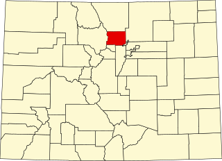
[3] Name on the Register [4] Image Date listed [5] Location City or town Description 1 Ammons Hall Ammons Hall June 15, 1978 (# 78000864 Colorado State University campus 40°34′40″N 105°04′52″W / 40.5778°N 105.0811°W / 40.5778; -105.0811 (Ammons Hall ) Fort Collins 2 Peter Anderson House Peter Anderson House October 25, 1979 (# 79000614 300 S. Howes St. 40°35′02″N 105°04′47″W / 40.5839°N 105.0797°W / 40.5839; -105.0797 (Peter Anderson House ) Fort Collins 3 Armstrong Hotel Armstrong Hotel August 31, 2000 (# 00001002 249-261 S. College Ave. 40°35′04″N 105°04′36″W / 40.5844°N 105.0767°W / 40.5844; -105.0767 (Armstrong Hotel ) Fort Collins 4 Arrowhead Lodge Arrowhead Lodge May 27, 1992 (# 92000502 34500 Poudre Canyon Highway in the Roosevelt National Forest 40°42′13″N 105°38′11″W / 40.70371°N 105.63637°W / 40.70371; -105.63637 (Arrowhead Lodge ) Bellvue Resort camp established 1931 on Cache la Poudre River ; now a United States Forest Service visitors' center. 5 Avery House Avery House June 24, 1972 (# 72000274 328 W. Mountain Ave. 40°35′14″N 105°04′53″W / 40.5872°N 105.0814°W / 40.5872; -105.0814 (Avery House ) Fort Collins 6 Baker House Baker House July 20, 1978 (# 78000866 304-304½ E. Mulberry St. 40°34′54″N 105°04′24″W / 40.5817°N 105.0733°W / 40.5817; -105.0733 (Baker House ) Fort Collins 7 Baldpate Inn Baldpate Inn January 11, 1996 (# 95001510 4900 S. State Highway 7 40°18′30″N 105°32′04″W / 40.3083°N 105.5344°W / 40.3083; -105.5344 (Baldpate Inn ) Estes Park 8 Bear Lake Comfort Station Bear Lake Comfort Station January 29, 1988 (# 87001137 Bear Lake 40°18′44″N 105°38′42″W / 40.3122°N 105.645°W / 40.3122; -105.645 (Bear Lake Comfort Station ) Estes Park 9 Bee Farm Bee Farm November 25, 2002 (# 02001409 4320 E. County Road 58 40°40′17″N 104°59′42″W / 40.6714°N 104.995°W / 40.6714; -104.995 (Bee Farm ) Fort Collins 10 A. S. Benson House A. S. Benson House January 6, 2004 (# 03001362 463 W. 5th St. 40°23′48″N 105°04′56″W / 40.3967°N 105.0822°W / 40.3967; -105.0822 (A. S. Benson House ) Loveland 11 Big Thompson River Bridge III Big Thompson River Bridge III October 15, 2002 (# 02001139 U.S. Highway 34 at milepost 85.15 40°24′54″N 105°11′42″W / 40.415°N 105.195°W / 40.415; -105.195 (Big Thompson River Bridge III ) Loveland 12 Big Thompson River Bridge IV Big Thompson River Bridge IV October 15, 2002 (# 02001140 U.S. Highway 34 at milepost 86.04 40°25′07″N 105°10′47″W / 40.4186°N 105.1797°W / 40.4186; -105.1797 (Big Thompson River Bridge IV ) Loveland 13 Bimson Blacksmith Shop Bimson Blacksmith Shop July 23, 1981 (# 81000185 224 Mountain St. 40°18′21″N 105°04′32″W / 40.3058°N 105.0756°W / 40.3058; -105.0756 (Bimson Blacksmith Shop ) Berthoud 14 Bingham Homestead Rural Historic Landscape Bingham Homestead Rural Historic Landscape April 16, 2013 (# 13000161 4916 Bingham Hill Rd. 40°37′33″N 105°10′07″W / 40.6259°N 105.1687°W / 40.6259; -105.1687 (Bingham Homestead Rural Historic Landscape ) Bellvue 15 Maude Stanfield Harter Borland House Maude Stanfield Harter Borland House July 6, 2004 (# 04000662 610 N. Jefferson Ave. 40°23′52″N 105°04′18″W / 40.39781°N 105.07159°W / 40.39781; -105.07159 (Maude Stanfield Harter Borland House ) Loveland House and garage built 1920 with "superb integrity" that are "among northern Colorado's best examples of the Craftsman style of architecture." 16 Botanical and Horticultural Laboratory Botanical and Horticultural Laboratory September 18, 1978 (# 78003395 Colorado State University campus 40°34′40″N 105°04′41″W / 40.57782°N 105.07796°W / 40.57782; -105.07796 (Botanical and Horticultural Laboratory ) Fort Collins 1890-built, among oldest remaining buildings of the old Colorado Agricultural College campus. Now called Routt Hall. 17 Jay H. Bouton House Jay H. Bouton House December 18, 1978 (# 78000867 113 N. Sherwood St. 40°35′15″N 105°05′04″W / 40.5875°N 105.0844°W / 40.5875; -105.0844 (Jay H. Bouton House ) Fort Collins 18 Buckeye School Buckeye School June 26, 2008 (# 08000599 Off W. County Road 80 40°49′35″N 105°05′36″W / 40.8265°N 105.0934°W / 40.8265; -105.0934 (Buckeye School ) Wellington 19 Buckhorn Ranger Station Historic District Upload image August 12, 2022 (# 100007990 Fire Route 133, Arapaho and Roosevelt National Forests Coordinates missing Bellvue 20 Cascade Cottages Cascade Cottages August 27, 2020 (# 100005475 4140 Fall River Rd. (Rocky Mountain National Park ) 40°24′09″N 105°36′02″W / 40.4026°N 105.6006°W / 40.4026; -105.6006 (Cascade Cottages ) Estes Park 21 Chasteen's Grove Upload image September 6, 1978 (# 78000872 West of Loveland off U.S. Highway 34 40°25′23″N 105°12′13″W / 40.4231°N 105.2036°W / 40.4231; -105.2036 (Chasteen's Grove ) Loveland 22 Clatworthy Place Clatworthy Place July 14, 2004 (# 04000681 225 Cyteworth Rd. 40°22′21″N 105°31′17″W / 40.3725°N 105.5214°W / 40.3725; -105.5214 (Clatworthy Place ) Estes Park 23 Colorado and Southern Railway Depot Colorado and Southern Railway Depot June 14, 1982 (# 82002303 405 Railroad Ave. 40°23′46″N 105°04′31″W / 40.3961°N 105.0753°W / 40.3961; -105.0753 (Colorado and Southern Railway Depot ) Loveland 24 Crags Lodge Crags Lodge July 1, 1998 (# 98000814 300 Riverside Dr. 40°22′12″N 105°31′25″W / 40.37°N 105.5236°W / 40.37; -105.5236 (Crags Lodge ) Estes Park 25 Downtown Loveland Historic District Downtown Loveland Historic District June 1, 2015 (# 15000281 Roughly bounded by Railroad & Jefferson Aves., alleys between 3rd & 4th Sts. & 4th & 5th Sts. 40°23′44″N 105°04′27″W / 40.3955°N 105.0741°W / 40.3955; -105.0741 (Downtown Loveland Historic District ) Loveland 26 Dunraven Cottage-Camp Dunraven Upload image April 5, 2019 (# 100003644 898 Fish Creek Rd. 40°21′50″N 105°29′37″W / 40.3640°N 105.4937°W / 40.3640; -105.4937 (Dunraven Cottage-Camp Dunraven ) Estes Park vicinity 27 East Longs Peak Trail East Longs Peak Trail July 10, 2007 (# 07000740 West of State Highway 7 [6] 40°16′20″N 105°36′02″W / 40.272222°N 105.600556°W / 40.272222; -105.600556 (East Longs Peak Trail ) Allenspark Extends into Boulder County . 28 Edgemont Edgemont July 15, 1998 (# 98000853 1861 Mary's Lake Rd. 40°21′02″N 105°32′21″W / 40.3506°N 105.5392°W / 40.3506; -105.5392 (Edgemont ) Estes Park 29 Elkhorn Lodge Elkhorn Lodge December 27, 1978 (# 78000862 530 W. Elkhorn Ave. 40°22′38″N 105°32′00″W / 40.3772°N 105.5333°W / 40.3772; -105.5333 (Elkhorn Lodge ) Estes Park 30 Fall River Entrance Historic District Fall River Entrance Historic District January 29, 1988 (# 87001139 Fall River Entrance 40°24′11″N 105°35′13″W / 40.40312°N 105.58707°W / 40.40312; -105.58707 (Fall River Entrance Historic District ) Estes Park Boundary increase approved March 5, 2018. 31 Fall River Pass Historic District Upload image December 10, 2021 (# 100007216 Fall River Pass 40°26′27″N 105°45′21″W / 40.4408°N 105.7557°W / 40.4408; -105.7557 (Fall River Pass Historic District ) Estes Park 32 Fall River Pass Ranger Station Fall River Pass Ranger Station January 29, 1988 (# 87001140 Fall River Pass 40°26′27″N 105°45′13″W / 40.440833°N 105.753611°W / 40.440833; -105.753611 (Fall River Pass Ranger Station ) Estes Park 33 Fall River Pump House and Catchment Basin Fall River Pump House and Catchment Basin August 30, 2006 (# 06000735 Near the top of Fall River Road in Rocky Mountain National Park 40°26′15″N 105°44′50″W / 40.4375°N 105.747222°W / 40.4375; -105.747222 (Fall River Pump House and Catchment Basin ) Estes Park 34 Fall River Road Fall River Road July 20, 1987 (# 87001129 Fall River Rd. 40°25′47″N 105°42′43″W / 40.429722°N 105.711944°W / 40.429722; -105.711944 (Fall River Road ) Estes Park Boundary increase approved May 21, 2018 35 Fern Lake Trail Fern Lake Trail February 28, 2005 (# 05000074 Rocky Mountain National Park 40°20′34″N 105°39′48″W / 40.342778°N 105.663333°W / 40.342778; -105.663333 (Fern Lake Trail ) Estes Park 36 First National Bank Building First National Bank Building August 10, 2000 (# 00000937 3728 Cleveland Ave. 40°42′15″N 105°00′20″W / 40.704167°N 105.005556°W / 40.704167; -105.005556 (First National Bank Building ) Wellington 37 First United Presbyterian Church First United Presbyterian Church July 7, 2004 (# 04000664 400 E. 4th St. 40°23′43″N 105°04′16″W / 40.395278°N 105.071111°W / 40.395278; -105.071111 (First United Presbyterian Church ) Loveland 38 Flattop Mountain Trail Flattop Mountain Trail September 27, 2007 (# 07000999 Rocky Mountain National Park [7] 40°18′50″N 105°40′42″W / 40.313889°N 105.678333°W / 40.313889; -105.678333 (Flattop Mountain Trail ) Estes Park 39 Jacob and Elizabeth Flowers House Jacob and Elizabeth Flowers House March 1, 2007 (# 07000086 5200 W. County Road 52E 40°37′48″N 105°10′19″W / 40.63°N 105.171944°W / 40.63; -105.171944 (Jacob and Elizabeth Flowers House ) Bellvue 40 Fort Collins Armory Fort Collins Armory October 15, 2002 (# 02001133 314 E. Mountain Ave. 40°35′14″N 105°04′21″W / 40.587222°N 105.0725°W / 40.587222; -105.0725 (Fort Collins Armory ) Fort Collins 41 Fort Collins Municipal Railway Birney Safety Streetcar No. 21 Fort Collins Municipal Railway Birney Safety Streetcar No. 21 January 5, 1984 (# 84000860 1801 W. Mountain Ave. 40°35′12″N 105°06′32″W / 40.586667°N 105.108889°W / 40.586667; -105.108889 (Fort Collins Municipal Railway Birney Safety Streetcar No. 21 ) Fort Collins 42 Fort Collins Post Office Fort Collins Post Office January 30, 1978 (# 78000868 201 S. College Ave. 40°35′07″N 105°04′37″W / 40.585278°N 105.076944°W / 40.585278; -105.076944 (Fort Collins Post Office ) Fort Collins Now used as the Ft. Collins Museum of Contemporary Art 43 Montezuma Fuller House Montezuma Fuller House December 15, 1978 (# 78000869 226 W. Magnolia St. 40°34′58″N 105°04′47″W / 40.582778°N 105.079722°W / 40.582778; -105.079722 (Montezuma Fuller House ) Fort Collins 44 Gem Lake Trail Gem Lake Trail January 29, 2008 (# 07001473 North of Devils Gulch Rd. to Gem Lake [8] 40°24′40″N 105°30′13″W / 40.411111°N 105.503611°W / 40.411111; -105.503611 (Gem Lake Trail ) Estes Park 45 Glacier Basin Campground Ranger Station Glacier Basin Campground Ranger Station July 20, 1987 (# 87001143 Glacier Basin 40°19′48″N 105°35′40″W / 40.33°N 105.594444°W / 40.33; -105.594444 (Glacier Basin Campground Ranger Station ) Estes Park 46 Graves Camp Rural Historic District Graves Camp Rural Historic District December 14, 2016 (# 16000155 Five miles west of I-25 just south of the Colorado-Wyoming state line, in far northeastern Larimer County 40°59′11″N 105°00′31″W / 40.986357°N 105.008686°W / 40.986357; -105.008686 (Graves Camp Rural Historic District ) Wellington In the Soapstone Prairie Natural Area 47 Great Western Sugar Company Effluent Flume and Bridge Great Western Sugar Company Effluent Flume and Bridge November 19, 2014 (# 14000927 Cache la Poudre R., 1/2 mi. W. of Timberline Rd. 40°34′42″N 105°02′43″W / 40.5784°N 105.0453°W / 40.5784; -105.0453 (Great Western Sugar Company Effluent Flume and Bridge ) Fort Collins 48 Greeley, Salt Lake and Pacific Railroad-Stout Branch Greeley, Salt Lake and Pacific Railroad-Stout Branch April 16, 2008 (# 08000291 Approximately 0.5 miles (0.80 km) south of the junction of U.S. Highway 287 and County Road 28 40°37′32″N 105°09′05″W / 40.625598°N 105.151416°W / 40.625598; -105.151416 (Greeley, Salt Lake and Pacific Railroad-Stout Branch ) Laporte 49 Harmony Mill Harmony Mill November 22, 1995 (# 95001327 131 Lincoln Ave. 40°35′18″N 105°04′13″W / 40.588333°N 105.070278°W / 40.588333; -105.070278 (Harmony Mill ) Fort Collins 50 Hewes-Kirkwood Inn Hewes-Kirkwood Inn October 28, 1994 (# 94001254 465 Long Peak Rd. 40°16′18″N 105°33′15″W / 40.2717°N 105.5542°W / 40.2717; -105.5542 (Hewes-Kirkwood Inn ) Estes Park Now part of an adult summer music camp. 51 Hollemon-Smith Homestead and Ranch Hollemon-Smith Homestead and Ranch March 23, 2023 (# 100008783 6671 Stove Prairie Rd. 40°39′10″N 105°22′20″W / 40.6527°N 105.3722°W / 40.6527; -105.3722 (Hollemon-Smith Homestead and Ranch ) Bellvue 52 Homestead Meadows Discontiguous District Homestead Meadows Discontiguous District October 4, 1990 (# 90001476 At the end of Lion Gulch [9] 40°19′N 105°27′W / 40.31°N 105.45°W / 40.31; -105.45 (Homestead Meadows Discontiguous District ) Estes Park 53 Kaplan-Hoover Site Upload image April 18, 2003 (# 03000229 800 metres (2,600 ft) south of the Cache La Poudre River , west of Windsor [10] 40°28′19″N 104°57′20″W / 40.471944°N 104.955556°W / 40.471944; -104.955556 (Kaplan-Hoover Site ) Windsor A bone bed 15 metres (49 ft) long, dating from the Late Archaic period [10] 54 Kelley House Kelley House November 15, 2019 (# 100004613 1410 N. Garfield Ave. 40°24′28″N 105°04′40″W / 40.4078°N 105.0777°W / 40.4078; -105.0777 (Kelley House ) Loveland 55 Kissock Block Building Kissock Block Building May 16, 1985 (# 85001061 115-121 E. Mountain Ave. 40°35′12″N 105°04′33″W / 40.586667°N 105.075833°W / 40.586667; -105.075833 (Kissock Block Building ) Fort Collins 56 Lake Haiyaha Trail Lake Haiyaha Trail March 5, 2008 (# 08000125 Roughly along Bear, Nymph, and Dream Lakes, then up Chaos Canyon [11] 40°18′17″N 105°39′44″W / 40.304722°N 105.662222°W / 40.304722; -105.662222 (Lake Haiyaha Trail ) Estes Park 57 Laurel School Historic District Laurel School Historic District October 3, 1980 (# 80000909 Off U.S. Highway 287 40°34′40″N 105°04′20″W / 40.577778°N 105.072222°W / 40.577778; -105.072222 (Laurel School Historic District ) Fort Collins 58 Leiffer House Upload image August 2, 1978 (# 78000278 South of Estes Park off State Highway 7 40°16′34″N 105°32′42″W / 40.276111°N 105.545°W / 40.276111; -105.545 (Leiffer House ) Estes Park 59 Lindenmeier site Lindenmeier site October 15, 1966 (# 66000249 Address Restricted Fort Collins 60 Livermore Hotel and General Store Livermore Hotel and General Store September 14, 2001 (# 01000970 2140 Red Feather Lakes Road [12] 40°47′16″N 105°15′14″W / 40.78773°N 105.25393°W / 40.78773; -105.25393 (Livermore Hotel and General Store ) Livermore 61 Lost Lake Trail Upload image March 5, 2008 (# 08000126 Roughly along the North Fork of the Big Thompson River [13] 40°29′56″N 105°33′02″W / 40.498889°N 105.550556°W / 40.498889; -105.550556 (Lost Lake Trail ) Estes Park 62 Loveland State Armory Loveland State Armory April 12, 2001 (# 01000350 201 S. Lincoln Ave. 40°23′28″N 105°04′23″W / 40.391111°N 105.073056°W / 40.391111; -105.073056 (Loveland State Armory ) Loveland 63 R.G. Maxwell House R.G. Maxwell House September 29, 1980 (# 80000910 2340 W. Mulberry St. 40°35′44″N 105°08′24″W / 40.595556°N 105.14°W / 40.595556; -105.14 (R.G. Maxwell House ) Fort Collins 64 MacGregor Ranch MacGregor Ranch July 31, 1989 (# 89001008 180 MacGregor Ave. 40°23′45″N 105°31′58″W / 40.395833°N 105.532778°W / 40.395833; -105.532778 (MacGregor Ranch ) Estes Park 65 William H. McCreery House William H. McCreery House May 2, 2001 (# 01000445 746 N. Washington Ave. 40°23′57″N 105°04′10″W / 40.399167°N 105.069444°W / 40.399167; -105.069444 (William H. McCreery House ) Loveland 66 McGraw Ranch McGraw Ranch September 17, 1998 (# 98001163 McGraw Ranch Rd. 40°25′53″N 105°30′06″W / 40.431389°N 105.501667°W / 40.431389; -105.501667 (McGraw Ranch ) Estes Park 67 McHugh–Andrews House McHugh–Andrews House December 27, 1978 (# 78000870 202 Remington St. 40°35′08″N 105°04′29″W / 40.585556°N 105.074722°W / 40.585556; -105.074722 (McHugh–Andrews House ) Fort Collins 68 Enos Mills Homestead Cabin Enos Mills Homestead Cabin May 11, 1973 (# 73000480 South of Estes Park off State Highway 7 40°16′54″N 105°32′24″W / 40.2817°N 105.54°W / 40.2817; -105.54 (Enos Mills Homestead Cabin ) Estes Park 69 Milner-Schwarz House Milner-Schwarz House March 19, 2014 (# 14000058 710 S. Railroad Ave. 40°23′09″N 105°04′52″W / 40.385798°N 105.081001°W / 40.385798; -105.081001 (Milner-Schwarz House ) Loveland 70 Moraine Lodge Moraine Lodge October 8, 1976 (# 76000206 West of Estes Park off U.S. Highway 36 on Bear Lake Rd. 40°21′31″N 105°34′59″W / 40.3586°N 105.5831°W / 40.3586; -105.5831 (Moraine Lodge ) Estes Park Boundaries increased on June 15, 2005 under the name of "Moraine Park Museum and Amphitheater" 71 Mosman House Mosman House December 15, 1978 (# 78000865 324 E. Oak St. 40°35′08″N 105°04′21″W / 40.585556°N 105.0725°W / 40.585556; -105.0725 (Mosman House ) Fort Collins 72 Mountainside Lodge Mountainside Lodge July 20, 2000 (# 00000814 2515 Tunnel Rd. 40°20′05″N 105°35′20″W / 40.3347°N 105.5889°W / 40.3347; -105.5889 (Mountainside Lodge ) Estes Park On the grounds of the YMCA of the Rockies 73 North Inlet Trail North Inlet Trail March 5, 2008 (# 08000127 Roughly along North Inlet and Hallett Creek to Flattop Mountain [14] 40°15′50″N 105°47′22″W / 40.263889°N 105.789444°W / 40.263889; -105.789444 (North Inlet Trail ) Grand Lake Extends into Grand County 74 Old Town Fort Collins Old Town Fort Collins August 2, 1978 (# 78000871 Roughly bounded by College Ave. and Mountain, Pine, Willow, and Walnut Sts. 40°35′22″N 105°04′27″W / 40.589444°N 105.074167°W / 40.589444; -105.074167 (Old Town Fort Collins ) Fort Collins 75 Opera House Block/Central Block Building Opera House Block/Central Block Building February 8, 1985 (# 85000214 117-131 N. College Ave. 40°35′15″N 105°04′37″W / 40.5875°N 105.076944°W / 40.5875; -105.076944 (Opera House Block/Central Block Building ) Fort Collins 76 Park Theatre Park Theatre June 14, 1984 (# 84000862 130 Moraine Ave. 40°22′35″N 105°31′22″W / 40.376389°N 105.522778°W / 40.376389; -105.522778 (Park Theatre ) Estes Park 77 Patterson House Patterson House January 22, 2019 (# 100003319 121 N. Grant Ave. 40°35′17″N 105°05′24″W / 40.588056°N 105.090000°W / 40.588056; -105.090000 (Patterson House ) Fort Collins 78 Peep O Day Park Peep O Day Park August 10, 2011 (# 11000520 5445 Wild Ln. 40°24′36″N 105°09′17″W / 40.410000°N 105.154722°W / 40.410000; -105.154722 (Peep O Day Park ) Loveland 79 Pleasant Valley School Pleasant Valley School October 11, 2003 (# 03001008 4032 N. County Road 25E 40°38′51″N 105°11′07″W / 40.6475°N 105.185278°W / 40.6475; -105.185278 (Pleasant Valley School ) Bellvue 80 Plummer School Plummer School April 29, 1999 (# 99000485 2524 E. Vine Dr. 40°35′47″N 105°01′46″W / 40.596389°N 105.029444°W / 40.596389; -105.029444 (Plummer School ) Fort Collins 81 Preston Farm Preston Farm May 10, 2001 (# 01000489 4605 S. Ziegler Rd. 40°31′19″N 105°01′14″W / 40.521944°N 105.020556°W / 40.521944; -105.020556 (Preston Farm ) Fort Collins 82 Provost Homestead-Herring Farm Rural Historic Landscape Provost Homestead-Herring Farm Rural Historic Landscape December 27, 2010 (# 10001053 2405 North Overland Trail 40°37′20″N 105°08′33″W / 40.622222°N 105.1425°W / 40.622222; -105.1425 (Provost Homestead-Herring Farm Rural Historic Landscape ) Laporte 83 Redfeather Ranger Station Upload image May 5, 2023 (# 100008985 274 Dowdy Lake Rd., Arapahoe and Roosevelt NF 40°47′38″N 105°34′21″W / 40.7938°N 105.5726°W / 40.7938; -105.5726 (Redfeather Ranger Station ) Red Feather Lakes 84 Rialto Theater Rialto Theater February 17, 1988 (# 87002213 228-230 E. 4th Ave. 40°23′43″N 105°04′24″W / 40.395278°N 105.073333°W / 40.395278; -105.073333 (Rialto Theater ) Loveland 85 T.H. Robertson House T.H. Robertson House July 2, 1992 (# 92000811 420 W. Mountain Ave. 40°35′15″N 105°04′59″W / 40.5875°N 105.083056°W / 40.5875; -105.083056 (T.H. Robertson House ) Fort Collins 86 Rocky Mountain National Park Administration Building Rocky Mountain National Park Administration Building January 3, 2001 (# 01000069 U.S. Highway 36 40°21′58″N 105°33′38″W / 40.366111°N 105.560556°W / 40.366111; -105.560556 (Rocky Mountain National Park Administration Building ) Estes Park 87 Rocky Mountain National Park Utility Area Historic District Rocky Mountain National Park Utility Area Historic District March 18, 1982 (# 82001717 Beaver Meadows Entrance Rd. 40°21′50″N 105°33′38″W / 40.363889°N 105.560556°W / 40.363889; -105.560556 (Rocky Mountain National Park Utility Area Historic District ) Estes Park 88 E.A. Schlichter House E.A. Schlichter House November 22, 2016 (# 16000784 1312 S. College Ave. 40°34′14″N 105°04′36″W / 40.570434°N 105.076762°W / 40.570434; -105.076762 (E.A. Schlichter House ) Fort Collins 89 The Scott Apartments and Garage The Scott Apartments and Garage April 4, 2022 (# 100007550 900 South College Ave. 40°34′30″N 105°04′37″W / 40.5751°N 105.0769°W / 40.5751; -105.0769 (The Scott Apartments and Garage ) Fort Collins 90 Henry K. and Mary E. Shaffer House Henry K. and Mary E. Shaffer House January 9, 2007 (# 06001219 1302 N. Grant Ave. 40°24′22″N 105°04′44″W / 40.40600°N 105.07892°W / 40.40600; -105.07892 (Henry K. and Mary E. Shaffer House ) Loveland English-Norman -style house built in 1928-29. 91 Snogo Snow Plow Snogo Snow Plow October 4, 2006 (# 06000934 Rocky Mountain National Park 40°21′51″N 105°33′34″W / 40.364167°N 105.559444°W / 40.364167; -105.559444 (Snogo Snow Plow ) Estes Park 92 Soloman Batterson Ranch Upload image October 15, 2010 (# 10000860 603 Mount Moriah Rd. 40°44′18″N 105°24′19″W / 40.738333°N 105.405278°W / 40.738333; -105.405278 (Soloman Batterson Ranch ) Livermore 93 Spruce Hall Spruce Hall January 9, 1977 (# 77000381 Colorado State University campus 40°34′38″N 105°04′40″W / 40.577222°N 105.077778°W / 40.577222; -105.077778 (Spruce Hall ) Fort Collins 94 The Stanley Hotel The Stanley Hotel May 26, 1977 (# 77000380 333 Wonder View Ave. 40°23′00″N 105°31′02″W / 40.383333°N 105.517222°W / 40.383333; -105.517222 (The Stanley Hotel ) Estes Park 95 Stanley Hotel District Stanley Hotel District June 20, 1985 (# 85001256 333 Wonder View Ave.; also Fish Hatchery Rd. at the Fall River 40°23′00″N 105°31′06″W / 40.383333°N 105.518333°W / 40.383333; -105.518333 (Stanley Hotel District ) Estes Park Fish Hatchery is the Stanley Power Plant, a boundary increase of April 14, 1998 96 Gustav and Annie Swanson Farm Gustav and Annie Swanson Farm October 5, 2005 (# 05001116 1932 N. U.S. Highway 287 40°22′03″N 105°04′21″W / 40.3675°N 105.0725°W / 40.3675; -105.0725 (Gustav and Annie Swanson Farm ) Berthoud 97 Tonahutu Creek Trail Tonahutu Creek Trail March 5, 2008 (# 08000130 Roughly along Tonahutu Creek to Flattop Mountain [15] 40°19′10″N 105°46′32″W / 40.319444°N 105.775556°W / 40.319444; -105.775556 (Tonahutu Creek Trail ) Grand Lake Extends into Grand County 98 Trail Ridge Road Trail Ridge Road November 14, 1984 (# 84000242 Rocky Mountain National Park 40°21′30″N 105°45′47″W / 40.358333°N 105.763056°W / 40.358333; -105.763056 (Trail Ridge Road ) Estes Park Extends into Grand County 99 Truscott Junior High School Truscott Junior High School July 16, 2017 (# 100001339 211 W. 6th St. 40°23′53″N 105°04′43″W / 40.397940°N 105.078690°W / 40.397940; -105.078690 (Truscott Junior High School ) Loveland 100 Twin Sisters Lookout Twin Sisters Lookout December 24, 1992 (# 92001670 On the Twin Sisters Peaks in Rocky Mountain National Park 40°17′21″N 105°31′03″W / 40.289167°N 105.5175°W / 40.289167; -105.5175 (Twin Sisters Lookout ) Estes Park 101 Agnes Vaille Shelter Agnes Vaille Shelter December 24, 1992 (# 92001669 Northwest of Longs Peak along the East Longs Peak Trail in Rocky Mountain National Park 40°15′38″N 105°37′13″W / 40.260556°N 105.620278°W / 40.260556; -105.620278 (Agnes Vaille Shelter ) Estes Park 102 Vincent-Hatchette Cabin Upload image July 18, 2022 (# 100007903 1629 Bear Lake Rd. Coordinates missing Estes Park vicinity 103 Virginia Dale Stage Station Virginia Dale Stage Station September 26, 1985 (# 85002562 Off U.S. Highway 287 40°58′24″N 105°21′54″W / 40.973333°N 105.365°W / 40.973333; -105.365 (Virginia Dale Stage Station ) Virginia Dale 104 Ernest Waycott House Ernest Waycott House December 2, 1993 (# 93001363 1501 W. Mountain Ave. 40°35′13″N 105°06′13″W / 40.586944°N 105.103611°W / 40.586944; -105.103611 (Ernest Waycott House ) Fort Collins 105 William Allen White Cabins William Allen White Cabins October 25, 1973 (# 73001944 West of Estes Park of Moraine Park Visitor Center in Rocky Mountain National Park 40°21′22″N 105°34′55″W / 40.356111°N 105.581944°W / 40.356111; -105.581944 (William Allen White Cabins ) Estes Park 106 Beatrice Willard Alpine Tundra Research Plots Beatrice Willard Alpine Tundra Research Plots October 25, 2007 (# 07001101 U.S. Highway 34 at Rock Cut and Forest Canyon 40°23′43″N 105°42′40″W / 40.3953°N 105.7111°W / 40.3953; -105.7111 (Beatrice Willard Alpine Tundra Research Plots ) Estes Park 107 Willow Park Patrol Cabin Willow Park Patrol Cabin July 20, 1987 (# 87001144 Fall River Rd. 40°25′59″N 105°44′01″W / 40.433056°N 105.733611°W / 40.433056; -105.733611 (Willow Park Patrol Cabin ) Estes Park 108 Willow Park Stable Willow Park Stable July 20, 1987 (# 87001145 Fall River Pass 40°26′01″N 105°43′59″W / 40.433611°N 105.733056°W / 40.433611; -105.733056 (Willow Park Stable ) Estes Park 109 Wind Ridge Wind Ridge October 15, 2002 (# 02001130 1397 Clara Dr. 40°23′41″N 105°30′36″W / 40.3947°N 105.51°W / 40.3947; -105.51 (Wind Ridge ) Estes Park 110 Ypsilon Lake Trail Ypsilon Lake Trail March 5, 2008 (# 08000131 Along a ridge between Chiquita Creek and the Roaring River 40°25′43″N 105°39′02″W / 40.428702°N 105.650573°W / 40.428702; -105.650573 (Ypsilon Lake Trail ) Estes Park