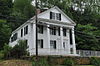
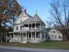
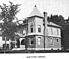
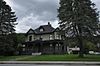
[2] Name on the Register [3] Image Date listed [4] Location City or town Description 1 Abbott Memorial Library Abbott Memorial Library January 6, 2015 (# 14001141 15 Library St. 43°39′54″N 72°32′21″W / 43.6651°N 72.5393°W / 43.6651; -72.5393 (Abbott Memorial Library ) Pomfret 2 Advent Camp Meeting Grounds Historic District Advent Camp Meeting Grounds Historic District September 21, 2017 (# 100001656 150 Advent Ln. 43°39′40″N 72°18′42″W / 43.661109°N 72.311698°W / 43.661109; -72.311698 (Advent Camp Meeting Grounds Historic District ) Hartford 3 Aiken Stand Complex Aiken Stand Complex January 27, 1983 (# 83003229 Jct Royalton Turnpike and Sayer Rd. 43°43′59″N 72°35′25″W / 43.7331°N 72.5904°W / 43.7331; -72.5904 (Aiken Stand Complex ) Barnard 4 Ascutney Mill Dam Historic District Ascutney Mill Dam Historic District January 9, 2007 (# 06001236 55 and 57 Ascutney St. 43°28′45″N 72°23′44″W / 43.479167°N 72.395556°W / 43.479167; -72.395556 (Ascutney Mill Dam Historic District ) Windsor 5 Ascutney State Park Ascutney State Park June 14, 2002 (# 02000664 1826 Back Mountain Rd. 43°26′34″N 72°26′08″W / 43.442778°N 72.435556°W / 43.442778; -72.435556 (Ascutney State Park ) Windsor 6 Atherton Farmstead Atherton Farmstead March 1, 2002 (# 02000119 31 Greenbush Rd. 43°24′52″N 72°32′49″W / 43.414444°N 72.546944°W / 43.414444; -72.546944 (Atherton Farmstead ) Cavendish 7 Beaver Meadow School Beaver Meadow School June 7, 2013 (# 13000374 246 Chapel Hill Rd. 43°45′50″N 72°22′19″W / 43.763967°N 72.371839°W / 43.763967; -72.371839 (Beaver Meadow School ) Norwich 8 Beaver Meadow Union Chapel Beaver Meadow Union Chapel March 9, 1995 (# 95000185 Northern side of Beaver Meadow Road 43°45′52″N 72°22′27″W / 43.764444°N 72.374167°W / 43.764444; -72.374167 (Beaver Meadow Union Chapel ) Norwich 9 Best's Covered Bridge Best's Covered Bridge July 2, 1973 (# 73000210 About 8 mi (13 km) west of Windsor off Vermont Route 44 43°27′19″N 72°30′58″W / 43.455278°N 72.516111°W / 43.455278; -72.516111 (Best's Covered Bridge ) West Windsor 10 Bethel Village Historic District Bethel Village Historic District September 3, 1976 (# 76000199 Both sides of S. Main, Main, N. Main, and Church Sts.May 24, 1990 ): Vermont Route 107 across the White River and north to the Central Vermont Railway tracks 43°49′51″N 72°38′02″W / 43.830833°N 72.633889°W / 43.830833; -72.633889 (Bethel Village Historic District ) Bethel 11 Black River Academy Black River Academy November 15, 1972 (# 72000108 High St. 43°23′47″N 72°41′45″W / 43.396389°N 72.695833°W / 43.396389; -72.695833 (Black River Academy ) Ludlow 12 Augustus and Laura Blaisdell House Augustus and Laura Blaisdell House January 29, 2014 (# 13001132 517 Depot St. 43°16′02″N 72°35′24″W / 43.267265°N 72.590057°W / 43.267265; -72.590057 (Augustus and Laura Blaisdell House ) Chester 13 Bowers Covered Bridge Bowers Covered Bridge August 28, 1973 (# 73000211 Bible Hill Road over Mill Creek 43°27′42″N 72°29′29″W / 43.461667°N 72.491389°W / 43.461667; -72.491389 (Bowers Covered Bridge ) West Windsor Washed off abutments by Hurricane Irene ; rebuilt in 2012. 14 Theron Boyd Homestead Theron Boyd Homestead May 20, 1993 (# 93000381 Town Highway 6 43°39′08″N 72°26′46″W / 43.652107°N 72.446156°W / 43.652107; -72.446156 (Theron Boyd Homestead ) Hartford 15 Bridge 15 Bridge 15 August 19, 2008 (# 08000792 F.A.S. Highway 177 43°46′55″N 72°27′36″W / 43.781944°N 72.46°W / 43.781944; -72.46 (Bridge 15 ) Sharon 16 Bridgewater Corners Bridge Bridgewater Corners Bridge October 29, 1992 (# 92001525 Vermont Route 100A over the Ottauquechee River 43°35′12″N 72°39′25″W / 43.586667°N 72.656944°W / 43.586667; -72.656944 (Bridgewater Corners Bridge ) Bridgewater 17 Bridgewater Village School Upload image June 16, 2022 (# 100007830 76 Southgate Loop 43°35′17″N 72°37′27″W / 43.5881°N 72.6243°W / 43.5881; -72.6243 (Bridgewater Village School ) Bridgewater 18 Bridgewater Woolen Mill Bridgewater Woolen Mill July 6, 1976 (# 76002240 U.S. Route 4 43°35′13″N 72°37′16″W / 43.586944°N 72.621111°W / 43.586944; -72.621111 (Bridgewater Woolen Mill ) Bridgewater 19 Brigham Hill Historic District Upload image March 5, 2020 (# 100005025 172, 185, 189 & 211 Brigham Hill Rd. 43°44′01″N 72°19′18″W / 43.7337°N 72.3217°W / 43.7337; -72.3217 (Brigham Hill Historic District ) Norwich 20 Brook Farm Brook Farm July 22, 1993 (# 93000676 Twenty Mile Stream Rd. northwest of Cavendish 43°26′30″N 72°39′20″W / 43.441667°N 72.655556°W / 43.441667; -72.655556 (Brook Farm ) Cavendish 21 Twing Buckman House Twing Buckman House April 4, 1996 (# 96000385 U.S. Route 5 , approximately 0.25 miles (0.40 km) north of Chase Island 43°28′14″N 72°23′26″W / 43.470556°N 72.390556°W / 43.470556; -72.390556 (Twing Buckman House ) Windsor 22 Cavendish Universalist Church Cavendish Universalist Church April 24, 1973 (# 73000252 Vermont Route 131 43°23′05″N 72°36′22″W / 43.3847°N 72.6061°W / 43.3847; -72.6061 (Cavendish Universalist Church ) Cavendish 23 Chester Village Historic District Chester Village Historic District August 8, 1985 (# 85001739 Roughly bounded by Lovers Lane Brook, Maple St., the Williams River , Middle Branch, and Lovers Lane 43°15′54″N 72°36′04″W / 43.265°N 72.6011°W / 43.265; -72.6011 (Chester Village Historic District ) Chester 24 Christian Street Rural Historic District Christian Street Rural Historic District December 5, 2003 (# 03001248 Christian St., Hemlock Ridge Dr., and Jericho St. 43°41′29″N 72°19′12″W / 43.6914°N 72.3199°W / 43.6914; -72.3199 (Christian Street Rural Historic District ) Hartford 25 Congregational Church of Ludlow Congregational Church of Ludlow January 28, 2004 (# 03001541 48 Pleasant St. 43°23′43″N 72°41′50″W / 43.3952°N 72.6971°W / 43.3952; -72.6971 (Congregational Church of Ludlow ) Ludlow 26 Coolidge State Park Coolidge State Park March 29, 2002 (# 02000281 855 Coolidge State Park Rd. 43°33′08″N 72°41′39″W / 43.5522°N 72.6942°W / 43.5522; -72.6942 (Coolidge State Park ) Plymouth 27 Calvin Coolidge Homestead District Calvin Coolidge Homestead District October 15, 1966 (# 66000794 Off Vermont Route 100A 43°32′14″N 72°43′28″W / 43.5372°N 72.7244°W / 43.5372; -72.7244 (Calvin Coolidge Homestead District ) Plymouth Notch President Calvin Coolidge 's birthplace and family home. 28 Cornish-Windsor Covered Bridge Cornish-Windsor Covered Bridge November 21, 1976 (# 76000135 West of Cornish City 43°28′26″N 72°23′01″W / 43.4739°N 72.3836°W / 43.4739; -72.3836 (Cornish-Windsor Covered Bridge ) Windsor Extends into Cornish in Sullivan County, New Hampshire 29 Rev. George Daman House Rev. George Daman House June 22, 1989 (# 89000759 Wyman Ln. 43°36′29″N 72°33′42″W / 43.6081°N 72.5617°W / 43.6081; -72.5617 (Rev. George Daman House ) Woodstock 30 Damon Hall Damon Hall June 2, 1988 (# 88000654 U.S. Route 5 and Vermont Route 12 43°32′29″N 72°24′01″W / 43.5414°N 72.4003°W / 43.5414; -72.4003 (Damon Hall ) Hartland 31 Dewey House Dewey House August 27, 1999 (# 99001051 173 Deweys Mills Rd. 43°38′30″N 72°24′19″W / 43.6417°N 72.4053°W / 43.6417; -72.4053 (Dewey House ) Hartford 32 Wentworth and Diana Eldredge House Upload image February 5, 2021 (# 100006133 Address Restricted Norwich 33 Ezekiel Emerson Farm Ezekiel Emerson Farm November 29, 2001 (# 01001284 Vermont Route 73 43°51′23″N 72°49′21″W / 43.8564°N 72.8225°W / 43.8564; -72.8225 (Ezekiel Emerson Farm ) Rochester 34 Eureka Schoolhouse Eureka Schoolhouse March 11, 1971 (# 71000074 470 Charlestown Rd. 43°16′12″N 72°26′52″W / 43.2701°N 72.4479°W / 43.2701; -72.4479 (Eureka Schoolhouse ) Goulds Mill 35 Joseph Fessenden House Joseph Fessenden House September 6, 2002 (# 02000953 58 Bridge St. 43°48′54″N 72°32′50″W / 43.815°N 72.5472°W / 43.815; -72.5472 (Joseph Fessenden House ) Royalton 36 Fire District No. 2 Firehouse Fire District No. 2 Firehouse March 16, 2020 (# 100005063 716 Depot St. 43°16′12″N 72°35′22″W / 43.2701°N 72.5894°W / 43.2701; -72.5894 (Fire District No. 2 Firehouse ) Chester 37 Fletcher-Fullerton Farm Fletcher-Fullerton Farm November 4, 2004 (# 04001215 1390 Fletcher Schoolhouse Road 43°34′08″N 72°33′35″W / 43.5689°N 72.5597°W / 43.5689; -72.5597 (Fletcher-Fullerton Farm ) Woodstock 38 Fowler-Steele House Fowler-Steele House June 17, 1982 (# 82001710 N. Main St. 43°29′24″N 72°23′10″W / 43.49°N 72.3861°W / 43.49; -72.3861 (Fowler-Steele House ) Windsor 39 Fox Stand Fox Stand July 23, 2015 (# 15000477 5615 VT 14 43°49′24″N 72°33′52″W / 43.8234°N 72.5645°W / 43.8234; -72.5645 (Fox Stand ) Royalton 40 Gate of the Hills Gate of the Hills November 18, 1991 (# 91001648 Junction of North and Royalton Hill Rds. 43°49′15″N 72°37′50″W / 43.8208°N 72.6306°W / 43.8208; -72.6306 (Gate of the Hills ) Bethel 41 Daniel Gay House Daniel Gay House January 9, 1978 (# 78000252 Vermont Route 107 43°46′42″N 72°41′52″W / 43.7784°N 72.6979°W / 43.7784; -72.6979 (Daniel Gay House ) Stockbridge Now the Belcher Library 42 Gilbert's Hill Gilbert's Hill March 18, 2019 (# 100003524 1362 Barnard Rd. 43°38′50″N 72°32′21″W / 43.6472°N 72.5392°W / 43.6472; -72.5392 (Gilbert's Hill ) Woodstock 43 Gilead Brook Bridge Gilead Brook Bridge October 11, 1990 (# 90001492 Vermont Route 12 over Gilead Brook 43°52′25″N 72°38′52″W / 43.8736°N 72.6478°W / 43.8736; -72.6478 (Gilead Brook Bridge ) Bethel 44 Glimmerstone Glimmerstone November 14, 1978 (# 78000253 Vermont Route 131 43°22′58″N 72°36′48″W / 43.382778°N 72.613333°W / 43.382778; -72.613333 (Glimmerstone ) Cavendish 45 Goodrich Four Corners Historic District Upload image June 26, 2019 (# 100004111 929-987 Union Village, 18 Pattrell & 694 Goodrich Four Corners Rds. 43°45′19″N 72°16′43″W / 43.7552°N 72.2785°W / 43.7552; -72.2785 (Goodrich Four Corners Historic District ) Norwich 46 Gould's Mill Bridge Gould's Mill Bridge February 1, 2006 (# 05001589 Town Hwy. 66 (Paddock Rd.) over the Black River 43°16′22″N 72°27′16″W / 43.272778°N 72.454444°W / 43.272778; -72.454444 (Gould's Mill Bridge ) Springfield 47 Greenwood House Greenwood House October 31, 1985 (# 85003442 Vermont Route 103 43°15′28″N 72°35′14″W / 43.257778°N 72.587222°W / 43.257778; -72.587222 (Greenwood House ) Chester 48 Harrington House Harrington House March 16, 1983 (# 83003230 River St. and Vermont Route 107 43°49′17″N 72°37′56″W / 43.821389°N 72.632222°W / 43.821389; -72.632222 (Harrington House ) Bethel 49 Hartford Library Hartford Library December 9, 1994 (# 94001447 1587 Maple St. 43°39′41″N 72°20′35″W / 43.661389°N 72.343056°W / 43.661389; -72.343056 (Hartford Library ) Hartford 50 Hartford Village Historic District Hartford Village Historic District September 3, 1998 (# 98001153 Roughly along Hartford Main, Summer and Christian Sts. 43°39′45″N 72°20′23″W / 43.6625°N 72.339722°W / 43.6625; -72.339722 (Hartford Village Historic District ) Hartford 51 Hartness House Hartness House December 20, 1978 (# 78000254 30 Orchard St. 43°18′05″N 72°28′39″W / 43.301380°N 72.477601°W / 43.301380; -72.477601 (Hartness House ) Springfield 52 Historic Crown Point Road Historic Crown Point Road December 2, 1974 (# 74000270 Off Vermont Route 131 43°23′29″N 72°30′12″W / 43.391389°N 72.503333°W / 43.391389; -72.503333 (Historic Crown Point Road ) Weathersfield The Crown Point Road spanned about a hundred miles when originally built. 53 Indian Stones Indian Stones November 20, 1974 (# 74000356 Vermont Route 106 43°26′47″N 72°32′07″W / 43.446389°N 72.535278°W / 43.446389; -72.535278 (Indian Stones ) Reading 54 Iron Bridge at Howard Hill Road Iron Bridge at Howard Hill Road September 9, 1982 (# 82001711 Howard Hill Rd. and Vermont Route 131 43°24′16″N 72°34′32″W / 43.404444°N 72.575556°W / 43.404444; -72.575556 (Iron Bridge at Howard Hill Road ) Cavendish The original 1890 structure was replaced in 2007 by the bridge in photo. 55 Jeffrey House Jeffrey House June 13, 1974 (# 74000271 North St. 43°16′44″N 72°35′51″W / 43.278884°N 72.597525°W / 43.278884; -72.597525 (Jeffrey House ) Chester 56 Jericho Rural Historic District Jericho Rural Historic District November 8, 2001 (# 01001228 Jericho St., Jericho Rd., Wallace Rd., Sugartop Rd., Joshua Rd. 43°42′17″N 72°22′32″W / 43.704722°N 72.375556°W / 43.704722; -72.375556 (Jericho Rural Historic District ) Hartford 57 Wales N. Johnson House Wales N. Johnson House November 7, 1995 (# 95001258 43 Senior Ln. 43°36′44″N 72°33′00″W / 43.612222°N 72.55°W / 43.612222; -72.55 (Wales N. Johnson House ) Woodstock Now the Jackson House Inn. 58 Juniper Hill Farm-Maxwell Evarts House Juniper Hill Farm-Maxwell Evarts House July 14, 1988 (# 88001044 Juniper Hill Rd. 43°29′31″N 72°23′45″W / 43.491944°N 72.395833°W / 43.491944; -72.395833 (Juniper Hill Farm-Maxwell Evarts House ) Windsor 59 Kendron Brook Bridge Kendron Brook Bridge August 27, 1992 (# 92001037 Town Highway 65 (Densmore Hill Road) over Kendron Brook 43°34′53″N 72°30′55″W / 43.581389°N 72.515278°W / 43.581389; -72.515278 (Kendron Brook Bridge ) Woodstock 60 The King Farm The King Farm January 31, 1997 (# 97000026 King Farm Rd., 0.5 miles (0.80 km) north of its junction with U.S. Route 4 43°37′23″N 72°32′41″W / 43.623056°N 72.544722°W / 43.623056; -72.544722 (The King Farm ) Woodstock 61 Lincoln Covered Bridge Lincoln Covered Bridge August 28, 1973 (# 73000212 Southwest of Woodstock off U.S. Route 4 43°36′02″N 72°34′10″W / 43.600556°N 72.569444°W / 43.600556; -72.569444 (Lincoln Covered Bridge ) Woodstock 62 Lockwood-Boynton House Lockwood-Boynton House May 4, 1982 (# 82001712 1 School St. 43°19′59″N 72°31′36″W / 43.333056°N 72.526667°W / 43.333056; -72.526667 (Lockwood-Boynton House ) North Springfield 63 Locust Creek House Complex Locust Creek House Complex December 10, 1982 (# 82001766 Vermont Route 12 43°48′32″N 72°39′04″W / 43.808889°N 72.651111°W / 43.808889; -72.651111 (Locust Creek House Complex ) Bethel 64 Luce Farm Upload image December 6, 2021 (# 100007219 170 Luce Rd. 43°48′22″N 72°43′45″W / 43.8060°N 72.7293°W / 43.8060; -72.7293 (Luce Farm ) Stockbridge 65 Ludlow Graded School Ludlow Graded School November 29, 1979 (# 79000276 High St. 43°23′48″N 72°41′52″W / 43.396667°N 72.697778°W / 43.396667; -72.697778 (Ludlow Graded School ) Ludlow 66 Ludlow Village Historic District Ludlow Village Historic District January 9, 2007 (# 06001235 Main St., Depot St. 43°23′53″N 72°41′59″W / 43.398056°N 72.699722°W / 43.398056; -72.699722 (Ludlow Village Historic District ) Ludlow 67 Maple Hill Farm Upload image March 16, 2020 (# 100005062 65 Maple Hill Rd. 43°44′06″N 72°18′04″W / 43.7350°N 72.3011°W / 43.7350; -72.3011 (Maple Hill Farm ) Norwich 68 Charles Marsh Law Office Charles Marsh Law Office December 9, 1994 (# 94001449 72 Pleasant St. 43°37′36″N 72°30′23″W / 43.626667°N 72.506389°W / 43.626667; -72.506389 (Charles Marsh Law Office ) Woodstock 69 George Perkins Marsh Boyhood Home George Perkins Marsh Boyhood Home June 11, 1967 (# 67000023 54 Elm St. 43°37′51″N 72°31′11″W / 43.630833°N 72.519722°W / 43.630833; -72.519722 (George Perkins Marsh Boyhood Home ) Woodstock Boyhood home of George Perkins Marsh , an American diplomat and philologist, an early environmentalist. Now in the Marsh-Billings-Rockefeller National Historical Park . 70 Joseph and Daniel Marsh House Joseph and Daniel Marsh House September 3, 1998 (# 98001149 1119 Quechee Main Street 43°38′55″N 72°24′27″W / 43.648525°N 72.407457°W / 43.648525; -72.407457 (Joseph and Daniel Marsh House ) Hartford Now the Quechee Inn. 71 Marsh-Billings-Rockefeller National Historical Park Marsh-Billings-Rockefeller National Historical Park August 26, 1992 (# 03000282 Vermont Route 12 43°38′00″N 72°31′16″W / 43.633333°N 72.521111°W / 43.633333; -72.521111 (Marsh-Billings-Rockefeller National Historical Park ) Woodstock Updated listing August 15, 2016. 72 Martin's Mill Covered Bridge Martin's Mill Covered Bridge August 28, 1973 (# 73000213 South of Hartland off U.S. Route 5 43°31′56″N 72°23′47″W / 43.532222°N 72.396389°W / 43.532222; -72.396389 (Martin's Mill Covered Bridge ) Hartland 73 McKenstry Manor McKenstry Manor December 1, 1978 (# 78000255 North of Bethel on Vermont Route 12 43°52′00″N 72°39′11″W / 43.866667°N 72.653056°W / 43.866667; -72.653056 (McKenstry Manor ) Bethel 74 Meeting House Farm Upload image March 16, 2020 (# 100005061 128 Union Village Rd. 43°43′42″N 72°18′36″W / 43.7283°N 72.3100°W / 43.7283; -72.3100 (Meeting House Farm ) Norwich 75 Owen Moon Farm Owen Moon Farm January 27, 1983 (# 83003231 South of South Woodstock off Vermont Route 106 43°33′18″N 72°31′59″W / 43.555°N 72.533056°W / 43.555; -72.533056 (Owen Moon Farm ) South Woodstock 76 Gen. Lewis R. Morris House Gen. Lewis R. Morris House June 25, 1992 (# 92000813 456 Old Connecticut River Rd. 43°17′23″N 72°24′37″W / 43.289722°N 72.410278°W / 43.289722; -72.410278 (Gen. Lewis R. Morris House ) Springfield 77 NAMCO Block NAMCO Block November 14, 1991 (# 91001615 1-17 Union St. 43°28′32″N 72°23′23″W / 43.475556°N 72.389722°W / 43.475556; -72.389722 (NAMCO Block ) Windsor 78 Norwich Mid-Century Modern Historic District Norwich Mid-Century Modern Historic District June 25, 2018 (# 100002604 Parts of Hopson, Pine Tree & Spring Pond Rds. 43°42′42″N 72°19′03″W / 43.7117°N 72.3175°W / 43.7117; -72.3175 (Norwich Mid-Century Modern Historic District ) Norwich 79 Norwich Village Historic District Norwich Village Historic District January 3, 1991 (# 90002116 Main St. from south of Elm St. to Turnpike Rd. and adjacent portions of Elm, Church, Mechanic, Hazen and Cliff Sts. 43°42′56″N 72°18′38″W / 43.715556°N 72.310556°W / 43.715556; -72.310556 (Norwich Village Historic District ) Norwich 80 Old Christ Church Old Christ Church March 6, 2008 (# 08000159 Junction of Vermont Route 12 and Gilead Brook Rd. 43°52′30″N 72°38′51″W / 43.875°N 72.6475°W / 43.875; -72.6475 (Old Christ Church ) Bethel 81 Old Constitution House Old Constitution House March 11, 1971 (# 71000075 16 N. Main St. 43°29′03″N 72°23′08″W / 43.484167°N 72.385556°W / 43.484167; -72.385556 (Old Constitution House ) Windsor 82 Old South Church Old South Church March 29, 2024 (# 100010130 146 Main St. 43°28′40″N 72°23′15″W / 43.4779°N 72.3875°W / 43.4779; -72.3875 (Old South Church ) Windsor 83 Ottauquechee River Bridge Ottauquechee River Bridge October 11, 1990 (# 90001491 U.S. Route 5 over the Ottauquechee River 43°36′09″N 72°21′17″W / 43.6025°N 72.354722°W / 43.6025; -72.354722 (Ottauquechee River Bridge ) Hartland 84 Park Street School Park Street School October 7, 2020 (# 100005653 60 Park St. 43°17′57″N 72°29′07″W / 43.2993°N 72.4854°W / 43.2993; -72.4854 (Park Street School ) Springfield 85 Parker Hill Rural Historic District Parker Hill Rural Historic District May 20, 1993 (# 93000431 Parker Hill and Lower Parker Hill Rds. 43°13′25″N 72°28′46″W / 43.2236°N 72.4794°W / 43.2236; -72.4794 (Parker Hill Rural Historic District ) Springfield Extends into Windham County 86 Aaron Jr. and Susan Parker Farm Aaron Jr. and Susan Parker Farm September 24, 2014 (# 14000405 1715 Brook Road 43°25′11″N 72°36′36″W / 43.4198°N 72.6101°W / 43.4198; -72.6101 (Aaron Jr. and Susan Parker Farm ) Cavendish 87 Plymouth Historic District Plymouth Historic District December 12, 1970 (# 70000084 Vermont Route 100A 43°32′30″N 72°42′51″W / 43.5417°N 72.7142°W / 43.5417; -72.7142 (Plymouth Historic District ) Plymouth 88 Pollard Block Pollard Block August 28, 2008 (# 08000855 7 Depot St. 43°22′57″N 72°38′18″W / 43.3825°N 72.6383°W / 43.3825; -72.6383 (Pollard Block ) Cavendish 89 Progressive Market Progressive Market July 10, 1995 (# 95000814 63 S. Main St. 43°38′46″N 72°19′09″W / 43.6461°N 72.3192°W / 43.6461; -72.3192 (Progressive Market ) Hartford 90 Quechee Gorge Bridge Quechee Gorge Bridge October 11, 1990 (# 90001490 U.S. Route 4 over Quechee Gorge 43°38′16″N 72°24′32″W / 43.6378°N 72.4089°W / 43.6378; -72.4089 (Quechee Gorge Bridge ) Hartford 91 Quechee Historic Mill District Quechee Historic Mill District July 3, 1997 (# 97000747 Roughly along High, Quechee Main, River, and School Sts., and River, Waterman Hill, Deweys Mill, and Cemetery Rds. 43°38′50″N 72°25′07″W / 43.6472°N 72.4186°W / 43.6472; -72.4186 (Quechee Historic Mill District ) Hartford 92 Isaac M. Raymond Farm Isaac M. Raymond Farm April 1, 1993 (# 93000242 Junction of Woodstock Town Highways 95 and 18 43°38′57″N 72°33′59″W / 43.6491°N 72.5665°W / 43.6491; -72.5665 (Isaac M. Raymond Farm ) Woodstock Now called Uphill Farm. 93 Reading Town Hall Reading Town Hall March 7, 1996 (# 96000252 Junction of Vermont Route 106 and Pleasant St. 43°27′20″N 72°32′16″W / 43.4556°N 72.5378°W / 43.4556; -72.5378 (Reading Town Hall ) Reading 94 Robbins and Lawrence Armory and Machine Shop Robbins and Lawrence Armory and Machine Shop November 13, 1966 (# 66000796 S. Main St. 43°28′29″N 72°23′23″W / 43.4747°N 72.3897°W / 43.4747; -72.3897 (Robbins and Lawrence Armory and Machine Shop ) Windsor Erected in 1846, an excellent example of 19th century American industrial architecture, and a site of the development of precision machinery. 95 Root School Root School June 10, 2013 (# 13000375 987 Union Village Rd. 43°45′22″N 72°16′37″W / 43.7562°N 72.2770°W / 43.7562; -72.2770 (Root School ) Norwich 96 Royalton Mill Complex Royalton Mill Complex February 3, 1983 (# 83003232 North of South Royalton on Town Rd. 12 43°49′54″N 72°30′56″W / 43.8317°N 72.5156°W / 43.8317; -72.5156 (Royalton Mill Complex ) South Royalton 97 Saddlebow Farm Saddlebow Farm November 14, 2002 (# 02001345 2477 Gold Coast Rd. 43°36′54″N 72°37′19″W / 43.615°N 72.6219°W / 43.615; -72.6219 (Saddlebow Farm ) Bridgewater 98 St. Pauls's Episcopal Church St. Pauls's Episcopal Church March 2, 2001 (# 01000214 Junction of Bridge St. and Vermont Route 14 43°48′55″N 72°32′48″W / 43.8153°N 72.5467°W / 43.8153; -72.5467 (St. Pauls's Episcopal Church ) Royalton 99 Simons' Inn Simons' Inn March 2, 1979 (# 79000233 Southwest of Andover on Vermont Route 11 43°15′28″N 72°43′01″W / 43.2578°N 72.7169°W / 43.2578; -72.7169 (Simons' Inn ) Andover 100 Slayton-Morgan Historic District Upload image June 24, 2010 (# 91001944 Address Restricted Woodstock 101 South Reading Schoolhouse South Reading Schoolhouse February 3, 1983 (# 83003233 Felchville-Tyson's Corner Rd. 43°28′34″N 72°35′41″W / 43.4761°N 72.5947°W / 43.4761; -72.5947 (South Reading Schoolhouse ) South Reading 102 South Royalton Historic District South Royalton Historic District September 3, 1976 (# 76000200 East of Royalton on Vermont Route 14 43°49′17″N 72°31′15″W / 43.8214°N 72.5208°W / 43.8214; -72.5208 (South Royalton Historic District ) South Royalton 103 South Woodstock Village Historic District South Woodstock Village Historic District August 12, 1982 (# 82001713 Both sides of Vermont Route 106 , Town Highway 61, and Church Hill Rd. 43°33′48″N 72°31′57″W / 43.5633°N 72.5325°W / 43.5633; -72.5325 (South Woodstock Village Historic District ) Woodstock 104 Southview Housing Historic District Southview Housing Historic District November 8, 2007 (# 07001171 1-107 Stanley Rd. 43°17′06″N 72°28′35″W / 43.285°N 72.4764°W / 43.285; -72.4764 (Southview Housing Historic District ) Springfield 105 Spaulding Bridge Spaulding Bridge January 11, 2006 (# 05001522 Mill St. 43°22′57″N 72°36′31″W / 43.3825°N 72.6086°W / 43.3825; -72.6086 (Spaulding Bridge ) Cavendish 106 Zachariah Spaulding Farm Zachariah Spaulding Farm November 4, 1993 (# 93001175 Town Highway 38 south of the Ludlow town center 43°22′53″N 72°41′29″W / 43.3814°N 72.6914°W / 43.3814; -72.6914 (Zachariah Spaulding Farm ) Ludlow 107 Spencer Hollow School Spencer Hollow School September 17, 2012 (# 12000803 50 Spencer Hollow Rd. 43°17′51″N 72°25′52″W / 43.2976°N 72.431°W / 43.2976; -72.431 (Spencer Hollow School ) Springfield 108 Springfield Downtown Historic District Springfield Downtown Historic District August 11, 1983 (# 83003234 Roughly bounded by the Black River and Mineral, Pearl, Main, and Valley Sts.September 11, 1986 ): Roughly the Brookline Apartments on Wall St., Park St., and along the Black River 43°18′04″N 72°29′05″W / 43.3011°N 72.4847°W / 43.3011; -72.4847 (Springfield Downtown Historic District ) Springfield 109 Stellafane Observatory Stellafane Observatory November 7, 1977 (# 77000107 South of North Springfield off Breezy Hill Rd. 43°16′41″N 72°31′10″W / 43.2781°N 72.5194°W / 43.2781; -72.5194 (Stellafane Observatory ) North Springfield Contains original clubhouse of the Springfield Telescope Makers, Inc. (1924), and the first large optical telescope (1930) built and owned by that kind of amateur society. 110 Stockbridge Common Historic District Stockbridge Common Historic District May 24, 1990 (# 90000800 Area around Stockbridge Common, including Maplewood Cemetery 43°47′12″N 72°45′19″W / 43.7867°N 72.7553°W / 43.7867; -72.7553 (Stockbridge Common Historic District ) Stockbridge 111 Stockbridge Four Corners Bridge Stockbridge Four Corners Bridge November 14, 1991 (# 91001611 Vermont Route 100 over the White River 43°46′56″N 72°45′30″W / 43.7822°N 72.7583°W / 43.7822; -72.7583 (Stockbridge Four Corners Bridge ) Stockbridge Demolished 2009 and replaced by modern bridge. 112 Walter and Sylvia Stockmayer House Upload image September 23, 2020 (# 100005643 48 Overlook Dr. 43°43′37″N 72°18′15″W / 43.7269°N 72.3041°W / 43.7269; -72.3041 (Walter and Sylvia Stockmayer House ) Norwich 113 Stone Village Historic District Stone Village Historic District May 17, 1974 (# 74000329 Both sides of Vermont Route 103 43°16′24″N 72°35′35″W / 43.2733°N 72.5931°W / 43.2733; -72.5931 (Stone Village Historic District ) Chester 114 Jedediah Strong II House Jedediah Strong II House August 13, 1974 (# 74000272 Quechee Main St. and Dewey's Mills Rd. 43°38′44″N 72°24′02″W / 43.6456°N 72.4006°W / 43.6456; -72.4006 (Jedediah Strong II House ) Hartford 115 David Sumner House David Sumner House March 2, 1989 (# 89000027 U.S. Route 5 43°32′24″N 72°23′56″W / 43.54°N 72.3989°W / 43.54; -72.3989 (David Sumner House ) Hartland 116 Taftsville Covered Bridge Taftsville Covered Bridge August 28, 1973 (# 73000214 East of Woodstock off U.S. Route 4 43°38′23″N 72°28′05″W / 43.6397°N 72.4681°W / 43.6397; -72.4681 (Taftsville Covered Bridge ) Woodstock 117 Taftsville Historic District Taftsville Historic District August 2, 2001 (# 01000824 Portions of U.S. Route 4 , Upper River Rd., Quechee Main St., all Butternut Ln., Happy Valley Rd., Sugar Hill Rd. 43°37′46″N 72°28′26″W / 43.6294°N 72.4739°W / 43.6294; -72.4739 (Taftsville Historic District ) Hartford 118 Terraces Historic District Terraces Historic District July 6, 2012 (# 12000410 22-60 Mapelwood Terr., 2-364 Fairview Terr., 12-249 Hillcrest Terr., 82, 176 Forest Hills Ave. 43°39′01″N 72°19′30″W / 43.6503°N 72.3251°W / 43.6503; -72.3251 (Terraces Historic District ) Hartford 119 Upper Falls Covered Bridge Upper Falls Covered Bridge August 28, 1973 (# 73000215 North of Perkinsville off Vermont Route 131 43°23′55″N 72°31′21″W / 43.3986°N 72.5225°W / 43.3986; -72.5225 (Upper Falls Covered Bridge ) Perkinsville 120 Weathersfield Center Historic District Weathersfield Center Historic District June 30, 1980 (# 80000345 Center Rd. 43°22′43″N 72°28′05″W / 43.3786°N 72.4681°W / 43.3786; -72.4681 (Weathersfield Center Historic District ) Weathersfield Center 121 West Hartford Bridge West Hartford Bridge October 29, 1992 (# 92001524 Town Highway 14 at Vermont Route 14 over the White River 43°42′44″N 72°25′06″W / 43.7122°N 72.4183°W / 43.7122; -72.4183 (West Hartford Bridge ) Hartford Truss bridge, replaced by modern bridge in 2006. 122 West Hartford Village Historic District West Hartford Village Historic District December 15, 2004 (# 04001368 Vermont Route 14 , Harper Savage Ln., Tigertown Rd., and Stetson Rd. 43°42′59″N 72°24′58″W / 43.7164°N 72.4161°W / 43.7164; -72.4161 (West Hartford Village Historic District ) Hartford 123 West Woodstock Bridge West Woodstock Bridge August 27, 1992 (# 92001038 Town Highway 50 over the Ottauquechee River 43°36′51″N 72°32′36″W / 43.6142°N 72.5433°W / 43.6142; -72.5433 (West Woodstock Bridge ) West Woodstock 124 Weston Village Historic District Weston Village Historic District August 29, 1985 (# 85001934 Main, Park, and School Sts., Lawrence Hill, Landgrove, and Trout Club Rds., Mill Lane, and Chester Mountain Rd. 43°17′30″N 72°47′40″W / 43.2917°N 72.7944°W / 43.2917; -72.7944 (Weston Village Historic District ) Weston 125 White River Junction Historic District White River Junction Historic District August 22, 1980 (# 80000390 Railroad Row, Main, Currier, Bridge, and Gates Sts.; also N. Main St., S. Main St. Bridge St., Gates St., and Church St.; also Currier St. & Maple St. 43°38′53″N 72°19′09″W / 43.6481°N 72.3192°W / 43.6481; -72.3192 (White River Junction Historic District ) Hartford Second and third address lists represent boundary increases approved December 20, 2002 and December 10, 2019 126 Wilder Village Historic District Wilder Village Historic District November 22, 1999 (# 99001396 Portions of Norwich, Passumpsic, and Horseshoe Aves., Chestnut, Gillette, Fern, Hawthorn, Locust and Division Sts. 43°40′30″N 72°18′31″W / 43.675°N 72.3086°W / 43.675; -72.3086 (Wilder Village Historic District ) Hartford 127 John Wilder House John Wilder House November 10, 1983 (# 83004231 Lawrence Hill Rd. 43°17′32″N 72°47′43″W / 43.292222°N 72.795278°W / 43.292222; -72.795278 (John Wilder House ) Weston 128 Wilgus State Park Wilgus State Park March 29, 2002 (# 02000282 3985 U.S. Route 5 43°23′27″N 72°24′38″W / 43.390833°N 72.410556°W / 43.390833; -72.410556 (Wilgus State Park ) Weathersfield 129 Willard Covered Bridge Willard Covered Bridge August 28, 1973 (# 73000216 Mill Rd. across the Ottauquechee River 43°35′37″N 72°21′01″W / 43.593611°N 72.350278°W / 43.593611; -72.350278 (Willard Covered Bridge ) Hartland 130 Windsor House Windsor House December 29, 1971 (# 71000060 N. Main St., north of the junction of Main and State Sts. 43°28′51″N 72°23′11″W / 43.480783°N 72.386369°W / 43.480783; -72.386369 (Windsor House ) Windsor 131 Windsor Village Historic District Windsor Village Historic District April 23, 1975 (# 75000212 Area centered around Main, Depot Ave., State St., and Court Sq.July 25, 1997 , refnum 97000828): Along Phelps Ct. and State St.December 1, 2014 , refnum 14001036): 43°28′50″N 72°23′13″W / 43.480556°N 72.386944°W / 43.480556; -72.386944 (Windsor Village Historic District ) Windsor Second and third set of addresses represents boundary increases 132 Woodstock Village Historic District Woodstock Village Historic District January 22, 1973 (# 73000274 Along the Ottauquechee River , roughly inclusive of Maple, South, River, Prospect, and Pleasant Sts., College Hill Rd., and Mountain Ave. 43°37′33″N 72°30′59″W / 43.625833°N 72.516389°W / 43.625833; -72.516389 (Woodstock Village Historic District ) Woodstock Boundary changes were approved on August 6, 2021 133 Woodstock Warren Through Truss Bridge Woodstock Warren Through Truss Bridge August 18, 1992 (# 92000987 Town Highway 24 across the Ottauquechee River 43°36′01″N 72°35′22″W / 43.600278°N 72.589444°W / 43.600278; -72.589444 (Woodstock Warren Through Truss Bridge ) Woodstock Swept away by Hurricane Irene in August 2011