Oxford | |
---|---|
Coordinates: 42°07′00″N71°51′55″W / 42.11667°N 71.86528°W | |
Country | United States |
State | Massachusetts |
County | Worcester |
Settled | 1687 |
Incorporated | 1713 |
Government | |
• Type | Open town meeting |
• Town Manager | Jennifer Callahan |
Area | |
• Total | 27.5 sq mi (71.3 km2) |
• Land | 26.6 sq mi (69.0 km2) |
• Water | 0.9 sq mi (2.3 km2) |
Elevation | 508 ft (155 m) |
Population (2020) | |
• Total | 13,347 |
• Density | 490/sq mi (190/km2) |
Time zone | UTC−5 (Eastern) |
• Summer (DST) | UTC−4 (Eastern) |
ZIP Codes | 01537, 01540 |
Area code | 508/ 774 |
FIPS code | 25-51825 |
GNIS feature ID | 0618379 |
Website | www.oxfordma.us |
Oxford is a town in Worcester County, Massachusetts, United States. The population was 13,347 as of the 2020 United States Census. [1]
Oxford was first settled in 1687 and was officially incorporated in 1713. It was the birthplace of Clara Barton, the first president and founder of the American Red Cross. Oxford was originally settled by Huguenots in two waves, the original settlement having been abandoned after four residents (John Johnson and his three children, Peter, Andrew and Mary) were killed in a violent confrontation with local Native Americans. This event, the Johnson Massacre, is commemorated near the south end of town on Main Street. The remains of the Huguenot Fort (built in 1686) still exist near Huguenot Road. [2]
The first town clerk of Oxford was John Town, who also served as selectman and as a church deacon.
According to the United States Census Bureau, the town has a total area of 27.5 square miles (71 km2), of which 26.6 square miles (69 km2) is land and 0.9 square miles (2.3 km2), or 3.20%, is water. The town sits in a valley, and much of its area lies in the flood plain of the French River, which runs through the town. A substantial parcel north and west of Oxford Center is held, for flood control purposes, by the U.S. Army Corps of Engineers. The land, known as Greenbriar, also serves as a nature preserve.
It also serves to cut off east–west travel on former roads through the site. Route 20 runs east–west through North Oxford, running north–south Route 12, locally called Main Street; less than a mile from Route 56, connecting North Oxford with points north; and Interstate 395, linking Oxford to Worcester and eastern Connecticut with three local exits: Depot Road in North Oxford; Sutton Avenue, the main east–west street in Oxford Center; and Cudworth Road, near the Webster town line.
The town used to include much of what is now Webster, on its southern border, but Oxford and neighboring Dudley both gave portions of their land to allow the creation of that town. Other towns bordering Oxford are Charlton to the west, Leicester and Auburn to the north, Millbury and Sutton to the east, and Douglas to the southeast.
Year | Pop. | ±% |
---|---|---|
1790 | 1,000 | — |
1800 | 1,273 | +27.3% |
1810 | 1,277 | +0.3% |
1820 | 1,562 | +22.3% |
1830 | 2,034 | +30.2% |
1840 | 1,742 | −14.4% |
1850 | 2,380 | +36.6% |
1860 | 3,034 | +27.5% |
1870 | 2,713 | −10.6% |
1880 | 2,604 | −4.0% |
1890 | 2,616 | +0.5% |
1900 | 2,677 | +2.3% |
1910 | 3,361 | +25.6% |
1920 | 3,820 | +13.7% |
1930 | 3,943 | +3.2% |
1940 | 4,623 | +17.2% |
1950 | 5,851 | +26.6% |
1960 | 9,282 | +58.6% |
1970 | 10,345 | +11.5% |
1980 | 11,680 | +12.9% |
1990 | 12,588 | +7.8% |
2000 | 13,352 | +6.1% |
2010 | 13,709 | +2.7% |
2020 | 13,347 | −2.6% |
2022* | 13,287 | −0.4% |
* = population estimate Source: United States census records and Population Estimates Program data. [3] [4] [5] [6] [7] [8] [9] [10] [11] [12] [13] |
As of the 2000 census [14] there were 13,352 people, 5,058 households, and 3,596 families residing in the town. The population density was 501.5 inhabitants per square mile (193.6/km2). There were 5,228 housing units at an average density of 196.4 per square mile (75.8/km2). The racial makeup of the town was 96.62% White, 0.87% Black or African American, 0.25% Native American, 0.84% Asian, 0.02% Pacific Islander, 0.32% from other races, and 1.07% from two or more races. Of the population, 1.97% were Hispanic or Latino of any race.
There were 5,058 households, out of which 34.6% had children under the age of 18 living with them, 56.0% were married couples living together, 11.6% had a female householder with no husband present, and 28.9% were non-families. Of all households, 23.6% were made up of individuals, and 8.6% had someone living alone who was 65 years of age or older. The average household size was 2.62 and the average family size was 3.12.
In the town, the population was spread out, with 26.1% under the age of 18, 7.5% from 18 to 24, 32.4% from 25 to 44, 22.8% from 45 to 64, and 11.2% who were 65 years of age or older. The median age was 37 years. For every 100 females, there were 93.5 males. For every 100 females age 18 and over, there were 89.6 males.
The median income for a household in the town was $52,233, and the median income for a family was $58,973. Males had a median income of $41,727 versus $30,828 for females. The per capita income for the town was $21,828. Of the population, 7.8% and 5.5% of families were below the poverty line. Of those, 12.5% under the age of 18 and 7.6% of those 65 and older were living below the poverty line.
The population was 13,709 at the 2010 census.
For geographic and demographic information on the census-designated place Oxford, please see the article Oxford (CDP), Massachusetts.
State government | |
---|---|
State Representative(s): | Peter Durant (R), Paul K. Frost (R) |
State Senator(s): | Ryan Fattman (R) |
Governor's Councilor(s): | Paul DePalo (D) |
Federal government | |
U.S. Representative(s): | James P. McGovern (D-2nd District), |
U.S. Senators: | Elizabeth Warren (D), Ed Markey (D) |
The Oxford public library was established in 1869. [15] [16] In fiscal year 2008, the town of Oxford spent 1.5% ($468,609) of its budget on its public library—approximately $34 per person, per year ($41.64 adjusted for inflation to 2021). [17]
Oxford has a public school system with two elementary schools, one middle school, and one high school.
The first elementary school is the Alfred M. Chaffee School, which offers kindergarten- 2nd grade education. The second elementary school is the Clara Barton School, which offers 3rd–5th grade education. The Oxford Middle School offers 6th–8th grade courses, and Oxford High School offers grades 9th –12th with preschool in the basement.
Oxford High School has a number of sports activities throughout the fall, winter and spring seasons. Some of these sports include, field hockey, cross country, football, soccer, indoor track, basketball, outdoor track, baseball, softball, golf, and ultimate frisbee.
Clarksburg is a town in Berkshire County, Massachusetts, United States. It is part of the Pittsfield, Massachusetts Metropolitan Statistical Area. The population was 1,657 at the 2020 census.
Peru is a town in Berkshire County, Massachusetts, United States. The population was 814 at the 2020 census.
Brimfield is a town in Hampden County, Massachusetts, United States. The population was 3,694 at the 2020 census. It is part of the Springfield, Massachusetts Metropolitan Statistical Area.
Tolland is a town in Hampden County, Massachusetts, United States. It is part of the Springfield, Massachusetts Metropolitan Statistical Area. The population was 471 at the 2020 census, making it the smallest town in Hampden County by population.
Wales is a town in Hampden County, Massachusetts, United States. The population was 1,838 at the 2020 census. It is part of the Springfield, Massachusetts Metropolitan Statistical Area.
Boylston is a town in Worcester County, Massachusetts, United States. The population was 4,849 at the 2020 census.
Charlton is a town in Worcester County, Massachusetts, United States. The population was 13,315 at the 2020 census.
Dudley is a town in Worcester County, Massachusetts, United States. The population was 11,921 at the 2020 census.
Hardwick is a town in Worcester County, Massachusetts, United States, about 20 miles (32 km) northwest of the city of Worcester. It had a population of 2,667 at the 2020 census. It includes the villages of Hardwick, Gilbertville, Wheelwright and Old Furnace.
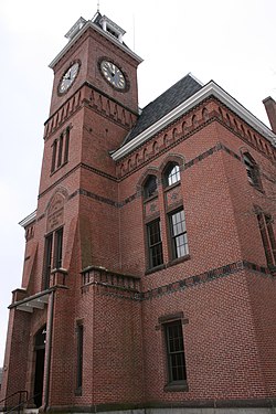
Holden is a town in Worcester County, Massachusetts, United States. The town was founded in 1741, and the Town Square was donated by John Hancock, former Governor of Massachusetts. The population was 19,905 at the 2020 census.
Millbury, officially the Town of Millbury, is a town in Worcester County, Massachusetts, United States. Located within Blackstone Valley, the population in Millbury was 13,831 at the 2020 United States Census.
Oakham is a town in Worcester County, Massachusetts, United States. The population was 1,851 at the 2020 census.
Phillipston is a town in Worcester County, Massachusetts, United States. The population was 1,724 at the 2020 census.
Royalston is a town in Worcester County, Massachusetts, United States. The population was 1,250 at the 2020 census.
Sutton, officially the Town of Sutton, is a town in Worcester County, Massachusetts, United States. The population was 9,357 in the 2020 United States Census. Located in the Blackstone Valley, the town was designated as a Preserve America community in 2004.
Templeton is a town in Worcester County, Massachusetts, United States. The population was 8,149 at the 2020 census. The town comprises four main villages: Templeton Center, East Templeton, Baldwinville, and Otter River.
Lunenburg is a town in Worcester County, Massachusetts, United States. The population was 11,946 at the 2020 census.
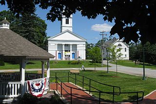
Sturbridge is a town in Worcester County, Massachusetts, United States. It is home to Old Sturbridge Village living history museum and other sites of historical interest such as Tantiusques.
Webster is a town in Worcester County, Massachusetts, United States. The population was 17,776 at the 2020 census.
North Brookfield is a town in Worcester County, Massachusetts, United States. The population was 4,735 at the 2020 census.