Pine Hills, California

Last updated
Pine Hills
Humboldt County California Incorporated and Unincorporated areas Pine Hills Highlighted.svg
Location in Humboldt County and the state of California
Coordinates: 40°43′59″N124°09′08″W / 40.73306°N 124.15222°W / 40.73306; -124.15222 Coordinates: 40°43′59″N124°09′08″W / 40.73306°N 124.15222°W / 40.73306; -124.15222
Country Flag of the United States.svg  United States
State Flag of California.svg  California
County Humboldt
Area
[1]
  Total10.160 sq mi (26.313 km2)
  Land10.118 sq mi (26.205 km2)
  Water0.042 sq mi (0.108 km2)  0.41%
Elevation
420 ft (128 m)
Population
 (2010)
  Total3,131
  Density310/sq mi (120/km2)
Time zone UTC-8 (Pacific (PST))
  Summer (DST) UTC-7 (PDT)
ZIP code
95503
Area code 707
FIPS code 06-57204
GNIS feature ID1867051
U.S. Geological Survey Geographic Names Information System: Pine Hills, California

Pine Hills is a census-designated place (CDP) in Humboldt County, California, United States, adjacent to Eureka. The population was 3,131 at the 2010 census, up from 3,108 at the 2000 census. Pine Hills includes areas like Ridgewood and areas as far south as the small neighborhood of Elk River. An area near this artificial census construct is called Pine Hill by Local government agencies and officials. Pine Hill is a much smaller area than "Pine Hills" and as defined by local agencies is actually within an adjacent CDP named Bayview. [2] [3] [4]

Contents

Geography

Pine Hills is located at 40°43′59″N124°09′08″W / 40.73306°N 124.15222°W / 40.73306; -124.15222 . [5]

According to the United States Census Bureau, the CDP has a total area of 10.1 square miles (26 km2), over 99% of it land.

Demographics

2010

The 2010 United States Census [6] reported that Pine Hills had a population of 3,131. The population density was 308.2 inhabitants per square mile (119.0/km2). The racial makeup of Pine Hills was 2,648 (84.6%) White, 22 (0.7%) African American, 86 (2.7%) Native American, 116 (3.7%) Asian, 4 (0.1%) Pacific Islander, 72 (2.3%) from other races, and 183 (5.8%) from two or more races. Hispanic or Latino of any race were 220 persons (7.0%).

The Census reported that 3,112 people (99.4% of the population) lived in households, 19 (0.6%) lived in non-institutionalized group quarters, and 0 (0%) were institutionalized.

There were 1,261 households, out of which 357 (28.3%) had children under the age of 18 living in them, 706 (56.0%) were opposite-sex married couples living together, 91 (7.2%) had a female householder with no husband present, 68 (5.4%) had a male householder with no wife present. There were 93 (7.4%) unmarried opposite-sex partnerships, and 11 (0.9%) same-sex married couples or partnerships. 282 households (22.4%) were made up of individuals, and 115 (9.1%) had someone living alone who was 65 years of age or older. The average household size was 2.47. There were 865 families (68.6% of all households); the average family size was 2.89.

The population was spread out, with 645 people (20.6%) under the age of 18, 239 people (7.6%) aged 18 to 24, 662 people (21.1%) aged 25 to 44, 1,051 people (33.6%) aged 45 to 64, and 534 people (17.1%) who were 65 years of age or older. The median age was 45.6 years. For every 100 females, there were 99.9 males. For every 100 females age 18 and over, there were 100.0 males.

There were 1,327 housing units at an average density of 130.6 per square mile (50.4/km2), of which 1,261 were occupied, of which 932 (73.9%) were owner-occupied, and 329 (26.1%) were occupied by renters. The homeowner vacancy rate was 1.2%; the rental vacancy rate was 3.8%. 2,308 people (73.7% of the population) lived in owner-occupied housing units and 804 people (25.7%) lived in rental housing units.

2000

As of the census [7] of 2000, there were 3,108 people, 1,199 households, and 888 families residing in the CDP. The population density was 304.9 inhabitants per square mile (117.7/km2). There were 1,253 housing units at an average density of 122.9 per square mile (47.5/km2). The racial makeup of the CDP was 89.61% White, 0.55% Black or African American, 2.61% Native American, 1.61% Asian, 0.29% Pacific Islander, 1.09% from other races, and 4.25% from two or more races. 4.60% of the population were Hispanic or Latino of any race.

There were 1,199 households, out of which 33.1% had children under the age of 18 living with them, 62.5% were married couples living together, 8.1% had a female householder with no husband present, and 25.9% were non-families. 19.1% of all households were made up of individuals, and 6.6% had someone living alone who was 65 years of age or older. The average household size was 2.59 and the average family size was 2.94.

In the CDP, the population was spread out, with 25.0% under the age of 18, 7.3% from 18 to 24, 25.9% from 25 to 44, 29.6% from 45 to 64, and 12.2% who were 65 years of age or older. The median age was 40 years. For every 100 females, there were 93.5 males. For every 100 females age 18 and over, there were 93.7 males.

The median income for a household in the CDP was $43,527, and the median income for a family was $49,000. Males had a median income of $36,746 versus $30,735 for females. The per capita income for the CDP was $20,786. About 6.8% of families and 9.6% of the population were below the poverty line, including 11.7% of those under age 18 and 3.2% of those age 65 or over.

Politics

In the state legislature, Pine Hills is in the 2nd Senate District , represented by Democrat Mike McGuire, [8] and the 2nd Assembly District , represented by Democrat Jim Wood. [9]

Federally, Pine Hills is in California's 2nd congressional district , represented by Democrat Jared Huffman. [10]

See also

Related Research Articles

<span class="mw-page-title-main">Eureka County, Nevada</span> County in Nevada, United States

Eureka County is a county in the U.S. state of Nevada. As of the 2020 census, the population was 1,855, making it the second-least populous county in Nevada. Its county seat is Eureka.

<span class="mw-page-title-main">Bayview, Humboldt County, California</span> Census-designated place in California, United States

Bayview is a census-designated place (CDP) located adjacent to the City of Eureka in Humboldt County, California, United States. Its population is 2,619 as of the 2020 census, up from 2,510 from the 2010 census. Many locals consider this area as part of "Pine Hill."

<span class="mw-page-title-main">Cutten, California</span> Census-designated place in California, United States

Cutten, a census-designated place (CDP) in Humboldt County, California, United States, is an unincorporated community, which is part of Greater Eureka. The city was named for David Page Cutten and his family, who were prominent figures in the history of Humboldt County during the early 1850s. Cutten is located 2.5 miles (4 km) south-southeast of downtown Eureka, at an elevation of 200 feet. Its population is 3,223 as of the 2020 census, up from 3,108 from the 2010 census.

<span class="mw-page-title-main">Humboldt Hill, California</span> Census-designated place in Humboldt County, California, U.S.

Humboldt Hill is a census-designated place (CDP) in Humboldt County, California, United States. Humboldt Hill rises to an elevation of 636 feet (194 m). The population was 3,414 at the 2010 census, up from 3,246 at the 2000 census. The area is in the 95503 zip code and part of unincorporated Eureka.

<span class="mw-page-title-main">Hydesville, California</span> Census-designated place in California, United States

Hydesville is a census-designated place (CDP) in Humboldt County, California, United States. Hydesville is located 4.5 miles (7.2 km) southeast of Fortuna, at an elevation of 364 feet (111 m). The population was 1,237 at the 2010 census, up from 1,209 at the 2000 census.

<span class="mw-page-title-main">McKinleyville, California</span> Census-designated place in California, United States

McKinleyville is a census-designated place (CDP) in Humboldt County, California McKinleyville is located 5.25 miles (8.4 km) north of Arcata, at an elevation of 141 feet (43 m). The population was 15,177 at the 2010 census, up from 13,599 at the time of the 2000 census.

<span class="mw-page-title-main">Myrtletown, California</span> Census designated place in California, United States

Myrtletown is a census-designated place (CDP) in Humboldt County, California, United States. Myrtletown lies at an elevation of 112 feet. Myrtletown is a part of the Eureka, California metropolitan area. The population was 4,675 at the 2010 census, up from 4,459 at the 2000 census.

<span class="mw-page-title-main">Redway, California</span> Census-designated place in California, United States

Redway is a census-designated place (CDP) in Humboldt County, California, United States. Redway is located 2.25 miles (3.6 km) northwest of Garberville, at an elevation of 538 feet (164 m). The population was 1,225 at the 2010 census, up from 1,188 at the 2000 census. Redway is also home to Redway Elementary School, with grades K–6.

<span class="mw-page-title-main">Willow Creek, California</span> Census-designated place in California, United States

Willow Creek is a census-designated place (CDP) in Humboldt County, California, United States. The population was 1,710 at the 2010 census, down from 1,743 at the 2000 census. Residents of this small mountain town are commonly referred to as "Willow Creekers." The town is located around 30 miles (48 km) from county seat and harbor city Eureka, with the two places vastly differing in climate.

<span class="mw-page-title-main">Lake of the Pines, California</span> Census-designated place in California, United States

Lake of the Pines is a census-designated place (CDP) and a gated residential community in Nevada County, California, United States. The population was 3,917 at the 2010 census.

<span class="mw-page-title-main">Plumas Eureka, California</span> Census-designated place in California, United States

Plumas Eureka is a census-designated place (CDP) in Plumas County, California, United States. The population was 320 at the 2000 census.

<span class="mw-page-title-main">Pine Valley, California</span> Census-designated place in California, United States

Pine Valley is a community and census-designated place (CDP) in the Cuyamaca Mountains of the Mountain Empire area, in southeastern San Diego County, California. The population was 1,510 at the 2010 census, up from 1,501 at the 2000 census.

<span class="mw-page-title-main">Mission Hills, Santa Barbara County, California</span> Census-designated place in the U.S. state of California

Mission Hills is a census-designated place (CDP) in Santa Barbara County, California, a short distance north of Lompoc on Highway 1. The population was 3,576 at the 2010 census, up from 3,142 at the 2000 census.

<span class="mw-page-title-main">Lely, Florida</span> Census-designated place in Florida

Lely is a census-designated place (CDP) in Collier County, Florida, United States. The population was 3,451 at the 2010 census. It is part of the Naples–Marco Island Metropolitan Statistical Area.

Rouzerville is an unincorporated community and census-designated place (CDP) in Franklin County, Pennsylvania, United States. The population was 903 at the 2020 census.

<span class="mw-page-title-main">Colonial Pine Hills, South Dakota</span> CDP in South Dakota, United States

Colonial Pine Hills is a census-designated place (CDP) and unincorporated community in Pennington County, South Dakota, United States. The population was 1,903 at the 2020 census.

<span class="mw-page-title-main">Benbow, California</span> Census designated place in California, United States

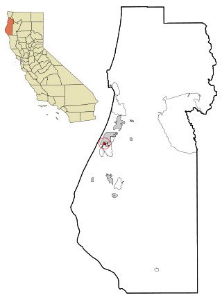
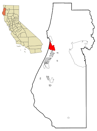
Benbow is a census-designated place in Humboldt County, California, located beside the South Fork Eel River. It is located 2 miles (3.2 km) south-southeast of Garberville, at an elevation of 440 feet. Its population is 422 as of the 2020 census, up from 321 from the 2010 census.

<span class="mw-page-title-main">Big Lagoon, California</span> Census-designated place in California, United States

Big Lagoon is a census-designated place in Humboldt County, California. It is located 7 miles (11 km) north of Trinidad, at an elevation of 56 feet (17 m). Its population is 161 as of the 2020 census, up from 93 from the 2010 census.

<span class="mw-page-title-main">Fields Landing, California</span> Census-designated place in California, United States

Fields Landing is a census-designated place in Humboldt County, California. It is located on Humboldt Bay 6 miles (9.7 km) south-southwest of downtown Eureka, at an elevation of 13 feet. The ZIP Code is 95537. The population was 276 at the 2010 census.

<span class="mw-page-title-main">Manila, California</span> Census-designated place in California, United States

Manila is a census-designated place located adjacent to Humboldt Bay in Humboldt County, California. It is located 3.25 miles (5.2 km) north of downtown Eureka, at an elevation of 13 feet. The ZIP Code is 95521. The population was 784 at the 2010 census.

References

  1. "2010 Census U.S. Gazetteer Files – Places – California". United States Census Bureau.
  2. "Eureka Community Plan: Zoning Map, Pine Hill". County of Humboldt . 1995. Retrieved 2008-10-05.{{cite web}}: External link in |publisher= (help)
  3. "Board Agenda Summary Minutes: 2000-12-18". Humboldt, Board of Supervisors. 2000. Retrieved 2008-10-06.
  4. "Sheriff's Office: Eureka Main Station". County of Humboldt. 2003. Retrieved 2008-10-06.
  5. U.S. Geological Survey Geographic Names Information System: Pine Hills, California
  6. "2010 Census Interactive Population Search: CA - Pine Hills CDP". U.S. Census Bureau. Archived from the original on July 15, 2014. Retrieved July 12, 2014.
  7. "U.S. Census website". United States Census Bureau . Retrieved 2008-01-31.
  8. "Senators". State of California. Retrieved March 10, 2013.
  9. "Members Assembly". State of California. Retrieved March 2, 2013.
  10. "California's 2nd Congressional District - Representatives & District Map". Civic Impulse, LLC. Retrieved March 1, 2013.