Grays Harbor County is a county in the U.S. state of Washington. As of the 2020 census, the population was 75,636. Its county seat is Montesano, and its largest city is Aberdeen. Grays Harbor County is included in the Aberdeen Micropolitan Statistical Area.

Moclips is an unincorporated community and census-designated place (CDP) in Grays Harbor County, Washington, United States. The population was 207 at the 2010 census. It is located near the mouth of the Moclips River.

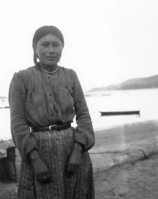
The Quileute are a Native American people in western Washington state in the United States, currently numbering approximately 2,000. They are a federally recognized tribe: the Quileute Tribe of the Quileute Reservation.

The Quinault are a group of Native American peoples from western Washington in the United States. They are a Southwestern Coast Salish people and are enrolled in the federally recognized Quinault Tribe of the Quinault Reservation.
The Hoh or Chalá·at are a Native American tribe in western Washington state in the United States. The tribe lives on the Pacific Coast of Washington on the Olympic Peninsula. The Hoh moved onto the Hoh Indian Reservation, 47°44′31″N124°25′17″W at the mouth of the Hoh River, on the Pacific Coast of Jefferson County, after the signing of the Quinault Treaty on July 1, 1855. The reservation has a land area of 1.929 square kilometres and a 2000 census resident population of 102 persons, 81 of whom were Native Americans. It lies about halfway between its nearest outside communities of Forks, to its north, and Queets, to its south. The river is central to their culture. The main resources they used included cedar trees, salmon, and the nearby vegetation. They also traded and bartered with other tribes closer to Eastern Washington, near the Plateaus and Great Plains.
The 49th parallel north is a circle of latitude that is 49° north of Earth's equator. It crosses Europe, Asia, the Pacific Ocean, North America, and the Atlantic Ocean.

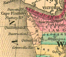
The Olympic Peninsula is a large arm of land in western Washington that lies across Puget Sound from Seattle, and contains Olympic National Park. It is bounded on the west by the Pacific Ocean, the north by the Strait of Juan de Fuca, and the east by Hood Canal. Cape Alava, the westernmost point in the contiguous United States, and Cape Flattery, the northwesternmost point, are on the peninsula. Comprising about 3,600 square miles (9,300 km2), the Olympic Peninsula contained many of the last unexplored places in the contiguous United States. It remained largely unmapped until Arthur Dodwell and Theodore Rixon mapped most of its topography and timber resources between 1898 and 1900.

The Bogachiel River is a river of the Olympic Peninsula in the U.S. state of Washington. It originates near Bogachiel Peak, and flows westward through the mountains of Olympic National Park. After emerging from the park it joins the Sol Duc River, forming the Quillayute River, which empties into the Pacific Ocean near La Push, Washington.

James Island is at the mouth of the Quillayute River near La Push, Washington. Local historians say it is named for Francis Wilcox James, a lighthouse keeper and friend of the Quileute Indians there, though the Origin of Washington Geographic Names attributes the name to Jimmie Howeshatta, a Quileute chief.

State Route 110 (SR 110) is a 11.10-mile-long (17.86 km) state highway serving Olympic National Park and the Quileute Indian Reservation within Clallam County, located in the U.S. state of Washington. The highway travels west from U.S. Route 101 (US 101) in Forks as La Push Road along the Quileute and Sol Duc rivers to the boundary of Olympic National Park east of La Push. La Push Road was originally added to the state highway system in 1937 as Secondary State Highway 9B (SSH 9B), but was removed in 1955. SR 110 was later established on the route in 1991 after a previous highway with the same designation was removed. A spur route extending west to Mora was originally added with SSH 9B and re-added with SR 110 in 1991.
The Quinault Treaty was a treaty agreement between the United States and the Native American Quinault and Quileute tribes located in the western Olympic Peninsula north of Grays Harbor, in the recently formed Washington Territory. The treaty was signed on 1 July 1855, at the Quinault River, and on 25 January 1856 at Olympia, the territorial capital. It was ratified by Congress on 8 March 1859, and proclaimed law on April 11, 1859.

The Quileute Indian Reservation is an Indian reservation for the Quileute people located on the northwestern Olympic Peninsula in Clallam County, Washington, United States. The reservation is at the mouth of the Quillayute River on the Pacific coast.

La Push Beach is a series of three beaches near the community of La Push, Washington, on the Pacific coast of the United States. The beach's most prominent natural vegetation the Sitka, spruce, and evergreen trees that populate the shore.
The Quinault Indian Nation, formerly known as the Quinault Tribe of the Quinault Reservation, is a federally recognized tribe of Quinault, Queets, Quileute, Hoh, Chehalis, Chinook, and Cowlitz peoples. They are a Southwestern Coast Salish people of indigenous peoples of the Pacific Northwest Coast. Their tribe is located in Washington state on the Pacific coast of the Olympic Peninsula. These peoples are also represented in other tribes in Washington and Oregon.
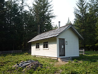
The Peter Roose Homestead is a historic homestead in the U.S. state of Washington that was settled by Peter Roose, an immigrant from Bollnäs, Sweden, in 1907. Located in Olympic National Park, the site was added as a historic district to the National Register of Historic Places in 2007.

The Satsop Hills are foothills of the Olympic Mountains in Mason County, Washington north of Matlock, Washington, between Wynoochee Lake to the west and Lake Cushman to the east.
Washington Maritime National Wildlife Refuge Complex is an administrative grouping of six National Wildlife Refuges in Washington, managed by the United States Fish and Wildlife Service. It includes: