According to Edmond S. Meany, the word moclips comes from a Quinault word meaning a place where girls were sent as they were approaching puberty.[3] However, according to William Bright, the name comes from the Quinault word meaning simply "large stream".[4]
History
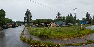
Houses along the beach, Moclips, 2023.Moclips preserves a lot of its naturally wooded area in order to block high winds from the Pacific Ocean, making it home to several forest-dwelling fauna, such as deer.
The indigenous inhabitants of the area were members of the Quinault tribe along the coast north of Grays Harbor and the Upper and Lower Chehalis tribes of the lower Chehalis River drainage. Other groups included the Copalis, Wynoochee, and Humptulips subtribes of the Upper Chehalis subtribe, and the Satsop subtribe of the Lower Chehalis. The Chehalis, Quinault, Cowlitz, and Queets spoke Coast Salish languages related to other Salishan language groups in the Northwest. The Quileute and Hoh spoke unrelated Chimakuan languages, while the Makah spoke a Wakashan language, also unrelated. To the south the Chinookan people spoke yet another family of unrelated languages, the Chinookan languages. All the tribes also used a trade pidgin called Chinook Jargon.
The area's indigenous people lived in permanent villages along rivers and lakes. Water defined their economic and cultural lives. They harvested salmon as they swam upstream to spawn, as well as whales and seals along the coast. In the summers, hunters ranged inland and into the Olympic Mountains for game and to trade with other tribal groups. The Indians developed a high degree of skill with canoes carved from cedar trees in a variety of specialized designs adapted to swift-flowing rivers, broad estuaries, and the sea.
The Quinaults' first recorded contact with Europeans, in 1775 near Point Grenville, ended in the deaths of seven Spaniards and as many as seven Indians. The Indians had traded peacefully with the explorers, but turned on them after the Spaniards landed, erected a cross, and claimed the land for the Spanish king. The reason for the sudden attack remains unexplained, but tribal historians have offered the possibility that the Europeans had violated a woman's safe haven.
In 1792, Captain Robert Gray discovered Grays Harbor and entered the Columbia River, the first non-indigenous people to have done so. In 1803, President Thomas Jefferson sent the Lewis and Clark Expedition to explore the vast interior between the Missouri River and the Pacific Ocean. Although the expedition cemented American claims to Oregon Country, it failed to find a practical wagon route. It wasn't until the Oregon Trail began to be used by American settlers in the 1840s that British control of the Pacific Northwest, in the form of the Hudson's Bay Company, became challenged.
Contact with Europeans and the frequent interaction between tribes accelerated the several epidemics that swept the region, beginning with smallpox in the 1770s and continuing with what was likely malaria in 1829, cholera in 1836, and smallpox again in 1853. The native population dropped from thousands to a few dozen. So many Chinooks died around Willapa Bay in the 1850s that the Chehalis moved in to take their place.
In 1855, after the creation of Washington Territory, the Quinault Treaty was signed by Chief Taholah of the Quinault and Chief How-yat'l of the Quileute, along with many other tribal delegates. One result of the treaty was the creation of the roughly triangular shaped Quinault Indian Reservation between the Pacific Ocean and Lake Quinault.
The first American settlers came to the North Beach area in the mid-19th century. Many homesteaded with 160 acres (0.65km2) of fine timber.
Although settled earlier by homesteaders such as Steve Grover in 1862, Moclips was not incorporated until 1905 with the completion of the Northern Pacific Railway and the first Moclips Beach Hotel built by Dr. Edward Lycan. The hotel was a two-story, 150-room beachside resort. It burned down in 1905, just months after it was completed. Dr. Lycan then had a new, larger hotel built on the same site. It was three stories high, a block long, and loomed from the dunes. This Moclips Beach Hotel was completed in 1907 and advertised as having 270 "outside" rooms, with 2,000 feet (610m) of 10-foot (3.0m) covered veranda, and a perfect view of the Pacific Ocean, reported to be just 12 feet (3.7m) from the hotel grounds. This close proximity to the ocean, however, would prove its undoing.
Back then Moclips was publicized as a healthy getaway from the toil and trouble of city life. It was a health resort. The moist salt air and bathing in the surf was touted as very medicinal. A promotional pamphlet of the time purports Moclips' climate to be "simply perfect". Dr. Lycan believed that Moclips was the Mecca for health and pleasure of the Northwest.
Moclips grew into a sizable town with restaurants, hotels, a candy store, theater, canneries, and the M.R. Smith Lumber and Shingle Mill. Many hotels, schools, canneries and shingle mills were quickly built. Four schools once taught children from Taholah to Ocean Shores. Class schedules for the local schools were based on the clamming tides. Two of these buildings exist today.
W.W. Kurtz's cannery in Moclips, 1915
In 1911 Moclips was struck by a series of fatal storms, eventually washing much of the town away. The Moclips Beach Hotel stood in pieces.[5] By the end of 1913, there was nothing left of the hotel. Fires destroyed much of Moclips along the beach. In 1948 a hilltop welding accident destroyed many homes and businesses.
The U.S. Navy and Air Force made the neighboring town of Pacific Beach their home during World War II. The Navy still occupies property along the bluff in Pacific Beach - now a recreational use center for the military.
In 1960, a second wave of tourism began. According to yearly polls by Evening magazine, this resort town is consistently near the top of places to visit in Washington state, being number two behind Seattle.[citation needed]
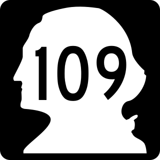
Washington State Route 109 passes through Moclips, leading north 9 miles (14km) along the Pacific coast to its terminus at Taholah and southeast 31 miles (50km) to Hoquiam.
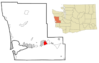
According to the United States Census Bureau, the CDP has a total area of 1.81 square miles (4.69km2), of which 1.78 square miles (4.62km2) are land and 0.03 square miles (0.07km2), or 1.48%, are water.
As of the 2000 census, the Moclips CDP included the area of Pacific Beach, which was split before the 2010 census to form its own CDP.
As of the census[7] of 2000, there were 615 people, 273 households, and 146 families residing in the CDP. The population density was 189.1 people per square mile (73.1/km2). There were 565 housing units at an average density of 173.7/sqmi (67.1/km2). The racial makeup of the CDP was 64.72% White, 0.16% African American, 24.72% Native American, 0.81% Asian, 0.49% Pacific Islander, 2.44% from other races, and 6.67% from two or more races. Hispanic or Latino of any race were 7.15% of the population.
There were 273 households, out of which 17.2% had children under the age of 18 living with them, 36.6% were married couples living together, 11.4% had a female householder with no husband present, and 46.5% were non-families. 36.6% of all households were made up of individuals, and 11.4% had someone living alone who was 65 years of age or older. The average household size was 2.25 and the average family size was 2.90.
In the CDP, the population was spread out, with 21.0% under the age of 18, 6.5% from 18 to 24, 25.0% from 25 to 44, 31.9% from 45 to 64, and 15.6% who were 65 years of age or older. The median age was 44 years. For every 100 females, there were 109.2 males. For every 100 females age 18 and over, there were 106.8 males.
The median income for a household in the CDP was $27,500, and the median income for a family was $32,045. Males had a median income of $31,250 versus $21,250 for females. The per capita income for the CDP was $17,411. About 8.1% of families and 9.5% of the population were below the poverty line, including 2.3% of those under age 18 and 5.5% of those age 65 or over.
Popular culture
The beach scenes of the 1974 John Wayne film McQ were filmed at Moclips.
Grays Harbor County is a county in the U.S. state of Washington. As of the 2020 census, the population was 75,636. Its county seat is Montesano, and its largest city is Aberdeen. Grays Harbor County is included in the Aberdeen Micropolitan Statistical Area.
Gray Summit is an unincorporated community and census-designated place (CDP) in Franklin County, Missouri, United States. The population was 2,701 at the 2010 census. Also called "Gray's Summit", it was founded by Daniel Gray of New York, who built a hotel here in 1845. It is located on Missouri Route 100 just north of Interstate 44.
Brady is a census-designated place (CDP) in Grays Harbor County, Washington, United States. The population was 676 at the 2010 census.
Copalis Beach is a census-designated place (CDP) in Grays Harbor County, Washington, United States. The population was 415 at the 2010 census.
Ocean City is a census-designated place (CDP) in Grays Harbor County, Washington, United States. The population was 200 at the 2010 census.
Ocean Shores is a city in Grays Harbor County, Washington, United States. The population was 6,715 at the 2020 census.
Taholah is a census-designated place (CDP) on the Quinault Indian Reservation, in Grays Harbor County, Washington, United States. Named for a Quinault chief in 1905, its population was 840 at the 2010 census. The headquarters for the Quinault Indian Nation was moved to Taholah from the town of Quinault on the shore of Lake Quinault.
Westport is a city in Grays Harbor County, Washington, United States. It had a population of 2,213 at the 2020 census. Westport is located on a peninsula on the south side of the entrance to Grays Harbor from the Pacific Ocean.
Fords Prairie is an unincorporated community and census-designated place (CDP) in Lewis County, Washington, United States. The population was 2,234 at the 2020 census.
Ocean Park is a census-designated place (CDP) in Pacific County, Washington, United States. The population was 1,573 at the 2010 census. It is on the Long Beach Peninsula, north of Long Beach, Washington.
The Quinault are a group of Native American peoples from western Washington in the United States. They are a Southwestern Coast Salish people and are enrolled in the federally recognized Quinault Tribe of the Quinault Reservation.
Pacific Beach is a census-designated place (CDP) in Grays Harbor County, Washington, United States. The population was 291 at the 2010 census. Prior to 2010 it was part of the Moclips CDP.
Queets is an unincorporated community and census-designated place (CDP) in Grays Harbor and Jefferson counties, Washington, United States. The population was 174 at the 2010 census. The primary residents of the community are Native Americans of the Quinault Indian Nation.
State Route 109 (SR 109) is a Washington state highway in Grays Harbor County. Beginning at its terminus at U.S. Route 101 (US 101) in Hoquiam, the highway travels west to intersect SR 115 near Ocean Shores and then turns north to continue along the Pacific coastline, terminating at the Quinault River Bridge in Taholah, located in the Quinault Indian Reservation. The Washington State Legislature extended the roadway north to end at US 101 south of Queets through tribal lands, although this segment has yet to be built. SR 109 was first established as Secondary State Highway 9C (SSH 9C) in 1937, which was on a more northern alignment until 1947, when it was switched to a Hoquiam to Quinault Indian Reservation route. In 1964, SSH 9C was renumbered to SR 109 and in 1983, a spur route of SR 109 that bypasses Hoquiam was added. SR 109 itself was extended by the legislature to US 101 near Queets in 1985, but the road has not been built.
The Quinault Treaty was a treaty agreement between the United States and the Native American Quinault and Quileute tribes located in the western Olympic Peninsula north of Grays Harbor, in the recently formed Washington Territory. The treaty was signed on 1 July 1855, at the Quinault River, and on 25 January 1856 at Olympia, the territorial capital. It was ratified by Congress on 8 March 1859, and proclaimed law on April 11, 1859.
The Quinault Indian Nation, formerly known as the Quinault Tribe of the Quinault Reservation, is a federally recognized tribe of Quinault, Queets, Quileute, Hoh, Chehalis, Chinook, and Cowlitz peoples. They are a Southwestern Coast Salish people of indigenous peoples of the Pacific Northwest Coast. Their tribe is located in Washington state on the Pacific coast of the Olympic Peninsula. These peoples are also represented in other tribes in Washington and Oregon.
Santiago is a census-designated place (CDP) in Grays Harbor County, Washington, United States. The population was 42 at the 2010 census.
Qui-nai-elt Village is a census-designated place (CDP) in Grays Harbor County, Washington, United States. The population was 54 at the 2010 census.
The Moclips Highway, also designated as BIA Road 26, is a rural east–west highway in the U.S. state of Washington. It travels about 22 miles (35 km) from a junction with State Route 109 near Moclips on the Pacific Ocean, through the Quinault Indian Reservation, to U.S. Route 101 near Lake Quinault.
The Quinault Canyon is a submarine canyon, off Washington state, in Olympic Coast National Marine Sanctuary.
This page is based on this Wikipedia article Text is available under the CC BY-SA 4.0 license; additional terms may apply. Images, videos and audio are available under their respective licenses.