Roosevelt Boulevard (Philadelphia)

Last updated

US 1.svg

Roosevelt Boulevard

Theodore Roosevelt Memorial Boulevard
Roosevelt Boulevard (Philadelphia)
Roosevelt Boulevard highlighted in red
Roosevelt Expressway highlighted in blue
Route information
Maintained by PennDOT and City of Philadelphia
Length14.9 mi [1]  (24.0 km)
Component
highways
US 1.svg US 1 for its entire length
US 13.svg US 13 from Hunting Park to Mayfair
PA-63.svg PA 63 in Somerton
Major junctions
South endI-76.svgUS 1.svg I-76  / US 1 in West Fairmount Park
Major intersections
North endUS 1.svg US 1 in Trevose
Location
Country United States
State Pennsylvania
Counties Philadelphia
Highway system

Roosevelt Boulevard, officially named the Theodore Roosevelt Memorial Boulevard and often referred to, chiefly by local Philadelphians, simply as "the Boulevard," [2] is a major traffic artery through North and Northeast Philadelphia. The road begins at Interstate 76 (Schuylkill Expressway) in Fairmount Park, running as a freeway also known as the Roosevelt Boulevard Extension or the Roosevelt Expressway through North Philadelphia, then transitioning into a twelve-lane boulevard that forms the spine of Northeast Philadelphia to its end at the city line.

Contents

Historically, Roosevelt Boulevard is a part of the Lincoln Highway, the first road across America, which ran for 3,389 miles (5,454 km) from Times Square in New York City to Lincoln Park on the Pacific Ocean in San Francisco, California.

Today, Roosevelt Boulevard is designated as US 1. Portions are concurrent with US 13 (between Hunting Park Avenue and Robbins Street) and Pennsylvania Route 63 (between Red Lion and Woodhaven Roads).

The road is notorious for two intersections which have been designated the second and third most dangerous intersections in the country by State Farm Insurance, at Red Lion Road and Grant Avenue respectively. [3] The dangerous reputation of the road led to installation of the first red light cameras in Philadelphia in 2004. The road has been the scene of numerous pedestrian casualties and studies are underway to allow pedestrian traffic to be separated from vehicular traffic. [4]

Route description

Roosevelt Boulevard northbound past Solly Avenue/Holme Avenue US 1 NB past Solly Avenue-Holme Avenue.jpeg
Roosevelt Boulevard northbound past Solly Avenue/Holme Avenue

Roosevelt Expressway

Overpass carrying PA 611 / North Broad Street and Broad Street Line over Roosevelt Expressway US 1 Roosevelt Expressway - Broad Street overpass looking east, Aug 2022.jpg
Overpass carrying PA 611 / North Broad Street and Broad Street Line over Roosevelt Expressway

The Roosevelt Boulevard Extension, also known as the Roosevelt Expressway, begins at Interstate 76 (Schuylkill Expressway) in Fairmount Park adjacent to the Philadelphia city line, as an expressway also known as the Roosevelt Boulevard Expressway U.S. Route 1. It crosses the Schuylkill River via the Twin Bridges and runs eastward through the neighborhoods of East Falls and Hunting Park. The Roosevelt Expressway interchanges with Broad Street (Pennsylvania Route 611) and ends at an interchange with US 13 (Roosevelt Boulevard), at which point US 1 merges onto the Roosevelt Boulevard and continues northeast along with US 13. [5]

Roosevelt Boulevard

The Roosevelt Boulevard begins at an intersection with Hunting Park Avenue, continuing northeast as a part of US 13. The road crosses Broad Street (PA 611) before US 1 (Roosevelt Expressway) merges in at an interchange and Roosevelt Boulevard becomes a 12-lane surface arterial with local and express lanes and at-grade intersections, carrying US 1 and US 13. [5]

The road continues east through Hunting Park and Feltonville, where it curves and resumes running in a northeasterly direction. It meets Oxford Avenue (Pennsylvania Route 232) at a large traffic circle known as Oxford Circle (the express lanes pass through the circle via an underpass). The road carries northbound U.S. Route 13 one more mile until it splits off onto Robbins Street and Levick Street (both one-way streets). The road continues to a large interchange with Cottman Avenue (Pennsylvania Route 73) and the Roosevelt Mall. The traffic circle with Holme and Solly Avenues known as the Pennypack Circle was rebuilt in 2015 and no longer exists. There is access to both avenues from the local lanes, both north- and southbound. The boulevard continues past Pennypack Park and Northeast Philadelphia Airport, passing through two notoriously dangerous intersections [3] with Grant Avenue and Red Lion Road. [5]

The road continues northeast, interchanging with Woodhaven Road (Pennsylvania Route 63), then narrowing as it approaches its end at an intersection on the Philadelphia-Bucks County border. After two traffic light intersections in Trevose in Bensalem Township, U.S. 1 continues as a freeway to the north. [5]

Public transportation

The Boulevard Direct, a limited-stop bus route that operates along a portion of Roosevelt Boulevard SEPTA Boulevard Direct bus at Neshaminy Mall.jpg
The Boulevard Direct, a limited-stop bus route that operates along a portion of Roosevelt Boulevard

Several SEPTA City Bus routes operate along portions of Roosevelt Boulevard, with routes 1 , 14, and R following the boulevard for a significant distance. The Route 1 bus runs along the entire length of Roosevelt Boulevard as part of its route between 54th Street and City Avenue in West Philadelphia and Parx Casino and Racing in Bensalem. The Route 14 bus follows Roosevelt Boulevard north of Bustleton Avenue as part of its route between the Frankford Transportation Center to the south and the Neshaminy Mall and Oxford Valley Mall to the north. The Route R bus follows Roosevelt Boulevard south of Pratt Street as part of its route between the Wissahickon Transportation Center and the Frankford Transportation Center. [6] The portion of Roosevelt Boulevard north of Bustleton Avenue is also served by the Boulevard Direct, a limited-stop bus route between the Frankford Transportation Center and the Neshaminy Mall. The Boulevard Direct offers improved travel times compared to traditional bus service along Route 14, with more frequent service and several bus stops located on the far side of intersections to improve performance. [7]

Proposed Roosevelt Blvd Subway

The Roosevelt Boulevard Subway is a proposed SEPTA subway line that would run along Roosevelt Boulevard. The route was first proposed in 1913 as part of the Broad Street Subway line from Adams Avenue. [8] Last studied in detail in 2003, the line was estimated to draw 124,523 daily boardings, approximately the current ridership of the Broad Street Line, and divert 83,300 daily automobile trips. Cost estimates ranged between $2.5 and $3.4 billion in year 2000 dollars. [9] The project however did not move forward due to lack of local financing. [10]

In June 2023, Philadelphia's City Council announced it would hold hearings on the proposed subway following the collapse of an I-95 overpass that severely impacted highway travel in Northeast Philadelphia. [11]

History

Roosevelt Boulevard (US 1) northbound past Welsh Road US 1 NB past PA 532.jpeg
Roosevelt Boulevard (US 1) northbound past Welsh Road

Proposed in 1903 by Mayor Samuel H. Ashbridge as part of the City Beautiful movement, the 300-foot-wide thoroughfare originally extended from Broad Street to the Torresdale neighborhood, and was first named Torresdale Boulevard, then Northeast Boulevard in 1914 when the road was completed. On its extension to Pennypack Creek in 1918, it was finally renamed to Roosevelt Boulevard, in honor of Theodore Roosevelt. The road was designated U.S. 1 in 1926, and was extended through Philadelphia to neighboring Bucks County in the post-World War II years.

The Roosevelt Expressway was built to connect the boulevard with the nearby Schuylkill Expressway (I-76).

In 1998 a series of gang-related criminal rock throwing attacks on cars driving near Ridge Avenue, Henry Avenue and Fox Street "terrorized" Philadelphia drivers. [12] [13]

In 2000, by act of the state legislature, the Boulevard was designated the "Police Officer Daniel Faulkner Memorial Highway" in memory of Daniel Faulkner, a Philadelphia police officer whom Mumia Abu-Jamal was convicted of having slain in the line of duty in 1981. The designation is alongside the roadway's official name of Roosevelt Boulevard. [14] [15]

There have been several plans to change the boulevard into an expressway-like artery, like the Roosevelt Expressway itself, and construct a subway underneath the boulevard, but no such plans have been acted upon.

Today, Roosevelt Boulevard is among the most congested arteries in the country. According to a 2001 report by State Farm Insurance, the second- and third-worst intersections in the country are both found on the Boulevard, at Red Lion Road and Grant Avenue, respectively, only a mile apart from each other. Red light cameras have been installed at these intersections, as well as Cottman Avenue, and have been operational since June 1, 2005. New cameras installed at the intersections with 9th Street, Mascher Street, Levick Street, Rhawn Street, Welsh Road, and Southampton Road became operational in summer 2007. [16] Additional plans include adding cameras at Devereaux Avenue and Tyson Avenue. On June 1, 2020, speed cameras were activated along Roosevelt Boulevard, with a 60-day warning period before fines are issued. [17]

Major intersections

The entire road is in Philadelphia, Philadelphia County.

Locationmi [1] kmDestinationsNotes
West Fairmount Park 0.00.0I-76.svgSouth plate.svg
US 1.svg
I-76  / US 1 south (Schuylkill Expressway) Central Philadelphia, Valley Forge
Exit 340B on I-76
Schuylkill River Twin Bridges
East FallsAllegheny West 0.40.64Ridge Avenue / Kelly Drive Southbound exit and northbound entrance; site of proposed interchange with Manayunk Expressway
1.01.6Fox Street / Henry AvenueSouthbound exit and entrance
Wissahickon Avenue south / Hunting Park AvenueNorthbound exit and southbound entrance
GermantownNicetown 1.52.4Wissahickon Avenue north / Germantown AvenueNorthbound exit and southbound entrance
Hunting ParkFern Rock 2.33.7PA-611.svg PA 611 (Broad Street)Southbound exit is via US 13
2.84.5South plate.svg
US 13.svg
US 13 south (Hunting Park Avenue) / Broad Street
Southern terminus of concurrency with US 13; southbound exit and northbound entrance
3.15.0Wingohocking Street / 9th Street At-grade intersection except northbound exit; western terminus of frontage roads
Oxford Circle 6.410.3PA-232.svg PA 232 (Oxford Avenue) / Cheltenham Avenue / Castor AvenueInterchange with Oxford Circle
Oxford CircleMayfair 7.111.4North plate.svg
US 13.svg
US 13 north (Robbins Street) Tacony–Palmyra Bridge
One-way northbound; northern terminus of northbound concurrency with US 13
7.211.6US 13.svg US 13 (Levick Street)One-way southbound; northern terminus of southbound concurrency with US 13
8.313.4PA-73.svgTo plate blue.svg
I-95.svg
PA 73 (Cottman Avenue) to I-95
Interchange
Rhawnhurst 9.415.1Holme Avenue / Solly AvenueInterchange
Bustleton 10.617.1North plate.svg
PA-532.svg
PA 532 north (Welsh Road)
Right turns via frontage roads; southern terminus of PA 532
Somerton 12.420.0West plate.svg
PA-63.svg
PA 63 west (Red Lion Road)
Right turns via frontage roads; southern terminus of concurrency with PA 63
13.722.0East plate.svg
PA-63.svg
To plate blue.svg
I-95.svg
PA 63 east (Woodhaven Road) to I-95
Interchange with frontage roads; northern terminus of concurrency with PA 63
14.924.0North plate.svg
US 1.svg
US 1 north (Lincoln Highway)
Continuation into Bucks County
1.000 mi = 1.609 km; 1.000 km = 0.621 mi

See also

Related Research Articles

<span class="mw-page-title-main">Broad Street Line</span> Subway line in Philadelphia, Pennsylvania

The Broad Street Line (BSL), also known as the Broad Street subway (BSS), Orange Line, or Broad Line, is a subway line owned by the city of Philadelphia and operated by the Southeastern Pennsylvania Transportation Authority (SEPTA). The line runs primarily north-south from the Fern Rock Transportation Center in North Philadelphia through Center City Philadelphia to NRG station at Pattison Avenue in South Philadelphia; the latter station provides access to the stadiums and arenas for the city's major professional sports teams at the South Philadelphia Sports Complex, about a quarter mile away. It is named for Broad Street, under which the line runs for almost its entire length. In 2024, as part of the SEPTA Metro plan, the Broad Street Line is expected to be renamed the B Line.

<span class="mw-page-title-main">Transportation in Philadelphia</span>

Transportation in Philadelphia involves the various modes of transport within the city and its required infrastructure. In addition to facilitating intracity travel, Philadelphia's transportation system connects Philadelphia to towns of its metropolitan area and surrounding areas within the Northeast megalopolis.

<span class="mw-page-title-main">Schuylkill Expressway</span> Highway in Pennsylvania

The Schuylkill Expressway, locally known as "the Schuylkill", is a freeway through southern Montgomery County and Philadelphia. It is the easternmost segment of Interstate 76 (I-76) in the U.S. state of Pennsylvania. It extends from the Valley Forge interchange of the Pennsylvania Turnpike in King of Prussia, paralleling its namesake Schuylkill River for most of the route, southeast to the Walt Whitman Bridge over the Delaware River in South Philadelphia. It serves as the primary corridor into Philadelphia from points west. Maintenance and planning for most of the highway are administered through Pennsylvania Department of Transportation (PennDOT) District 6, with the Delaware River Port Authority (DRPA) maintaining the approach to the Walt Whitman Bridge.

<span class="mw-page-title-main">Pennsylvania Route 309</span> State highway in Pennsylvania, United States

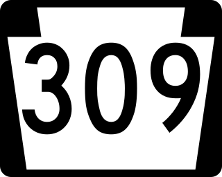
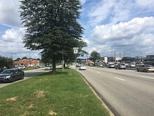
Pennsylvania Route 309 is a state highway that runs for 134 miles (216 km) through eastern Pennsylvania. The route runs from an interchange between PA 611 and Cheltenham Avenue on the border of Philadelphia and Cheltenham Township north to an intersection with PA 29 in Bowman Creek, a village in Monroe Township in Wyoming County. The highway connects Philadelphia and its northern suburbs to Allentown and the Lehigh Valley, and Hazleton and Wilkes-Barre in Wyoming Valley.

<span class="mw-page-title-main">SEPTA Route 15</span> SEPTA trolley line in Philadelphia, Pennsylvania

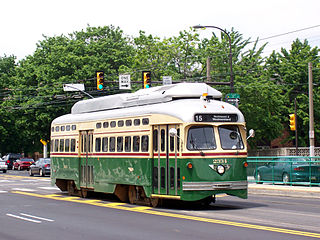
Route 15, the Girard Avenue Line, is a trolley line operated by the Southeastern Pennsylvania Transportation Authority (SEPTA) along Girard Avenue through North and West Philadelphia, Pennsylvania, United States. As of 2007, it is the only surface trolley line in the City Transit Division that is not part of the Subway–Surface Trolley Lines. SEPTA PCC II vehicles are used on the line.

<span class="mw-page-title-main">Rhawnhurst, Philadelphia</span> Neighborhood of Philadelphia, USA

Rhawnhurst is a residential neighborhood in the Northeast section of Philadelphia, Pennsylvania, United States, named for George and William Rhawn by area real estate developers. Roughly bordered by Cottman Avenue to the south, Pennway Street to the west, the Pennypack Creek to the north, and Roosevelt Boulevard to the east, Rhawnhurst encompasses ZIP codes 19152 and part of ZIP code 19111. The geographic center of Rhawnhurst is at the intersection of Castor Avenue and Rhawn Street.

<span class="mw-page-title-main">U.S. Route 422</span> Highway in Ohio and Pennsylvania

U.S. Route 422 (US 422) is a 271-mile-long (436 km) spur route of US 22 split into two segments in the U.S. states of Ohio and Pennsylvania. The western segment of US 422 runs from downtown Cleveland, Ohio, east to Ebensburg, Pennsylvania. The eastern segment, located entirely within Pennsylvania, runs from Hershey east to King of Prussia, near Philadelphia. US 422 Business serves as a business route into each of four towns along the way.

<span class="mw-page-title-main">U.S. Route 30 in Pennsylvania</span> Highway in Pennsylvania

U.S. Route 30 (US 30) is a U.S. Highway that runs east–west across the southern part of Pennsylvania, passing through Pittsburgh and Philadelphia on its way from the West Virginia state line east to the Benjamin Franklin Bridge over the Delaware River into New Jersey.

<span class="mw-page-title-main">Pennsylvania Route 3</span> State highway in Chester, Delaware, and Philadelphia counties in Pennsylvania, US

Pennsylvania Route 3 is a 24.3-mile (39.1 km) state highway located in the southeastern portion of Pennsylvania. The route runs from U.S. Route 322 Business in West Chester east to PA 611 in Philadelphia.

<span class="mw-page-title-main">Interstate 95 in Pennsylvania</span> Section of Interstate Highway in United States

Interstate 95 (I-95) is a major north–south Interstate Highway that runs along the East Coast of the United States from Miami, Florida, north to the Canada–United States border at Houlton, Maine. In the state of Pennsylvania, it runs 51.00 miles (82.08 km) from the Delaware state line near Marcus Hook in Delaware County in the southeastern part of the state northeast to the Delaware River–Turnpike Toll Bridge at the New Jersey state line near Bristol in Bucks County, closely paralleling the New Jersey state line for its entire length through Pennsylvania.

<span class="mw-page-title-main">Pennsylvania Route 291</span> State highway in Pennsylvania, US

Pennsylvania Route 291 is an east–west state route in Pennsylvania that runs from U.S. Route 13 and US 13 Business in Trainer, Delaware County, east to Interstate 76 (I-76) in South Philadelphia near the Walt Whitman Bridge and the South Philadelphia Sports Complex. Except for a short 1-mile (1.6 km) section between the western terminus and the Chester/Trainer line, PA 291 is mostly a four-lane highway. From the western terminus to the eastern part of Chester, the route has a concurrency with US 13. It runs parallel to the Delaware River for much of the route. The route passes through industrial areas near the river in Delaware County, serving Chester, Eddystone, Essington, and Lester. PA 291 enters Philadelphia near the Philadelphia International Airport, at which point it has an interchange with I-95. The route crosses the Schuylkill River on the George C. Platt Memorial Bridge and continues along Penrose Avenue to I-76. It has been designated the Industrial Heritage Highway.

<span class="mw-page-title-main">Pennsylvania Route 63</span> 37.4-mile-long (60.2 km) state highway located in Pennsylvania

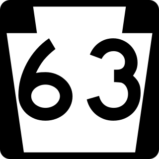
Pennsylvania Route 63 (PA 63) is a 37.4-mile-long (60.2 km) state highway located in the Philadelphia, Pennsylvania, area. The western terminus of the route is at PA 29 in Green Lane, Montgomery County. The eastern terminus is at Interstate 95 (I-95) in Bensalem Township, Bucks County. PA 63 runs northwest to southeast for most of its length. The route heads through a mix of suburban and rural areas of northern Montgomery County as a two-lane road, passing through Harleysville, before coming to an interchange with I-476 in Kulpsville. From this point, PA 63 continues through predominantly suburban areas of eastern Montgomery County as a two- to four-lane road, passing through Lansdale, Maple Glen, Willow Grove, and Huntingdon Valley. Upon entering Northeast Philadelphia, the route follows Red Lion Road and U.S. Route 1 (US 1) before heading southeast on a freeway called Woodhaven Road to I-95.

<span class="mw-page-title-main">Pennsylvania Route 232</span> State highway in Pennsylvania, US

Pennsylvania Route 232 (PA 232) is a 25.2-mile-long (40.6 km) state highway located in southeastern Pennsylvania. The southern terminus of the route is at U.S. Route 1 (US 1)/US 13 at the Oxford Circle in Philadelphia. The northern terminus is at PA 32 in the borough of New Hope, Bucks County, on the banks of the Delaware River. The route passes through the urban areas of Northeast Philadelphia as Oxford Avenue, serving the Lawncrest, Burholme, and Fox Chase neighborhoods. Upon entering Montgomery County, PA 232 becomes Huntingdon Pike and through suburban areas, serving the communities of Rockledge, Huntingdon Valley, and Bryn Athyn. The route passes through more suburban development in Bucks County as Second Street Pike, running through Southampton and Richboro. In Wrightstown Township, PA 232 enters rural areas and becomes Windy Bush Road as it heads north to New Hope.

<span class="mw-page-title-main">U.S. Route 1 in Pennsylvania</span> Highway in Pennsylvania

U.S. Route 1 (US 1) is a major north–south U.S. Route, extending from Key West, Florida, in the south to Fort Kent, Maine, at the Canada–United States border in the north. In the U.S. state of Pennsylvania, US 1 runs for 81 miles (130 km) from the Maryland state line near Nottingham northeast to the New Jersey state line at the Delaware River in Morrisville, through the southeastern portion of the state. The route runs southwest to northeast and serves as a major arterial road through the city of Philadelphia and for many of the suburbs in the Delaware Valley metropolitan area. South of Philadelphia, the road mostly follows the alignment of the Baltimore Pike. Within Philadelphia, it mostly follows Roosevelt Boulevard. North of Philadelphia, US 1 parallels the route of the Lincoln Highway. Several portions of US 1 in Pennsylvania are freeways, including from near the Maryland state line to Kennett Square, the bypass of Media, the concurrency with Interstate 76 and the Roosevelt Expressway in Philadelphia, and between Bensalem Township and the New Jersey state line.

<span class="mw-page-title-main">U.S. Route 13 in Pennsylvania</span> Highway in Pennsylvania

U.S. Route 13 (US 13) is a United States Numbered Highway running from Fayetteville, North Carolina, north to Morrisville, Pennsylvania. The route runs for 49.359 miles (79.436 km) through the Delaware Valley in the U.S. state of Pennsylvania. The route enters the state from Delaware in Marcus Hook, Delaware County. It continues northeast through Delaware County, passing through the city of Chester before heading through suburban areas along Chester Pike to Darby. US 13 enters the city of Philadelphia on Baltimore Avenue and runs through West Philadelphia to University City, where it turns north along several city streets before heading east across the Schuylkill River along Girard Avenue. The route turns north and heads to North Philadelphia, where it runs northeast along Hunting Park Avenue. US 13 becomes concurrent with US 1 on Roosevelt Boulevard, continuing into Northeast Philadelphia. US 13 splits southeast on a one-way pair of streets before heading northeast out of the city on Frankford Avenue. The route continues into Bucks County as Bristol Pike, heading northeast to Bristol, where it turns into a divided highway. US 13 becomes a freeway in Tullytown and continues north to its terminus at US 1 in Falls Township, near Morrisville. US 13 roughly parallels Interstate 95 (I-95) through its course in Pennsylvania.

<span class="mw-page-title-main">SEPTA Route 60</span> Bus route in Philadelphia

SEPTA's Trolley Route 60, the Allegheny Avenue Line is a former streetcar line and current bus route, operated by the Southeastern Pennsylvania Transportation Authority (SEPTA) in Northwest and Northeast Philadelphia, Pennsylvania, United States. It connects to the East Falls to the Port Richmond, and runs primarily along Allegheny Avenue.

<span class="mw-page-title-main">SEPTA Route 53</span>

SEPTA Route 53 is a former street car line and current bus route, operated by the Southeastern Pennsylvania Transportation Authority (SEPTA) in Philadelphia, Pennsylvania, United States. The line runs between the West Mount Airy and Hunting Park neighborhoods primarily along Wayne Avenue.

Cheltenham Avenue is a major east-west road in Philadelphia and its suburbs. It is served by SEPTA bus routes, trolleys, regional rail, and subway. Cheltenham Avenue is an unsigned quadrant route in Montgomery County. It serves as the border between Springfield and Cheltenham townships. A section of the road along the Philadelphia border with Cheltenham Township is part of PA Route 309.

<span class="mw-page-title-main">Roosevelt Boulevard Subway</span> Proposed subway line in Philadelphia, Pennsylvania

The Roosevelt Boulevard Subway is a proposed SEPTA subway line that would run along Roosevelt Boulevard in Northeast Philadelphia, Pennsylvania.

Ridge Pike is a major historic road in the U.S. state of Pennsylvania that opened in 1706 that originally connected Wissahickon Creek to Perkiomen Creek. Inside Philadelphia, it is called Ridge Avenue. Going westward, it traverses many eastern Pennsylvania neighborhoods in Montgomery County including Conshohocken and beyond, connecting with Germantown Pike near Collegeville and continuing to Pottstown. In Montgomery County, Ridge Pike is called Main Street in the Norristown area and again in Collegeville and Trappe, and is called High Street in the Pottstown area.

References

  1. 1 2 Google (July 13, 2018). "Roosevelt Boulevard and Expressway" (Map). Google Maps . Google. Retrieved July 13, 2018.
  2. "Focus on lethal Roosevelt Blvd". The Philadelphia Inquirer . December 13, 2006.[ dead link ]
  3. 1 2 "List of 'most dangerous' intersections released". CNN. June 27, 2001. Archived from the original on April 5, 2007.
  4. "Study Evaluates the Effectiveness of Red Light Camera Enforcement in Philadelphia". Government Technology. January 31, 2007.[ permanent dead link ]
  5. 1 2 3 4 Philadelphia and Vicinity (PDF) (Map). Pennsylvania Department of Transportation. c. 2010. Retrieved May 31, 2022.
  6. SEPTA Official Philadelphia Transit & Street Map (PDF) (Map). SEPTA. Retrieved November 25, 2018.
  7. "Boulevard Direct - Service Profile". SEPTA. Retrieved October 22, 2017.
  8. Saksa, Jim (May 19, 2015). "Mass transit plans take shape for Roosevelt Blvd". The Philadelphia Inquirer .
  9. "New Page 2". www.libertynet.org. Archived from the original on June 4, 2004. Retrieved January 12, 2022.
  10. Smith, Sandy (May 10, 2015). "The Roosevelt Boulevard Subway Is Dead … Unless It Isn't". Philadelphia Magazine.
  11. Prihar, Asha (June 14, 2023). "Philly's Roosevelt Blvd Subway inches closer with planned Council hearings". Billy Penn at WHYY. Retrieved June 14, 2023.
  12. Goldblatt, Michael (November 19, 1998). "A Deadly Game". The Jewish Exponent. ProQuest   227261294.
  13. Frisby, Mann (October 23, 1998). "Cops Hold 3 for Throwing Rocks at Cars". Philadelphia Daily News . ProQuest   429655707.
  14. "HB 2503. PN 3498" (PDF). Commonwealth of Pennsylvania Legislative Journal (40): 1431. June 14, 2000.
  15. Walker, Julian. "It's Danny's way". The Northeast Times. Archived from the original on March 25, 2009.
  16. "Archived copy". Archived from the original on January 7, 2015. Retrieved February 14, 2015.{{cite web}}: CS1 maint: archived copy as title (link)
  17. Madej, Patricia (May 21, 2020). "Speed cameras will go active June 1 on Roosevelt Blvd., with warnings before tickets". The Philadelphia Inquirer . Retrieved May 23, 2020.

40°01′59″N75°04′48″W / 40.032937°N 75.079879°W / 40.032937; -75.079879