
The Grande Ronde River is a tributary of the Snake River, 182 miles (293 km) long, in northeastern Oregon and southeastern Washington in the United States. It drains an area southeast of the Blue Mountains and northwest of the Wallowa Mountains, on the Columbia Plateau. It flows through the agricultural Grande Ronde Valley in its middle course and through a series of scenic canyons in its lower course.

The Clearwater River is a river situated on the Olympic Peninsula in Washington. It is the main tributary of the Queets River. The Clearwater River is 39 miles (63 km) long. Its drainage basin is 61.5 square miles (159 km2) in area. The Clearwater's main tributaries are the Snahapish River and the Solleks River.

The Queets River is a river in the U.S. state of Washington. It is located on the Olympic Peninsula, mostly within the Olympic National Park and empties into the Pacific Ocean.
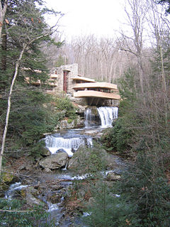
Bear Run is a 5.0-mile-long (8.0 km) tributary of the Youghiogheny River in Fayette County, Pennsylvania, in the United States.
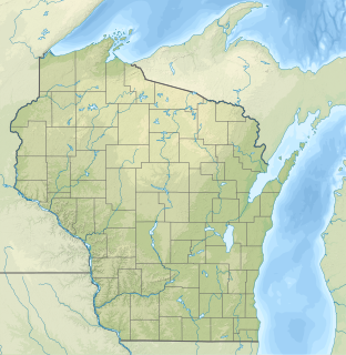
The Wind River is a minor tributary of the Mississippi River in western Wisconsin in the United States. It flows for its entire 9.0-mile (14.5 km) length in western Pierce County. It rises in the town of Trimbelle and flows southward through the towns of Oak Grove and Diamond Bluff. Wind River joins the Mississippi near the unincorporated community of Diamond Bluff, which is within the larger jurisdiction. The confluence is 801 miles (1,289 km) from the Mississippi's mouth on the Gulf of Mexico.

Marsh Creek is a 13.0-mile-long (20.9 km) tributary of Pine Creek in Pennsylvania in the United States.

The Quinault River is a 69-mile (111 km) long river located on the Olympic Peninsula in the U.S. state of Washington. It originates deep in the Olympic Mountains in the Olympic National Park. It flows southwest through the "Enchanted Valley" to opposite Quinault Canyon. Several miles above Lake Quinault the river is joined by its main tributary, the North Fork Quinault River. The main stem Quinault River above this confluence is sometimes called the East Fork Quinault River. Below the confluence the river marks the boundary of Olympic National Park for several miles before emptying into Lake Quinault. After the lake, the Quinault River flows southwest, reaching the Pacific at Taholah. From Lake Quinault to the ocean, the river is contained within the Quinault Indian Reservation.

The Lemhi River is a 60-mile-long (97 km) river in Idaho in the United States. It is a tributary of the Salmon River, which in turn is tributary to the Snake River and Columbia River.

The Calfpasture River is a river in the U.S. state of Virginia. It flows about 41.0 miles (66.0 km) from its source, Gordons Peak in the Allegheny Mountains, to its confluence with the Little Calfpasture River, forming the Maury River. Via the Maury, the Calfpasture's waters flow into the James River, thence Chesapeake Bay and the Atlantic Ocean.
The Salmon River is a tributary of the Queets River in U.S. state of Washington.

Succor Creek is a 69.4-mile-long (111.7 km) tributary of the Snake River in the U.S. states of Idaho and Oregon. The creek begins in the Owyhee Mountains in Owyhee County, Idaho. After flowing for about 23 miles (37 km) in Idaho, Succor Creek enters Malheur County, Oregon, where it flows for 39 miles (63 km) before re-entering Idaho for its final 5 miles (8.0 km). It joins the Snake near Homedale, about 413 river miles (665 km) from the larger river's confluence with the Columbia River.
The Wallace River is a medium-sized river in Washington, United States. It is a tributary of the Skykomish River and joins near Sultan, just upstream from the mouth of the Sultan River. The Wallace River is 15 miles (24 km) long. Its drainage basin is 30 square miles (78 km2) in area.
The Pennamaquan River is a short, 8.1-mile (13 km) river in the U.S. state of Maine, draining from medium-sized, low-elevation Pennamaquan Lake into Cobscook Bay.
The Moclips River is a river in the U.S. state of Washington. It is about 12 miles (19 km) long. Its main tributary, the North Fork Moclips River, is longer than the main stem. The length of the North Fork, along with the lower main stem below the North Fork's confluence, is 17 miles (27 km). The drainage basin of the Moclips River is 22.4 square miles (58 km2) in area.
The Rapid River is a tributary of the Beckler River in the U.S. state of Washington in the United States. It is 13 miles (21 km) long, with a drainage basin of 41 square miles (106 km2).

Birch Creek is a 16-mile (26 km) tributary of the Umatilla River in eastern Oregon in the United States. It rises at the confluence of East and West Birch creeks south of Pilot Rock, Oregon, at the base of the Blue Mountains and flows north, slightly west of the city of Pendleton. It enters the Umatilla River about 49 miles (79 km) from the larger stream's confluence with the Columbia River.

Rock Creek is a 56-mile (90 km) intermittent stream flowing in Lake and Harney counties in the U.S. state of Oregon. The source of Rock Creek is at an elevation of 6,914 feet (2,107 m) on Hart Mountain, while the mouth is at an elevation of 4,557 feet (1,389 m) in the Catlow Valley. Rock Creek has a 269-square-mile (700 km2) watershed.
Sams River is a river in the U.S. state of Washington. A tributary of the Queets River, Sams River flows through Olympic National Park and Olympic National Forest. Part of the river's lower course forms the boundary between the national park and national forest.
The Snahapish River is a river in the U.S. state of Washington. It is a tributary of the Clearwater River, which in turn flows into the Queets River.
