
U.S. Route 75 is a north–south U.S. Highway that runs 1,239 miles (1,994 km) in the central United States. The highway's northern terminus is located at the Canadian border near Noyes, Minnesota, at a now-closed border crossing. From this point, the highway once continued farther north as Manitoba Highway 75. Its southern terminus is located at Interstate 30 (I-30) and I-45 in Dallas, Texas, where US 75 is known as North Central Expressway.

U.S. Route 77 is a major north–south United States Numbered Highway which extends for 1,305 miles (2,100 km) in the central United States. As of 2005, Its southern terminus is in Brownsville, Texas, at Veteran's International Bridge on the Mexican border, where it connects with both Mexican Federal Highway 101 and Mexican Federal Highway 180, and the highway's northern terminus is in Sioux City, Iowa, at an interchange with Interstate 29 (I-29), less than 1⁄2 mile (800 m) north of the Nebraska state line.

U.S. Route 266 is a 43.09-mile (69.35 km), east–west U.S. Numbered Highway in Okmulgee, McIntosh, and Muskogee counties in Oklahoma, United States, that connects U.S. Route 62 U.S. Route 75 in Henryetta with U.S. Route 64 in Warner. The highway no longer meets the former route of its parent, U.S. Route 66, and is closely paralleled by Interstate 40 (I-40), which replaced US 266 as the major east–west highway east of Oklahoma City during the 1960s.

Interstate 129 (I-129) is an auxiliary Interstate Highway which connects South Sioux City, Nebraska, to I-29 in Sioux City, Iowa. Opened in 1976, I-129 is a 3.5-mile-long (5.6 km) route, running 3.21 miles (5.17 km) in Nebraska. At 0.286 miles (0.460 km), I-129 is the shortest highway in the state of Iowa. All of the route's length is concurrent with U.S. Route 20 (US 20) and most of its length is concurrent with US 75.

State Highway 97 is a 19.86-mile (31.96 km) state highway, maintained by the U.S. state of Oklahoma. It connects two towns in the northeast part of the state: Sapulpa and Sand Springs. Several communities of West Tulsa are along the road between these two towns, including Pretty Water, Allen, and Prattville.

State Highway 66 is a 192.7-mile (310.1 km) state highway in the U.S. state of Oklahoma, beginning at U.S. Highway 81 in El Reno and ending at U.S. Highway 60 near White Oak. The highway was designated in 1985 as a replacement for the decommissioned U.S. Highway 66. Although most of the highway follows Historic Route 66, the highway follows US 66's final alignment, joining Interstate 44 through Tulsa and Oklahoma City, while older versions of the route follow various city streets through both cities.
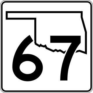
State Highway 67, abbreviated as SH-67, is a 9.94-mile-long (16.00 km) highway on the south side of Tulsa. It begins in the west at U.S. Route 75 Alternate in Kiefer and runs east along 151st St. South before ending at US-64 in Bixby. Along the way it crosses US-75 in Glenpool. It has no lettered spur routes.

Iowa Highway 3 (Iowa 3) is a state highway that runs from east to west across the state of Iowa. It is the longest state highway in Iowa, at 323 miles (520 km) long. Iowa 3 begins at the South Dakota state line where it continues as South Dakota Highway 50 and ends at the Northwest Arterial at the Dubuque city limits. It is designated the American Veterans Memorial Highway for its entirety. It is located approximately halfway between Interstate 80 and Interstate 90.

State Highway 56 is a state highway in the U.S. state of Oklahoma. The road serves Seminole County, Okfuskee County, and Okmulgee Counties in central and east-central Oklahoma. In Seminole County, it is also designated as the Seminole Nation Highway in honor of the contributions the Seminole Nation has made to the state of Oklahoma.

State Highway 16 is a state highway in Oklahoma. It runs in an irregular 99.2-mile west-to-east pattern through the northeastern part of the state, running from SH-33 at Drumright to SH-51 at Wagoner. There are no letter-suffixed spur highways branching from SH-16.

Nebraska Highway 2 (N-2) is a state highway in Nebraska consisting of two discontinuous segments. The western segment begins at the South Dakota border northwest of Crawford and ends southeast of Grand Island at an intersection with Interstate 80 (I-80). The eastern segment begins in Lincoln and ends at the Iowa border at Nebraska City. Previously, the two segments were connected via a route shared with U.S. Highway 34 (US 34) between Grand Island and Lincoln.

In the US state of Iowa, Interstate 29 (I-29) is a north–south Interstate Highway which closely parallels the Missouri River. I-29 enters Iowa from Missouri near Hamburg and heads to the north-northwest through the Omaha–Council Bluffs and the Sioux City areas. It exits the state by crossing the Big Sioux River into South Dakota. For its entire distance through the state, it runs on the flat land between the Missouri River and the Loess Hills.

Interstate 29 (I-29) is a north–south Interstate Highway in the midwestern United States. In the state of South Dakota, I-29 traverses on the eastern side of the state from the Iowa border near Sioux City to the North Dakota border near New Effington. On its route, I-29 passes through western portions of Sioux Falls, the state's largest city. It travels 252.5 miles (406.4 km) in the state, the longest stretch of any of the four states through which it passes. I-229, the highway's lone auxiliary route in South Dakota, serves as a bypass around southern and eastern Sioux Falls.

In Oklahoma, U.S. Highway 62 (US 62) runs diagonally across the state, from the Texas state line in far southwestern Oklahoma to the Arkansas state line near Fayetteville. US-62 spends a total of 402.48 miles (647.73 km) in the Sooner State. The highway passes through fifteen of Oklahoma's counties. Along the way the route serves two of Oklahoma's largest cities, Lawton and Oklahoma City, as well as many regionally important cities, like Altus, Chickasha, Muskogee, and Tahlequah. Despite this, US-62 has no lettered spur routes like many other U.S. routes in Oklahoma do.
U.S. Route 75 is a part of the United States Numbered Highway System that runs for 1,239 miles (1,994 km) from Dallas, Texas to Kittson County, Minnesota where it ends just short of the Canada–United States border. Within the State of Nebraska it is a state highway that enters Nebraska on the Kansas state line about 9 miles (14 km) south of Dawson and travels north across the extreme eastern portion of the state, to the Nebraska–Iowa border in South Sioux City where it crosses the Missouri River along a concurrency with Interstate 129. The northern 210 miles (340 km) of the route generally travels parallel to the Missouri River. The 87.32-mile (140.53 km) section between the I-680 interchange in Omaha and the Interstate 129 interchange is designated the Lewis & Clark Scenic Byway, one of nine scenic byways in the state.
U.S. 75 Alternate is a 30.15-mile (48.52 km) highway near Tulsa. The southern terminus is at U.S. Highway 75 and SH-16 east of Beggs. The northern terminus is signed at State Highway 66 and State Highway 97 in Sapulpa. However, the highway continues unsigned along SH-66, ending at the north terminus of the Turner Turnpike, where SH-66 merges onto the free portion of I-44. It runs parallel to US-75 for its entire length.

Several special routes of U.S. Route 20 (US 20) exist. In order from west to east, they are as follows.
U.S. Highway 77 (US 77) is the shortest U.S. Highway in the state of Iowa. It crosses into Iowa over the Missouri River from South Sioux City, Nebraska, at Sioux City and runs approximately three-tenths mile (500 m) to an interchange with Interstate 29 where the road continues north as Wesley Parkway. Like all other state highways in Iowa, the route is maintained by the Iowa Department of Transportation.
U.S. Highway 75 (US 75) is a United States Highway in northwestern Iowa. It begins at the Missouri River on a bridge with Interstate 129 (I-129) and US 20. Immediately upon landing in Iowa from Nebraska, I-129 ends at an interchange with I-29. US 20 and US 75 continue around Sioux City on a four-lane expressway until US 20 exits to the east. US 75 heads to the north-northeast, parallel to the Floyd River, until Le Mars. There, Iowa Highway 60 (Iowa 60) continues northeastward on the expressway while US 75 heads due north. Near Hull, it is briefly overlapped by US 18. It leaves the state and enters Minnesota north of Rock Rapids.

Iowa Highway 7 was a state highway that existed from 1957 to 1968. It began at the interchange between Interstate 29 (I-29), U.S. Highway 20, and U.S. Highway 77 in Sioux City and traveled north to end at Iowa 3 west of Le Mars. The route of Iowa 7 was an original primary road in 1920, but then it was known as Primary Road No. 29 and later Iowa 29. When I-29 was designated to come through Iowa in the 1950s, Iowa 29 was renumbered Iowa 7. Through Sioux City, the highway was well traveled, especially near I-29 and the downtown area; the inverse was true at the rural northern end. Subsequently, Iowa 7 was removed from the primary highway system in 1968.
