
Bareilly is a city in Bareilly district in the Indian state of Uttar Pradesh. It is among the largest metropolises in Western Uttar Pradesh and is the centre of the Bareilly division as well as the historical region of Rohilkhand. The city lies in the Indo-Gangetic Plains, about 252 kilometres (157 mi) north west of the state capital, Lucknow, and 265 kilometres (165 mi) east of the national capital, New Delhi. With a population of 898,167 in 2011, it is the eighth most populous city in the state, seventeenth in northern India and fifty-fourth in India. It is located on the bank of Ramganga River and is the site of the Ramganga Barrage built for canal irrigation.

Faizabad is a city situated near the southern banks of Saryu river in Ayodhya district in the Indian state of Uttar Pradesh. The area of this Faizabad region is administered by Ayodhya Municipal Corporation. It was the headquarters of Faizabad district and Faizabad division until 6 November 2018, when the Uttar Pradesh cabinet headed by chief minister Yogi Adityanath approved the renaming of Faizabad district as Ayodhya district and Faizabad division as Ayodhya division. Faizabad is situated on the banks of river Saryu about 130 km east of state capital Lucknow. It was the first capital of the Nawabs of Awadh and has monuments built by the Nawabs, like the Tomb of Bahu Begum, Gulab Bari.

Uttarakhand, also known as Uttaranchal, is a state in the northern part of India. It is often referred to as the "Devbhumi" due to its religious significance and numerous Hindu temples and pilgrimage centres found throughout the state. Uttarakhand is known for the natural environment of the Himalayas, the Bhabar and the Terai regions. It borders the Tibet Autonomous Region of China to the north; the Sudurpashchim Province of Nepal to the east; the Indian states of Uttar Pradesh to the south and Himachal Pradesh to the west and north-west. The state is divided into two divisions, Garhwal and Kumaon, with a total of 13 districts. The winter capital of Uttarakhand is Dehradun, the largest city of the state, which is a rail head. Bhararisain, a town in Chamoli district, is the summer capital of Uttarakhand. The High Court of the state is located in Nainital.
Saharanpur is a city and a municipal corporation in Uttar Pradesh, India. It is also the administrative headquarters of Saharanpur district.

Haldwani is the largest city of Kumaon. It is also the third most populous city and largest commercial market in the Indian state of Uttarakhand. Haldwani is said to be the financial capital of Uttarakhand, having the most commercial, economic and industrial activities of the state. Haldwani is located in the Nainital District, and is one of its eight Subdivisions. The Haldwani Urban agglomeration has 232,060 people as of 2011, and is the fourth most populous UA in Uttarakhand, after Dehradun, Haridwar and Roorkee. Being situated in the immediate foothills of Kumaon Himalayas, the Kathgodam neighbourhood of Haldwani is known as the "Gateway to Kumaon".

Roorkee (Rūṛkī) is a city and a municipal corporation in the Haridwar district of the state of Uttarakhand, India. It is 31 km (19 mi) from Haridwar city, the district headquarter. It is spread over a flat terrain under Sivalik Hills of Himalayas. The city is developed on the banks of Ganges Canal, its dominant feature, which flows from north–south through middle of the city. Roorkee is home to Asia's first engineering college Indian Institute of Technology Roorkee, formerly known as Thomson College of Civil Engineering. Roorkee is also known for the Roorkee Cantonment, one of the country's oldest military establishments and the headquarters of Bengal Engineer Group since 1853. A freight train ran in between Roorkee and Piran Kaliyar on 22 December 1851, this was two years before first passenger trains were started between Bombay and Thana in 1853 and 14 years after first freight trains ran in Chennai in 1837.

Udham Singh Nagar District is a district of Uttarakhand state in northern India. Rudrapur is the district headquarters. This district consists of nine Tehsils named Bajpur, Gadarpur, Rudrapur, Jaspur, Kashipur, Kichha, Khatima, Sitarganj, Nanakmatta. The district is located in the Terai region, and is part of Kumaon Division. It is bounded on the north by Nainital District, on the northeast by Champawat District, on the east by Nepal, and on the south and west by Bareilly, Rampur, Moradabad, Pilibhit and Bijnor District of Uttar Pradesh state. The district was created on 29 September 1995, by Mayawati government out of Nainital District. It is named for freedom fighter and Indian revolutionary Udham Singh.

Kurseong is a town and a municipality in Darjeeling district in the Indian state of West Bengal. It is the headquarters of the Kurseong subdivision.

Pantnagar is a town and a university campus in Udham Singh Nagar district, Uttarakhand. Nainital, Kashipur, Rudrapur and Kiccha, Haldwani are the major cities surrounding Pantnagar.
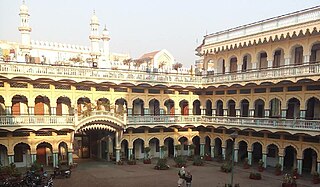
Kashipur is a city of Udham Singh Nagar district in the Indian state of Uttarakhand, and one of its seven subdivisions. Located in the western part of Udham Singh Nagar district, it is Kumaun's third most populous city and the sixth most populous in Uttarakhand. According to the 2011 Census of India, the population is 121,623 for the city of Kashipur and 283,136 for Kashipur Tehsil. Kashipur also has IIM Kashipur, one of the thirteen Indian Institutes of Managements the government has set up during the Eleventh Five-year Plan.
Laksar is a small town, near Haridwar city and Nagar Palika in Haridwar district of the Indian state of Uttarakhand, situated along National Highway 334A. It is an important sugar manufacturing destination in the state and also known for the Laksar Junction railway station (LRJ), the largest railway junction in the state, which was built in 1866.
Mandapeta was originally called "Mandavyapuram", which came from Sage Mandukya. Mandapeta is a second-grade municipality established on October 1, 1958 in Dr. B.R. Ambedkar Konaseema District in the Indian state of Andhra Pradesh. It is located at mean elevation of about 15.48 msl at 16.520 N, 81.560 E.
Rithora is a town and a nagar panchayat in Bareilly Tehsil of Bareilly district in the Indian state of Uttar Pradesh.
Rudrapur is a city that serves as the headquarters of the Udham Singh Nagar district in the Indian state of Uttarakhand. Located at a distance of about 250 km (160 mi) northeast of New Delhi and 250 km (160 mi) south of Dehradun, Rudrapur is located in the fertile Terai plains in the southern part of Kumaon division over an area of 27.65 km2. With a population of 140,857 according to the 2011 census of India, it is the 5th most populous city of Uttarakhand.

Ramnagar is a town and municipal board in the Nainital district of Kumaon, India. It is located approximately 65 kilometres (40 mi) from Nainital, the headquarters of the district.

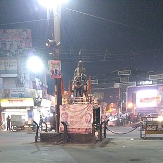
Shree Moteshwar Mahadev, also known as Shree Bheem Shankar Mahadev, is an abode of Lord Shiva in Kashipur of Uttarakhand state, India. This place was known as the Dakini State in ancient days.

Uttaranchal Sampark Kranti Express is a Sampark Kranti Express train which connects Delhi to Ramnagar and Kathgodam of Uttarakhand state in India. The train runs daily via Moradabad, then split into two trains, one is for Ramnagar and another for Kathgodam. It is the shortest-running Sampark Kranti Express of Indian Railways.
The 22975 Bandra Terminus–Ramnagar Express is an express train of Western Railway Zone that runs between Bandra Terminus in Mumbai and Ramnagar in Uttarakhand. It is operated by Western Railway zone of Indian Railways. It is currently being operated with 22975/22976 train numbers on a weekly basis.
The Lalkuan–Amritsar Superfast Express is an Express train belonging to Northern Railway zone that runs between Lalkuan Junction and Amritsar Junction in India. It is currently being operated with 14615/14616 train numbers on a weekly basis.

