Jaspur

Last updated

Jaspur
Town
Jaspur market.jpg
Gahlot market in Jaspur
India Uttarakhand location map.svg
Red pog.svg
Jaspur
Location in Uttarakhand, India
India location map.svg
Red pog.svg
Jaspur
Jaspur (India)
Coordinates: 29°17′00″N78°49′00″E / 29.283331°N 78.816673°E / 29.283331; 78.816673
CountryFlag of India.svg  India
State Uttarakhand
District Udham Singh Nagar
Government
  TypeMunicipal council
Elevation
220 m (720 ft)
Population
 (2011)
  Total50,523
Languages
  Official Hindi
  Kumaoni Khari Boli
Time zone UTC+5:30 (IST)
PIN
244712 [1]
Vehicle registration UK 18
Website uk.gov.in

Jaspur is a developing town and a municipal board in Udham Singh Nagar district in the Indian state of Uttarakhand.

Contents

Demographics

At the 2001 India census, [2] Jaspur had a population of 39,048, with men making up 53% of the population, and women making up the remaining 47%. According to 2011 India census, [3] Jaspur has a population of 126,397. 52.37% of the population is male, and 47.64% is female. Jaspur has an average literacy rate of 60%, higher than the national average of 59.5%: male literacy is 67%, and female literacy is 52%. In Jaspur, 17% of the population is under 6 years of age. Hindi is the most common language here but some people also understand Punjabi, Urdu and English.

Geography

Jaspur is located at 29°17′N78°49′E / 29.28°N 78.82°E / 29.28; 78.82 . [4] It has an average elevation of 320m (1050ft). Jaspur is a small city, 45km from Corbett National Park, west of Ramnagar and 210km east from New Delhi. It is 110km from Nainital. It is the border town of Uttarakhand.

Transportation

It is well connected to all major cities of the states and region. NH-74 connects Haridwar in Uttranchal with Bareilly in Uttar Pradesh via Pilibhit. The total length of NH 74 is 333km. It connects Jaspur to major cities like Haldwani, Kashipur, Gadarpur, Rudrapur, Kicha, Ramnagar, Haridwar, and Dehradun. The town has its own local bus stand, while the government bus station lies on the outskirts of the city. The railway project is proposed to begin soon in the town connecting Kashipur to Dhampur via Jaspur.

Culture and People

The majority of the population is Hindu or Muslim along with a smaller Sikh community.

Jaspur has a largely educated population. Dr Mohammad Azeem from Government Medical College Haldwani is a gem of Jaspur. Mr. Varun Goel of Jaspur was awarded the Wiedenfeld-Hoffman scholarship by the University of Oxford in May 2021.

Economy

Jaspur also known as the wood city of India, it has a traditional wood mandi and some agro-processing industries. Many people in the city are self-employed and run shops, though the economy of the city is mainly based on agriculture. There is a sugar mill at Nandehi near the city, and many rice and paper mills in the vicinity of the city. The town has a number of hospitals. A number of businesses are also well settled in the town, such as automobile, clothing and garments, bookstores, jewellers, confectioneries, hardware stores, paint stores, photography, sweet shops and restaurants.

Many new food and agro processing industries have come up in Jaspur, including Shri Ram Solvent Extractions and KOOK Frozen Foods.

Temples

Temples include the historical Buddhist Monastery at the village of Bahadurpur, the Shri Thakur Mandir, which is also called Manokamna Mandir, having the great statues of Abhimantrit Hanuman Ji along with Ram Parivar and Shri Radha Krishna Ji, and Bada Mandir. A Shiv Mandir also placed in Gopal Nagar, near Awas Vikas. Jaspur had a Mosque known as Jama Masjid which is an honour of the city.

Population

As per the Population Census 2011 data, following are some quick facts about Jaspur.

Population: 170,315, Sex Ratio: 911.

TotalMaleFemale
Children (Age 0-6)23,90212,72511,177
Literacy73.59%70.06%55.79%
Scheduled Caste27,96214,68513,277
Scheduled Tribe291415
Illiterate62,57626,68235,894

Caste-wise Population - Jaspur

Schedule Caste (SC) constitutes 16.4% while Schedule Tribe (ST) were 0% of total population in Jaspur Tehsil of .

TotalMaleFemale
Schedule Caste27,96214,68513,277
Schedule Tribe291415

Religion-wise Population - Jaspur

ReligionTotalMaleFemale
Hindu87,746(51.52%)46,13141,615
Muslim63,622(37.36%)33,15530,467
Christian233(0.14%)125108
Sikh18,595(10.92%)9,6338,962
Buddhist11(0.01%)92
Jain16(0.01%)115
Other Religion0(0%)00
No Religion Specified92(0.05%)5339

Urban/Rural Population - Jaspur

As per Census 2011, there are total 9,958 families under Jaspur Tehsil living in urban areas while 9,958 families are living within Rural areas. Thus around 34% of total population of Jaspur Tehsil lives in Urban areas while 66% lives under Rural areas. Population of children (0 - 6 years) in urban region is 8,121 while that in rural region is 15,781.

TotalUrbanRural
Population170,31557,849112,466
Children (0 - 6 years)23,9028,12115,781
Schedule Caste27,9624,05523,907
Schedule Tribe29029
Literacy73.59%77.04%71.81%
Sex Ratio911918908

Working Population - Jaspur

In Jaspur Tehsil out of total population, 61,916 were engaged in work activities. 74.4% of workers describe their work as Main Work (Employment or Earning more than 6 Months) while 25.6% were involved in Marginal activity providing livelihood for less than 6 months. Of 61,916 workers engaged in Main Work, 10,948 were cultivators (owner or co-owner) while 11,751 were Agricultural labourer.

TotalMaleFemale
Main Workers46,09438,7617,333
Cultivators10,9489,981967
Agriculture Labourer11,7519,4392,312
Household Industries2,3991,0281,371
Other Workers20,99618,3132,683
Marginal Workers15,8227,9597,863
Non Working108,39942,39766,002

Related Research Articles

<span class="mw-page-title-main">Haldwani</span> Metropolis in Uttarakhand, India

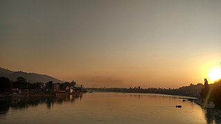
Haldwani is the largest city of Kumaon. It is also the third most populous city and largest commercial market in the Indian state of Uttarakhand. Haldwani is said to be the financial capital of Uttarakhand, having the most commercial, economic and industrial activities of the state. Haldwani is located in the Nainital District, and is one of its eight Subdivisions. The Haldwani Urban agglomeration has 232,060 people as of 2011, and is the third most populous UA in Uttarakhand, after Dehradun and Haridwar. Being situated in the immediate foothills of Kumaon Himalayas, the Kathgodam neighbourhood of Haldwani is known as the "Gateway to Kumaon".

<span class="mw-page-title-main">Udham Singh Nagar district</span> District in Uttarakhand, India

Udham Singh Nagar District is a district of Uttarakhand state in northern India. Rudrapur is the district headquarters. This district consists of nine Tehsils named Bajpur, Gadarpur, Rudrapur, Jaspur, Kashipur, Kichha, Khatima, Sitarganj, Nanakmatta. The district is located in the Terai region, and is part of Kumaon Division. It is bounded on the north by Nainital District, on the northeast by Champawat District, on the east by Nepal, and on the south and west by Bareilly, Rampur, Moradabad, Pilibhit and Bijnor District of Uttar Pradesh state. The district was created on 29 September 1995, by Mayawati government out of Nainital District. It is named for freedom fighter and Indian revolutionary Udham Singh.

<span class="mw-page-title-main">Dehradun district</span> District in Uttarakhand, India

Dehradun district is a district in Garhwal which is a part of Uttarakhand state in northern India. The district headquarters is Dehradun, which has also served as the interim capital of Uttarakhand since its founding in 2000. The district has 6 tehsils, 6 community development blocks, 17 towns and 764 inhabited villages, and 18 unpopulated villages. As of 2011, it is the second most populous district of Uttarakhand, after Haridwar. Dehradun district also includes the prominent towns of Rishikesh, Mussoorie, Landour and Chakrata. The district stretches from the Ganges river in the east to the Yamuna river in the west, and from the Terai and Shivaliks in the south and southeast to the Great Himalaya in the northwest. During the days of British Raj, the official name of the district was Dehra Dun. In 1842, Dun was attached to Saharanpur district and placed under an officer subordinate to the Collector of the district but since 1871 it is being administered as separate district.

<span class="mw-page-title-main">Kashipur, Uttarakhand</span> City of Udham Singh Nagar district in the Indian state of Uttarakhand

Kashipur is a city of Udham Singh Nagar district in the Indian state of Uttarakhand, and one of its seven subdivisions. Located in the western part of Udham Singh Nagar district, it is Kumaun's third most populous city and the sixth most populous in Uttarakhand. According to the 2011 Census of India, the population is 121,623 for the city of Kashipur and 283,136 for Kashipur Tehsil. Kashipur also has IIM Kashipur, one of the thirteen Indian Institutes of Managements the government has set up during the Eleventh Five-year Plan.

Bazpur, or Bajpur, is a city and a municipality in Udham Singh Nagar district in the state of Uttarakhand, India.

<span class="mw-page-title-main">Gadarpur</span> Town in Uttarakhand, India

Gadarpur is a post independence city and a municipal board in Udham Singh Nagar district in the state of Uttarakhand, India. This city was formed with the arrival of the refugees from Pakistan at the time of partition of 1947. The refugees settled here and started living here. The refugees are Punjabi which makes up a majority in the city.

Ramnagar may refer to the following places:

Kelakhera is a Municipality Town in Tehsil Bajpur of Udham Singh Nagar district in the Indian state of Uttarakhand.

Noorpur is a City and a Municipal Board in Bijnor District in the Indian State of Uttar Pradesh.

Rithora is a town and a nagar panchayat in Bareilly Tehsil of Bareilly district in the Indian state of Uttar Pradesh.

<span class="mw-page-title-main">Rudrapur, Uttarakhand</span> City in Uttarakhand, India

Rudrapur is a city that serves as the headquarters of the Udham Singh Nagar district in the Indian state of Uttarakhand. Located at a distance of about 250 km (160 mi) northeast of New Delhi and 250 km (160 mi) south of Dehradun, Rudrapur is located in the fertile Terai plains in the southern part of Kumaon division over an area of 27.65 km2. With a population of 140,857 according to the 2011 census of India, it is the 5th most populous city of Uttarakhand.

<span class="mw-page-title-main">Sitarganj</span> City in Uttarakhand, India

Sitarganj is a city and a municipal board in Udham Singh Nagar district in the Indian state of Uttarakhand. Now it is home to the Integrated Industrial Estate Sitarganj (IIE) being developed by State Industrial Development Corporation of Uttarakhand Limited (SIDCUL).

<span class="mw-page-title-main">Ramnagar, Nainital</span> Town in Uttarakhand, India

Ramnagar is a town and municipal board in the Nainital district of Kumaon, India. It is located approximately 65 kilometres (40 mi) from Nainital, the headquarters of the district.

Maldhan chaur is situated 19 km from Ramnagar and 23 km from Kashipur, having an area of around 15 to 20 villages in Ramnagar Block in 'Nainital' District of Uttarakhand, also called 'Devbhumi'. It has more than 20,000 of population, most of the population belongs to the Kumauni and Garhwali communities. The literacy rate is moderate. Most of the employed people work for government sector or near by Companies. The primary languages are Pahari, Garwali, Hindi and English. Here is very famous dam named as 'Tumariya Dam' which is used for irrigation of crops and for fishing and also a Tourist Attaraction.

Mehalchauri is a village in Gairsain Tehsil located in Chamoli district in the Indian state of Uttarakhand. It is situated in Garhwal mandal nearby the center of the Garhwal and Kumaon mandal.

<span class="mw-page-title-main">Bigwara</span>

Bigwara is a village and gram panchayat in Rudrapur city, Udham Singh Nagar district in the Indian state of Uttarakhand. Bigwara is located in the fertile Terai region on National Highway 74, 3km milestone from Rudrapur. Since the establishment of SIDCUL, the village has enjoyed rapid development.

Ramnagar Kashipur, is a village in Kashipur, Udham Singh Nagar district in the state of Uttarakhand in India.

Ramnagar Jaspur, is a village in Jaspur, Udham Singh Nagar district in the state of Uttarakhand in India.

References

  1. "Jaspur Khurd Pin code". pin-code.net. Retrieved 7 July 2021.
  2. "Census of India 2001: Data from the 2001 Census, including cities, villages and towns (Provisional)". Census Commission of India. Archived from the original on 16 June 2004. Retrieved 1 November 2008.
  3. "Census of India 2011: Data from the 2011 District Census Handbook, Udham Singh Nagar, including villages and towns" (PDF). Census Commission of India.
  4. Falling Rain Genomics, Inc – Jaspur