Related Research Articles

Transportation planning is the process of defining future policies, goals, investments, and spatial planning designs to prepare for future needs to move people and goods to destinations. As practiced today, it is a collaborative process that incorporates the input of many stakeholders including various government agencies, the public and private businesses. Transportation planners apply a multi-modal and/or comprehensive approach to analyzing the wide range of alternatives and impacts on the transportation system to influence beneficial outcomes.

Travel behavior is the study of what people do over geography, and how people use transport.
Urban economics is broadly the economic study of urban areas; as such, it involves using the tools of economics to analyze urban issues such as crime, education, public transit, housing, and local government finance. More specifically, it is a branch of microeconomics that studies the urban spatial structure and the location of households and firms.
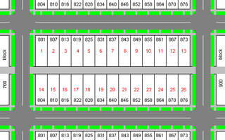
A city block, residential block, urban block, or simply block is a central element of urban planning and urban design.
In economics, an input–output model is a quantitative economic model that represents the interdependencies between different sectors of a national economy or different regional economies. Wassily Leontief (1906–1999) is credited with developing this type of analysis and earned the Nobel Prize in Economics for his development of this model.
Trip generation is the first step in the conventional four-step transportation forecasting process used for forecasting travel demands. It predicts the number of trips originating in or destined for a particular traffic analysis zone (TAZ). Trip generation analysis focuses on residences and residential trip generation is thought of as a function of the social and economic attributes of households. At the level of the traffic analysis zone, residential land uses "produce" or generate trips. Traffic analysis zones are also destinations of trips, trip attractors. The analysis of attractors focuses on non-residential land uses.

Trip distribution is the second component in the traditional four-step transportation forecasting model. This step matches tripmakers’ origins and destinations to develop a “trip table”, a matrix that displays the number of trips going from each origin to each destination. Historically, this component has been the least developed component of the transportation planning model.
Land-use forecasting undertakes to project the distribution and intensity of trip generating activities in the urban area. In practice, land-use models are demand-driven, using as inputs the aggregate information on growth produced by an aggregate economic forecasting activity. Land-use estimates are inputs to the transportation planning process.
A transport network, or transportation network, is a network or graph in geographic space, describing an infrastructure that permits and constrains movement or flow. Examples include but are not limited to road networks, railways, air routes, pipelines, aqueducts, and power lines. The digital representation of these networks, and the methods for their analysis, is a core part of spatial analysis, geographic information systems, public utilities, and transport engineering. Network analysis is an application of the theories and algorithms of graph theory and is a form of proximity analysis.
Geodemography is the study of people based on where they live; it links the sciences of demography, the study of human population dynamics, and geography, the study of the locational and spatial variation of both physical and human phenomena on Earth, along with sociology. It includes the application of geodemographic classifications for business, social research and public policy but has a parallel history in academic research seeking to understand the processes by which settlements evolve and neighborhoods are formed. Geodemographic systems estimate the most probable characteristics of people based on the pooled profile of all people living in a small area near a particular address.

Spatial analysis is any of the formal techniques which studies entities using their topological, geometric, or geographic properties. Spatial analysis includes a variety of techniques using different analytic approaches, especially spatial statistics. It may be applied in fields as diverse as astronomy, with its studies of the placement of galaxies in the cosmos, or to chip fabrication engineering, with its use of "place and route" algorithms to build complex wiring structures. In a more restricted sense, spatial analysis is geospatial analysis, the technique applied to structures at the human scale, most notably in the analysis of geographic data. It may also be applied to genomics, as in transcriptomics data.
Microsimulation is the use of computerized analytical tools to perform analysis of activities such as highway traffic flowing through an intersection, financial transactions, or pathogens spreading disease through a population on the granularity level of individuals. Synonyms include microanalytic simulation and microscopic simulation. Microsimulation, with its emphasis on stochastic or rule-based structures, should not be confused with the similar complementary technique of multi-agent simulation, which focuses more on the behaviour of individuals.

The modifiable areal unit problem (MAUP) is a source of statistical bias that can significantly impact the results of statistical hypothesis tests. MAUP affects results when point-based measures of spatial phenomena are aggregated into spatial partitions or areal units as in, for example, population density or illness rates. The resulting summary values are influenced by both the shape and scale of the aggregation unit.

Mixed use is a type of urban development, urban design, urban planning and/or a zoning classification that blends multiple uses, such as residential, commercial, cultural, institutional, or entertainment, into one space, where those functions are to some degree physically and functionally integrated, and that provides pedestrian connections. Mixed-use development may be applied to a single building, a block or neighborhood, or in zoning policy across an entire city or other administrative unit. These projects may be completed by a private developer, (quasi-) governmental agency, or a combination thereof. A mixed-use development may be a new construction, reuse of an existing building or brownfield site, or a combination.

Transportation forecasting is the attempt of estimating the number of vehicles or people that will use a specific transportation facility in the future. For instance, a forecast may estimate the number of vehicles on a planned road or bridge, the ridership on a railway line, the number of passengers visiting an airport, or the number of ships calling on a seaport. Traffic forecasting begins with the collection of data on current traffic. This traffic data is combined with other known data, such as population, employment, trip rates, travel costs, etc., to develop a traffic demand model for the current situation. Feeding it with predicted data for population, employment, etc. results in estimates of future traffic, typically estimated for each segment of the transportation infrastructure in question, e.g., for each roadway segment or railway station. The current technologies facilitate the access to dynamic data, big data, etc., providing the opportunity to develop new algorithms to improve greatly the predictability and accuracy of the current estimations.

Aggregate data is high-level data which is acquired by combining individual-level data. For instance, the output of an industry is an aggregate of the firms’ individual outputs within that industry. Aggregate data are applied in statistics, data warehouses, and in economics.
TRANSIMS is an integrated set of tools developed to conduct regional transportation system analyses. With the goal of establishing TRANSIMS as an ongoing public resource available to the transportation community, TRANSIMS is made available under the NASA Open Source Agreement Version 1.3
Statistical geography is the study and practice of collecting, analysing and presenting data that has a geographic or areal dimension, such as census or demographics data. It uses techniques from spatial analysis, but also encompasses geographical activities such as the defining and naming of geographical regions for statistical purposes. For example, for the purposes of statistical geography, the Australian Bureau of Statistics uses the Australian Standard Geographical Classification, a hierarchical regionalisation that divides Australia up into states and territories, then statistical divisions, statistical subdivisions, statistical local areas, and finally census collection districts.
UrbanSim is an open source urban simulation system designed by Paul Waddell of the University of California, Berkeley and developed with numerous collaborators to support metropolitan land use, transportation, and environmental planning. It has been distributed on the web since 1998, with regular revisions and updates, from www.urbansim.org. Synthicity Inc coordinates the development of UrbanSim and provides professional services to support its application. The development of UrbanSim has been funded by several grants from the National Science Foundation, the U.S. Environmental Protection Agency, the Federal Highway Administration, as well as support from states, metropolitan planning agencies and research councils in Europe and South Africa. Reviews of UrbanSim and comparison to other urban modeling platforms may be found in references.
Stan Openshaw was a British geographer. His last post was professor of human geography based in the School of Geography at the University of Leeds. After eighteen years at Newcastle University, including three years as professor of quantitative geography, he moved to work in Leeds in 1992. Openshaw was a researcher in computer-based/computational geography and his work aimed to automate aspects of geographical research and reduce subjectivity in geographical analyses. He worked on geographical information systems, analysis technology and models. He debated the direction geography should take putting forward a view that the subject needed an applied and scientific edge that harnessed the growing power of computers to make positive impacts to help us avoid and mitigate risk and cope better with disasters.
References
- Miller, Harvey J. & Shih-Lung Shaw. (2001) Geographic Information Systems for Transportation, Oxford University Press US. p. 248. ISBN 0-19-512394-8.
- Caliper Corporation. (2007) "Transcad: Traffic Demand Forecasting"