
The Illinois and Michigan Canal connected the Great Lakes to the Mississippi River and the Gulf of Mexico. In Illinois, it ran 96 miles (154 km) from the Chicago River in Bridgeport, Chicago to the Illinois River at LaSalle-Peru. The canal crossed the Chicago Portage, and helped establish Chicago as the transportation hub of the United States, before the railroad era. It was opened in 1848. Its function was partially replaced by the wider and deeper Chicago Sanitary and Ship Canal in 1900, and it ceased transportation operations with the completion of the Illinois Waterway in 1933.

The Chesapeake and Ohio Canal, abbreviated as the C&O Canal and occasionally called the Grand Old Ditch, operated from 1831 until 1924 along the Potomac River between Washington, D.C. and Cumberland, Maryland. It replaced the Potomac Canal, which shut down completely in 1828, and could operate during months in which the water level was too low for the former canal. The canal's principal cargo was coal from the Allegheny Mountains.
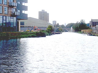
The Hertford Union Canal or Duckett's Cut, just over 1 mile (1.6 km) long, connects the Regent's Canal to the Lee Navigation in the London Borough of Tower Hamlets in East London. It was opened in 1830 but quickly proved to be a commercial failure. It was acquired by the Regents Canal Company in 1857, and became part of the Grand Union Canal in 1927.

The Chesapeake and Ohio Canal National Historical Park is located in the District of Columbia and the state of Maryland. The park was established in 1961 as a National Monument by President Dwight D. Eisenhower to preserve the neglected remains of the Chesapeake and Ohio Canal and many of its original structures.

The Patowmack Canal, sometimes called the Potomac Canal, is a series of five inoperative canals located in Maryland and Virginia, United States, that was designed to bypass rapids in the Potomac River upstream of the present Washington, D.C., area. The most well known of them is the Great Falls skirting canal, whose remains are managed by the National Park Service since it is within Great Falls Park, an integral part of the George Washington Memorial Parkway.

The Ohio and Erie Canal was a canal constructed during the 1820s and early 1830s in Ohio. It connected Akron with the Cuyahoga River near its outlet on Lake Erie in Cleveland, and a few years later, with the Ohio River near Portsmouth. It also had connections to other canal systems in Pennsylvania.

The James River and Kanawha Canal was a partially built canal in Virginia intended to facilitate shipments of passengers and freight by water between the western counties of Virginia and the coast. Ultimately its towpath became the roadbed for a rail line following the same course.

The Delaware and Hudson Canal was the first venture of the Delaware and Hudson Canal Company, which would later build the Delaware and Hudson Railway. Between 1828 and 1899, the canal's barges carried anthracite coal from the mines of northeastern Pennsylvania to the Hudson River and thence to market in New York City.

The National Register of Historic Places in the United States is a register including buildings, sites, structures, districts, and objects. The Register automatically includes all National Historic Landmarks as well as all historic areas administered by the U.S. National Park Service. Since its introduction in 1966, more than 90,000 separate listings have been added to the register.

Enfield Falls Canal is a canal that was built to circumvent the shallows at Enfield Falls on the Connecticut River, between Hartford, Connecticut and Springfield, Massachusetts. It is situated along the west side of the river, adjacent to the towns of Suffield and Windsor Locks in Hartford County in the state of Connecticut, United States. Windsor Locks is named after the series of locks on the canal.

The Locks on the Chesapeake and Ohio Canal, located in Maryland, West Virginia, and Washington, D.C. of the United States, were of three types: lift locks; river locks; and guard, or inlet, locks.
The Whitewater Canal, which was built between 1836 and 1847, spanned a distance of 76 miles (122 km) and stretched from Lawrenceburg, Indiana on the Ohio River to Hagerstown, Indiana near the West Fork of the White River.

Lock and Dam No. 14 is a lock and dam located near LeClaire, Iowa on the Upper Mississippi River above Davenport, Iowa and Moline, Illinois. The movable portion of the dam is 1,343 feet (409.3 m) long and consists of 13 tainter gates and 4 roller gates. Connected to it is a 1,127 feet (343.5 m) long non-submersible rock fill dike which extends to the Illinois side. The main lock is 110 feet (33.5 m) wide by 600 feet (182.9 m) long. The site on the National Register of Historic Places as the Lock and Dam No. 14 Historic District (#04000174) listed in 2004 consisting of 3,043 acres (12.3 km2), 1 building, 6 structures, and 2 objects. It was completed in two phases, the first as part of the six foot channel project from 1921 to 1924, which included a lock and canal bypassing a hazardous rapids. The second phase was part of the nine foot channel project from 1935 to 1939 and included the main dam and the current main lock.

Lock and Dam No. 19 is a lock and dam located on the Upper Mississippi River near Keokuk, Iowa. In 1978, the Keokuk Lock and Dam was listed in the National Register of Historic Places, #78001234. In 2004, the facility was listed in the National Register of Historic Places as Lock and Dam No. 19 Historic District, #04000179 covering 1,605 acres (650 ha), 7 buildings, 12 structures, 1 object. The lock is owned and operated by the U.S. Army Corps of Engineers. The dam is owned and operated by Ameren Missouri.

Lock and Dam No. 20 is a lock and dam located on the Upper Mississippi River, the lock side in Canton, Missouri and the dam crossing to Meyer, Illinois.

The Lehigh Canal is a navigable canal that begins at the mouth of Nesquehoning Creek on the Lehigh River in the Lehigh Valley and Northeastern regions of Pennsylvania. It was built in two sections over a span of 20 years beginning in 1818. The lower section spanned the distance between Easton and present-day Jim Thorpe. In Easton, the canal met the Pennsylvania Canal's Delaware Division and Morris Canals, which allowed anthracite coal and other goods to be transported further up the U.S. East Coast. At its height, the Lehigh Canal was 72 miles (116 km) long.

Vischer Ferry is a hamlet in the town of Clifton Park in Saratoga County, New York, United States, along the Mohawk River.

Starved Rock Lock and Dam, also known as Lock and Dam No. 6, is a lock and dam facility managed by the U.S. Army Corps of Engineers along the Illinois River, near Starved Rock. It is part of the Illinois Waterway and was constructed between 1926 and 1933. The lock and dam was added to the National Register of Historic Places as the Starved Rock Lock and Dam Historic District in 2004.

The Georges River Canal, also known as the General Knox Canal was a short-lived canal that operated on and near the course of the Saint George River in Knox and Waldo Counties in south-central Maine. First owned and operated by American Revolutionary War General Henry Knox between 1794 and 1806, it was briefly revived in 1847–50, but was not financially successful. It provided for transport of goods from near the river's headwaters in Searsmont to the head of navigation at Warren. A few elements of the canal survive today, and its route was listed on the National Register of Historic Places in 1970.

Violette's Lock is part of the 184.5-mile (296.9 km) Chesapeake and Ohio Canal that operated in the United States along the Potomac River from the 1830s through 1923. It is located at towpath mile-marker 22.1, in Montgomery County, Maryland. The name Violette comes from Alfred L. "Ap" Violette and his wife Kate, who were lock keepers from the beginning of the 20th century through the permanent closure of the canal in 1924.


