Walden, Colorado

Last updated

Walden, Colorado
Walden Colorado Main Street.jpg
Main Street in Walden, July 2010
Jackson County Colorado Incorporated and Unincorporated areas Walden Highlighted 0882130.svg
Location of Walden in Jackson County, Colorado.
Coordinates: 40°43′54″N106°16′53″W / 40.73167°N 106.28139°W / 40.73167; -106.28139
CountryFlag of the United States.svg United States
State Flag of Colorado.svg  Colorado
County [1] Jackson County - seat [2]
Established1889
Incorporated December 2, 1890 [3]
Named for Marcus Aurelius Walden (former postmaster)
Government
  Type Statutory Town [1]
Area
[4]
  Total0.34 sq mi (0.87 km2)
  Land0.34 sq mi (0.87 km2)
  Water0.00 sq mi (0.00 km2)
Elevation
[5]
8,098 ft (2,468 m)
Population
 (2020) [6]
  Total606
  Density1,800/sq mi (700/km2)
Time zone UTC−7 (Mountain (MST))
  Summer (DST) UTC−6 (MDT)
ZIP codes [7]
80430, 80480
Area code 970
FIPS code 08-82130
GNIS feature ID2413440 [5]
Website www.townofwaldenco.com

Walden is the Statutory Town that is the county seat, the most populous community, and the only incorporated municipality in Jackson County, Colorado, United States. [1] [8] It is situated in the center of a large open valley called North Park. People from Walden and the surrounding area refer to themselves as "North Parkers".[ citation needed ] The town population was 606 at the 2020 census. [6] The town sits at an elevation of 8,099 feet (2,469 meters). It was established in 1889 and was incorporated December 2, 1890. [3] Mark A. Walden, an early postmaster, gave the community his name. [9]

Contents

Geography

According to the United States Census Bureau, the town has a total area of 0.3 square miles (0.78 km2), all of it land.

Climate

Due to its elevation, Walden has a semi-arid climate (BSk), closely bordering on a subalpine climate (Köppen climate classification Dfc). The hottest temperature recorded in Walden was 94 °F (34 °C) on July 6, 1989, August 1, 2000 and July 15, 2002, while the coldest temperature recorded was −48 °F (−44 °C) on January 12, 1963, February 2, 2011 and January 6, 2017. [10]

Climate data for Walden, Colorado, 1991–2020 normals, extremes 1897–present
MonthJanFebMarAprMayJunJulAugSepOctNovDecYear
Record high °F (°C)56
(13)
54
(12)
70
(21)
74
(23)
84
(29)
92
(33)
94
(34)
94
(34)
89
(32)
78
(26)
66
(19)
58
(14)
94
(34)
Mean maximum °F (°C)43.6
(6.4)
45.9
(7.7)
56.5
(13.6)
66.2
(19.0)
75.4
(24.1)
82.1
(27.8)
86.9
(30.5)
85.0
(29.4)
80.2
(26.8)
70.8
(21.6)
57.1
(13.9)
46.4
(8.0)
86.9
(30.5)
Mean daily maximum °F (°C)26.7
(−2.9)
29.6
(−1.3)
38.6
(3.7)
47.4
(8.6)
58.1
(14.5)
68.8
(20.4)
76.1
(24.5)
74.1
(23.4)
66.4
(19.1)
52.9
(11.6)
38.3
(3.5)
27.7
(−2.4)
50.4
(10.2)
Daily mean °F (°C)14.3
(−9.8)
17.0
(−8.3)
25.8
(−3.4)
33.7
(0.9)
42.9
(6.1)
51.7
(10.9)
57.3
(14.1)
55.2
(12.9)
47.9
(8.8)
36.8
(2.7)
25.1
(−3.8)
15.4
(−9.2)
35.3
(1.8)
Mean daily minimum °F (°C)1.9
(−16.7)
4.4
(−15.3)
13.1
(−10.5)
20.0
(−6.7)
27.6
(−2.4)
34.5
(1.4)
38.4
(3.6)
36.3
(2.4)
29.4
(−1.4)
20.7
(−6.3)
11.8
(−11.2)
3.2
(−16.0)
20.1
(−6.6)
Mean minimum °F (°C)−22.2
(−30.1)
−19.7
(−28.7)
−8.4
(−22.4)
4.9
(−15.1)
15.5
(−9.2)
27.5
(−2.5)
32.4
(0.2)
28.9
(−1.7)
17.4
(−8.1)
2.1
(−16.6)
−10.4
(−23.6)
−21.2
(−29.6)
−28.9
(−33.8)
Record low °F (°C)−48
(−44)
−48
(−44)
−34
(−37)
−16
(−27)
2
(−17)
17
(−8)
21
(−6)
19
(−7)
5
(−15)
−28
(−33)
−32
(−36)
−39
(−39)
−48
(−44)
Average precipitation inches (mm)0.58
(15)
0.64
(16)
0.72
(18)
1.14
(29)
1.53
(39)
1.21
(31)
1.34
(34)
1.27
(32)
1.34
(34)
0.98
(25)
0.75
(19)
0.62
(16)
12.12
(308)
Average snowfall inches (cm)9.3
(24)
9.0
(23)
7.7
(20)
10.1
(26)
3.8
(9.7)
0.5
(1.3)
0.0
(0.0)
0.0
(0.0)
1.0
(2.5)
6.0
(15)
9.5
(24)
10.2
(26)
67.1
(171.5)
Average precipitation days (≥ 0.01 in)7.98.17.39.410.37.79.910.68.37.37.88.3102.9
Average snowy days (≥ 0.1 in)8.38.56.26.72.60.30.00.00.73.67.38.853.0
Source 1: NOAA [11]
Source 2: National Weather Service [10]

Demographics

Historical population
CensusPop.Note
1890 64
1900 141120.3%
1910 16214.9%
1920 26060.5%
1930 2849.2%
1940 668135.2%
1950 6964.2%
1960 80916.2%
1970 90712.1%
1980 9474.4%
1990 890−6.0%
2000 734−17.5%
2010 608−17.2%
2020 606−0.3%
U.S. Decennial Census

Transportation

OATS (Older Americans Transport Service) provides seniors with transportation to Laramie, Wyoming or Steamboat Springs, CO and to Denver International Airport.

See also

Related Research Articles

<span class="mw-page-title-main">Northglenn, Colorado</span> City in Colorado, United States

The City of Northglenn is a home rule municipality located in Adams and Weld counties, Colorado, United States. Northglenn is a part of the Denver–Aurora–Lakewood, CO Metropolitan Statistical Area. As of the 2020 census the city's population was 38,131. It was built as a master planned community in 1959 by Jordon Perlmutter.

<span class="mw-page-title-main">Walsh, Colorado</span> Town in Colorado, United States

Walsh is a Statutory Town in Baca County, Colorado, United States. The population was 543 at the 2020 census.

<span class="mw-page-title-main">Eagle, Colorado</span> Town in Colorado, United States

Eagle is the Statutory Town that is the county seat of Eagle County, Colorado, United States. The town population was 7,511 at the 2020 United States Census, a +15.41% increase since the 2010 United States Census. Eagle is the part of the Edwards, CO Micropolitan Statistical Area.

<span class="mw-page-title-main">Silt, Colorado</span> Town in Colorado, United States

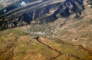
Silt is a statutory town in Garfield County, Colorado, United States. The population was 3,536 at the 2020 census, up from 2,930 at the 2010 census. The town is part of the Glenwood Springs Micropolitan Area.

<span class="mw-page-title-main">Fraser, Colorado</span> Town in Colorado, United States

The Town of Fraser is a Statutory Town located in Grand County, Colorado, United States. The town population was 1,400 at the 2020 United States Census, a +14.38% increase since the 2010 United States Census. The town is situated in Middle Park in the valley of the Fraser River along U.S. Highway 40. Its location northwest of Winter Park, the location of a popular ski resort, has provided growth in recent years with new condominium and other real estate developments.

<span class="mw-page-title-main">Edgewater, Colorado</span> City in Colorado, United States

The City of Edgewater is a home rule municipality located in Jefferson County, Colorado, United States. The city population was 5,005 at the 2020 United States Census. Edgewater is surrounded by Denver to the east, Lakewood to the south and west, and Wheat Ridge to the north. The city is a part of the Denver–Aurora–Lakewood, CO Metropolitan Statistical Area and the Front Range Urban Corridor.

<span class="mw-page-title-main">Kim, Colorado</span> Town in Colorado, United States

Kim is a Statutory Town in Las Animas County, Colorado, United States. The population was 63 at the time of the 2020 United States Census.

<span class="mw-page-title-main">Merino, Colorado</span> Town in Colorado, United States

The Town of Merino is a Statutory Town in Logan County, Colorado, United States. The town population was 281 at the 2020 United States Census.

<span class="mw-page-title-main">Sterling, Colorado</span> City in Colorado, United States

Sterling is a home rule municipality and the county seat and most populous municipality of Logan County, Colorado, United States. Sterling is the principal city of the Sterling, CO Micropolitan Statistical Area. The city population was 13,735 at the 2020 census.

<span class="mw-page-title-main">Craig, Colorado</span> City in Moffat County, Colorado, U.S.

Craig is a home rule municipality that is the county seat and the most populous municipality of Moffat County, Colorado, United States. The city population was 9,060 at the 2020 United States Census. Craig is the principal city of the Craig, CO Micropolitan Statistical Area.

<span class="mw-page-title-main">Naturita, Colorado</span> Town in Colorado, United States

Naturita is a statutory town in Montrose County, Colorado, United States. The population was 485 at the 2020 census, down from 546 in 2010.

<span class="mw-page-title-main">Alma, Colorado</span> Town in Park County, Colorado, United States

Alma is a statutory town in Park County, Colorado, United States. The town population was 296 at the 2020 United States Census. Alma is located West and South of the Denver-Aurora-Lakewood, CO Metropolitan Statistical Area and the Front Range Urban Corridor.

<span class="mw-page-title-main">Holly, Colorado</span> Town in Colorado, United States

Holly is a statutory town in Prowers County in southeastern Colorado, United States. The town is located 4.3 miles (6.9 km) west of the Kansas border at an elevation of 3,393 feet (1,034 m). Despite having the lowest elevation of any Colorado municipality, Holly is higher than the high points of 19 states and the District of Columbia. The town population was 837 at the 2020 United States Census.

<span class="mw-page-title-main">Rye, Colorado</span> Town in Colorado, United States

Rye is a Statutory Town in Pueblo County, Colorado, United States. The population was 206 at the 2020 census.

<span class="mw-page-title-main">Meeker, Colorado</span> Town in and county seat of Rio Blanco County, Colorado, United States

Meeker is the Statutory Town in and the county seat of Rio Blanco County, Colorado, United States, that is the most populous municipality in the county. The town population was 2,374 at the 2020 United States Census.

<span class="mw-page-title-main">Woodland Park, Colorado</span> City in Colorado, United States

Woodland Park is a home rule municipality in Teller County, Colorado, United States. Woodland Park is part of the Colorado Springs, CO Metropolitan Statistical Area. Many residents in this bedroom community commute to Colorado Springs. Woodland Park is surrounded by the 1,000,000-acre (400,000 ha) Pike National Forest. The population was 7,920 as of the 2020 Census.

<span class="mw-page-title-main">Akron, Colorado</span> Town in Colorado, United States

Akron is the Statutory Town that is the county seat and the most populous municipality of Washington County, Colorado, United States. The town population was 1,757 at the 2020 United States Census.

<span class="mw-page-title-main">Raymer, Colorado</span> Town in Colorado, United States

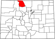
The Town of Raymer is a Statutory Town located in Weld County, Colorado, United States. The population was 110 at the U.S. Census 2020.

<span class="mw-page-title-main">Wray, Colorado</span> City in Colorado, United States

Wray is the home rule municipality that is the county seat of Yuma County, Colorado, United States. Located in the Colorado Plains, the city is 170 miles east of Denver, 9 miles west of the Nebraska state line, and 25 miles northwest of the Kansas state line. The population was 2,358 at the 2020 United States census.

<span class="mw-page-title-main">Hartsel, Colorado</span> Census-designated place in Park County, Colorado, United States

Hartsel is a census-designated place (CDP) in and governed by Park County, Colorado United States. The population was 38 at the 2020 census. The Hartsel post office has the ZIP Code 80449. The CDP is a part of the Denver–Aurora–Lakewood, CO Metropolitan Statistical Area.

References

  1. 1 2 3 "Active Colorado Municipalities". State of Colorado, Department of Local Affairs. Archived from the original on December 12, 2009. Retrieved September 1, 2007.
  2. "Colorado County Seats". State of Colorado, Department of Public Health and Environment. Retrieved December 31, 2007.
  3. 1 2 "Colorado Municipal Incorporations". State of Colorado, Department of Personnel & Administration, Colorado State Archives. December 1, 2004. Retrieved September 2, 2007.
  4. "2019 U.S. Gazetteer Files". United States Census Bureau. Retrieved July 1, 2020.
  5. 1 2 U.S. Geological Survey Geographic Names Information System: Walden, Colorado
  6. 1 2 United States Census Bureau. "Walden town; Colorado" . Retrieved April 23, 2023.
  7. "ZIP Code Lookup". United States Postal Service. Archived from the original (JavaScript/HTML) on November 22, 2010. Retrieved January 8, 2008.
  8. "Find a County". National Association of Counties. Retrieved June 7, 2011.
  9. Dawson, John Frank (1954). Place names in Colorado: why 700 communities were so named, 150 of Spanish or Indian origin. Denver, CO: The J. Frank Dawson Publishing Co. p. 51.
  10. 1 2 "NOAA Online Weather Data". National Weather Service. Retrieved September 9, 2022.
  11. "U.S. Climate Normals Quick Access". National Oceanic and Atmospheric Administration. Retrieved September 9, 2022.