Washington, Iowa

Last updated

Washington, Iowa
Washington iowa.jpg
The north side of the Washington Square with the Courthouse in the background.
Washington, Iowa logo.png
Nickname(s): 
City of Flowers and Trees
Motto: 
Onward! To the Salt Mines!
Washington County Iowa Incorporated and Unincorporated areas Washington Highlighted.svg
Location of Washington, Iowa
Coordinates: 41°17′53″N91°41′35″W / 41.29806°N 91.69306°W / 41.29806; -91.69306
Country Flag of the United States (23px).png  United States
State Flag of Iowa.svg  Iowa
County Washington
Government
  MayorMillie Youngquist
Area
[1]
  Total5.34 sq mi (13.82 km2)
  Land5.33 sq mi (13.82 km2)
  Water0.00 sq mi (0.01 km2)
Elevation
[2]
758 ft (231 m)
Population
 (2020)
  Total7,352
  Density1,378.33/sq mi (532.15/km2)
Time zone UTC-6 (Central (CST))
  Summer (DST) UTC-5 (CDT)
ZIP code
52353
Area code 319
FIPS code 19-82335
GNIS feature ID2397207 [2]
Website washingtoniowa.gov

Washington is a city in and the county seat of Washington County, Iowa, United States. [3] It is part of the Iowa City, Iowa Metropolitan Statistical Area. The population was 7,352 at the time of the 2020 census. [4]

Contents

History

1858 drawing of the Washington County Courthouse Washington Iowa Courthouse1858.jpg
1858 drawing of the Washington County Courthouse

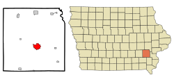
Washington was founded in 1839 as the county seat of the newly established Washington County. In 1854 it became the home of a United Presbyterian College, which was dissolved in 1864. As of 2014, the town has celebrated its 175th anniversary, only 5 years behind the oldest city in Iowa, Dubuque, Iowa. [5]

In 2016, the Guinness World Book of Records certified the State Theatre in Washington, Iowa, as the "world's oldest continually operating cinema theatre". [6]

Geography

According to the United States Census Bureau, the city has a total area of 4.92 square miles (12.74 km2), all land. [7]

Climate

Climate data for Washington, Iowa, 1991–2020 normals, extremes 1893present
MonthJanFebMarAprMayJunJulAugSepOctNovDecYear
Record high °F (°C)70
(21)
76
(24)
89
(32)
94
(34)
103
(39)
107
(42)
113
(45)
109
(43)
102
(39)
96
(36)
82
(28)
74
(23)
113
(45)
Mean maximum °F (°C)53.3
(11.8)
58.3
(14.6)
72.7
(22.6)
82.0
(27.8)
87.9
(31.1)
92.6
(33.7)
94.9
(34.9)
94.0
(34.4)
91.2
(32.9)
83.8
(28.8)
70.4
(21.3)
57.6
(14.2)
96.8
(36.0)
Mean daily maximum °F (°C)30.2
(−1.0)
35.0
(1.7)
48.3
(9.1)
62.0
(16.7)
72.2
(22.3)
81.4
(27.4)
85.0
(29.4)
83.3
(28.5)
77.3
(25.2)
64.2
(17.9)
48.7
(9.3)
35.6
(2.0)
60.3
(15.7)
Daily mean °F (°C)20.8
(−6.2)
25.1
(−3.8)
37.4
(3.0)
49.7
(9.8)
60.9
(16.1)
70.6
(21.4)
74.1
(23.4)
72.0
(22.2)
64.3
(17.9)
52.0
(11.1)
38.2
(3.4)
26.7
(−2.9)
49.3
(9.6)
Mean daily minimum °F (°C)11.5
(−11.4)
15.3
(−9.3)
26.5
(−3.1)
37.5
(3.1)
49.7
(9.8)
59.8
(15.4)
63.1
(17.3)
60.7
(15.9)
51.4
(10.8)
39.9
(4.4)
27.7
(−2.4)
17.9
(−7.8)
38.4
(3.6)
Mean minimum °F (°C)−10.7
(−23.7)
−4.6
(−20.3)
6.3
(−14.3)
23.2
(−4.9)
35.0
(1.7)
47.7
(8.7)
52.8
(11.6)
50.2
(10.1)
37.3
(2.9)
24.7
(−4.1)
12.1
(−11.1)
−2.1
(−18.9)
−14.8
(−26.0)
Record low °F (°C)−32
(−36)
−29
(−34)
−16
(−27)
7
(−14)
23
(−5)
35
(2)
45
(7)
39
(4)
23
(−5)
6
(−14)
−7
(−22)
−25
(−32)
−32
(−36)
Average precipitation inches (mm)1.25
(32)
1.56
(40)
2.32
(59)
3.65
(93)
5.11
(130)
5.17
(131)
4.13
(105)
4.18
(106)
3.60
(91)
3.03
(77)
2.23
(57)
1.71
(43)
37.94
(964)
Average snowfall inches (cm)7.5
(19)
8.1
(21)
2.3
(5.8)
0.8
(2.0)
0.0
(0.0)
0.0
(0.0)
0.0
(0.0)
0.0
(0.0)
0.0
(0.0)
0.4
(1.0)
1.4
(3.6)
4.7
(12)
25.2
(64.4)
Average precipitation days (≥ 0.01 in)7.77.38.210.212.512.29.09.27.98.87.77.8108.5
Average snowy days (≥ 0.1 in)4.84.21.50.40.00.00.00.00.00.10.83.715.5
Source 1: NOAA [8]
Source 2: National Weather Service [9]

Demographics

Historical populations
YearPop.±%
1870 2,575    
1880 2,949+14.5%
1890 3,235+9.7%
1900 4,255+31.5%
1910 4,380+2.9%
1920 4,697+7.2%
1930 4,814+2.5%
1940 5,227+8.6%
1950 5,902+12.9%
1960 6,037+2.3%
1970 6,317+4.6%
1980 6,584+4.2%
1990 7,074+7.4%
2000 7,047−0.4%
2010 7,266+3.1%
2020 7,352+1.2%
Source: "U.S. Census website". United States Census Bureau . Retrieved March 29, 2020. and Iowa Data Center
Source:
U.S. Decennial Census [10] [4]
Kurtz House listed on the National Register of Historic Places Kurtz House.jpg
Kurtz House listed on the National Register of Historic Places

2010 census

As of the census [11] of 2010, there were 7,266 people, 3,048 households, and 1,861 families living in the city. The population density was 1,476.8 inhabitants per square mile (570.2/km2). There were 3,301 housing units at an average density of 670.9 per square mile (259.0/km2). The racial makeup of the city was 92.5% White, 1.4% African American, 0.2% Native American, 0.5% Asian, 0.2% Pacific Islander, 2.7% from other races, and 2.6% from two or more races. Hispanic or Latino of any race were 10.7% of the population.

There were 3,048 households, of which 29.4% had children under the age of 18 living with them, 46.5% were married couples living together, 10.2% had a female householder with no husband present, 4.3% had a male householder with no wife present, and 38.9% were non-families. 33.8% of all households were made up of individuals, and 16.6% had someone living alone who was 65 years of age or older. The average household size was 2.31 and the average family size was 2.93.

The median age in the city was 42.4 years. 23.8% of residents were under the age of 18; 7.1% were between the ages of 18 and 24; 22.1% were from 25 to 44; 25.9% were from 45 to 64; and 21.1% were 65 years of age or older. The gender makeup of the city was 48.1% male and 51.9% female.

2000 census

As of the census [12] of 2000, there were 7,047 people, 2,928 households, and 1,903 families living in the city. The population density was 1,454.3 inhabitants per square mile (561.5/km2). There were 3,132 housing units at an average density of 646.3 per square mile (249.5/km2). The racial makeup of the city was 95.20% White, 0.57% African American, 0.11% Native American, 0.35% Asian, 0.04% Pacific Islander, 2.72% from other races, and 0.99% from two or more races. Hispanic or Latino of any race were 4.71% of the population.

There were 2,928 households, out of which 27.7% had children under the age of 18 living with them, 53.8% were married couples living together, 8.6% had a female householder with no husband present, and 35.0% were non-families. 30.9% of all households were made up of individuals, and 16.7% had someone living alone who was 65 years of age or older. The average household size was 2.31 and the average family size was 2.88.

Age spread: 22.8% under the age of 18, 7.2% from 18 to 24, 24.9% from 25 to 44, 21.6% from 45 to 64, and 23.5% who were 65 years of age or older. The median age was 42 years. For every 100 females, there were 85.1 males. For every 100 females age 18 and over, there were 82.8 males.

The median income for a household in the city was $36,067, and the median income for a family was $44,497. Males had a median income of $29,961 versus $20,706 for females. The per capita income for the city was $18,145. About 5.4% of families and 9.3% of the population were below the poverty line, including 16.3% of those under age 18 and 5.7% of those age 65 or over.

Government

Washington is governed by a six-member city council headed by a mayor. The mayor and council members are elected for four-year terms. The city council consists of four ward counselors and two at-large members. As of August 2023, the mayor is Jaron Rosien and council members are Bethany Glinsmann (1st Ward), Ivan Rangel (Ward 2), Illa Earnest (Ward 3), Fran Stigers (Ward 4), Elaine Moore (at-large), and Millie Youngquist (at-large). [13]

Education

The Washington Community School District operates local schools, including Washington High School. [14]

Notable people

See also

Footnotes

  1. "2020 U.S. Gazetteer Files". United States Census Bureau. Retrieved March 16, 2022.
  2. 1 2 U.S. Geological Survey Geographic Names Information System: Washington, Iowa
  3. "Find a County". National Association of Counties. Retrieved June 7, 2011.
  4. 1 2 "2020 Census State Redistricting Data". census.gov. United states Census Bureau. Retrieved August 12, 2021.
  5. The History of Washington County, Iowa: Its Cities, Towns, Etc. Union Historical Company. 1880. pp.  542.
  6. "State Theater - Washington, Iowa | Travel Iowa | #ThisIsIowa". www.traveliowa.com. Retrieved October 5, 2021.
  7. "US Gazetteer files 2010". United States Census Bureau. Archived from the original on January 25, 2012. Retrieved May 11, 2012.
  8. "U.S. Climate Normals Quick Access – Station: Washington, IA". National Oceanic and Atmospheric Administration. Retrieved March 4, 2023.
  9. "NOAA Online Weather Data – NWS Quad Cities". National Weather Service. Retrieved March 4, 2023.
  10. "Census of Population and Housing". Census.gov. Retrieved June 4, 2015.
  11. "U.S. Census website". United States Census Bureau . Retrieved May 11, 2012.
  12. "U.S. Census website". United States Census Bureau . Retrieved January 31, 2008.
  13. "City Council & Mayor". City of Washington, Iowa. August 3, 2023.
  14. "FY20_WASHINGTON" (PDF). Iowa Department of Education. Retrieved August 5, 2020.

Related Research Articles

<span class="mw-page-title-main">Decatur County, Iowa</span> County in Iowa, United States

Decatur County is a county located in the U.S. state of Iowa. As of the 2020 census, the population was 7,645. The county seat is Leon. This county is named for Stephen Decatur Jr., a hero in the War of 1812.

<span class="mw-page-title-main">Beaver, Iowa</span> City in Iowa, United States

Beaver is a city in Amaqua Township, Boone County, Iowa, United States. The population was 46 at the 2020 census. It is part of the 'Boone, Iowa Micropolitan Statistical Area', which is a part of the larger Ames-Boone, Iowa Combined Statistical Area.

<span class="mw-page-title-main">Tipton, Iowa</span> City in Iowa, United States

Tipton (/ˈtɪptən/) is a city in Cedar County, Iowa, United States. The population was 3,149 at the time of the 2020 census. It is the county seat of Cedar County.

<span class="mw-page-title-main">Weldon, Iowa</span> City in Iowa, United States

Weldon is a city in Clarke and Decatur counties of the U.S. state of Iowa. The population was 136 at the time of the 2020 census.

<span class="mw-page-title-main">Sidney, Iowa</span> City in Iowa, United States

Sidney is a city in Fremont County, Iowa, United States. The population was 1,070 at the time of the 2020 census. It is the county seat of Fremont County and is one of the smallest county seats in the state.

<span class="mw-page-title-main">Woodbine, Iowa</span> City in Iowa, United States

Woodbine is a city in Harrison County, Iowa, United States, along the Boyer River. The population was 1,625 at the time of the 2020 census.

<span class="mw-page-title-main">Packwood, Iowa</span> City in Iowa, United States

Packwood is a city in Jefferson County, Iowa, United States. The population was 183 at the time of the 2020 census. The Burlington and Western Railway arrived in Packwood in late 1882. This was a narrow gauge line, widened to standard gauge in 1902 and taken over by the Chicago, Burlington and Quincy, and then sold to the Minneapolis and St. Louis in 1934.

<span class="mw-page-title-main">Keota, Iowa</span> City in Iowa, United States

Keota is a city in Keokuk and Washington counties, Iowa, United States. The population was 897 at the time of the 2020 census.

<span class="mw-page-title-main">Walker, Iowa</span> City in Iowa, United States

Walker is a city in Linn County, Iowa. The population was 688 at the 2020 census. It is part of the Cedar Rapids, Iowa metropolitan area.

<span class="mw-page-title-main">Fremont, Iowa</span> City in Iowa, United States

Fremont is a city in Mahaska County, Iowa, United States. The population was 708 at the time of the 2020 census.

<span class="mw-page-title-main">State Center, Iowa</span> City in Iowa, United States

State Center is a city in Marshall County, Iowa, United States. The population was 1,391 at the time of the 2020 census. State Center is known as the Rose Capital of Iowa.

<span class="mw-page-title-main">Macedonia, Iowa</span> City in Iowa, United States

Macedonia is a city in Pottawattamie County, Iowa, United States. The population was 267 at the time of the 2020 census.

<span class="mw-page-title-main">Neola, Iowa</span> City in Iowa, United States

Neola is a city in Pottawattamie County, Iowa, United States. The population was 918 at the time of the 2020 census.

<span class="mw-page-title-main">Harlan, Iowa</span> City in Iowa, United States

Harlan is a city in Shelby County, Iowa, along the West Nishnabotna River. The population was 4,893 at the time of the 2020 census. It is the county seat of Shelby County.

<span class="mw-page-title-main">Panama, Iowa</span> City in Iowa, United States

Panama is a city in Shelby County, Iowa, United States. The population was 235 at the time of the 2020 census.

<span class="mw-page-title-main">Brighton, Iowa</span> City in Iowa, United States

Brighton is a city in Washington County, Iowa, United States. It's part of the Iowa City, Iowa Metropolitan Statistical Area. The population was 600 at the 2020 census.

<span class="mw-page-title-main">Crawfordsville, Iowa</span> City in Iowa, United States

Crawfordsville is a city in Washington County, Iowa, United States. It is part of the Iowa City, Iowa Metropolitan Statistical Area. The population was 277 at the 2020 census.

<span class="mw-page-title-main">West Chester, Iowa</span> City in Iowa, United States

West Chester is a city in Washington County, Iowa, United States. It is part of the Iowa City, Iowa Metropolitan Statistical Area. The population was 144 at the time of the 2020 census.

May Township is a township in Washington County, Minnesota, United States. The population was 2,928 at the 2000 census.

<span class="mw-page-title-main">North English, Iowa</span> City in Iowa, United States

North English is a city located mainly in Iowa county with a small portion in Keokuk county in the U.S. state of Iowa. The population was 1,065 at the time of the 2020 census. It is named for the English River.