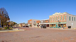
Geography
Mount Ayr is at the intersection of US Route 169 and Iowa Highway 2. Kellerton is approximately nine miles to the east and Diagonal is about eight miles to the northwest. [6]
According to the United States Census Bureau, the city has a total area of 2.69 square miles (6.97 km2), of which 2.67 square miles (6.92 km2) is land and 0.02 square miles (0.05 km2) is water. [7]
Climate
According to the Köppen Climate Classification system, Mount Ayr has a hot-summer humid continental climate, abbreviated "Dfa" on climate maps.
| Climate data for Mount Ayr, Iowa, 1991–2020 normals, extremes 1893–present |
|---|
| Month | Jan | Feb | Mar | Apr | May | Jun | Jul | Aug | Sep | Oct | Nov | Dec | Year |
|---|
| Record high °F (°C) | 67
(19) | 80
(27) | 90
(32) | 92
(33) | 103
(39) | 105
(41) | 112
(44) | 111
(44) | 105
(41) | 93
(34) | 82
(28) | 70
(21) | 112
(44) |
|---|
| Mean maximum °F (°C) | 54.2
(12.3) | 59.3
(15.2) | 73.2
(22.9) | 81.2
(27.3) | 86.1
(30.1) | 90.4
(32.4) | 94.6
(34.8) | 93.3
(34.1) | 89.4
(31.9) | 82.6
(28.1) | 69.4
(20.8) | 58.6
(14.8) | 95.5
(35.3) |
|---|
| Mean daily maximum °F (°C) | 31.9
(−0.1) | 36.8
(2.7) | 49.4
(9.7) | 61.4
(16.3) | 70.8
(21.6) | 80.3
(26.8) | 84.6
(29.2) | 83.3
(28.5) | 76.4
(24.7) | 64.1
(17.8) | 49.0
(9.4) | 36.8
(2.7) | 60.4
(15.8) |
|---|
| Daily mean °F (°C) | 21.8
(−5.7) | 26.5
(−3.1) | 38.5
(3.6) | 49.7
(9.8) | 60.2
(15.7) | 70.0
(21.1) | 74.2
(23.4) | 72.5
(22.5) | 64.5
(18.1) | 52.1
(11.2) | 38.4
(3.6) | 27.2
(−2.7) | 49.6
(9.8) |
|---|
| Mean daily minimum °F (°C) | 11.7
(−11.3) | 16.1
(−8.8) | 27.5
(−2.5) | 38.
(3) | 49.7
(9.8) | 59.6
(15.3) | 63.9
(17.7) | 61.8
(16.6) | 52.7
(11.5) | 40.2
(4.6) | 27.9
(−2.3) | 17.7
(−7.9) | 38.9
(3.8) |
|---|
| Mean minimum °F (°C) | −10.1
(−23.4) | −3.4
(−19.7) | 7.1
(−13.8) | 21.8
(−5.7) | 35.2
(1.8) | 47.3
(8.5) | 53.7
(12.1) | 51.0
(10.6) | 37.2
(2.9) | 24.0
(−4.4) | 10.7
(−11.8) | −3.4
(−19.7) | −14.2
(−25.7) |
|---|
| Record low °F (°C) | −30
(−34) | −29
(−34) | −20
(−29) | 5
(−15) | 22
(−6) | 36
(2) | 41
(5) | 37
(3) | 24
(−4) | 0
(−18) | −15
(−26) | −28
(−33) | −30
(−34) |
|---|
| Average precipitation inches (mm) | 0.73
(19) | 1.25
(32) | 2.16
(55) | 3.37
(86) | 5.35
(136) | 5.39
(137) | 4.40
(112) | 3.98
(101) | 3.71
(94) | 2.88
(73) | 2.11
(54) | 1.63
(41) | 36.96
(940) |
|---|
| Average snowfall inches (cm) | 5.8
(15) | 5.9
(15) | 2.6
(6.6) | 0.7
(1.8) | 0.0
(0.0) | 0.0
(0.0) | 0.0
(0.0) | 0.0
(0.0) | 0.0
(0.0) | 0.3
(0.76) | 1.2
(3.0) | 4.0
(10) | 20.5
(52.16) |
|---|
| Average precipitation days (≥ 0.01 in) | 4.0 | 4.6 | 6.2 | 8.5 | 11.0 | 9.2 | 8.2 | 7.9 | 6.5 | 7.1 | 5.0 | 4.7 | 82.9 |
|---|
| Average snowy days (≥ 0.1 in) | 2.9 | 3.4 | 1.1 | 0.3 | 0.0 | 0.0 | 0.0 | 0.0 | 0.0 | 0.1 | 0.7 | 2.5 | 11 |
|---|
| Source 1: NOAA [8] |
| Source 2: National Weather Service [9] |
Demographics
Historical populations| Year | | |
|---|
| 1870 | 422 | — |
|---|
| 1880 | 1,275 | +202.1% |
|---|
| 1890 | 1,265 | −0.8% |
|---|
| 1900 | 1,729 | +36.7% |
|---|
| 1910 | 1,646 | −4.8% |
|---|
| 1920 | 1,738 | +5.6% |
|---|
| 1930 | 1,704 | −2.0% |
|---|
| 1940 | 1,930 | +13.3% |
|---|
| 1950 | 1,793 | −7.1% |
|---|
| 1960 | 1,738 | −3.1% |
|---|
| 1970 | 1,762 | +1.4% |
|---|
| 1980 | 1,938 | +10.0% |
|---|
| 1990 | 1,796 | −7.3% |
|---|
| 2000 | 1,822 | +1.4% |
|---|
| 2010 | 1,691 | −7.2% |
|---|
| 2020 | 1,623 | −4.0% |
|---|
Source: "U.S. Census website". United States Census Bureau . Retrieved March 29, 2020. and Iowa Data Center
Source: |
2020 census
As of the census of 2020, [11] there were 1,623 people, 739 households, and 437 families residing in the city. The population density was 601.1 inhabitants per square mile (232.1/km2). There were 811 housing units at an average density of 300.4 per square mile (116.0/km2). The racial makeup of the city was 95.4% White, 0.1% Black or African American, 0.2% Native American, 0.3% Asian, 0.0% Pacific Islander, 0.6% from other races and 3.5% from two or more races. Hispanic or Latino persons of any race comprised 2.0% of the population.
Of the 739 households, 26.0% of which had children under the age of 18 living with them, 44.8% were married couples living together, 4.6% were cohabitating couples, 32.7% had a female householder with no spouse or partner present and 17.9% had a male householder with no spouse or partner present. 40.9% of all households were non-families. 35.9% of all households were made up of individuals, 18.0% had someone living alone who was 65 years old or older.
The median age in the city was 45.5 years. 24.2% of the residents were under the age of 20; 4.3% were between the ages of 20 and 24; 21.2% were from 25 and 44; 23.3% were from 45 and 64; and 27.0% were 65 years of age or older. The gender makeup of the city was 46.0% male and 54.0% female.
2010 census
As of the census [12] of 2010, there were 1,691 people, 746 households, and 437 families residing in the city. The population density was 633.3 inhabitants per square mile (244.5/km2). There were 822 housing units at an average density of 307.9 per square mile (118.9/km2). The racial makeup of the city was 98.1% White, 0.1% African American, 0.1% Native American, 0.7% Asian, 0.8% from other races, and 0.4% from two or more races. Hispanic or Latino of any race were 1.6% of the population.
There were 746 households, of which 24.1% had children under the age of 18 living with them, 47.9% were married couples living together, 7.4% had a female householder with no husband present, 3.4% had a male householder with no wife present, and 41.4% were non-families. 37.3% of all households were made up of individuals, and 24.8% had someone living alone who was 65 years of age or older. The average household size was 2.14 and the average family size was 2.80.
The median age in the city was 49.5 years. 19.9% of residents were under the age of 18; 6.3% were between the ages of 18 and 24; 17.5% were from 25 to 44; 26.6% were from 45 to 64; and 29.7% were 65 years of age or older. The gender makeup of the city was 44.5% male and 55.5% female.
2000 census
As of the census [13] of 2000, there were 1,822 people, 780 households, and 492 families residing in the city. The population density was 720.2 inhabitants per square mile (278.1/km2). There were 856 housing units at an average density of 338.4 per square mile (130.7/km2). The racial makeup of the city was 98.96% White, 0.27% Native American, 0.27% Asian, 0.05% from other races, and 0.44% from two or more races. Hispanic or Latino of any race were 0.44% of the population.
There were 780 households, out of which 26.4% had children under the age of 18 living with them, 53.6% were married couples living together, 6.9% had a female householder with no husband present, and 36.9% were non-families. 34.7% of all households were made up of individuals, and 23.5% had someone living alone who was 65 years of age or older. The average household size was 2.21 and the average family size was 2.82.
Age spread: 22.1% under the age of 18, 6.8% from 18 to 24, 20.6% from 25 to 44, 19.7% from 45 to 64, and 30.8% who were 65 years of age or older. The median age was 46 years. For every 100 females, there were 80.4 males. For every 100 females age 18 and over, there were 75.2 males.
The median income for a household in the city was $26,893, and the median income for a family was $37,188. Males had a median income of $27,333 versus $20,184 for females. The per capita income for the city was $14,444. About 8.3% of families and 13.1% of the population were below the poverty line, including 16.1% of those under age 18 and 14.5% of those age 65 or over.
Education
Mount Ayr is the home of the Mount Ayr Community School District, which serves Mount Ayr, Beaconsfield, Benton, Delphos, Ellston, Kellerton, Maloy, Redding, Tingley, and portions of Clearfield. [18]
Mount Ayr has one high school (grades 7-12) [19] and one elementary school (grades K-6), [20] as well as a preschool and alternative high school. Enrollment averages around 50 students in each class. The drama department of Mount Ayr Community High School (MACHS) has produced several students who have played at district and state competitions.
Education statistics
For population 25 years and over in Mount Ayr:
- High school or higher: 81.4%
- Bachelor's degree or higher: 16.6%
- Graduate or professional degree: 5.2%
This page is based on this
Wikipedia article Text is available under the
CC BY-SA 4.0 license; additional terms may apply.
Images, videos and audio are available under their respective licenses.