Douglas County is one of the 36 counties in the U.S. state of Oregon. As of the 2020 census, the population was 111,201. The county seat is Roseburg. The county is named after Stephen A. Douglas, an American politician who supported Oregon statehood. Douglas County comprises the Roseburg, OR Micropolitan Statistical Area. In regards to area, Douglas County is the largest county west of the Oregon Cascades.

Elkton is a city in Douglas County, Oregon, United States. It is located on the lower Umpqua River, at the junction of Oregon Route 38 and Oregon Route 138, about 20 miles (32 km) west of Interstate 5 and about 14 miles (23 km) west of Drain. The population was 195 at the 2010 census, an increase from 147 people in 2000.

Reedsport is a city in northwest Douglas County, Oregon, United States. As of the 2020 census, the population was 4,310.

Riddle is a city in Douglas County, Oregon, United States. The population was 1,185 at the 2010 census.

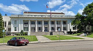
Roseburg is a city in the U.S. state of Oregon. It is in the Umpqua River Valley in southern Oregon and is the county seat and most populous city of Douglas County. Founded in 1851, the population was 23,683 at the 2020 census, making it the principal city of the Roseburg, Oregon Micropolitan Statistical Area. The community developed along both sides of the South Umpqua River and is traversed by Interstate 5. Traditionally a lumber industry town, Roseburg was the original home of Roseburg Forest Products, which is now based in nearby Springfield.

Winchester Bay, formerly Umpqua City, is an unincorporated community in Douglas County, Oregon, United States. For statistical purposes, the United States Census Bureau has defined Winchester Bay as a census-designated place (CDP). The census definition of the area may not precisely correspond to local understanding of the area with the same name. The population of the CDP was 382 at the 2010 census. The community of Umpqua City was established in 1850.

The Umpqua River on the Pacific coast of Oregon in the United States is approximately 111 miles (179 km) long. One of the principal rivers of the Oregon Coast and known for bass and shad, the river drains an expansive network of valleys in the mountains west of the Cascade Range and south of the Willamette Valley, from which it is separated by the Calapooya Mountains. From its source northeast of Roseburg, the Umpqua flows northwest through the Oregon Coast Range and empties into the Pacific at Winchester Bay. The river and its tributaries flow almost entirely within Douglas County, which encompasses most of the watershed of the river from the Cascades to the coast. The "Hundred Valleys of the Umpqua" form the heart of the timber industry of southern Oregon, generally centered on Roseburg.

The South Umpqua River is a tributary of the Umpqua River, approximately 115 miles (185 km) long, in southwestern Oregon in the United States. It drains part of the Cascade Range east of Roseburg. The river passes through a remote canyon in its upper reaches then emerges in the populated South Umpqua Valley east of Canyonville.
The Little River is a tributary of the North Umpqua River, about 30 miles (48 km) long, in southwestern Oregon in the United States. It drains part of the western side of the Cascade Range east of Roseburg, between the North and South Umpqua.
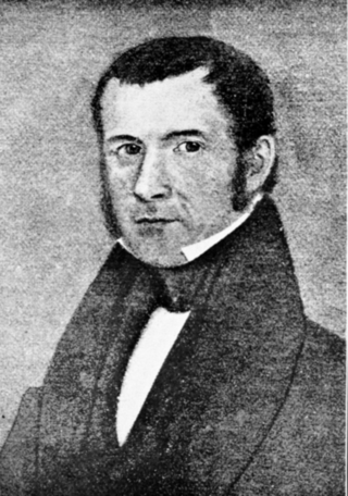
Hall Jackson Kelley was an American settler and writer from New England known for his strong advocacy for settlement by the United States of the Oregon Country in the 1820s and 1830s. A native of New Hampshire, he was a school teacher in Maine and Massachusetts, and a longtime resident of the latter state after graduating from Harvard College.

Umpqua Community College (UCC) is a public community college near Roseburg, Oregon. The college has sixteen campus buildings located on 100 acres (40 ha) bordering the North Umpqua River. The campus also features a track, tennis courts, and an outdoor pool. In 2009, a vineyard was added to the campus. About 3,300 full-time students and 16,000 part-time students attend UCC. Umpqua Community College serves the greater Douglas County region with the exception of Reedsport and its immediate area along the Oregon Coast.
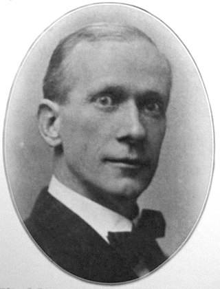
Frank Williamson Benson was an American politician, a Republican, and the 12th Governor of Oregon from 1909 to 1910. A native of California, Benson also served as educator, a land office clerk, and was twice elected as Oregon Secretary of State. From this position he became governor after sitting governor George Earle Chamberlain resigned to become a United States senator.
The Methodist Mission was the Methodist Episcopal Church's 19th-century conversion efforts in the Pacific Northwest. Local Indigenous cultures were introduced to western culture and Christianity. Superintendent Jason Lee was the principal leader for almost a decade. It was a political and religious effort. Two years after the mission began, the church's Board of Foreign Missions described its intent to reclaim "these wandering savages, who are in a very degraded state, to the blessings of Christianity and civilized life." Alongside the missions founded in the region were several secular operations opened. These were maintained to allow for material independence from the Hudson's Bay Company (HBC), then the preeminent economic entity in the region among European descendants.

Lorane is an unincorporated community in Lane County, Oregon, United States. It is located on Territorial Road about 20 miles (32 km) southwest of Eugene; it is 13 miles (21 km) northwest of Cottage Grove. The community is near the headwaters of the North Fork Siuslaw River in a valley in the foothills of the Central Oregon Coast Range. Local businesses include several wineries, including the King Estate Winery, Chateau Lorane Winery and Iris Hill Winery, and two general stores.

Lookingglass is an unincorporated community and census-designated place in the Lookingglass Valley of Douglas County, Oregon, United States, about 9 miles (14 km) southwest of Roseburg. As of the 2010 census it had a population of 855. Lookingglass is considered a suburb of Roseburg.

Milo is an unincorporated community in Douglas County, Oregon, United States, about 17 miles (27 km) east of Canyonville on the South Umpqua River.
Nonpareil is an unincorporated historic community in Douglas County, Oregon, United States. It is about 8 miles (13 km) east of Sutherlin, near Calapooya Creek. The population of the area was about 202 in 2000. Nonpareil was the birthplace of novelist H. L. Davis.

The Umpqua Community College shooting occurred on October 1, 2015, at the UCC campus near Roseburg, Oregon, United States. Chris Harper-Mercer, a 26-year-old student who was enrolled at the school, fatally shot an assistant professor and eight students in a classroom, and injured eight others. Roseburg police detectives responded to the incident and engaged Harper-Mercer in a brief shootout. After being wounded, he committed suicide by shooting himself in the head. The mass shooting is the deadliest in Oregon's modern history.

Elk Creek is a tributary, about 46 miles (74 km) long, of the Umpqua River in the U.S. state of Oregon. The creek begins near Ben More Mountain in the lower Cascade Range south of Elkhead and flows generally north until passing under Interstate 5 in Scotts Valley. It then turns sharply west, flowing through the small city of Drain before meeting the Umpqua at Elkton. Oregon Route 99 runs along the creek for a short distance south of Drain, and Oregon Route 38 follows the creek from Drain to Elkton.
French Settlement is the original name of Melrose, Oregon and its neighbouring valleys in Douglas County including Flournoy, Garden and Coles valleys. It is along the west side of the South Umpqua River South of its fork, a few miles West of Roseburg in Southern Oregon, West of Interstate 5. It roughly occupies a stretch of 8 miles by 4 miles of lush fertile well irrigated soil. The first American newcomers gave the location such a generic name based on the ethnicity or language spoken by the original settlers, namely French Canadians.


