Arlington (Jacksonville)

Last updated

Arlington
Greater Arlington
Fort Caroline moat FOCA1566.jpg
JU2014.JPG
Marabanong mansion, Jacksonville.JPG
Jacksonville FL Fort Caroline Natl Mem Ribault mnmt03.jpg
Mathews Bridge.jpg
from the left, Fort Caroline, Jacksonville University, Marabanong mansion, Ribault Monument and the Mathews Bridge.
Jacksonville divisions.png
Vernacular regions of Jacksonville:
  1. Urban core
  2. Arlington
  3. Southside
  4. Westside
  5. Northside
  6. Beaches
Coordinates: 30°19′16″N81°33′05″W / 30.321205°N 81.551487°W / 30.321205; -81.551487
Country Flag of the United States.svg  United States
State Flag of Florida.svg  Florida
City Flag of Jacksonville, Florida.svg  Jacksonville
Government
   Florida House Reggie Fullwood
Charles McBurney
   Florida Senate Aaron Bean
Audrey Gibson
   U.S. House John Rutherford (R)
Area
  Land64.307 sq mi (166.55 km2)
Population
 (2013)
  Total120,593 [1]
  Density1,875/sq mi (724/km2)
ZIP Code
32277, 32211, 32225
Area code 904

Arlington is a large region of Jacksonville, Florida, and is generally understood as a counterpart to the city's other large regions, the Urban Core, Northside, Southside, Westside, and the Beaches. It borders the Southside area at its southern end, and has several bridge connections to nearby beaches, the Northside and Downtown. The expansive neighborhood was incorporated into the city in 1968 as a result the Jacksonville Consolidation, a city-county consolidation of the governments of the City of Jacksonville and Duval County. Arlington is known for its mid-century modern architecture, and contains several architecturally significant homes designed by local architects Robert C. Broward, Taylor Hardwick, and William Morgan.

Contents

History

Fort Caroline depicted in an old etching Fort caroline.jpg
Fort Caroline depicted in an old etching

Arlington was one of the first areas in the United States visited by Europeans; it was the site of the French Fort Caroline in 1564–1565, now represented by the Fort Caroline National Memorial. After the destruction of Fort Caroline, the area was only sparsely inhabited until the 19th century, when sawmills and plantations were established along the St. Johns River. After the American Civil War these gave way to residential developments, which were gradually absorbed into the Arlington community as it grew.

Completed in 1910, Atlantic Boulevard was Florida's first modern "improved" highway and is considered to have been the beginning of the state's highway system. The highway connects the mainland portion of the city of Jacksonville with the Jacksonville Beaches. Its eastern terminus is in the San Marco neighborhood; running through Arlington and on to the Atlantic Ocean at the Jacksonville Beaches. [2] First proposed in the 1890s by Eugene F. Gilbert, who personally paid for land surveys and eventually convinced the Duval County Commission to use convict labor to start building the road. A new set of county commissioners would eventually terminate the project as it neared completion. The road was eventually completed after the arrival of the automobile. [3] [4] Originally only 18 feet (5.5 m) wide, the road would soon draw criticism as being too narrow for the large amount of traffic carried between the mainland and the beach. [5]

Poster for The Flying Ace starring Laurence Criner The Flying Ace.jpg
Poster for The Flying Ace starring Laurence Criner

Film Company Norman Studios was in Arlington in the 1920s. The studio's films included race films with African American casts.

In 1947 the administration of Jacksonville University purchased land in the Arlington neighborhood on which to establish a main campus. The first building was completed in 1950 and classes officially began. [6] The same year the school received full accreditation as a two-year college from the Southern Association of Colleges and Schools (SACS). [7] Originally known as William J. Porter University, Jacksonville University was founded in 1934 by William J. Porter. It began as a small private two-year college. [7] Sixty students were enrolled in Porter University's first year of operation. [8] The school changed its name to Jacksonville Junior College in 1935. It relocated three times over the next fifteen years, but the influx of GI bill students following the end of World War II made a permanent location necessary. [7] The school received full accreditation in 1962 as a four-year school from SACS.

Following the 1953 opening of the Mathews Bridge the Arlington area experienced a significant increase in development, maintaining a faster growth rate than any other area in Jacksonville for two decades. The Mathews Bridge is a cantilever bridge which spans the St. Johns River, brings traffic along the Arlington Expressway between Downtown Jacksonville and Arlington. Midway between downtown and the beaches, the Sandalwood neighborhood began developing in spring of 1960 and is just one example of the many planned subdivisions beginning to sprawl across the area at that time. [9]

Opening in 1967, Regency Square Mall is an enclosed shopping mall developed by Regency Centers. Constructed at an expanse of sand dunes at an expense of $12 million, it initially featured three anchor stores: national chain JCPenney, along with May-Cohens and Furchgotts. The mall also included a Woolworth dime store as a junior anchor, a cafeteria style Piccadilly restaurant, as well as the single-screen Regency Cinema. Annie Tiques bar and restaurant opened on an outparcel of the mall. According to an Urban Land Institute study published by the Florida Times-Union in 1979, it was one of the most profitable retail centers in the nation, with yearly average sales of $156/ft² versus a national average of $88/ft². To give back to the community, the mall operators turned over thousands of dollars in coins from their decorative fountains to charities. All types of social events, from art shows to science fairs to horticultural exhibits were held there.

Construction of the Dames Point Bridge began in 1985 and was completed in 1989. The bridge crosses the St. Johns River using a cable-stayed design, connecting Arlington to the Northside of Jacksonville. designed by HNTB Corporation and RS&H, Inc, and constructed by The Massman Construction Company, the main span is 1,300 feet (396.2 m), and is 175 feet (53.3 m) high. [10] When built, it was longest concrete cable-stayed bridge in the world. [11]

Geography

Together with Northside, Westside, and Southside, Arlington is considered one of the large sections of Jacksonville. Initially, Arlington was a small settlement across the St. Johns River east of the present day central business district. The area grew substantially in the latter part of the 20th century, and now includes many smaller neighborhoods and developments. Today it refers to most of Jacksonville east and south of the St. Johns, west of the Intracoastal Waterway, and north of the Arlington River and Southside. [12] Using GIS to sort 87 businesses with "Arlington" in their name, McEwen came to a similar definition, though noted that Arlington overlaps with Southside at its southern end. [13]

Parks and open spaces

Economy

Regency Tower is an office building located near the corner of Regency Square Boulevard and Monument Road. RegencyTowerJacksonsonville.JPG
Regency Tower is an office building located near the corner of Regency Square Boulevard and Monument Road.

Commercial districts

The Regency area describes the commercial and retail development centered around Regency Square Mall. The commercial district encompasses an area equitable in size to Jacksonville's downtown, and consist of multiple corridors along the Southside Connector (SR 113). These include SR 115 (Southside Boulevard), SR 10 (Atlantic Boulevard), Regency Square Boulevard and Tredinick Parkway. [14] In a 2010 Arlington vision plan, citizens recognized the Regency Square Mall property as being ripe for redevelopment, with the potential to attract new businesses and consumers. The comprehensive report covered environmental, economic, and quality of life issues in the Greater Arlington region. The groups approach to the mall property was to redevelop the land with transportation and density in mind. The approach would entail mix-used structures, a gridded street pattern, and infill development. Emphasis is put on the vastness of the area and its equitable size to downtown. [14] Crowley Maritime Corporation, a shipping company, is headquartered in the Regency business district. [15] As of July 2016, the company was ranked the 13th largest private company in Florida, with revenue of $2.2 billion. [16]

Education

The Duval County Public Schools district operates public schools, including Terry Parker High School, Arlington Middle School and Fort Caroline Middle School.

Higher education

Private colleges

Jacksonville University (JU) is a private university founded in 1934. It is a member of the Independent Colleges and Universities of Florida and is accredited by the Southern Association of Colleges and Schools (SACS) and the Association to Advance Collegiate Schools of Business (AACSB). JU offers more than 70 majors and programs at the undergraduate level, 23 master's degree programs and doctorate degree programs, leading to the M.S., M.A., M.A.T., and Master of Business Administration, and Doctor of Nursing Practice (DNP). The university is divided into four colleges and two institutes: the College of Arts and Sciences, the Davis College of Business (DCOB), the College of Fine Arts (CFA), the Brooks Rehabilitation College of Healthcare Sciences (BRCHS), the Marine Science Research Institute (MSRI), and its newest addition, the Public Policy Institute (PPI).

Public colleges

The south campus of Florida State College at Jacksonville is located at 11901 Beach Boulevard.

Transportation

Airports

Jacksonville Executive at Craig Airport ( IATA : CRG, ICAO : KCRG, FAA LID : CRG) is a public airport owned by the Jacksonville Aviation Authority. The airport covers an area of 1,432 acres (580 ha) containing two asphalt paved runways: 5/23 measuring 4,004 x 120 ft and 14/32 measuring 4,008 x 120 ft. [17] The mid-sized general aviation airport handling 400-500 aircraft operations daily, consisting of personal aircraft and small commuter planes. On June 15, 1946, the United States Navy's Blue Angels performed their first airshow at Jacksonville Executive at Craig Airport. [18]

Public transportation

Arlington is served by several Jacksonville Transportation Authority (JTA) bus routes. On December 1, 2014, JTA underwent a complete system redesign called Route Optimization. This was to provide more frequent, more direct, and more reliable service. The new routes in Arlington were as follows. [19]

Roadways and bridges

Highways

Several major limited access highways traverse Arlington. These include:

Bridges

One bridge connects Arlington to Downtown Jacksonville, one bridge connects the Northside and two access the Beaches. These include, from west to east:

To Downtown: the Mathews Bridge

To the Northside: the Dames Point Bridge, officially known as the Napoleon Bonaparte Broward Bridge.

To the Beaches: the Charles E. Bennett Memorial Bridge and the Atlantic Boulevard Bridge

See also

Related Research Articles

<span class="mw-page-title-main">Jacksonville, Florida</span> City in Florida, United States

Jacksonville is a city located on the Atlantic coast of northeastern Florida, the most populous city proper in the state and the largest city by area in the contiguous United States as of 2020. It is the seat of Duval County, with which the city government consolidated in 1968.

<span class="mw-page-title-main">Interstate 295 (Florida)</span> Interstate Highway in Florida, United States

Interstate 295 (I-295), an auxiliary route of I-95, is a beltway around central Jacksonville, Florida, United States. The 61.04-mile-long (98.23 km) beltway consists of two segments, the West Beltway and the East Beltway, with I-95 serving as the dividing line between the two. The entire highway carries a hidden designation as SR 9A by the Florida Department of Transportation (FDOT). The West Beltway was constructed in the 1970s, with the East Beltway being built from the 1980s to the 2000s.

<span class="mw-page-title-main">Florida State College at Jacksonville</span> American public college system in Florida

Florida State College at Jacksonville (FSCJ) is a public college in Jacksonville, Florida. It is part of the Florida College System and one of several institutions in that system designated a "state college" as it offers a greater number of four-year bachelor's degrees than traditional community colleges.

<span class="mw-page-title-main">Jacksonville Transportation Authority</span> Agency responsible for public transit in Jacksonville

The Jacksonville Transportation Authority (JTA) is the independent agency responsible for public transit in the city of Jacksonville, Florida, and roadway infrastructure that connects northeast Florida. However, they do not maintain any roadways. In 2022, the system had a ridership of 6,646,100, or about 21,400 per weekday as of the second quarter of 2023.

<span class="mw-page-title-main">Florida State Road 202</span> Highway in Florida

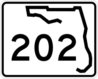
State Road 202 (SR 202) is a 13.042-mile-long (20.989 km) state highway that extends from U.S. Route 1, in Jacksonville, Florida to SR A1A, in Jacksonville Beach, near the Atlantic Ocean, just north of Ponte Vedra Beach, and includes a bridge over the Intracoastal Waterway. To locals, the road is better known as J. Turner Butler Boulevard, Butler Boulevard, or JTB. Except for a 0.5-mile-long (800 m) section from US 1 to Interstate 95 (I-95), it is a completely limited-access expressway. It was constructed in sections by the Jacksonville Transportation Authority. The first section opened in 1979, but the entire road was not completed until 1997.

<span class="mw-page-title-main">Jacksonville metropolitan area, Florida</span> Metropolitan statistical area in the United States

The Jacksonville Metropolitan Area, also called the First Coast, Metro Jacksonville, or Northeast Florida, is the metropolitan area centered on the principal city of Jacksonville, Florida and including the First Coast of North Florida. As of the 2020 United States census, the total population was 1,605,848. The Jacksonville–St. Marys–Palatka, FL–GA Combined Statistical Area (CSA) had a population of 1,733,937 in 2020 and was the 34th largest CSA in the United States. The Jacksonville metropolitan area is the 40th largest in the country and the fourth largest in the State of Florida, behind the Miami, Tampa, and Orlando metropolitan areas.

<span class="mw-page-title-main">Interstate 95 in Florida</span> Highway in Florida

Interstate 95 (I-95) is the main Interstate Highway of Florida's Atlantic Coast. It begins at a partial interchange with US Highway 1 (US 1) just south of downtown Miami and heads north through Jacksonville, and to the Georgia state line at the St. Marys River near Becker. The route also passes through the cities of Fort Lauderdale, West Palm Beach, Port St. Lucie, Titusville, and Daytona Beach.

<span class="mw-page-title-main">Florida State Road 228</span> Highway in Florida, USA

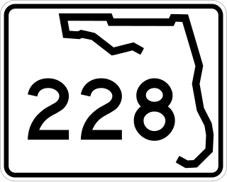
State Road 228 (SR 228) is a 32.532-mile-long (52.355 km) state highway in the northeastern part of the U.S. state of Florida. It exists in two distinct sections, separated by both Baker County Road 228 and Duval CR 228, which are former segments of SR 228.

<span class="mw-page-title-main">Arlington Expressway</span>

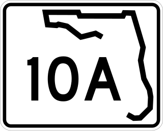
The Arlington Expressway, which carries the unsigned State Road 10A and mostly also the signed State Road 115 in Jacksonville, Florida, is a freeway that heads east from Downtown Jacksonville over the Mathews Bridge to Atlantic Boulevard at the Regency Square Mall.

<span class="mw-page-title-main">Florida State Road 115</span>

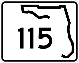
State Road 115 is a state highway in the U.S. state of Florida.

<span class="mw-page-title-main">Downtown Jacksonville</span> Neighborhood of Jacksonville, Florida

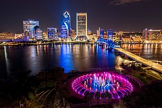
Downtown Jacksonville is the historic core and central business district (CBD) of Jacksonville, Florida. It comprises the earliest area of the city to be developed and is located in its geographic center along the narrowing point of the St. Johns River.

<span class="mw-page-title-main">Neighborhoods of Jacksonville</span>

There are more than 500 neighborhoods within the area of Jacksonville, Florida, the largest city in the contiguous United States by area. These include Downtown Jacksonville and surrounding neighborhoods. Additionally, greater Jacksonville is traditionally divided into several major sections with amorphous boundaries: Northside, Westside, Southside, and Arlington, as well as the Jacksonville Beaches.

<span class="mw-page-title-main">Beach Boulevard (Jacksonville)</span>

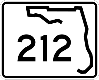
Beach Boulevard is an east–west road running from Jacksonville, Florida, United States east to Jacksonville Beach. Most of the road is part of U.S. Route 90 and unsigned as State Road 212, and a small portion at the eastern end is unsigned as County Road 212.

<span class="mw-page-title-main">Florida State Road 109</span>

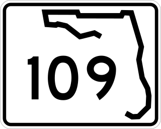
State Road 109 is a 8.707-mile-long (14.013 km) state road in Jacksonville, Florida. It is an east–west road that starts at SR 13 and ends at Jacksonville University. SR 109 is known as University Boulevard because the route forms the eastern border of Jacksonville University's campus.

Roosevelt Boulevard is a six lane highway on the west side of Jacksonville, Florida. It takes US 17 and SR 15, from the Duval county line just south Interstate 295, until its northern end at Willow Branch Avenue, with the road itself becoming one of the incarnations of College Street in the Riverside area of Jacksonville.

<span class="mw-page-title-main">Florida State Road 116</span>

State Road 116 (SR 116) is a 9.026-mile-long (14.526 km) state highway in the northeastern part of the U.S. state of Florida. It travels nearly due west-east entirely within the city limits of Jacksonville, in Duval County. At its west terminus, SR 116 is signed as Merrill Road beginning at the intersection with Interstate 295 and SR 113 near the St. Johns River. At its eastern terminus, it is signed as Wonderwood Road, ending at the intersection with SR 101 just south of Naval Station Mayport. Here, the Wonderwood Road designation continues to Hanna Park.

<span class="mw-page-title-main">Florida State Road 113</span>

State Road 113 (SR 113), also known as Southside Connector, is a 2.770-mile-long (4.458 km) state highway. The freeway travels almost due north–south entirely within the neighborhood of Jacksonville known as Arlington. This is completely within the city limits of Jacksonville, in Duval County, in the U.S. state of Florida. As its name implies, it "connects" SR 115 with Interstate 295 (I-295).

<span class="mw-page-title-main">Transportation in Jacksonville, Florida</span> Overview of transportation in Jacksonville, Florida

The Jacksonville transportation network includes ground, air, and sea options for passenger and freight transit. The Jacksonville Port Authority (Jaxport) operates the Port of Jacksonville, which includes container shipping facilities at Blount Island Marine Terminal, the Talleyrand Marine Terminal and the Dames Point Marine Terminal. Jacksonville Aviation Authority managers Jacksonville International Airport in Northside, as well as several smaller airports. The Jacksonville Transportation Authority (JTA) operates bus, people mover, and park-n-ride services throughout the city and region. A major bus terminal at the intermodal Rosa Parks Transit Station serves as JTA's main transit hub. Various intercity bus companies terminate near Central Station. Amtrak operates passenger rail service to and from major cities throughout North America. The city is bisected by major highways, I-95 and I-10, I-295 creates a full beltway around the city.

<span class="mw-page-title-main">Northside (Jacksonville)</span> Region of Jacksonville, Florida, US

The Northside is a large region of Jacksonville, Florida, and is generally understood as a counterpart to the city's other large regions, the Urban Core, Arlington, Southside, Westside, and the Beaches. The expansive area consists of historic communities, cultural landmarks, protected ecosystems and vital transportation and logistics facilities, all fundamental to the history and development of Jacksonville.

<span class="mw-page-title-main">Architecture of Jacksonville</span>

The architecture of Jacksonville is a combination of historic and modern styles reflecting the city's early position as a regional center of business. According to the National Trust for Historic Preservation, there are more buildings built before 1967 in Jacksonville than any other city in Florida, though few structures in the city center predate the Great Fire of 1901. Numerous buildings in the city have held state height records, dating as far back as 1902, and last holding a record in 1981.

References

Notes

    Citations

    1. "Greater Arlington neighborhood". www.city-data.com. Retrieved January 1, 2018.
    2. Frommer's USA . 2009. Page 364
    3. Bill Foley, Atlantic, Girvin met on road in 1910, Florida Times Union , 25 July 1998
    4. Bill Foley, A 'typical Yankee' is to thank for road, Florida Times Union , 20 August 1997
    5. Charles E. Foote, Road Improvement in the Far South, The Horseless Age 35(9), pages 351-352. March 10, 1915.
    6. Humphrey, Joe (September 29, 2000). "The hidden treasure awaiting excavation". The Florida Times-Union . Retrieved October 20, 2010.
    7. 1 2 3 "Timeline" Archived 2010-09-28 at the Wayback Machine . www.ju.edu. Retrieved October 20, 2010.
    8. "75th Anniversary" Archived 2010-09-24 at the Wayback Machine . www.ju.edu. Retrieved October 20, 2010.
    9. Conner, Deirdre:"Saving Arlington: What residents are doing to save it" Florida Times-Union, February 14, 2010
    10. Hannan, Larry (March 10, 2009). "Dames Point bridge reaches 20-year mark". The Florida Times-Union . Retrieved January 13, 2018.
    11. Stepzinski, Teresa (March 9, 2014). "Dames Point bridge spans 25 years, uniting city, sparking growth". The Florida Times-Union . Retrieved January 13, 2018.
    12. Wood, pp. 302–303.
    13. McEwen, p. 64, 69.
    14. 1 2 "Greater Arlington/Beaches Greater Arlington/Beaches Vision Plan". Zyscovich Architects. City of Jacksonville Planning and Development Department. 2010. pp. 35–36. Retrieved January 13, 2018.
    15. "Crowley Career & Scholarships". Edumaritime.com. Retrieved January 13, 2018.
    16. Amy Keller, Mike Vogel (July 1, 2016). "Florida Trend 350". Florida Trend. Retrieved January 13, 2018.
    17. FAA Airport Form 5010 for CRG PDF , effective 2007-10-25
    18. "U.S. Navy Blue Angels | Home". www.blueangels.navy.mil. Retrieved August 31, 2020.
    19. "Pages - Main". Archived from the original on April 19, 2016. Retrieved January 13, 2018.

    Further reading

    Associations:

    History: