
North Side refers to the region of Pittsburgh, Pennsylvania, located to the north of the Allegheny River and the Ohio River. The term "North Side" does not refer to a specific neighborhood, but rather to a disparate collection of contiguous neighborhoods.

North Park is one of 77 well-defined community areas of the City of Chicago. It is bordered by the North Shore Channel on the east, the Chicago River's North Branch and Foster Avenue on the south, Cicero Avenue on the west and Devon Avenue on the north.

Northside is a neighborhood in Cincinnati, Ohio. It was originally known as Cumminsville, but changed names to "Northside" several decades ago after I-74 divided the neighborhood into Northside and South Cumminsville. The population was 7,467 at the 2010 census. Northside has a very racially and socio-economically diverse population, with concentrations of college students, artists, young professionals, and many members of the creative class. In recent years, Northside has earned a reputation as welcoming to Cincinnati's gay and lesbian community.

Downtown Jacksonville is the historic core and central business district (CBD) of Jacksonville, Florida USA. It comprises the earliest area of the city to be developed and is located in its geographic center along the narrowing point of the St. Johns River. There are various definitions of what constitutes Jacksonville's downtown; the one used by the city government and other entities defines it as including eight districts: the Central Core, the Southbank, LaVilla, Brooklyn, the Working Waterfront, the Cathedral, the Church, and the Entertainment & Sports District. The area features offices for major corporations such as CSX Corporation, Fidelity National Financial, TIAA Bank, Black Knight Financial, One Call Care Management, Suddath, Interline Brands Haskell, FIS, and Stein Mart.
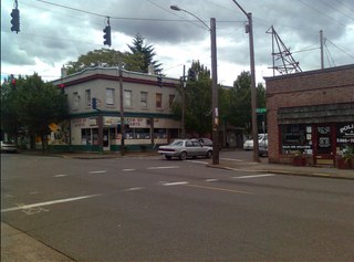
The Beaumont-Wilshire neighborhood of Portland, Oregon is located in the city's northeast section, on Alameda Ridge with views of Downtown, the Willamette River, and the Cascades. It is bordered by the Alameda, Concordia, Cully, Rose City Park, and Grant Park neighborhoods. "Beaumont Village", located on NE Fremont Street, from NE 33rd Ave. to NE 50th Ave., is the main commercial district in the neighborhood, but the neighborhood also lies within walking distance of the Hollywood District, a major commercial and shopping area to the south.

There are more than 500 neighborhoods within the area of Jacksonville, Florida, the largest city in the contiguous United States by area. These include Downtown Jacksonville and surrounding neighborhoods. Additionally, greater Jacksonville is traditionally divided into several major sections with amorphous boundaries: Northside, Westside, Southside, and Arlington, as well as the Jacksonville Beaches.

Neighborhoods in Spokane, Washington are officially grouped by the Spokane City Council into three main city council districts: 1, 2, and 3. Each city council district contains multiple, official neighborhoods that are recognized with a neighborhood council. Informally, neighborhoods are colloquially grouped by local geographical, geological, cultural, or historical features The list of neighborhoods below is organized based on the official designations by the City of Spokane. Unofficial neighborhoods and districts are listed within the official neighborhood in which they are located.

The neighborhoods of Milwaukee include a number of areas in southeastern Wisconsin within the state's largest city at nearly 600,000 residents.
The Mt. Scott-Arleta neighborhood of Portland, Oregon is located in the city's southeast quadrant. It is bounded on the north by SE Foster Road, west by SE 60th Avenue, east by SE 82nd Avenue, and south by SE Duke. Mt. Scott-Arleta borders the neighborhoods of Woodstock on the west, Foster-Powell on the north, Lents on the east, and Brentwood-Darlington on the south.
Columbus, the state capital and Ohio's largest city, has numerous neighborhoods within its city limits. Neighborhood names and boundaries are not officially defined. They may vary or change from time to time due to demographic and economic variables.

Clark Street is a north-south street in Chicago, Illinois that runs close to the shore of Lake Michigan from the northern city boundary with Evanston, to 2200 South in the city street numbering system. At its northern end, Clark Street is at 1800 West; however the street runs diagonally through the Chicago grid for about 8 miles (13 km) to North Avenue and then runs at 100 West for the rest of its course south to Cermak Road. It is also seen in Riverdale beyond 127th street across the Calumet River, along with other nearby streets that ended just south of the Loop. The major length of Clark Street runs a total of 98 blocks.

The Trout River is a 20-mile-long (32 km) tributary of the St. Johns River in Duval County, Florida. Located entirely within Jacksonville's Northside area, the river is brackish in its lower section. The widest point of the river is near the St. Johns River, where it is 0.6 miles (1.0 km) across. The Trout River has wetlands as far as the mouth of the river's longest tributary, the Ribault River.
The neighborhoods of Omaha are a diverse collection of community areas and specific enclaves. They are spread throughout the Omaha metro area, and are all on the Nebraska side of the Missouri River.
Roosevelt Boulevard is a six lane highway on the west side of Jacksonville, Florida. It takes US 17 and SR 15, from the Duval county line just south Interstate 295, until its northern end at Willow Branch Avenue, with the road itself becoming one of the incarnations of College Street in the Riverside area of Jacksonville.

Riverside and Avondale are two adjacent and closely associated neighborhoods, alternatively considered one continuous neighborhood, of Jacksonville, Florida. The area is primarily residential, but includes some commercial districts, including Five Points, the King Street District, and the Shoppes of Avondale.

Brooklyn is a neighborhood of Jacksonville, Florida, considered part of the downtown area. Originally a residential suburb, commercial uses became prominent during the 20th century, particularly along the St. Johns River and Riverside Avenue, and the area became included in Jacksonville's central business district. In the 21st century, it has become the site of mixed-use developments.

The Southbank is a neighborhood of Jacksonville, Florida, considered part of the Urban Core.
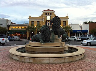
San Marco is a neighborhood of Jacksonville, Florida, south of Downtown across the St. Johns River. The neighborhood was formerly the independent city of South Jacksonville until it was annexed by Jacksonville in 1932. The neighborhood is primarily residential, with an integrated commercial sector known as San Marco Square.

The Northside is a large region of Jacksonville, Florida, and is generally understood as a counterpart to the city's other large regions, the Urban Core, Arlington, Southside, Westside, and the Beaches. The expansive area consists of historic communities, cultural landmarks, protected ecosystems and vital transportation and logistics facilities, all fundamental to the history and development of Jacksonville.


