from the left, Blount Island Marine Terminal, Jacksonville Zoo Asian Bamboo Garden, Kingsley Plantation, Jacksonville International Airport and Big Talbot Island.
The Northside is a large region of Jacksonville, Florida, and is generally understood as a counterpart to the city's other large regions, the Urban Core, Arlington, Southside, Westside, and the Beaches. The expansive area consists of historic communities, cultural landmarks, protected ecosystems and vital transportation and logistics facilities, all fundamental to the history and development of Jacksonville.
The Northside area has yielded some of the oldest known pottery from what is now the United States, uncovered by a University of North Florida team on Black Hammock Island in the Timucuan Ecological and Historic Preserve.[1] The team also excavated more recent artifacts contemporary with the Mocama chiefdoms and some that indicate a Spanish mission. Archaeological research dates human habitation in the area eventually known as the Mocama Province to at least 2500 BC.[2][3]
Established near the mouth of the St. Johns River, on Fort George Island, San Juan del Puerto was a Spanish Franciscanmission, founded some time before 1587. It was founded to serve the Saturiwa, a Timucua tribe who lived in the area. It has an important place in the study of the Timucua, as the place where Father Francisco Pareja undertook his work on the Timucua language. He devised a system of writing for Timucuan[4] and taught some of the Mocama. In 1612, he printed a catechism in Spanish and Timucua, the first book printed in an indigenous language of the Americas.[5] This became one of the three principal missions in what the Spanish called the Mocama Province, together with San Pedro de Mocama (serving the Tacatacuru chiefdom) on Cumberland Island and Santa Maria de Sena between them on Amelia Island.[3] After 1650, Guale refugees from the next chiefdom to the north along the (present-day) Georgia coast were settled at the mission. The Spanish abandoned the mission around 1702, partly in response to raids from Native Americans and allied Englishcolonists from South Carolina during Queen Anne's War.
The United Kingdom took ownership of Florida in 1763, and quickly established several plantations in the region. Richard Hazard owned the first plantation on Fort George Island in 1765, harvesting indigo with several dozen enslaved Africans. Spain regained ownership of Florida in 1783 after the American Revolution and recruited new Americans with promises of free land.[6] In 1793, American Revolution veteran John McQueen was lured to Fort George Island from South Carolina by the Spanish government, which rewarded McQueen with the island. McQueen settled with 300 slaves and constructed a large house, but was soon bankrupt due to misfortunes. Possession of the plantation turned over to John McIntosh from Georgia, who revived it in 1804.[7] McIntosh, however, took a leading role in an insurgency attempting to annex Florida into the United States. Unsuccessful, McIntosh fled back into Georgia to escape punishment from the Spanish.[8]Zephaniah Kingsley settled on Fort George Island in 1814, after leasing the estate from McIntosh. He purchased the land and buildings for $7,000 in 1817. Today, it is now known as Kingsley Plantation. Free blacks and several private owners lived at the plantation until it was transferred to the State of Florida in 1955. It was acquired by the National Park Service in 1991. The main house, kitchen and numerous slave quarters have survived.
1940 Census Enumeration District Map of the Riverview neighborhood, and the surrounding communities
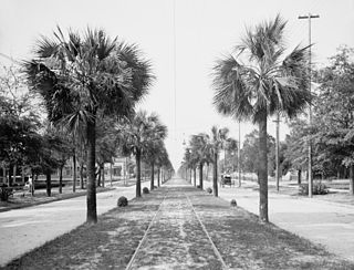
The Northside began to grow as a suburb of Jacksonville in the 19th century. Although the site of East Florida's first steam-powered sawmill, completed in 1828, major growth in Panama Park only came after 1905. In 1915, a new school was constructed, notably designed by architect Henry J. Klutho. By 1931, Panama Park was annexed by Jacksonville.[9] Tallulah-North Shore, a neighborhood adjacent to Panama Park, was first platted in 1879. The area was annexed by Jacksonville in 1925.[10] Riverview is a neighborhood bordered by the Trout River to the North and East, Ribault River to the South, and Ribault Ave to the West.[11] Riverview was originally platted in 1911 by Dr. E.H. Armstrong. Dr. Armstrong also converted his 25-acre waterfront home property into Riverview Tropical Gardens, an attraction with boating, fishing and garden trails of roses, azaleas, and lilies.[12] In 1979, the city purchased the land and converted the property into a public park.[13] On July 19, 1925, the Jacksonville Zoo and Gardens moved to a 37.5-acre (152,000m2) site on the Trout River, off Heckscher Drive. The zoo had formerly operated in the Springfield neighborhood since May 12, 1914.
Imeson Airport
The Jacksonville Municipal Airport opened on October 11, 1927, at the intersection of North Main Street (U.S. 17) and Busch Drive. The dedication ceremony was notably attended by Charles Lindbergh, who flew to Jacksonville in the "Spirit of St. Louis" to promote the new airport. Eastern Air Service (later known as Eastern Air Lines) was the first passenger airline to service Jacksonville, beginning in 1931. By 1941 the airport had expanded to 600 acres (240ha) adding five hangars, a terminal building and five asphalt runways. The first scheduled jet flights were Northeast Convair 880s in April–May 1961. The facility was renamed after Thomas Cole Imeson in the 1950s. Imeson's work led to the creation of the Jacksonville Municipal Airport, as well as improvements to its runways, hangars and terminal buildings. Imeson Field served as the city's main airport for 42 years. Jacksonville International Airport, also located on the Northside, was dedicated on September 1, 1968, replacing Imeson Field.
On October 1, 1968, the city and county governments merged to create the Consolidated City of Jacksonville, winning voter approval the year prior. Fire, police, health & welfare, recreation, public works, and housing & urban development were all unified under the new government. The consolidation created a 900-square-mile entity. Jacksonville Consolidation was led by J. J. Daniel and Claude Yates, who found support from both inner-city blacks, who wanted more involvement in government after passage of the Voting Rights Act of 1965, that provided federal oversight and enforcement of their right to vote, and whites in the suburbs, who wanted more services and more control over the central city. Lower taxes, increased economic development, unification of the community, better public spending, and effective administration by a more central authority were all cited as reasons for a new consolidated government.[14]
Construction of the Dames Point Bridge began in 1985 and was completed in 1989. The bridge crosses the St. Johns River using a cable-stayed design, connecting Arlington to the Northside of Jacksonville. designed by HNTB Corporation and RS&H, Inc, and constructed by The Massman Construction Company, the main span is 1,300 feet (396.2m), and is 175 feet (53.3m) high.[17] Upon completion, it was longest concrete cable-stayed bridge in the world.[18]
Opening in 2003, the JAXPORT Cruise Terminal was completed in only six months, and was intended to be a temporary structure. Maintained by the Jacksonville Port Authority, the cruise shipterminal is located near the Dames Point Bridge, on the northern banks of the St. Johns River.[19]Celebrity Cruises began regular service from Jacksonville on October 27, 2003, discontinuing service in 2005.[20] The ship Carnival Miracle was christened at the Port of Jacksonville on February 27, 2004, beginning Jacksonville service by Carnival Cruise Lines.[21] Five cruise ships were chartered to serve as floating hotels during the week preceding Super Bowl XXXIX in February 2005. Four of the vessels docked at JAXPORT terminals, providing over 3,500 rooms plus restaurants and night clubs for fans.[22] As of 2019, cruises from Jacksonville visit the Bahamas and Eastern Caribbean on board the Carnival Ecstasy.[23]
River City Marketplace opened on November 17, 2006 as the only quasi-regional outdoor shopping mall in the Northside, and the only one north of the St. Johns River. The 125-acre (0.51km2) shopping district is located south of Airport Road on the east side of Interstate 95, two miles (3km) east of Jacksonville International Airport. When Phase II is fully built out, the project will have cost over $300 million to build and boast more than 100 retailers. [24]
Together with the Urban Core, Arlington, Southside, Westside and the Beaches, Northside is considered one of the large regions of Jacksonville, and the remaining municipalities in Duval County. As the name would suggest, the Northside consist of areas in northern Jacksonville, but there is no consistent definition for what constitute the boundaries of the region. The geographer John W. McEwen determined, using a Geographic Information System to sort names of 47 businesses with "Northside" in their name, that the area is roughly considered to be north of the Urban Core and north of Westside at 20th Street, and stretching west and north of the St. Johns River.[25]
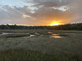
The Trout River is one of the most defining geographic feature of the Northside. The 20-mile-long (32km) long tributary of the St. Johns River is located entirely within Jacksonville's Northside, and is considered brackish in its lower section.[26] The Trout River has wetlands as far as the mouth of the river's longest tributary, the Ribault River. A notable feature itself, the Ribault River is named after Jean Ribault, a French naval officer. The river's headwaters are near Old Kings Road at an elevation of 7 feet (2.1m) above sea level. The river cuts through the forest floor near its source, that portion of the river being classified as a creek. The river flows northward, as does the St. Johns River and many of the other tributaries of the Trout River. The river is 6.4 miles (10.3km) long.[26] Black Hammock Island is an island in a marsh area at the edge of Jacksonville, Florida, in the United States. It lies almost directly adjacent to the Timucuan Ecological and Historic Preserve. Cedar Point is located at the south end of Black Hammock Island.[27]
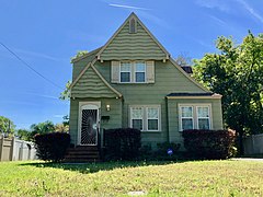
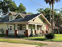
There are numerous neighborhoods located within the vast area of the Northside. These include, but are not limited to, Black Hammock Island, Brentwood, Dinsmore, Fort George Island, Garden City, Highlands, Lake Forest, Longbranch, Moncrief Park, Norwood, Panama Park, Pecan Park, Oceanway, Ribault, Riverview, Royal Terrance, San Mateo and Tallulah-North Shore.
The Northside has protected lands operated by a variety of entities, including the National Park Service, Florida State Parks, City of Jacksonville Department of Parks and Recreation, and other private ventures.
Jacksonville operates the largest urban park system in the United States, providing facilities and services at more than 337 locations on more than 80,000 acres (320km2)[28] City parks located in the Northside include the following:
Alimacani Park is located on scenic State Road A1A on the south bank of the Fort George River. The marshy location offers ample bird observation. A boat ramp provides access to Fort George River and its tributaries.[29]
Betz-Tiger Point Preserve is surrounded by scenic saltwater marsh and offers views diverse wildlife includes gopher tortoise, birds, dolphins and reptiles. Pumpkin Hill Creek Preserve State Park and Betz Tiger Point Preserve adjoin.[30]
Cedar Point Preserve is located on Black Hammock Island and provides a habitat to several bird species.[31]
Huguenot Memorial Park is located on the Atlantic Ocean between the St. Johns River and the Fort George Inlet. The park requires an admission fee for access and features campsites, rental cabins and a nature center.[32]
Seaton Creek Historic Preserve is a pristine 840-acre preservation park on Jacksonville's Northside and is thought to be the site of the southernmost battle of the American Revolution. The park offers three trails covering about five miles, three creeks with a kayak landing on one and access for hikers, off-road bicyclists and Equestrians with parking for horse trailers.[33]
Thomas Creek Conservation Area is a historical preserve part of the Black Creek system and beckons water enthusiasts, kayakers and canoeists to its natural setting.[34]
Sheffield Park is located near the intersection of Cedar Point Road and New Berlin Road. Acquired in 2003, this 385 acre former dairy site houses two large ponds.[35]
Memorial Cemetery is home to the Lewis Mausoleum, resting place of Abraham Lincoln Lewis (1865-1947), a Florida pioneer and prominent businessman in the African-American community.
Private
The Northside is also home to an array of other operations with the intent is to preserve land for the public good. These include:
Jacksonville Zoo and Gardens houses over 2,400 rare and exotic animals and over 1,500 unique plant species and participates in many preservation and breeding programs to ensure the survival of endangered and threatened species as well as local fauna and flora.
Established in 1970, the North Campus of Florida State College at Jacksonville is one of four campuses located throughout the city, the other being the Downtown Campus, Kent Campus, and South Campus. In 2009, in recognition of a shortage of four-year colleges in the state, the Florida Legislature passed legislation creating the Florida College System, enabling some community colleges to become "state colleges", meaning they can offer more bachelor's degrees than traditional community colleges, but no graduate degree programs. FCCJ was one of the first community colleges to make the change, and, also in 2009, announced the change to their "Florida Community College at Jacksonville" to their current name, "Florida State College at Jacksonville".[39] located off Dunn Avenue, near I-295, it houses many of FSCJ's health programs, including nursing, dental hygiene, and emergency medical services. North Campus also includes the Culinary Institute of the South, a culinary school with its own restaurant, and a cosmetology program. The North Campus includes the college's baseball and softball facilities.[40]
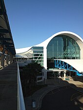
Jacksonville International Airport(IATA: JAX, ICAO: KJAX, FAALID: JAX) is a major regional passenger air service provider, featuring non-stop flights to dozens of major US cities. The facility opened on Jacksonville's Northside in 1968. Commercial air service at Imeson Field, also located in the Northside, ceased operations. The airport covers 7,911 acres (3,201ha) and has two concrete runways: 8/26, 10,000 x 150ft (3,048 x 46 m) and 14/32, 7,701 x 150ft (2,347 x 46 m). The terminal at JIA is composed of a baggage claim area, on the first floor and a ticketing area on the second floor, at the front of the structure. Past baggage claim and ticketing is the mezzanine, where shops, restaurants and the security checkpoint are located. Beyond the mezzanine are the airport's Concourses A and C, which include 10 gates each (for a total of 20), along with other shops and restaurants.[41] In 2018, the airport handled 6,460,253 passengers, breaking the previous record set in 2007.[42] This increase in traffic prompted the JAA to revive the plan to rebuild concourse B.[43] The new concourse could open as early as 2022, providing six additional gates and could be expanded later with six more. The design of concourses A and C also allow them to be extended to accommodate additional gates. In 2019, RS&H and Jacobs Engineering were chosen to perform the design, while Balfour Beatty was selected as the construction manager for the concourse B project.[44]
The Saint Johns River Ferry, also known as the Mayport Ferry, has been operating between Mayport and Fort George Island since 1874. The 0.9 miles (1.4km) voyage crosses the Saint Johns River about 2.5 miles (4.0km) inland of the river's mouth and travels in an east–west direction for approximately 2,000 feet (610m) on State Road A1A. Departures still occur daily every half-hour.[45]
Jacksonville is the most populous city proper in the U.S. state of Florida, located on the Atlantic coast of northeastern Florida. It is the seat of Duval County, with which the City of Jacksonville consolidated in 1968. It is the largest city by area in the contiguous United States as of 2020.
Jean Ribault was a French naval officer, navigator, and a colonizer of what would become the southeastern United States. He was a major figure in the French attempts to colonize Florida. A Huguenot and officer under Admiral Gaspard de Coligny, Ribault led an expedition to the New World in 1562 that founded the outpost of Charlesfort on Parris Island in present-day South Carolina. Two years later, he took over command of the French colony of Fort Caroline in what is now Jacksonville, Florida. He and many of his followers died at the hands of Spanish soldiers during the Massacre at Matanzas Inlet, near St. Augustine.
Fort Caroline was an attempted French colonial settlement in Florida, located on the banks of the St. Johns River in present-day Duval County. It was established under the leadership of René Goulaine de Laudonnière on 22 June 1564, following King Charles IX's enlisting of Jean Ribault and his Huguenot settlers to stake a claim in French Florida ahead of Spain. The French colony came into conflict with the Spanish, who established St. Augustine in September 1565, and Fort Caroline was sacked by Spanish troops under Pedro Menéndez de Avilés on 20 September. The Spanish continued to occupy the site as San Mateo until 1569.
San Juan del Puerto was a Spanish Franciscan mission founded before 1587 on Fort George Island, near the mouth of the St. Johns River in what is now Jacksonville, Florida. It was founded to serve the Saturiwa, a Timucua tribe who lived around the mouth of the St. Johns. It was organized by separating them into nine smaller villages. It has an important place in the study of the Timucua, as the place where Francisco Pareja undertook his work on the Timucua language.
The city of Jacksonville, Florida, began to grow in the late 18th century as Cow Ford, settled by British colonists. Its major development occurred in the late nineteenth century, when it became a winter vacation destination for tourists from the North and Midwest. Its development was halted or slowed by the Great Fire of 1901, the Florida Land Bust of the 1920s, and the economic woes of the 1960s and 70s. Since the late 20th century, the city has experienced steady growth, with a new federal building constructed in downtown in 2003.
The Timucuan Ecological and Historic Preserve is a U.S. National Preserve in Jacksonville, Florida. It comprises 46,000 acres (19,000 ha) of wetlands, waterways, and other habitats in northeastern Duval County. Managed by the National Park Service in cooperation with the City of Jacksonville and Florida State Parks, it includes natural and historic areas such as the Fort Caroline National Memorial and the Kingsley Plantation.
Fort George Island Cultural State Park is a Florida state park located on Fort George Island in far northeast Duval County/Jacksonville, Florida. The site was previously very near a major Timucua center, where Spaniards founded the mission of San Juan del Puerto, It is home to the Ribault Inn Club, constructed in 1928 as a winter resort and now used as a visitors' center for the nearby Kingsley Plantation and the island as a whole. Many weddings are held there.
The Jacksonville Metropolitan Area, also called the First Coast, Metro Jacksonville, or Northeast Florida, is the metropolitan area centered on the principal city of Jacksonville, Florida and including the First Coast of North Florida. As of the 2020 United States census, the total population was 1,605,848. The Jacksonville–Kingsland–Palatka, FL–GA Combined Statistical Area (CSA) had a population of 1,733,937 in 2020 and was the 34th largest CSA in the United States. The Jacksonville metropolitan area is the 40th largest in the country and the fourth largest in the State of Florida, behind the Miami, Tampa, and Orlando metropolitan areas.
For the island in James Bay, Canada, see Chisasibi.
There are more than 500 neighborhoods within the area of Jacksonville, Florida, the largest city in the contiguous United States by area. These include Downtown Jacksonville and surrounding neighborhoods. Additionally, greater Jacksonville is traditionally divided into several major sections with amorphous boundaries: Northside, Westside, Southside, and Arlington, as well as the Jacksonville Beaches.
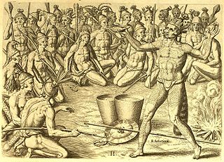
The Mocama were a Native American people who lived in the coastal areas of what are now northern Florida and southeastern Georgia. A Timucua group, they spoke the dialect known as Mocama, the best-attested dialect of the Timucua language. Their heartland extended from about the Altamaha River in Georgia to south of the mouth of the St. John's River, covering the Sea Islands and the inland waterways, Intracoastal. and much of present-day Jacksonville. At the time of contact with Europeans, there were two major chiefdoms among the Mocama, the Saturiwa and the Tacatacuru, each of which evidently had authority over multiple villages. The Saturiwa controlled chiefdoms stretching to modern day St. Augustine, but the native peoples of these chiefdoms have been identified by Pareja as speaking Agua Salada, which may have been a distinct dialect.
Saturiwa was chief of the Saturiwa tribe, a Timucua chiefdom centered at the mouth of the St. Johns River in Florida, during the 16th century. His main village, also known as Saturiwa, was located on the south bank of the river near its mouth, and according to French sources he was sovereign over thirty other village chiefs. Chief Saturiwa was a prominent figure in the early days of European settlement in Florida, forging friendly relations with the French Huguenot settlers, who founded Fort Caroline in his territory.
The Ribault Club is an historic building on Fort George Island near Jacksonville, Florida. It is now home to the Fort George Island Visitor Center. The building was designed in a Colonial Revival architecture style and is credited to Maurice Fatio and Mellen Clark Greeley. It was added to the U.S. National Register of Historic Places on May 11, 2000, and is located on Fort George Road. It was built in 1928 for winter recreation on the site of a former hotel and is considered a legacy of Fort George Island's resort era. Winter recreational opportunities included golf, tennis, hunting, fishing, and yachting. Today many weddings are held at the Club. The building is listed as a Historic Landmark by the City of Jacksonville. It became part of the Fort George Island Cultural State Park in 1989.
The Port of Jacksonville (JAXPORT) is an international trade seaport on the St. Johns River in Jacksonville, Florida. JAXPORT is the largest port by volume in Florida, and the 14th largest container port in the United States. It carries about 18 million short tons of cargo each year and has an annual economic impact of over $31 billion, including 138,500 jobs across the state of Florida related to cargo moving through the port. It handled 1,338,000 containers, and is the second largest handler of vehicles in the United States with 696,500 in 2019.
Mission San Pedro de Mocama was a Spanish colonial Franciscan mission on Cumberland Island, on the coast of the present-day U.S. state of Georgia, from the late 16th century through the mid-17th century. It was built to serve the Tacatacuru, a Mocama Timucua people.
The Jacksonville Port Authority (JPA) also known by its brand name, JAXPORT, is the independent government agency in Jacksonville, Florida, that owns and operates much of the seaport system at the Port of Jacksonville.
The Saturiwa were a Timucua chiefdom centered on the mouth of the St. Johns River in what is now Jacksonville, Florida. They were the largest and best attested chiefdom of the Timucua subgroup known as the Mocama, who spoke the Mocama dialect of Timucuan and lived in the coastal areas of present-day northern Florida and southeastern Georgia. They were a prominent political force in the early days of European settlement in Florida, forging friendly relations with the French Huguenot settlers at Fort Caroline in 1564 and later becoming heavily involved in the Spanish mission system.
Tacatacuru was a Timucua chiefdom located on Cumberland Island in what is now the U.S. state of Georgia in the 16th and 17th centuries. It was one of two chiefdoms of the Timucua subgroup known as the Mocama, who spoke the Mocama dialect of Timucuan and lived in the coastal areas of southeastern Georgia and northern Florida.
The Jacksonville transportation network includes ground, air, and sea options for passenger and freight transit. The Jacksonville Port Authority (Jaxport) operates the Port of Jacksonville, which includes container shipping facilities at Blount Island Marine Terminal, the Talleyrand Marine Terminal and the Dames Point Marine Terminal. Jacksonville Aviation Authority managers Jacksonville International Airport in Northside, as well as several smaller airports. The Jacksonville Transportation Authority (JTA) operates bus, people mover, and park-n-ride services throughout the city and region. A major bus terminal at the intermodal Rosa Parks Transit Station serves as JTA's main transit hub. Various intercity bus companies terminate near Central Station. Amtrak operates passenger rail service to and from major cities throughout North America. The city is bisected by major highways, I-95 and I-10, I-295 creates a full beltway around the city.
↑ McEwen, John W. 2007. "The Vernacular Neighborhoods of Jacksonville, Florida: Can GIS Help Determine their Boundaries?" The Florida Geographer, Vol. 38: 54–71.
1 2 U.S. Geological Survey. National Hydrography Dataset high-resolution flowline data. The National Map, accessed February 20, 2020
McEwen, John W. (2007). "The Vernacular Neighborhoods of Jacksonville, Florida: Can GIS Help Determine their Boundaries?". The Florida Geographer. 38: 54–71.
Ward, James Robertson (1985). Old Hickory's Town. Old Hickory's Town, Inc. ASINB000OL8E9O.
This page is based on this Wikipedia article Text is available under the CC BY-SA 4.0 license; additional terms may apply. Images, videos and audio are available under their respective licenses.