
Thornhill is a village in the Scottish council area of Stirling. It lies 14 miles north west of Stirling itself - south of Callander, east of Aberfoyle and west of Doune.
Education in Scotland is overseen by the Scottish Government and its executive agency Education Scotland. Education in Scotland has a history of universal provision of public education, and the Scottish education system is distinctly different from those in the other countries of the United Kingdom. The Scotland Act 1998 gives the Scottish Parliament legislative control over all education matters, and the Education (Scotland) Act 1980 is the principal legislation governing education in Scotland. Traditionally, the Scottish system at secondary school level has emphasised breadth across a range of subjects, while the English, Welsh and Northern Irish systems have emphasised greater depth of education over a smaller range of subjects.

Dunblane is a small town in the council area of Stirling in central Scotland, and prior to 1994 inside the boundaries of Perthshire. It is a commuter town, with many residents making use of good transport links to much of the Central Belt, including Glasgow and Edinburgh.

Callander is a small town in the council area of Stirling, Scotland, situated on the River Teith. The town is located in the historic county of Perthshire and is a popular tourist stop to and from the Highlands.

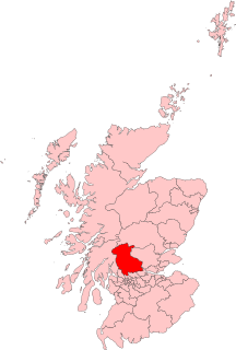
The Stirling council area is one of the 32 council areas of Scotland, and has a population of about 94,330. It was created under the Local Government etc (Scotland) Act 1994 with the boundaries of the Stirling district of the former Central local government region, and it covers most of Stirlingshire and the south-western portion of Perthshire. Both counties were abolished for local government purposes under the Local Government (Scotland) Act 1973.

The Trossachs generally refers to an area of wooded glens, braes, and lochs lying to the east of Ben Lomond in the Stirling council area of Scotland. The name is taken from that of a small woodland glen that lies at the centre of the area, but is now generally applied to the wider region.

Fintry is a village in central Scotland, nestled in the strath of the Endrick Water between the Campsie Fells and the Fintry Hills, some 19 miles (30.5 km) north of Glasgow. It is within the local government council area of Stirling. The 2011 census results report that Fintry and the surrounding rural area had a population of 717. The centre of the village along Main Street has been designated a Conservation Area by Stirling Council.

Larbert is a small town in the Falkirk council area of Scotland. The town lies in the Forth Valley above the River Carron which flows from the west. Larbert is 3 miles (4.8 km) from the shoreline of the Firth of Forth and 2.5 miles (4.0 km) northwest of Falkirk, the main town in the area. The village of Stenhousemuir lies directly east of Larbert, with both settlements being contiguous and sharing certain public amenities with one another.
Stirling is a county constituency of the House of Commons of the Parliament of the United Kingdom. It elects one Member of Parliament (MP) by the first past the post system of election.

Kippen is a village in west Stirlingshire, Scotland. It lies between the Gargunnock Hills and the Fintry Hills and overlooks the Carse of Forth to the north. The village is 9 miles west of Stirling and 20 mi (32 km) north of Glasgow. It is 4+1⁄2 mi (7 km) south-east of Loch Lomond and the Trossachs National Park, Scotland's first National Park.

Lecropt is a rural parish lying to the west of Bridge of Allan, Scotland.

Inversnaid is a small rural community on the east bank of Loch Lomond in Scotland, near the north end of the loch. It has a pier and a hotel, and the West Highland Way passes through the area. A small passenger ferry runs from Inversnaid to Inveruglas on the opposite shore of the loch, and also to Tarbet. There is a seasonal ferry that also operates between Ardlui and Ardleish as well, which is a walkable distance from Inversnaid. To reach Inversnaid by road involves a 15-mile (24-kilometre) route from Aberfoyle. Nearby is an alleged hideout of Rob Roy MacGregor known as Rob Roy's Cave. The cave is difficult to access, and is best seen from Loch Lomond, where there is white paint indicating the location of the hideout.

Balfron High School is a secondary school situated in the village of Balfron, approximately 18 miles (29 km) west of Stirling and 16 miles (26 km) north of Glasgow. The catchment area extends over most of West Stirlingshire including the villages of Arnprior, Balfron, Balmaha, Blanefield, Buchlyvie, Croftamie, Drymen, Fintry, Killearn, Kippen, Milton of Buchanan and Strathblane, along with the hamlets of Balfron Station, Boquhan, Buchanan Smithy, Dumgoyne,Gartness and Mugdock. The school also has pupils attending from other nearby areas of Dunbartonshire and Stirlingshire.

Port of Menteith is a village and civil parish in the Stirling district of Scotland, the only significant settlement on the Lake of Menteith. It was established as a burgh of barony, then named simply Port, in 1457 by King James III of Scotland. It lay in the former county of Perthshire.

Kinbuck is a hamlet in Stirlingshire, Scotland. It lies by the Allan Water and the Stirling-Perth Railway line. It is four miles north of Dunblane.

Kincorth Academy was an Aberdeen City Council secondary school in Kincorth, Aberdeen, Scotland. Local primary feeder schools were: Abbotswell Primary, Charleston Primary, Kirkhill Primary and Loirston Primary.

Auldhouse is a hamlet in South Lanarkshire, around 0.5 miles (0.80 km) to the south of the suburban edge of East Kilbride.

Gartness is a hamlet in Stirling, Scotland. It is located 1.8 miles/2.9 km from Killearn and 3.1 miles/5 km from Drymen. Most pupils attend Killearn Primary School and senior pupils attend Balfron High School. The Endrick Water passes through the hamlet.

Newton is a mainly residential district in the town of Cambuslang in Scotland; it is situated directly south of the River Clyde. Newton is within the Cambuslang East ward of the South Lanarkshire Council area. Formerly a mining settlement from the mid-19th to mid-20th centuries then sparsely populated for several decades, in the early 2000s it was designated a 'Community Growth Area' for residential development with several hundred houses, a new primary school and associated infrastructure constructed in phases over several years into the 2020s, mostly on fields previously used by a farm which had operated for several centuries before closing around the turn of the 21st century.

