Thornhill is a village in the Scottish council area of Stirling. It lies 14 miles north west of Stirling itself, south of Callander, east of Aberfoyle and west of Doune.

The River Forth is a major river in central Scotland, 47 km (29 mi) long, which drains into the North Sea on the east coast of the country. Its drainage basin covers much of Stirlingshire in Scotland's Central Belt. The Gaelic name for the upper reach of the river, above Stirling, is Abhainn Dubh, meaning "black river". The name for the river below the tidal reach is Uisge For.

Dunblane is a small town in the council area of Stirling in central Scotland, and inside the historic boundaries of the county of Perthshire. It is a commuter town, with many residents making use of good transport links to much of the Central Belt, including Glasgow and Edinburgh.

Alloa is a town in Clackmannanshire in the Central Lowlands of Scotland. It is on the north bank of the Forth at the spot where some say it ceases to be the River Forth and becomes the Firth of Forth. Alloa is south of the Ochil Hills, 5.5 miles (8.9 km) east of Stirling and 7.9 miles (12.7 km) north of Falkirk; by water Alloa is 25 miles (40 km) from Granton.
Cupar is a town, former royal burgh and parish in Fife, Scotland. It lies between Dundee and Glenrothes. According to a 2011 population estimate, Cupar had a population around 9,000, making it the ninth-largest settlement in Fife, and the civil parish a population of 11,183. It is the historic county town of Fife, although the council now sits at Glenrothes.

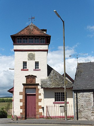
Callander is a small town in the council area of Stirling, Scotland, situated on the River Teith. The town is located in the historic county of Perthshire and is a popular tourist stop to and from the Highlands.

The Stirling council area is one of the 32 council areas of Scotland, and has a population of about 93,470. It was created in 1975 as a lower-tier district within the Central region. The district covered parts of the historic counties of Stirlingshire and Perthshire, which were abolished for local government purposes. In 1996 the Central region was abolished and Stirling Council took over all local government functions within the area.
Tillicoultry is a town in Clackmannanshire, Scotland. Tillicoultry is usually referred to as Tilly by the locals.

Fintry is a small riverside village in Stirlingshire, central Scotland. It is located 16 miles (26 km) south-west of Stirling and around 19 miles (31 km) north of Glasgow.

Larbert is a town in the Falkirk council area of Scotland. The town lies in the Forth Valley above the River Carron which flows from the west. Larbert is three miles from the shoreline of the Firth of Forth and 2+1⁄2 miles northwest of Falkirk. Stenhousemuir lies directly east of Larbert, with both settlements being contiguous and sharing certain public amenities with one another.

Kippen is a village in west Stirlingshire, Scotland. It lies between the Gargunnock Hills and the Fintry Hills and overlooks the Carse of Forth to the north. The village is 9 miles west of Stirling and 20 mi (32 km) north of Glasgow. It is 4+1⁄2 mi (7 km) south-east of Loch Lomond and the Trossachs National Park, Scotland's first National Park.

St Monans, sometimes spelt St Monance, is a village and parish in the East Neuk of Fife and is named after the legendary Saint Monan.

Killin is a village in Perthshire in the central Highlands of Scotland. Situated at the western head of Loch Tay, it is administered by the Stirling Council area. Killin is a historic conservation village and sits within the Loch Lomond and The Trossachs National Park. It is the central settlement of the historic region of Breadalbane.

Balfron is a village in the Stirling council area of Scotland. It is situated near Endrick Water on the A875 road, 18 miles (29 km) west of Stirling and 16 miles (26 km) north of Glasgow. Although a rural settlement, it lies within commuting distance of Glasgow, and serves as a dormitory settlement.

Dalmuir is an area nine miles northwest of Glasgow, Scotland, on the western side of Clydebank, and part of West Dunbartonshire Council Area. The name is a lowland Scots derivation of the Gaelic meaning Big Field. The area was originally two separate villages with Dalmuir Shore joining with Clydebank in 1886 and Dalmuir Village in 1906, during a period of rapid industrialization and expansion. Dalmuir is bounded by the village of Old Kilpatrick to the west, the Mountblow and Parkhall housing schemes to the north, and the Clydebank town centre area to the east. To the south is the River Clyde.
Buchlyvie is a village in the Stirling council area of Scotland. It is situated 14 miles (23 km) west of Stirling and 18 miles (29 km) north of Glasgow. Lying within the Carse of Forth, to the north is Flanders Moss and to the south are the Campsie Fells. The village lies on the A811, which follows the line of an eighteenth-century military road between Stirling and Balloch. According to the 2001 census the village's population was 479.

Strathblane is a village and parish in the registration county of Stirlingshire, situated in the southwestern part of the Stirling council area, in central Scotland. It lies at the foothills of the Campsie Fells and the Kilpatrick Hills on the Blane Water, 12 miles (19 km) north of Glasgow, 14 miles (23 km) east-southeast of Dumbarton, and 20 miles (32 km) southwest of Stirling. Strathblane is a dormitory village for Greater Glasgow, and has a total resident population of 1,811.
Longforgan is a village and parish in the Carse of Gowrie, in Perth and Kinross, Scotland. It lies 5 miles west of Dundee on the main A90 road.
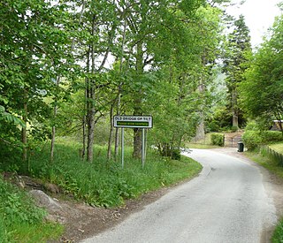
Bridge of Tilt is a village in Perthshire, Scotland, built around the River Tilt, near its confluence with the River Garry. It is 5+3⁄4 miles northwest of Pitlochry. The newer part of the village is continuous with Blair Atholl, only separated by the River Tilt. The village is located primarily on the B8079 between Pitlochry and Dunalastair Water, but the older part of the village is located further up the River Tilt. The A9 runs past the River Garry to the south of Bridge of Tilt, and connects the village with Newtonmore and Inverness in the north and Pitlochry, Perth and Stirling in the south.
Touch House is a country house located 4 kilometres (2.5 mi) west of Stirling in central Scotland. It stands at the foot of the Touch Hills, on the south side of the River Forth. The house incorporates a 16th-century tower house, but its present form dates to the middle of the 18th century when the south facade was added, described by Historic Environment Scotland as "Probably the finest Georgian elevation in the County of Stirling."

