Baldwin, Florida

Last updated

Baldwin, Florida
Town of Baldwin
Baldwin2012C.png
From top, left to right: Baldwin Town Hall, Water tower, William Coleman House, Larry M. Carroll Memorial Park, Old Jail, First Baptist Church
Duval County Florida Incorporated and Unincorporated areas Baldwin Highlighted 1203250.svg
Location of Baldwin in Duval County, Florida.
USA Florida location map.svg
Red pog.svg
Baldwin, Florida
Location in Florida
Usa edcp location map.svg
Red pog.svg
Baldwin, Florida
Baldwin, Florida (the United States)
North America laea location map.svg
Red pog.svg
Baldwin, Florida
Baldwin, Florida (North America)
Coordinates: 30°18′14″N81°58′30″W / 30.30389°N 81.97500°W / 30.30389; -81.97500
Country Flag of the United States.svg  United States
State Flag of Florida.svg  Florida
County   Duval
Settled (Thigpen Settlement) 1835-1860 [1]
Incorporated (Town of Baldwin) 1876 [2]
Reincorporated
(Town of Baldwin)
May 22, 1913 [1]
Government
  Type Mayor-Council
   Mayor Sean Lynch
   Councilors Clayton Plank,
Chris Douglas,
Harry Ervin, and
Georgeann McKenna
   Town Clerk Lula Hill
   Town Attorney Zachary Roth
Area
[3]
  Total2.02 sq mi (5.24 km2)
  Land2.02 sq mi (5.23 km2)
  Water0.00 sq mi (0.01 km2)
Elevation
[4]
85 ft (26 m)
Population
 (2020)
  Total1,396
  Density690.75/sq mi (266.70/km2)
Time zone UTC-5 (Eastern (EST))
  Summer (DST) UTC-4 (EDT)
ZIP code
32234
Area code(s) 904, 324
FIPS code 12-03250
GNIS feature ID0278061 [4]
Website Town of Baldwin

Baldwin is a town in Duval County, Florida, United States. When the majority of communities in Duval County were consolidated with the city of Jacksonville in 1968, Baldwin, along with Jacksonville Beach, Atlantic Beach and Neptune Beach, remained partly independent. Like the other towns, it maintains its own municipal government, but its residents vote in the Jacksonville mayoral election and vote for the Jacksonville City Council; unlike the others, Baldwin no longer supports its own police force. The population was 1,396 at the 2020 census, down from 1,425 at the 2010 census. [5] It is part of the Jacksonville, Florida Metropolitan Statistical Area.

Contents

History

The Town of Baldwin was first settled under the name of Thigpen in 1846. Mr. Thigpen had opened a tavern to benefit the stagecoach line at the crossroads of what is today Baldwin. He supplied horses for the stage and shelter and food for the passengers. The first railroad was built through Thigpen in 1857, with a second crossing it in 1859. [1] The name was changed to Baldwin in honor of Abel Seymour Baldwin, the president of the Florida, Atlantic and Gulf Central Railroad, a railroad that ran from Lake City to Jacksonville. Further development in Baldwin led to the establishment of a telegraphic line running from Jacksonville to Baldwin. Baldwin lies between Macclenny and Jacksonville

A country store with gas pumps in 1926 in Baldwin. Baldwin1926.jpg
A country store with gas pumps in 1926 in Baldwin.

During the Civil War, Baldwin was captured by Federal forces early in 1864. Northern troops and correspondents noted that the citizens of Baldwin were "wretchedly poor." [6]

On August 10, 1864, a skirmish occurred between a Confederate cavalry and the 102nd Regiment United States Colored Troops. A section of railroad track was destroyed by the Union Army troops. Two days later the Federals dispatched cavalry troops from Baldwin to drive Confederate forces back. One Federal soldier was killed and four were captured in the process. [7] Baldwin was then burned down by the Federals. From 1865 to 1875 Baldwin was rebuilt reaching a population of 250.

In 1947, the original school building serving the white population burned to the ground. There was no fire department to control it, and it was completely destroyed. The students from the school were temporarily housed in a variety of public buildings, including churches and the city hall. Later, barracks buildings from nearby army training base Camp Blanding were moved to the site of the burned school, where classes continued for about two years while a new school was being built. A school for the black population was located in a building located near the old ice plant that served the railroad. The school was occupied for a number of years after the new white school was built.

Florida State law, in 1948, required new school buildings be placed on parcels not less than 10 acres (40,000 m2) in size. As the property under the existing school was not large enough, a site on Mill Street was chosen. A $50,000 school was erected during the winter and summers of 1948 and 1949. In 1950, an auditorium was completed. At that time the school enrollment was 365. In 1964, a Music Suite was added.

In 1965, Baldwin became the first Duval County school to be integrated.

Geography

The exact coordinates for the Town of Baldwin is located at 30°18′14″N81°58′30″W / 30.30389°N 81.97500°W / 30.30389; -81.97500 (30.303788, –81.975029). [8]

According to the United States Census Bureau, the town has a total area of 2.0 square miles (5.3 km2), all land. [9]

Climate

The climate in this area is characterized by hot, humid summers and generally mild winters. According to the Köppen climate classification, the Town of Baldwin has a humid subtropical climate zone (Cfa).

Demographics

Historical population
CensusPop.Note
1920 470
1930 74959.4%
1940 1,00233.8%
1950 1,0484.6%
1960 1,27221.4%
1970 1,40810.7%
1980 1,5268.4%
1990 1,450−5.0%
2000 1,63412.7%
2010 1,425−12.8%
2020 1,396−2.0%
U.S. Decennial Census [10]
2013 Estimate [11]

2010 and 2020 census

Baldwin racial composition
(Hispanics excluded from racial categories)
(NH = Non-Hispanic)
RacePop 2010 [12] Pop 2020 [13] % 2010% 2020
White (NH)1,03093872.28%67.19%
Black or African American (NH)30730821.54%22.06%
Native American or Alaska Native (NH)340.21%0.29%
Asian (NH)400.28%0.00%
Pacific Islander or Native Hawaiian (NH)010.00%0.07%
Some other race (NH)1130.07%0.93%
Two or more races/Multiracial (NH)48683.37%4.87%
Hispanic or Latino (any race)32642.25%4.58%
Total1,4251,396

As of the 2020 United States census, there were 1,396 people, 588 households, and 391 families residing in the town. [14]

As of the 2010 United States census, there were 1,425 people, 623 households, and 380 families residing in the town. [15]

2000 census

As of the census of 2000, there were 1,634 people, 628 households, and 432 families residing in the town. The population density was 767.3 inhabitants per square mile (296.3/km2). There were 702 housing units at an average density of 329.6 per square mile (127.3/km2). The racial makeup of the town was 67.07% White, 30.91% African American, 0.18% Native American, 0.86% Asian, 0.06% Pacific Islander, 0.06% from other races, and 0.86% from two or more races. Hispanic or Latino of any race were 0.80% of the population.

In 2000, there were 628 households, out of which 35.2% had children under the age of 18 living with them, 41.2% were married couples living together, 22.5% had a female householder with no husband present, and 31.2% were non-families. 27.5% of all households were made up of individuals, and 8.6% had someone living alone who was 65 years of age or older. The average household size was 2.60 and the average family size was 3.16.

In 2000, in the town, the population was spread out, with 29.3% under the age of 18, 10.2% from 18 to 24, 27.4% from 25 to 44, 22.3% from 45 to 64, and 10.7% who were 65 years of age or older. The median age was 34 years. For every 100 females, there were 86.7 males. For every 100 females age 18 and over, there were 82.5 males.

In 2000, the median income for a household in the town was $28,603, and the median income for a family was $31,023. Males had a median income of $28,350 versus $23,056 for females. The per capita income for the town was $13,560. About 17.6% of families and 17.7% of the population were below the poverty line, including 24.8% of those under age 18 and 12.9% of those age 65 or over.

Government and politics

The municipality operates a 10,000-square-foot (930 m2) supermarket that opened on September 20, 2019, in response to the closure of the last remaining private grocery store, an IGA, in 2018; the county market is located in the former IGA building, which post-2018 prospective small business supermarket owners found too large and corporate chains found too small. The nearest privately run supermarkets are in Macclenny and Jacksonville, and the Dollar General lacks fresh food. [16]

In the 2016 U.S. Presidential Election, 68% of the residents selected Donald Trump. [16]

Transportation

Baldwin is the terminus of three CSX subdivisions: the western terminus of the Jacksonville Terminal Subdivision, the northern terminus of the Wildwood Subdivision and the southern terminus of the Callahan Subdivision.

The Florida Gulf & Atlantic Railroad acquired the former CSX main line from Pensacola to Baldwin on June 1, 2019. CSX retained trackage rights on that route.

No passenger trains stop in Baldwin, but Amtrak's Palmetto train served the Wildwood Subdivision until November 2004, and the Sunset Limited served the Tallahassee and Jacksonville Terminal Subdivisions until Hurricane Katrina ravaged the Gulf Coast in 2005. Additionally, the Jacksonville-Baldwin Rail Trail was a former Atlantic Coast Line Railroad line that was abandoned by CSX in 1992.

Major highways

Culture

As of 2019 eleven churches are in the area. [16]

Education

Duval County Public Schools operates area public schools, including Mamie Agnes Jones Elementary School [17] and Baldwin Middle-Senior High School.

Related Research Articles

<span class="mw-page-title-main">Putnam County, Florida</span> County in Florida, United States

Putnam County is a county located in the northern part of the state of Florida. As of the 2020 census, the population was 73,321. Its county seat is Palatka.

<span class="mw-page-title-main">Clay County, Florida</span> County in Florida, United States

Clay County is located in the northeastern part of the U.S. state of Florida along the west bank of the St. Johns River. As of 2020, the population was 218,245 and in 2023, that number increased to 232,439, making it the third largest county in the Jacksonville metropolitan area. While most of the county is unincorporated, there are 4 municipalities with Green Cove Springs being the county seat and the unincorporated Lakeside CDP being the largest place. It is named in honor of Henry Clay, a famous American statesman, member of the United States Senate from Kentucky, and United States Secretary of State in the 19th century.

<span class="mw-page-title-main">Baker County, Florida</span> County in Florida, United States

Baker County is a county in the U.S. state of Florida. As of the 2020 census, the population was 28,259. Its county seat is Macclenny. The county was founded in 1861 and is named for James McNair Baker, a judge and Confederate Senator.

<span class="mw-page-title-main">Duval County, Florida</span> County in Florida, United States

Duval County is in the northeastern part of the U.S. state of Florida. As of July 2022, the population was 1,016,536, up from 864,263 in 2010. It is Florida's sixth-most populous county. Its county seat is Jacksonville, with which the Duval County government has been consolidated since 1968. Duval County was established in 1822, and is named for William Pope Duval, Governor of Florida Territory from 1822 to 1834. Duval County is the central county of the Jacksonville, Florida Metropolitan Statistical Area.

<span class="mw-page-title-main">Gadsden County, Florida</span> County in Florida, United States

Gadsden County is a county located in the panhandle of the U.S. state of Florida. As of the 2020 census, the population was 43,826. Its county seat is Quincy. Gadsden County is included in the Tallahassee, FL Metropolitan Statistical Area. Gadsden County is the only majority African-American county in Florida.

<span class="mw-page-title-main">Nassau County, Florida</span> County in Florida, United States

Nassau County is the northeasternmost county of the U.S. state of Florida. According to the July 2022 United States Census analysis, the county's population was 97,899, up from 90,352 at the 2020 census.

<span class="mw-page-title-main">Macclenny, Florida</span> City in Florida, United States

Macclenny is a city and the county seat of Baker County, Florida. Located just west of Jacksonville, it is a municipalities in the Jacksonville, Florida Metropolitan Statistical Area. The population was 7,304 at the 2020 census, up from 6,374 in 2010.

<span class="mw-page-title-main">Atlantic Beach, Florida</span> City in Florida, United States

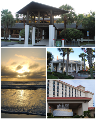
Atlantic Beach is a city in Duval County, Florida, United States and the second largest of the Jacksonville Beaches communities. When the majority of communities in Duval County consolidated with Jacksonville in 1968, Atlantic Beach, along with Jacksonville Beach, Neptune Beach, and Baldwin, remained quasi-independent. Like the other towns, it maintains its own municipal government, but its residents vote in the Jacksonville mayoral election and have representation on the Jacksonville city council. The population was 13,513 at the 2020 census, up from 12,655 at the 2010 census. It is part of the Jacksonville, Florida Metropolitan Statistical Area.

<span class="mw-page-title-main">Jacksonville Beach, Florida</span> City in Florida, United States

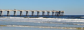
Jacksonville Beach is a coastal resort city in Duval County, Florida, United States. It was incorporated on May 22, 1907, as Pablo Beach, and changed to Jacksonville Beach in 1925. The city is part of group of communities collectively referred to as the Jacksonville Beaches. These communities include Mayport, Atlantic Beach, Neptune Beach, and Ponte Vedra Beach. When the city of Jacksonville consolidated with Duval County in 1968, Jacksonville Beach, together with Atlantic Beach, Neptune Beach, and Baldwin, voted to retain their own municipal governments. As a result, citizens of Jacksonville Beach are also eligible to vote in mayoral election for the City of Jacksonville. As of the 2020 US census, Jacksonville Beach had a total population of 23,830, up from 21,362 at the 2010 census. It is part of the Jacksonville, Florida Metropolitan Statistical Area.

<span class="mw-page-title-main">Neptune Beach, Florida</span> City in Florida, United States of America

Neptune Beach is a beachfront city east of Jacksonville in Duval County, Florida, United States. When the majority of Duval County communities consolidated with Jacksonville in 1968, Neptune Beach, along with Jacksonville Beach, Atlantic Beach and Baldwin remained quasi-independent. Like those other municipalities, it maintains its own municipal government but its residents vote in the Jacksonville mayoral election and are represented on the Jacksonville city council. As of the 2020 census, the population is 7,217, up from 7,037 at the 2010 census. Neptune Beach is the smallest of the Jacksonville Beaches communities. it is part of the Jacksonville, Florida Metropolitan Statistical Area.

<span class="mw-page-title-main">Century, Florida</span> Town in Florida, United States

Century is a town in Escambia County, Florida, United States. Per the 2020 census, the population was 1,713, up from 1,698 at the 2010 census. It is part of the Pensacola–Ferry Pass–Brent, Florida Metropolitan Statistical Area.

<span class="mw-page-title-main">Bonifay, Florida</span> City in Florida, United States

Bonifay is a city in Holmes County, Florida, United States. As of the 2020 census, the population was 2,759. It is the county seat of Holmes County.

<span class="mw-page-title-main">Callahan, Florida</span> Town in Florida, United States

Callahan is a town in Nassau County, Florida, United States, adjacent to Duval County. The population was 1,526 at the 2020 census, up from 1,123 at the 2010 census. It is part of the Jacksonville, Florida Metropolitan Statistical Area. It is one location of the Northeast Florida Fair.

<span class="mw-page-title-main">Hilliard, Florida</span> Town in the state of Florida, United States

Hilliard is a town in Nassau County, Florida, United States; northwest of Jacksonville. It is part of the Jacksonville, Florida Metropolitan Statistical Area. As of the 2020 census, the population was 2,967, down from 3,086 at the 2010 census.

<span class="mw-page-title-main">Zephyrhills, Florida</span> City in Florida, United States of America

Zephyrhills is a city in Pasco County, Florida, United States. The population was counted at 17,194 in the 2020 census. The city is the headquarters of the Zephyrhills bottled water company. The current mayor is Melonie Monson.

<span class="mw-page-title-main">Auburndale, Florida</span> City in Florida, United States of America

Auburndale is a city in Polk County, Florida, United States. It is part of the Lakeland-Winter Haven, Florida Metropolitan Statistical Area. The population was 15,616 at the 2020 census.

<span class="mw-page-title-main">Davenport, Florida</span> City in Florida, United States

Davenport is a city in Polk County, Florida, United States. It is part of the Lakeland–Winter Haven Metropolitan Statistical Area. The population was 9,043 at the 2020 Census. The city's population has increased dramatically since the 2010 Census, when the population was 2,888.

<span class="mw-page-title-main">Bushnell, Florida</span> City in Florida, United States

Bushnell is a city in western Florida and is the county seat of Sumter County, Florida, United States. The population was 3,047 at the 2020 census.

<span class="mw-page-title-main">Wildwood, Florida</span> City in Florida, United States

Wildwood is a city in Sumter County, Florida, United States. The population was 15,730 at the 2020 census.

The Jacksonville Terminal Subdivision is a group of railroad lines owned by CSX Transportation in and around Jacksonville, which was historically a major railroad hub. The Jacksonville Terminal Subdivision includes about 13.0 miles of track.

References

  1. 1 2 3 "History of Baldwin". Town of Baldwin. Retrieved March 31, 2014.
  2. "FLORIDA CITIES BY INCORPORATION YEAR" (PDF). Florida League of Cities.
  3. "2020 U.S. Gazetteer Files". United States Census Bureau. Retrieved October 31, 2021.
  4. 1 2 U.S. Geological Survey Geographic Names Information System: Baldwin, Florida
  5. "Search Results". The United States Census Bureau. United States Census Bureau. Retrieved March 6, 2023.
  6. Reiger, John F. (January 1970). "Deprivation, Disaffection, and Desertion in Confederate Florida". The Florida Historical Quarterly. 48 (3): 281. Retrieved February 22, 2023.
  7. "August 1861-1865". Archived from the original on March 31, 2014. Retrieved March 20, 2014.
  8. "US Gazetteer files: 2010, 2000, and 1990". United States Census Bureau. February 12, 2011. Retrieved April 23, 2011.
  9. "Geographic Identifiers: 2010 Demographic Profile Data (DP-1): Baldwin town, Florida". U.S. Census Bureau, American Factfinder. Archived from the original on February 10, 2020. Retrieved March 25, 2013.
  10. United States Census Bureau. "Census of Population and Housing" . Retrieved November 18, 2013.
  11. "Population Estimates". United States Census Bureau. Archived from the original on May 22, 2014. Retrieved September 10, 2014.
  12. "P2 HISPANIC OR LATINO, AND NOT HISPANIC OR LATINO BY RACE - 2010: DEC Redistricting Data (PL 94-171) - Baldwin town, Florida". United States Census Bureau .
  13. "P2 HISPANIC OR LATINO, AND NOT HISPANIC OR LATINO BY RACE - 2020: DEC Redistricting Data (PL 94-171) - Baldwin town, Florida". United States Census Bureau .
  14. "S1101 HOUSEHOLDS AND FAMILIES - 2020: Baldwin town, Florida". United States Census Bureau .
  15. "S1101 HOUSEHOLDS AND FAMILIES - 2010: Baldwin town, Florida". United States Census Bureau .
  16. 1 2 3 Farzan, Antonia Noori (November 22, 2019). "Morning Mix When a deep red town's only grocery closed, city hall opened its own store. Just don't call it 'socialism.'". The Washington Post . Retrieved November 25, 2019.
  17. "Home". Mamie Agnes Jones Elementary School. Retrieved November 25, 2019.