Barnby Moor

Last updated

Barnby Moor
Civil parish
Ford and bridge over the River Ryton at Bilby - geograph.org.uk - 4480006.jpg
Ford and bridge over the River Ryton at Bilby
Barnby Moor
Parish map
Nottinghamshire UK location map.svg
Red pog.svg
Barnby Moor
Location within Nottinghamshire
Area3.09 sq mi (8.0 km2)
Population274 (2021)
  Density 89/sq mi (34/km2)
OS grid reference SK6684
  London 130 mi (210 km)  SE
District
Shire county
Region
Country England
Sovereign state United Kingdom
Post town RETFORD
Postcode district DN22
Dialling code 01777
Police Nottinghamshire
Fire Nottinghamshire
Ambulance East Midlands
UK Parliament
Website www.hugofox.com/community/barnby-moor-parish-council-20063/2023-2024
List of places
UK
England
Nottinghamshire
53°21′N1°00′W / 53.35°N 1.00°W / 53.35; -1.00

Barnby Moor is a village and civil parish in the Bassetlaw district of Nottinghamshire, England, with a population of 257 (2001 census), increasing to the 2011 Census to 278, [1] and dropping marginally to 274 in 2021. [2] The village is about three miles north of Retford.

Contents

Geography

The A638 passes through the village.

Bilby exclave

The hamlet of Bilby is within the parish of Barnby Moor constituting a detached portion thereof due to being separated by narrow strips of Hodsock and Babworth. This means Barnby Moor is one of a very small number of civil parishes in England to still have a detached portion. [3]

History

In 1086 at the Domesday Survey, the village was known as Barnet-Juxta-Blidas, becoming over time Barneby Super Le Moor, Barnbie on the Moor, Barnebi and finally to Barnby Moor.  The name is derived from the Norse ‘Beorn’, meaing a town and the suffix ‘by’, meaning a farm. The added ‘Moor’ was because to the land around being a combination of woods, moorland and fen. In the 13th century, a number of land-owners, including Wyot de Barneby and his heirs, bequeathed land and woods to the Benedictines of Blyth Priory, later this land was taken by Henry VIII at the Dissolution of the Monasteries and handed over as an endowment for his new foundation of Trinity College in the University of Cambridge. The Great North Road (currently Old London Road) ran through Barnby Moor, and was a route for highwaymen, by the 18th century as traffic and the Industrial Revolution increased the demand for improved roads, a new road was cuyt through Gamston, Retford and Barnby Moor.  The A1 road eventually replaced this as the main route north from London to Edinburgh. In the 16th century, the village was used as the headquarters of Royal Army Forces who were engaged to crush a rebellion in Doncaster. [4]

The village had a coaching inn, the ‘Blue Bell’ which was always referred to as ‘the Bell’ and later ‘The Olde Bell Hotel’. It was originally a private residence and divided into two, one side was used as a chapel as the village did not have a church, the arrangement being unusual for the time. The inn became well-known during the 18th century when stagecoaches began running and in 1714, a traveller remarked there were so many coaches at the Bell that ‘some were ill to find room’.  A notable landlord was George Clark, who was a sportsman and horse-breeder.  A notable incident involved a Captain Swing and his men setting fire to hay close to the Bell during a bitter row between peasants and landowners. From 1840, the Bell had capacity to stable 120 horses and beds for the post boys, if more stabling was required, an alternative site was the White Horse Inn. Famous people who stayed there include Princess Victoria who later became queen, Edmund Gwenn, and Sir Walter Scott. [4]

John Cromwell was born in the village and was a congregationalist who was presented by Oliver Cromwell (no relation) to the rectory in Clayworth, in 1664 he was sentenced for alleged involvement in the Farnley Wood Plot, he became very ill in prison and had to be rescued by the Duke of Newcastle, he returned to Barnby Moor but later died and was buried in nearby Sutton-cum-Lound. In the 18th century, Barnby Moor had a Mansion House with surrounding pleasure-grounds but these were built on by Mr Darcy Clark, who replaced it with Barnby Moor House. Joshua Gladwin Jebb bought it in 1875 but it was pulled down in 1881 and rebuilt.  He died in 1901 and his son Sydney inherited the estate and Firbeck Hall from a relative, however he preferred the latter and sold Barnby Moor House to the Barber family, notably holding coal rights, including Harworth Colliery. One of the Barbers married into the Darleys, who were a Yorkshire brewing family. [4]

The village has since expanded but it is still one of the smallest in Nottinghamshire. Historically the village was an agricultural village, but in latter years is a commuter settlement and seen many changes. The village shop, post office and church have become private residences and The Reindeer Hotel is an old people's home. In 2021, a glamping and caravan site opened at Hill Crest Farm on Old London Road. Some recent ‘infill’ development along the Great North Road has created a number of new residences. [4]

People

Beatrice Tomasson, the mountaineer, was born here in 1859 to William and Sarah Anne Tomasson, she was their second child. [5]

See also

Related Research Articles

<span class="mw-page-title-main">Elland</span> Town in West Yorkshire, England

Elland is a market town in Calderdale, in the county of West Yorkshire, England. It is situated south of Halifax, by the River Calder and the Calder and Hebble Navigation. Elland was recorded as Elant in the Domesday Book of 1086. It had a population in 2001 of 14,554, with the ward being measured at 11,676 in the 2011 Census.

<span class="mw-page-title-main">Blyth, Nottinghamshire</span> Village and civil parish in England

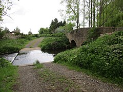
Blyth is a village and civil parish in the Bassetlaw district of the county of Nottinghamshire, in the East Midlands, north west of East Retford, on the River Ryton. The population of the civil parish as of the 2011 census was 1,233, and this increased to 1,265 in 2021. It sits at a junction with the A1, and the end of the motorway section from Doncaster.

<span class="mw-page-title-main">Retford</span> Market town in Nottinghamshire, England

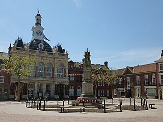
Retford, also known as East Retford, is a market town in the Bassetlaw District in Nottinghamshire, England. It lies on the River Idle and the Chesterfield Canal. Retford is 26 miles (42 km) east of Sheffield, 23 miles (37 km) west of Lincoln and 31 miles (50 km) north-east of Nottingham. The population at the 2021 census was 23,740. Retford railway station is on the East Coast Main Line and the town is bypassed by the A1 road.

<span class="mw-page-title-main">Bawtry</span> Market town in South Yorkshire, England

Bawtry is a market town and civil parish in the City of Doncaster in South Yorkshire, England. It lies 8 miles (13 km) south-east of Doncaster, 10 miles (16 km) west of Gainsborough and 8 miles (13 km) north-west of Retford, on the border with Nottinghamshire and close to Lincolnshire. The town was historically divided between the West Riding of Yorkshire and Nottinghamshire. Its population of 3,204 in the 2001 UK census increased to 3,573 in 2011, and was put at 3,519 in 2019. Nearby settlements include Austerfield, Everton, Scrooby, Blyth, Bircotes and Tickhill.

<span class="mw-page-title-main">East Markham</span> Civil parish in England

East Markham, historically also known as Great Markham, is a small village and civil parish near Tuxford, Nottinghamshire. The population of the civil parish taken at the 2011 Census was 1,160, and this increased to 1,279 in 2021. It lies about 8 km south of Retford. It is sandwiched between the East Coast Main Line, the A1 to the west and A57 to the north.

Babworth is a village and civil parish in the Bassetlaw district of Nottinghamshire, England, about 2 miles west of Retford. According to the 2001 census the parish had a population of 1,329, rising to 1,687 at the 2011 Census, but dropping to 1,489 in 2021. In addition to the village of Babworth, the parish also includes Ranby.

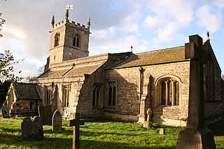
Sutton Cum Lound is a village located in Bassetlaw, north Nottinghamshire. It is located 3 miles from Retford. The civil parish is called Sutton. According to the 2001 census it has a population of 687, including Tithby and falling slightly to 673 at the 2011 census. The parish church of St Bartholomew is Norman, rebuilt in the Perpendicular style, with "unbridled curvilinear tracery" in the chancel windows. The village has a primary school. It borders the village of Barnby Moor which is about 1 mile away and is also very close to the village of Lound. The village has a number of public footpaths and walks such as those on Mire Hill.

<span class="mw-page-title-main">Lound, Nottinghamshire</span> Civil parish in England

Lound is a village in Nottinghamshire, England, four miles north of Retford. It had a population of 493 in the census of 2001, reducing to 471 at the 2011 census, and 454 in 2021. The village is of Danish origin dating from the 8th century with a street running along the spine of the village, leading on to Lound Low Road. The oldest houses are tofts which are endways on to the street with strips of land running back from the road. Nearby villages are Sutton cum Lound and Mattersey.

South Leverton is a village and civil parish in Bassetlaw, north Nottinghamshire, England, four miles from Retford. According to the 2001 census it has a population of 478, increasing only marginally to 480 at the 2011 census.

<span class="mw-page-title-main">Cottam, Nottinghamshire</span> Civil parish in England

Cottam is a village and civil parish in Nottinghamshire 8 miles east of Retford within the Bassetlaw district. The name is pronounced 'Cotum' locally.

Bilby is a hamlet in Nottinghamshire, England. It is part of the civil parish of Barnby Moor. It is located 5 miles west of Retford, close to the A1 road. Bilby was recorded in the Domesday Book as Billebi.

<span class="mw-page-title-main">Ordsall, Nottinghamshire</span> Human settlement in England

Ordsall is an area and former civil parish in Retford, in the Bassetlaw district of Nottinghamshire, England. The Bassetlaw ward of the same name had a population of 14,194 at the 2011 census.

<span class="mw-page-title-main">Gamston, Bassetlaw</span> Civil parish in England

Gamston is a village and civil parish four miles south of Retford in the English county of Nottinghamshire. The village lies on the A638 road between Retford and the Markham Moor junction with the A1 and the A57 roads. The population of the civil parish as at the 2011 Census was 246, which increased to 253 in 2021. The River Idle lies to the west of the village.

<span class="mw-page-title-main">West Drayton, Nottinghamshire</span> Human settlement in England

West Drayton is a village and civil parish in the Bassetlaw district in the county of Nottinghamshire, England. It lies 24 miles (39 km) north east of Nottingham and 4 miles (6.4 km) south of Retford.

<span class="mw-page-title-main">Hodsock</span> Village and civil parish in Nottinghamshire, England

Hodsock is a village and civil parish about 4 miles from Worksop, in the Bassetlaw district, in the county of Nottinghamshire, England. The parish includes the village of Langold and the country house Hodsock Priory. In 2021 the parish had a population of 2,603. The parish is surrounded by the settlements of Babworth, Barnby Moor, Blyth, Carlton in Lindrick, Costhorpe, Firbeck, Letwell, Maltby, Styrrup with Oldcotes and Torworth.

<span class="mw-page-title-main">Scaftworth</span> Hamlet and civil parish in Nottinghamshire, England

Scaftworth is a hamlet and civil parish within the Bassetlaw district of north Nottinghamshire, England.

<span class="mw-page-title-main">Styrrup with Oldcotes</span> Civil parish in England

Styrrup with Oldcotes is a civil parish in the Bassetlaw district, within the county of Nottinghamshire, England. The overall area had a population of 731 at the 2021 census, an increase from 684 at the 2011 census. The parish lies in the north of the county. It is 31 miles north of Nottingham, and 15 miles east of Sheffield. The parish rests alongside the county border with South Yorkshire.

<span class="mw-page-title-main">Clarborough and Welham</span> Civil parish in Nottinghamshire, England

Clarborough and Welham is a civil parish in the Bassetlaw district, in the county of Nottinghamshire, England. The parish includes the village of Clarborough and the hamlet of Welham. In 2021 the parish had a population of 1,041. It is 130 miles north of London, 28 miles north east of the city of Nottingham, and 2 miles north east of the market town of Retford. The parish touches Hayton, North and South Wheatley, North Leverton with Habblesthorpe and Sturton Le Steeple. There are 14 listed buildings in Clarborough and Welham.

<span class="mw-page-title-main">North and South Wheatley</span> Civil parish in Nottinghamshire, England

North and South Wheatley is a civil parish in the Bassetlaw district, in the county of Nottinghamshire, England. The parish includes the villages of North Wheatley and South Wheatley. In 2021 the parish had a population of 610 residents. It is 130 miles north of London, 30 miles north east of the county town of Nottingham, and 5 miles north east of the Nottinghamshire town of Retford. The parish touches Bole, Clarborough and Welham, Clayworth, Hayton, Saundby, Sturton Le Steeple and West Burton. There are 18 listed buildings in North and South Wheatley.

<span class="mw-page-title-main">Scofton</span> Hamlet in Nottinghamshire, England

Scofton is a hamlet in the Bassetlaw district of northern Nottinghamshire, England. It is 130 miles (210 km) north west of London, 25 miles (40 km) north of the county town and city of Nottingham, and 3 miles (4.8 km) east of the nearest town Worksop. Having a shared modern history with nearby Osberton Hall, it is sometimes referred to as Scofton-with-Osberton. Other close neighbours are Bilby and Rayton which also have historical associations.

References

  1. "Civil Parish population 2011". Neighbourhood Statistics. Office for National Statistics. Retrieved 5 April 2016.
  2. UK Census (2021). "2021 Census Area Profile – Barnby Moor (E04007789)". Nomis. Office for National Statistics . Retrieved 15 January 2024.
  3. "Custom report - Nomis - Official Labour Market Statistics".
  4. 1 2 3 4 "Some History of Barnby Moor - Barnby Moor Parish Council - Barnby Moor Parish Council, Barnby Moor, Retford". www.hugofox.com. Retrieved 15 January 2024.
  5. Reisach, Hermann (2001). "Beatrice Tomasson and the South Face of the Marmolada" (PDF). Alpine Journal : 105–113. Retrieved 8 April 2014.