
Marion Junction is a railroad junction in western Jersey City, New Jersey. Currently, it connects CSX's River Line to Conrail's Passaic and Harsimus Line. The two lines merge towards the west, allowing through trains from upstate New York to continue towards the rest of the country. The track actually making the connection is known as the Marion Running Track.

For the purposes of this article, the Jersey City area extends North to Edgewater, South to Bayonne and includes Kearny Junction and Harrison but not Newark. Many routes east of Newark are listed here.

The Northern Branch is a railroad line that runs from Jersey City to Northvale in northeastern New Jersey, and formerly extended further into New York State. The line was constructed in 1859 by the Northern Railroad of New Jersey to connect the New York and Erie Railroad's Piermont Branch terminus in Piermont, New York, directly to Erie's primary terminal in Jersey City, initially Exchange Place, later Pavonia Terminal. In 1870 the line was extended to Nyack, New York, and continued to provide passenger service until 1966. After the Erie's unsuccessful merger with the Lackawanna Railroad to form the Erie-Lackawanna, ownership of the line passed into the hands of Conrail upon its formation in 1976 from a number of bankrupt railroads.

The River Line was a Conrail rail line located between Jersey City, New Jersey and Selkirk, New York, running along the west side of the Hudson Palisades and, after passing through a tunnel at Haverstraw, New York, along the west bank of the Hudson River. It was previously the New York Central's West Shore Railroad and Weehawken Branch. The River Line has since been split into several sections, following the 1999 division of Conrail assets between Norfolk Southern Railway and CSX Transportation.
The United New Jersey Railroad and Canal Company (UNJ&CC) was a United States-based railroad company established in 1872. It was formed by the consolidation of three existing companies: the Camden and Amboy Railroad, Delaware and Raritan Canal Company, and New Jersey Rail Road and Transportation Company. The Camden and Amboy and New Jersey Rail Road were among the earliest North American railroads. The Pennsylvania Railroad leased the United New Jersey Railroad and Canal Company in 1872.

The Pennsylvania Railroad Station was the intermodal passenger terminal for the Pennsylvania Railroad's (PRR) vast holdings on the Hudson River and Upper New York Bay in Jersey City, New Jersey. By the 1920s the station was called Exchange Place. The rail terminal and its ferry slips were the main New York City station for the railroad until the opening in 1910 of New York Pennsylvania Station, made possible by the construction of the North River Tunnels. It was one of the busiest stations in the world for much of the 19th century.

The Central Railroad of New Jersey Terminal, also known as Communipaw Terminal and Jersey City Terminal, was the Central Railroad of New Jersey's waterfront passenger terminal in Jersey City, New Jersey. The terminal was built in 1889, replacing an earlier one that had been in use since 1864. It operated until April 30, 1967.

Pavonia Terminal was the Erie Railroad terminal on the Hudson River situated on the landfilled Harsimus Cove in Jersey City, New Jersey. The station opened in 1861 and closed in 1958 when the Erie Railroad moved its passenger services to nearby Hoboken Terminal. The New York, Susquehanna and Western Railway also ran commuter trains from the terminal and various street cars, ferries and the underground Hudson and Manhattan Railroad serviced the station. The station was abandoned in 1958 and demolished in 1961. The site was eventually redeveloped into the Newport district in the late 20th century.
Paterson Plank Road is a road that runs through Passaic, Bergen and Hudson Counties in northeastern New Jersey. The route, originally laid in the colonial era, connects the city of Paterson and the Hudson River waterfront. It has largely been superseded by Route 3, but in the many towns it passes it has remained an important local thoroughfare, and in some cases been renamed.

The Hackensack Plank Road, also known as Bergen Turnpike, was a major artery which connected the cities of Hoboken and Hackensack, New Jersey. Like its cousin routes, the Newark Plank Road and Paterson Plank Road, it travelled over Bergen Hill and across the Hackensack Meadows from the Hudson River waterfront to the city for which it was named. It was originally built as a colonial turnpike road as Hackensack and Hoboken Turnpike. The route mostly still exists today, though some segments are now called the Bergen Turnpike. It was during the 19th century that plank roads were developed, often by private companies which charged a toll. As the name suggests, wooden boards were laid on a roadbed in order to prevent horse-drawn carriages and wagons from sinking into softer ground on the portions of the road that passed through wetlands. The company that built the road received its charter on November 30, 1802. The road followed the route road from Hackensack to Communipaw that was described in 1679 as a "fine broad wagon-road."

The Hudson River Waterfront Walkway, also known as the Hudson River Walkway, is a promenade along the Hudson Waterfront in New Jersey. The ongoing and incomplete project located on Kill van Kull and the western shore of Upper New York Bay and the Hudson River was implemented as part of a New Jersey state-mandated master plan to connect the municipalities from the Bayonne Bridge to the George Washington Bridge with an urban linear park and provide contiguous unhindered access to the water's edge.

Weehawken Terminal was the waterfront intermodal terminal on the North River in Weehawken, New Jersey for the New York Central Railroad's West Shore Railroad division, whose route traveled along the west shore of the Hudson River. It opened in 1884 and closed in 1959. The complex contained five ferry slips, sixteen passenger train tracks, car float facilities, and extensive yards. The facility was also used by the New York, Ontario and Western Railway. The terminal was one of five passenger railroad terminals that lined the Hudson Waterfront during the 19th and 20th centuries; the others were located at Hoboken, Pavonia, Exchange Place and Communipaw, with Hoboken being the only one still in use.

Bergen Neck is the peninsula between the Upper New York Bay and the Newark Bay in the Hudson County, New Jersey municipalities of Bayonne and Jersey City. Its southernmost tip, Bergen Point, is separated from Staten Island by the Kill van Kull, which is crossed by the Bayonne Bridge.
Curries Woods is a neighborhood in the southern part of Greenville in Jersey City, New Jersey bordering Bayonne. It was named after James Curie, who was on the town Committee for Greenville when it was its own Township in the 19th century. The area remained rural until the later part of the century when the Central Railroad of New Jersey built a line connecting ferries to Elizabeth, New Jersey and New York City. Currie's Woods still remained untouched through the late part of the century and it was valued for its woods, rocky shore and dunes on Newark Bay. A lot of the land was eventually lost, but a tract was set aside in the early part of the 20th century. A small cemetery, the Old Greenville Cemetery, was nearby. This park lost much of its land to the city's largest Housing Authority project in 1959, except a small tract in Bayonne, Mercer Park.
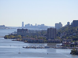
The Hudson Waterfront is an urban area of northeastern New Jersey along the lower reaches of the Hudson River, the Upper New York Bay and the Kill van Kull. Though the term can specifically mean the shoreline, it is often used to mean the contiguous urban area between the Bayonne Bridge and the George Washington Bridge that is approximately 19 miles (31 km) long. Historically, the region has been known as Bergen Neck, the lower peninsula, and Bergen Hill, lower Hudson Palisades. It has sometimes been called the Gold Coast.

The North Hudson Railway Company built and operated a streetcar system in Hudson County and southeast Bergen County, New Jersey before and after the start of the 20th century. It was founded by Hillric J. Bonn who became the first President in 1865 and served for 26 years until his death, and eventually taken over by the Public Service Railway. In its endeavors to overcome the formidable obstacle of ascending the lower Hudson Palisades, or Bergen Hill, it devised numerous innovative engineering solutions including funicular wagon lifts, an inclined elevated railway, an elevator and viaducts.

Palisade Avenue is the name given to a historic road which parallels the eastern crest of Hudson Palisades in northeastern New Jersey. It travels between Jersey City and Fort Lee, passing through Jersey City Heights, North Hudson, and Cliffside Park, with various parts carrying Hudson and Bergen county route designations. The avenue re-aligns itself at several places along its route as it crosses traditional municipal boundaries created in the 19th century. As a primary route running along the top of the Hudson Palisades, many segments offer scenic views of the Hudson River and the New York skyline.

Bergen Hill is the name given to the emergence of the Hudson Palisades along the Bergen Neck peninsula in Hudson County, New Jersey and the inland neighborhood of Jersey City where they rise from the coastal plain at the Upper New York Bay. The name is taken from the original 17th-century New Netherland settlement of Bergen, which in Dutch means hills.

The Edgewater Branch was a branch of the New York, Susquehanna and Western Railway (NYS&W) that ran about 3.174 miles (5.108 km) through eastern Bergen County, New Jersey in the United States. Starting from a rail junction at the Little Ferry Yard, it went east through the Edgewater Tunnel to Undercliff to the Hudson Waterfront.


