Cedarville, Illinois

Last updated
Cedarville
Cedarville Il Addams Homestead8.jpg
John H. Addams Homestead, Birthplace of Jane Addams, Cedarville, Illinois.
Stephenson County Illinois Incorporated and Unincorporated areas Cedarville Highlighted.svg
Location of Cedarville in Stephenson County, Illinois.
Illinois in United States (US48).svg
Location of Illinois in the United States
Coordinates: 42°22′30″N89°38′02″W / 42.37500°N 89.63389°W / 42.37500; -89.63389 Coordinates: 42°22′30″N89°38′02″W / 42.37500°N 89.63389°W / 42.37500; -89.63389
CountryUnited States
StateIllinois
County Stephenson
Townships Buckeye, Harlem, Lancaster
Government
  Village PresidentShawn Cox
Area
[1]
  Total0.46 sq mi (1.19 km2)
  Land0.46 sq mi (1.19 km2)
  Water0.00 sq mi (0.00 km2)
Elevation
866 ft (264 m)
Population
 (2020)
  Total663
  Density1,444.44/sq mi (557.86/km2)
ZIP Code(s)
61013
Area code(s) 815
FIPS code 17-12008
Wikimedia CommonsCedarville, Illinois

Cedarville is a village in Stephenson County, Illinois, United States. The population was 741 at the 2010 census, up from 719 in 2000. It is the birthplace of social activist Jane Addams, the 1931 Nobel Peace Prize winner.

Contents

Geography

Cedarville is located at 42°22′30″N89°38′2″W / 42.37500°N 89.63389°W / 42.37500; -89.63389 (42.375078, -89.633823). [2]

According to the 2010 census, Cedarville has a total area of 0.45 square miles (1.17 km2), all land. [3]

Demographics

Historical population
CensusPop.
1890 326
1900 37715.6%
1910 311−17.5%
1920 258−17.0%
1930 33630.2%
1940 42025.0%
1950 46611.0%
1960 57022.3%
1970 5781.4%
1980 76632.5%
1990 751−2.0%
2000 719−4.3%
2010 7413.1%
2020 663−10.5%
U.S. Decennial Census [4]

As of the census [5] of 2010, there were 741 people, 290 households, and 216 families residing in the village. The population density was 1,599.8 people per square mile (616.9/km2). There were 313 housing units at an average density of 696.4 per square mile (268.6/km2). The racial makeup of the village was 98.75% White, 0.14% Native American and 1.11% Asian. Hispanic or Latino of any race were 0.14% of the population.

There were 290 households, out of which 29.3% had children under the age of 18 living with them, 69.0% were married couples living together, 2.8% had a female householder with no husband present, and 25.5% were non-families. 21.0% of all households were made up of individuals, and 8.3% had someone living alone who was 65 years of age or older. The average household size was 2.48 and the average family size was 2.89.

In the village, the population was spread out, with 22.7% under the age of 18, 7.0% from 18 to 24, 30.9% from 25 to 44, 25.6% from 45 to 64, and 13.9% who were 65 years of age or older. The median age was 38 years. For every 100 females, there were 99.2 males. For every 100 females age 18 and over, there were 96.5 males.

The median income for a household in the village was $44,609, and the median income for a family was $49,821. Males had a median income of $37,500 versus $25,481 for females. The per capita income for the village was $20,076. Below the poverty line were 2.6% of people, 2.2% of families, 1.2% of those under 18 and 3.8% of those over 64.

See also

Related Research Articles

Greene County, Ohio County in Ohio, United States

Greene County is located in the southwestern portion of the U.S. state of Ohio. As of the 2020 census, the population was 167,966. Its county seat is Xenia. The county was established on March 24, 1803 and named for General Nathanael Greene, an officer in the Revolutionary War.

Point MacKenzie, Alaska CDP in Alaska, United States

Point MacKenzie is a census-designated place (CDP) in Matanuska-Susitna Borough, Alaska, United States. It is part of the Anchorage, Alaska Metropolitan Statistical Area. At the 2020 census the population was 1,852, up from 529 in 2010.

Adeline, Illinois Village in Illinois, United States

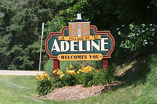
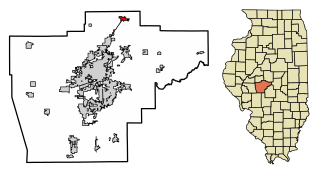
Adeline is a village in Maryland Township, Ogle County, Illinois, United States, along the Leaf River. The population was 85 at the 2010 census, down from 139 in 2000.

Bellevue, Illinois Village in Illinois, United States

Bellevue is a village in Peoria County, Illinois, United States. The population was 1,978 at the 2010 census. Bellevue is a suburb of Peoria and is part of the Peoria, Illinois Metropolitan Statistical Area.

Williamsville, Illinois Village in Illinois, United States

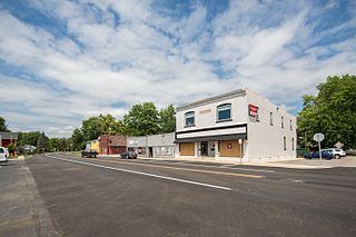
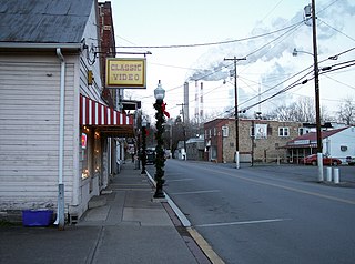
Williamsville is a village in Sangamon County, Illinois, United States. The population was 1,476 at the 2010 census, and 1,491 at a 2018 estimate. It is part of the Springfield, Illinois Metropolitan Statistical Area.

Rock City, Illinois Village in Illinois, United States

Rock City is a village in Stephenson County, Illinois. The population was 315 at the 2010 census, up from 313 in 2000.

Leo-Cedarville, Indiana Town in Indiana, United States

Leo-Cedarville is a town in Cedar Creek Township, Allen County, Indiana, United States. The population was 3,603 at the 2010 census.

Cedarville, Ohio Village in Ohio, United States

Cedarville is a village in Greene County, Ohio, United States. The village is within the Dayton Metropolitan Statistical Area. The population was 4,019 at the 2010 census.

Turpin Hills, Ohio Census-designated place in Ohio, United States

Turpin Hills is a census-designated place (CDP) outside of Anderson Township, Hamilton County, Ohio, United States. The population was 5,099 at the 2010 census.

Wilmot, Ohio Village in Ohio, United States

Wilmot is a village in Stark County, Ohio, United States. The population was 304 at the 2010 census. It is part of the Canton–Massillon Metropolitan Statistical Area.

Vandling, Pennsylvania Borough in Pennsylvania, United States

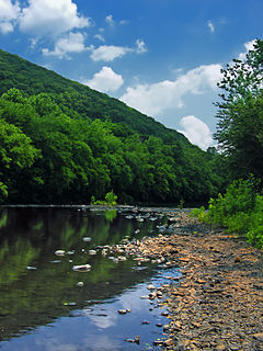
Vandling is a borough in the northeastern corner of Lackawanna County, Pennsylvania, United States. The population was 751 at the 2010 census. It is located immediately south of Forest City, which is in Susquehanna County.

West Brunswick Township, Schuylkill County, Pennsylvania Township in Pennsylvania, United States

West Brunswick Township is a township in Schuylkill County, Pennsylvania, United States. Brunswick Township was formed in 1801 as one of the original townships of Schuylkill County, being named for Brunswick (Braunschweig), Germany. In 1835, Brunswick Township was divided into East and West Brunswick Townships. Among the village names in the township are Molino, Pinedale and Frisbie.

Braden, Tennessee Place in Tennessee, United States

Braden is a town in Fayette County, Tennessee. The population was 282 at the 2010 census. The town is named after Joseph P. Braden.

Laurel, Virginia Census-designated place in Virginia, United States

Laurel is a census-designated place (CDP) in western Henrico County, Virginia. The population was 16,713 at the 2010 United States Census. It is the county seat of Henrico County.

Lumberport, West Virginia Town in West Virginia, United States

Lumberport is a town in Harrison County, located in northern West Virginia, United States. The population was 876 at the 2010 census.

Rockdale, Wisconsin Village in Wisconsin, United States

Rockdale is a village in Dane County, Wisconsin, United States. The population was 214 at the 2010 census. The village is split in half by the Koshkonong Creek. It is part of the Madison Metropolitan Statistical Area.

Browntown, Wisconsin Village in Wisconsin, United States

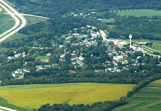
Browntown is a village in Green County, Wisconsin, United States. The population was 280 at the 2010 census.

South Wayne, Wisconsin Village in Wisconsin, United States

South Wayne is a village in Lafayette County, Wisconsin, United States. The population was 489 at the 2010 census.

Tigerton, Wisconsin Village in Wisconsin, United States

Tigerton is a village in Shawano County, Wisconsin, United States. The population was 741 at the 2010 census.

Ridgeway, Wisconsin Village in Wisconsin, United States

Ridgeway is a village in Iowa County, Wisconsin, United States. The population was 653 at the 2010 census. The village is adjacent to the Town of Ridgeway. It is part of the Madison Metropolitan Statistical Area.

References

  1. "2020 U.S. Gazetteer Files". United States Census Bureau. Retrieved March 15, 2022.
  2. "US Gazetteer files: 2010, 2000, and 1990". United States Census Bureau. 2011-02-12. Retrieved 2011-04-23.
  3. "G001 - Geographic Identifiers - 2010 Census Summary File 1". United States Census Bureau. Archived from the original on 2020-02-13. Retrieved 2015-08-02.
  4. "Census of Population and Housing". Census.gov. Retrieved June 4, 2015.
  5. "U.S. Census website". United States Census Bureau . Retrieved 2008-01-31.