Chesapeake Bay Bridge

Last updated

Chesapeake Bay Bridge
Chesapeake Bay Bridge viewed from Sandy Point State Park.jpg
Both spans of the Chesapeake Bay Bridge as seen from Sandy Point State Park, 2011
Coordinates 38°59′30″N76°22′20″W / 38.99167°N 76.37222°W / 38.99167; -76.37222
Carries5 lanes of US 50.svgUS 301.svg US 50  / US 301
Crosses Chesapeake Bay
Locale Anne Arundel and Queen Anne's Counties, Maryland
Official nameGov. William Preston Lane Jr. Memorial Bridge
Other name(s)"Bay Bridge"
Maintained by Maryland Transportation Authority, State of Maryland
ID number AAZ050 [1] [2]
Website baybridge.maryland.gov
Characteristics
Design Cantilever bridge (eastbound), Continuous truss bridge (westbound), and Suspension bridges (both spans)
Material Steel, concrete
Total length21,273 ft (6,484.0 m) (eastbound)
21,047 ft (6,415.1 m) (westbound)
Width28 ft (8.5 m) (eastbound)
38 ft (11.6 m) (westbound)
Height354 ft (107.9 m) (eastbound)
379 ft (115.5 m) (westbound)
Longest span1,600 ft (488 m)
Clearance below 186 ft (56.7 m)
History
OpenedJuly 30, 1952 (eastbound)
June 28, 1973 (westbound)
Statistics
Daily traffic 61,000
Toll$4.00 (eastbound only)
Location
Chesapeake Bay Bridge

The Gov. William Preston Lane Jr. Memorial Bridge (informally called the Chesapeake Bay Bridge and, locally, the Bay Bridge) is a major dual-span bridge in the U.S. state of Maryland. Spanning the Chesapeake Bay, it connects the state's rural Eastern Shore region with its urban and suburban Western Shore, running between Stevensville and Sandy Point State Park near the capital city of Annapolis. The original span, opened in 1952 and with a length of 4 miles (6.4 km), was the world's longest continuous over-water steel structure. The parallel span was added in 1973. The bridge is named for William Preston Lane Jr., who as the 52nd Governor of Maryland launched its construction in the late 1940s after decades of political indecision and public controversy.

Contents

The bridge is part of U.S. Route 50 (US 50) and US 301, and serves as a vital link in both routes. As part of cross-country US 50, it connects the Baltimore–Washington Metropolitan Area with Ocean City, Maryland, Rehoboth Beach, Delaware, and other coastal tourist destinations. As part of US 301, it serves as part of an alternative route for Interstate 95 travelers, between northern Delaware and the Washington, D.C., area. The bridge is busy and often congested with traffic, particularly during peak hours and summer months.

The bridge's role in transportation was filled by ferries before the first span's construction. The bridge has fostered the state's economic growth, particularly of Queen Anne's County and Ocean City. Further expansion of the bridge has been discussed since 2004, with a task force being formed to investigate the possibility of building a third span.

The bridge is often confused with the Chesapeake Bay Bridge–Tunnel, a bridge–tunnel linking the Eastern Shore of Virginia with the Hampton Roads region and the rest of Virginia.[ citation needed ]

History

Proposals and ferries

It is possible that studies may have been conducted as early as the 1880s into the possibility of a bridge across the Chesapeake Bay. [3] However, the first known proposal came about in 1907 and called for a crossing between Baltimore and Tolchester Beach. [4] In 1927, local businesspeople were authorized to finance the construction of a Baltimore to Tolchester Beach crossing. Plans for the new bridge were made, but construction was canceled following the Wall Street Crash of 1929 with the collapse of the American economy and resulting Great Depression of the 1930s. [3]

Ferries were used as the main mode of transportation across the bay from the colonial period until the completion of the 1952 bridge. The first service ran from Annapolis to Broad Creek on Kent Island, roughly where the bridge is today. [5] In 1919, the Claiborne–Annapolis Ferry Company began running ferries between Annapolis and Claiborne, a community near St. Michaels.

In July 1930, the Claiborne–Annapolis Ferry Company added a new route, one running from Annapolis to Matapeake, a significantly shorter distance. [6] The auto and passenger ferries were taken over by the State Roads Commission in 1941 (reorganized into today's State Highway Administration of the Maryland Department of Transportation in 1973). Two years later, the commission moved the western terminus of the old Annapolis–Matapeake ferry to Sandy Point (later adjacent to Sandy Point State Park), shortening the cross-bay trip. [6]

Construction of 1952 span

A 1938 proposal by the Maryland General Assembly was the first to call for a bridge at the Sandy Point–Kent Island location. [4] Although the legislation authorizing the new bridge passed, the involvement of the United States in World War II delayed the bridge's construction. In 1947, with the war over, the Assembly, under the leadership of Maryland Governor William Preston Lane Jr., (1892–1967), passed legislation directing the old State Roads Commission to begin construction. [3] Ground was broken in January 1949, and after a 3+12-year construction project, the bridge opened to traffic on July 30, 1952, as both the longest continuous over-water steel structure, and the third longest bridge in the world. [7] Before the opening, a parade of vehicles made the first official crossing, led by then current Governor Theodore Roosevelt McKeldin, (1900–1974), and other state officials in a distinctive white Cadillac convertible flying huge American and Maryland flags. [8] On November 9, 1967, the bridge was dedicated to Governor Lane, who had died earlier that year, and officially renamed the "William Preston Lane Jr. Memorial Bridge". [3]

1973 expansion

In 1967, due to increasing traffic volume, the Maryland General Assembly authorized three possible new crossings, all suggested during the 1964 Chesapeake Bay crossing study. [9] These included one further north near Baltimore, one in southern Maryland, and an additional span to be added to the existing bridge from Kent Island to Sandy Point; ultimately, the third option was chosen. Construction of the new parallel span began in 1969 to the north of the original bridge, and it was completed on June 28, 1973. [8]

Notable incidents

Looking up Chesapeake Bay Bridge during Isabel, Sept 18, 2003.jpg
The Bay Bridge during 2003's Hurricane Isabel
Police block traffic to Chesapeake Bay Bridge during Isabel, Sept 18 2003.jpg
Policemen block traffic toward the Bay Bridge during Hurricane Isabel due to high winds.

Because of its height, the narrowness of the spans (there are no hard shoulders), the low guardrails, and the frequency of high winds, it is often cited as one of the scariest bridges in the United States. [10] [11] [12] Several weather-related incidents have caused complete closures of the bridge.

The bridge has been closed four times due to extreme weather. The first time was September 18, 2003, during Hurricane Isabel and its high winds. [13] [14] On August 27, 2011, the bridge was closed to all traffic due to the impact of Hurricane Irene. Then-Governor Martin O'Malley ordered the bridge closed when sustained winds exceeded 55 miles per hour (89 km/h). On October 29, 2012, the bridge was closed due to the effects of Hurricane Sandy. [15] On March 6, 2013, during the March 2013 nor'easter, high winds again caused the bridge to be closed. [16]

On August 10, 2008, a tractor trailer involved in a head-on collision near the west end fell from the bridge; the driver died in the crash. [17] The incident highlighted concern that the bridge may not be structurally safe, but the Maryland Transportation Authority (MDTA) discounted any structural or engineering problems with it. [18] Inspections of the wall in the weeks following the accident revealed that there was deterioration in the form of corrosion of the steel reinforcements inside barriers; this prompted immediate repairs to the wall. [19]

Specifications and operations

A timelapse of an eastbound trip over the Chesapeake Bay Bridge

With shore-to-shore lengths of 3.83 and 4.03 miles (6.16 and 6.49 km), [3] [20] the two spans of the bridge form the longest fixed water crossing in Maryland. [21] The bridge's western terminus is in Sandy Point State Park, located northeast of Annapolis in Anne Arundel County, and its eastern terminus is in Stevensville on Kent Island in Queen Anne's County. The two spans are relatively similar in height, with the older span at 354 feet (108 m) and the newer span at 379 feet (116 m). [20]

Structural details

With the exception of the number of lanes on each (two on the original span and three on the newer span) and differences owing to the design standards for the periods in which they were built, the spans are structurally similar. Both were designed by J. E. Greiner Company, [22] which later became a part of AECOM through the company's acquisition of URS Corporation. Each span features:

Chesapeake Bay Bridge Panorama 60465636.jpg
Panoramic view of the bridge, looking south, in which the two main spans (suspension at center and through truss at left) are visible. The towers with the X-shaped latticework are on the eastbound (1952) suspension span, while those with the horizontal crossmembers are on the westbound (1973) suspension span. Notice the difference in the locations of the anchoring points of the main cables: at water level for the eastbound span and at deck level atop large concrete piers for the westbound span.

Traffic control

Green arrows show the proper direction of traffic on both spans. Bay Bridge Sign Crop.jpg
Green arrows show the proper direction of traffic on both spans.

Traffic patterns on the bridge's five lanes can be adjusted via its lane control system, which consists of overhead lane control signals on both spans and approaches. [20] Typically, the two lanes on the south-most span are configured for vehicles traveling east on eastbound US 50/US 301, while the three lanes on the north-most span are configured for vehicles traveling west on westbound US 50/US 301; the spans are therefore referred to as the "eastbound span" and "westbound span", respectively. [3] However, this pattern is adjusted during incidents or peak travel times: for instance, on the outset of weekends when there is a high volume of beach-bound traffic, one lane on the westbound span is configured for eastbound traffic. [20]

In 2006, pink markers were placed along the eastbound span to mark out the suggested following distance, similar to systems used in Minnesota and Pennsylvania. The markers are a part of the MDTA's "Pace Your Space" campaign to prevent vehicle collisions and traffic congestion due to tailgating on the bridge. [25] [26]

In April 2013, changes were made to increase safety on the westbound span during two-way operations: signs, pavement markings, and rumble strips were modified, and a buffer zone between the left and center lanes was created. As a result, motorists can no longer switch between the left and center lanes, whether or not two-way operations are in effect. [27] [28] Two-way traffic may occur on the eastbound span during overnight roadwork or during emergency situations that close the westbound span, on which two-way traffic is more common. When the MDTA closes either span for overnight roadwork, it implements two-way traffic on the span that remains open. During eastbound span closure, two-way traffic operates on the westbound span with the center lane closed. [29]

A tollbooth is removed in January 2020 following Governor Hogan's announcement. Bay Bridge Tollbooth Removal.jpg
A tollbooth is removed in January 2020 following Governor Hogan's announcement.

In January 2020, Governor Larry Hogan announced that the tollbooths on the eastbound side of bridge were being removed in preparation for all-electronic tolling on the Kent Island side of the eastbound bridge. [30] The merged lanes tie directly into the two lanes on the eastbound bridge. The MDTA is replacing lane control signals on both bridges with those that have flashing strobe lights to indicate a lane closure or a lane with contraflow traffic, and is installing an automated gate system on the bridge to allow quicker implementation of two-way traffic on the bridge. The automated gate system will reduce traffic congestion when implementing two-way traffic. Illuminated pavement markings will be installed to show where the crossovers are during two-way traffic operations. MDTA crews will no longer have to manually open and close the crossovers for two-way traffic operations. [31] [32]

The MDTA has used traffic cones and barrels to open and close crossovers, and to create tapers for the reversible lane. When two-way traffic is implemented, the MDTA momentarily stops traffic to reposition traffic cones and barrels to taper traffic into the reversible lane. MDTA Police then escort traffic across the bridge in the reversible lane. The MDTA will not implement two-way traffic in certain weather conditions, including excess precipitation and high winds. The MDTA may stop all traffic when the wind speed exceeds 55 mph. [33] Two-way traffic on the bridge requires all associated signage and systems to be operational. [34] The MDTA has to monitor two-way traffic operations on the bridge due to the length of the bridge and its lack of shoulders. The MDTA will stop two-way traffic if westbound delays pile up, at which point westbound traffic will be prioritized. Any time contraflow traffic is implemented on either of the bridges, the speed limit for the contraflow lane is reduced to 40 mph while the other lanes remain at 50 mph. [35] MDTA Police will momentarily stop traffic for MDTA crews to reposition traffic cones and barrels to close off the left lane leading up to the bridge in the event of inclement weather during contraflow traffic. [35]

Tolls and fees

Operated by the MDTA, the bridge has a one-way toll (eastbound) of $4.00 for two-axle vehicles; vehicles with a Maryland E-ZPass pay $2.50. [36] Previously the bridge had a one-way (eastbound) toll of $6.00 for two-axle vehicles (raised from $4 on July 1, 2013); vehicles with E-ZPass that were enrolled in the Bay Bridge Commuter Plan paid $2.10 (raised from $1 on July 1, 2013). [37] Tolls were collected in both directions until April 1989, when tolls were doubled and only collected in the Eastbound direction. [38] All-electronic tolling began on May 12, 2020, with tolls payable through E-ZPass or Video Tolling, which uses automatic license plate recognition. [39]

The MDTA previously provided transportation across the bridge for nervous drivers, but that role is now filled by private companies. [40] [41]

Bay Bridge Walk and Run

Governor Larry Hogan participates in the 2016 Across the Bay 10K. Across the Bay 10k with Team HoganStrong (30247605744).jpg
Governor Larry Hogan participates in the 2016 Across the Bay 10K.

While there are no pedestrian facilities on the bridge, the Bay Bridge Walk and Governor's Bay Bridge Run used to afford an opportunity to cross the bridge on foot, usually on the first Sunday in May. [42] The events took place on the eastbound span, which was closed to vehicles while two-way traffic shared the westbound span. Participants started on the east end of the bridge (on Kent Island) and proceeded west to the finish near the toll plaza. WMATA and MTA transit buses transported participants between outlying parking areas and the start and finish points.

The run, a 10K race across the bridge, is held early in the morning before the walk. It is conducted by the Annapolis Striders, a local running organization, and controlled by the MDTA and Maryland Department of Natural Resources. Proceeds went to the Chesapeake Bay Trust in support of the bay. [43]

The first walk was held in 1975, [44] when a Towson Boy Scout leader asked Governor Marvin Mandel if his troop could walk across the bridge during maintenance. [42] The annual walk was canceled for the first time in 1980 due to poor weather conditions, and later saw frequent cancellations throughout the 2000s. During this period the walk was canceled in:

Following its cancellation in 2005, the MDTA considered decreasing the annual frequency of the event, citing traffic, fiscal, manpower, and security concerns. The most recent event (held in 2006) cost over $350,000, and the cost estimate for 2012 was almost $400,000. In late 2011, a non-profit group, the Greater Washington Sports Alliance (GWSA), approached the MDTA Capital Committee to propose sponsoring the event, along with a concert at Sandy Point State Park, at no cost to the MDTA. While the Capital Committee unanimously recommended that the MDTA Board approve the proposal contingent upon an agreement between the GWSA and the MDTA, the 2012 event was ultimately cancelled. [51]

After increasingly consistent cancellations of the walking event, the MDTA, along with Queen Anne's County, contracted with an outside company to have a professional 10K race across the bridge, which has been labeled the "Across the Bay 10K". The inaugural event occurred November 9, 2014. [52] [53] The Race Director is Dave McGillivray, [54] who has served in that capacity for the BAA Boston Marathon since 1988. The Across the Bay 10K has several charity beneficiaries, including bay research, bay restoration, and breast cancer research. [55] [56] The IRONMAN Foundation took over the race's organization in 2016. In 2019, the race was held virtually due to maintenance on the bridge. [57]

Impact

In the years since the bridge's completion, Ocean City (pictured) has experienced significant growth. Ocean City Maryland USA 2018-07-14.png
In the years since the bridge's completion, Ocean City (pictured) has experienced significant growth.

Since its construction, the bridge has made significant impacts on both sides of the bay; among them has been the growth of Eastern Shore communities. When the bridge opened in 1952, and again when the second span was added in 1973, the Eastern Shore was given easier access to Baltimore and Washington, causing areas in southern Queen Anne's County to develop as bedroom communities. This extension of the Baltimore–Washington suburbs has led Queen Anne's County to be listed as part of the Baltimore–Washington Metropolitan Area. The bridge has also given easier access to Ocean City from the Western Shore, which has caused Ocean City to grow from a small town to one that is said to become the second largest city in Maryland during the summer. [58]

In 1948, the impending completion of the bridge gave rise to an extension of US 50 to Ocean City. [59] The route was extended along the corridor of Maryland Route 404 (MD 404) and a large portion of US 213, cutting both of those routes back. During the 1950s, US 50 on the Western Shore was rerouted onto the long-proposed Annapolis–Washington Expressway (now known as the John Hanson Highway), which was built at the time in order to provide better access to the bridge. [60] As the Eastern Shore, particularly Ocean City, grew, further upgrades and realignments of US 50 took place. This work included the aforementioned 1973 completion of the second Bay Bridge span, the extension of the US 50 freeway eastward to the US 50/US 301 split in Queenstown, and the construction of a freeway bypass around the north side of Salisbury in 2002. Additionally, the road has been upgraded and realigned over the years from its original two-lane configuration to a four-lane divided highway, with the last such section being in Vienna, bypassed in 1991. [61] Previous plans to expand US 50's freeway portion and replace the aging Harry W. Kelley Memorial Bridge into Ocean City have been delayed. [62]

The bridge is often the site of suicides by jumpers. [63] [64] [65] [66] [67] As of 1995, more than 75 people had committed suicide during the bridge's 43-year existence. [68]

Future expansion

Chesapeake Bay Bridge Chesapeake Bay Bridge Aerial.jpg
Chesapeake Bay Bridge

In December 2004, a study concluded that traffic across the bridge was expected to increase by 40% by 2025. The following year, a task force formed by Governor Bob Ehrlich met to again explore the possibility of establishing a new Chesapeake Bay crossing. [69] The task force concluded that a bridge would be the best option for an additional crossing, and four geographic locations for such a bridge were explored: Anne Arundel County to Queen Anne's County (the existing location), Baltimore County to Kent County, Anne Arundel or Calvert County to Talbot County, and Calvert County to Dorchester County. [70] In late 2006, the task force released a report on the study but did not make a final recommendation; members of the task force requested additional time to continue the study. [71]

In 2020, it was announced that 11 of 14 potential sites for a third span had been rejected by the Maryland Transportation Authority following a $5 million study into the impacts of an additional span. Significant environmental and economic impacts were identified, with a report stating that any additional crossing is "expected to be multiple billions of dollars." [72]

USA Maryland location map.svg
1
2
3
4
5
Proposed additional spans of the Chesapeake Bay Bridge
1
Current location; 2 spans
2
Additional span at current location
3
Baltimore County to Kent County
4
Anne Arundel/Calvert County to Talbot County
5
Calvert County to Dorchester County

See also

Related Research Articles

<span class="mw-page-title-main">San Francisco–Oakland Bay Bridge</span> Complex of bridges spanning San Francisco Bay

The San Francisco–Oakland Bay Bridge, known locally as the Bay Bridge, is a complex of bridges spanning San Francisco Bay in California. As part of Interstate 80 and the direct road between San Francisco and Oakland, it carries about 260,000 vehicles a day on its two decks. It includes one of the longest bridge spans in the United States.

<span class="mw-page-title-main">New Jersey Route 139</span> State highway in Hudson County, New Jersey, US

Route 139 is a state highway in Jersey City, New Jersey in the United States that heads east from the Pulaski Skyway over Tonnele Circle to the state line with New Jersey and New York in the Holland Tunnel, which is under the Hudson River, to New York City. The western portion of the route is a two level highway that is charted by the New Jersey Department of Transportation (NJDOT) as two separate roadways: The 1.45-mile (2.33 km) lower roadway (Route 139) between U.S. Route 1/9 (US 1/9) over Tonnele Circle and Interstate 78 (I-78) at Jersey Avenue, and the 0.83-mile (1.34 km) upper roadway running from County Route 501 and ending where it joins the lower highway as part of the 12th Street Viaduct, which ends at Jersey Avenue. The lower roadway is listed on the federal and NJ state registers of historic places since 2005. The eastern 1.32 miles (2.12 km) of the route includes the Holland Tunnel approach that runs concurrent with Interstate 78 on the one-way pair of 12th Street eastbound and 14th Street westbound. Including the concurrency, the total length of Route 139 is 2.77 miles (4.46 km).

<span class="mw-page-title-main">Goethals Bridge</span> Bridge between New Jersey and New York, United States

The Goethals Bridge is the name of a pair of cable-stayed bridge spans connecting Elizabeth, New Jersey, to Staten Island, New York, in the United States. The spans cross a strait known as Arthur Kill, and replaced a cantilever bridge span built in 1928. The bridge is operated by the Port Authority of New York and New Jersey.

<span class="mw-page-title-main">Interstate 895</span> Highway in Maryland

Interstate 895 (I-895) is an auxiliary Interstate Highway in the US state of Maryland. Known as the Harbor Tunnel Thruway, the highway runs 11.44 miles (18.41 km) between one junction with I-95 in Elkridge and another interchange with I-95 on the east side of Baltimore. I-895 is a toll road that crosses the Patapsco River estuary via the Baltimore Harbor Tunnel, connecting U.S. Route 1 (US 1), I-695, and the Baltimore–Washington Parkway in the southwestern suburbs of Baltimore with US 40 on the east side of Baltimore. In conjunction with a pair of spurs, unsigned I-895A and I-895B, I-895 provides access to the tunnel from I-97 and Maryland Route 2 (MD 2) in Glen Burnie. The highway is designed for through traffic by having partial interchanges that require vehicles from almost all starting points to pass through the tunnel and the tunnel toll plaza, where a $1.40-$6.00 toll is charged to passenger vehicles, before exiting the facility.

<span class="mw-page-title-main">Governor Harry W. Nice Memorial Bridge</span> Bridge in Virginia and Newburg, Maryland

The Governor Harry W. Nice Memorial/Senator Thomas "Mac" Middleton Bridge, also known as the Potomac River Bridge, is a 1.7-mile (2.7 km), four-lane continuous truss bridge that spans the Potomac River between Newburg in Charles County, Maryland and Dahlgren in King George County, Virginia, United States. It is one of eight toll facilities operated by the Maryland Transportation Authority, and is one of two toll bridges over the Potomac River. The other, the privately owned Oldtown Low Water Toll Bridge, connects Maryland and West Virginia, far upstream. The new Nice Bridge opened to traffic in October 2022. Demolition of the original bridge began on March 21, 2023.

<span class="mw-page-title-main">Hampton Roads Bridge–Tunnel</span> Bridge–tunnel connecting Virginia cities Norfolk and Hampton

The Hampton Roads Bridge–Tunnel (HRBT) is a 3.5-mile-long (5.6 km) Hampton Roads crossing for Interstate 64 (I-64) and US Route 60 (US 60). It is a four-lane facility comprising bridges, trestles, artificial islands, and tunnels under the main shipping channels for Hampton Roads harbor in the southeastern portion of Virginia in the United States.

<span class="mw-page-title-main">Interstate 695 (Maryland)</span> Highway in Maryland

Interstate 695 (I-695) is a 51.46-mile-long (82.82 km) auxiliary Interstate Highway that constitutes a beltway extending around Baltimore, Maryland, United States. I-695 is officially designated the McKeldin Beltway but is colloquially referred to as either the Baltimore Beltway or 695. The route is an auxiliary route of I-95, intersecting that route southwest of Baltimore near Arbutus and northeast of the city near White Marsh. It also intersects other major roads radiating from the Baltimore area, including I-97 near Glen Burnie, the Baltimore–Washington Parkway near Linthicum, I-70 near Woodlawn, I-795 near Pikesville, and I-83 in the Timonium area. The 19.37-mile (31.17 km) portion of the Baltimore Beltway between I-95 northeast of Baltimore and I-97 south of Baltimore is officially Maryland Route 695 (MD 695) and is not part of the Interstate Highway System but is signed as I-695. The Francis Scott Key Bridge that crossed over the Patapsco River was included in this section of the route before the bridge's collapse on March 26, 2024. The bridge and its approaches were maintained by the Maryland Transportation Authority (MDTA), while the remainder of the Baltimore Beltway is maintained by the Maryland State Highway Administration (MDSHA).

The Maryland Transportation Authority (MDTA) is an independent state agency responsible for financing, constructing, operating, and maintaining eight transportation facilities, currently consisting of two toll roads, two tunnels, and four bridges in Maryland. It also provides the Maryland Department of Transportation with financing for other revenue producing transportation projects.

<span class="mw-page-title-main">San Diego–Coronado Bridge</span> Bridge in San Diego and Coronado, California

The San Diego–Coronado Bridge, locally referred to as the Coronado Bridge, is a prestressed concrete/steel girder bridge fixed-link, crossing over San Diego Bay in the United States, linking San Diego with Coronado, California. The bridge is signed as part of State Route 75.

<span class="mw-page-title-main">Clara Barton Parkway</span> Parkway in Maryland and Washington D.C.

Clara Barton Parkway is an automobile parkway in the U.S. state of Maryland and the District of Columbia. The highway runs 6.8 miles (10.9 km) from MacArthur Boulevard in Carderock, Maryland, east to Canal Road at the Chain Bridge in Washington. Clara Barton Parkway is a two- to four-lane parkway that parallels the Potomac River and the Chesapeake and Ohio Canal (C&O) in southwestern Montgomery County, Maryland, and the far western corner of Washington. The parkway provides access to the communities of Cabin John and Glen Echo and several units of the Chesapeake and Ohio Canal National Historical Park. The Maryland portion of the George Washington Memorial Parkway was constructed from Carderock past Interstate 495 (I-495) to Glen Echo in the early to mid-1960s. The parkway was proposed to continue west to Great Falls and east to Georgetown. However, these proposals never came to fruition and the parkway was extended only to the Chain Bridge in the early 1970s. The Maryland portion of the George Washington Memorial Parkway was renamed in 1989 for Clara Barton, the founder of the American Red Cross, and whose original headquarters is located in Glen Echo.

<span class="mw-page-title-main">American Legion Memorial Bridge (Potomac River)</span> Potomac River crossing between the states of Maryland and Virginia, United States

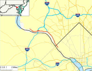
The American Legion Memorial Bridge, also known as the American Legion Bridge and formerly as the Cabin John Bridge, is a bridge carrying Interstate 495 across the Potomac River between Montgomery County, Maryland and Fairfax County, Virginia in the United States. It is an American Water Landmark. Plummers Island is located immediately downstream of the bridge.

<span class="mw-page-title-main">Maryland Route 404</span> Highway in Maryland

Maryland Route 404 (MD 404) is a major highway on Maryland's Eastern Shore in the United States. Signed east-west, it runs 24.61 miles (39.61 km) from MD 662 in Wye Mills on the border of Queen Anne's and Talbot counties, southeast to the Delaware state line in Caroline County, where the road continues as Delaware Route 404 (DE 404) to the Five Points intersection near Rehoboth Beach. The Maryland and Delaware state highways together cross the width of the Delmarva Peninsula and serve to connect the Baltimore–Washington Metropolitan Area by way of the Chesapeake Bay Bridge and U.S. Route 50 (US 50) with the Delaware Beaches. Along the way, MD 404 passes through mostly farmland and woodland as well as the towns of Queen Anne, Hillsboro, and Denton. The route is a four-lane divided highway between US 50 and east of Denton, with the remainder of the route a two-lane undivided road.

<span class="mw-page-title-main">U.S. Route 50 in Maryland</span> Section of U.S. Highway in Maryland, United States

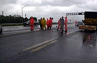
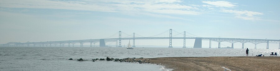
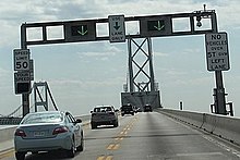
U.S. Route 50 is a major east–west route of the U.S. Highway system, stretching just over 3,000 miles (4,800 km) from West Sacramento, California, east to Ocean City, Maryland, on the Atlantic Ocean. In the U.S. state of Maryland, US 50 exists in two sections. The longer of these serves as a major route connecting Washington, D.C., with Ocean City; the latter is the eastern terminus of the highway. The other section passes through the southern end of Garrett County for less than 10 miles (16 km) as part of the Northwestern Turnpike, entering West Virginia at both ends. One notable section of US 50 is the dual-span Chesapeake Bay Bridge across the Chesapeake Bay, which links the Baltimore–Washington metropolitan area with the Eastern Shore region, allowing motorists to reach Ocean City and the Delaware Beaches.

<span class="mw-page-title-main">Interstate 95 in Maryland</span> Interstate Highway in Maryland

Interstate 95 (I-95) is an Interstate Highway running along the East Coast of the United States from Miami, Florida, north to the Canada–United States border at Houlton, Maine. In Maryland, the route is a major highway that runs 110.01 miles (177.04 km) diagonally from southwest to northeast, entering from the District of Columbia and Virginia at the Woodrow Wilson Bridge over the Potomac River, northeast to Maryland's border with Delaware near Elkton. It is the longest Interstate Highway within Maryland and is one of the most traveled Interstate Highways in the state, especially between Baltimore and Washington, D.C., despite alternate routes along the corridor, such as the Baltimore–Washington Parkway, U.S. Route 1 (US 1), and US 29. I-95 also has eight auxiliary routes in the state, the most of any state along the I-95 corridor. Portions of the highway, including the Fort McHenry Tunnel and the Millard E. Tydings Memorial Bridge, are tolled.

<span class="mw-page-title-main">Baltimore Harbor Tunnel</span> Tunnel in Baltimore, Maryland, US

The Baltimore Harbor Tunnel is a pair of two-lane road tunnels carrying I-895 under the Patapsco River southeast of downtown Baltimore, Maryland.

<span class="mw-page-title-main">Escambia Bay Bridge</span> Bridge in Florida, United States

The Escambia Bay Bridge is a six-lane freeway bridge that carries Interstate 10 (I-10) across Escambia Bay near Pensacola, Florida.

<span class="mw-page-title-main">I-10 Twin Span Bridge</span> Bridge in Louisiana

The I-10 Twin Span Bridge, a nearly 5.5-mile (8.9 km) causeway officially known as the Frank Davis "Naturally N'Awlins" Memorial Bridge, consists of two parallel trestle bridges. These parallel bridges cross the eastern end of Lake Pontchartrain in southern Louisiana from New Orleans to Slidell. The current bridge spans were constructed in the second half of the 2000s after the original bridges were extensively damaged by Hurricane Katrina on August 29, 2005. The first span opened to eastbound traffic on July 9, 2009. On April 7, 2010, the second span was opened to traffic and the old twin spans were permanently closed to traffic.

<span class="mw-page-title-main">U.S. Route 301 in Maryland</span> Highway in Maryland

U.S. Route 301 (US 301) in the state of Maryland is a major highway that runs 122.85 miles (197.71 km) from the Governor Harry W. Nice Memorial Bridge over the Potomac River into Virginia northeast to Delaware. It passes through three of Maryland's four main regions: Southern Maryland, the Baltimore-Washington Metropolitan Area, and the Eastern Shore. US 301 serves mainly as a bypass of Baltimore and Washington, D.C. from Virginia to Delaware.

<span class="mw-page-title-main">Pensacola Bay Bridge</span> Bridge in Florida, United States of America

The Pensacola Bay Bridge, also known locally as the Three-Mile Bridge, runs between downtown Pensacola, Florida, and Gulf Breeze, Florida. It carries six lanes of U.S. Highway 98 across Pensacola Bay.

<span class="mw-page-title-main">Maryland Route 908</span> State highway in Maryland, United States

Maryland Route 908 is a collection of unsigned state highways in the U.S. state of Maryland. These five highways are service roads that parallel and provide access to U.S. Route 50 and US 301 along their western approach to the Chesapeake Bay Bridge; the highways also provide access to Sandy Point State Park. The first modern highway from Cape St. Claire to Skidmore was constructed in the late 1920s and replaced by the modern alignment of US 50 in the late 1940s. The frontage roads on either side of the U.S. Highway were constructed in the early 1950s. The mainline segments of MD 908 assumed their present form when US 50 and US 301 were upgraded to a freeway in the early 1990s.

References

  1. Maryland State Highway Administration (2018). "Highway Location Reference: Anne Arundel County" (PDF). Retrieved October 7, 2020.
  2. Maryland State Highway Administration (2018). "Highway Location Reference: Queen Anne's County" (PDF). Retrieved October 7, 2020.
  3. 1 2 3 4 5 6 "The William Preston Lane Jr. Memorial Bridge" (PDF). Maryland Transportation Authority. Archived from the original (PDF) on May 31, 2009. Retrieved October 26, 2007.
  4. 1 2 Intern, Waxter (May 26, 2017). "How the Chesapeake Bay Bridge Connected Maryland". Preservation Maryland. Retrieved October 6, 2020.
  5. Gayman, Jennifer. "Kent Island". Maryland Online Encyclopedia. Retrieved November 18, 2007.
  6. 1 2 Saucedo, Brian; McNulty, Anne (July 12, 2018). "Ferry Tales of the Chesapeake Bay". What's Up? Media. Retrieved October 6, 2020.
  7. "William Preston Lane Jr. Memorial Bay Bridge: Engineering Feats". Maryland Transit Administration. Archived from the original on July 1, 2008. Retrieved February 5, 2008.
  8. 1 2 "William Preston Lane Jr. Memorial Bay Bridge: History". Maryland Transit Administration. Archived from the original on July 1, 2008. Retrieved February 5, 2008.
  9. "Crossing the Bay". Kent Conservation and Preservation Alliance. December 4, 2017. Retrieved October 6, 2020.
  10. "World's Scariest Bridges". Travel and Leisure. October 2010. Retrieved September 2, 2013.
  11. "Is This The Scariest Bridge In America?". Inside Edition. July 23, 2015. Retrieved October 6, 2020.
  12. Glover, Mary Clare (August 5, 2011). "Bay Bridge: One of America's Ten Scariest". Washingtonian. Retrieved October 6, 2020.
  13. "Hurricane Isabel photo log". Indepth:Forces of Nature. CBC News. September 18, 2003. Retrieved November 16, 2007.
  14. Martin, Patrick (September 25, 2003). "US: Millions still without power a week after Hurricane Isabel". World Socialist Website . Retrieved November 16, 2007.
  15. "Chesapeake Bay Bridge Now Closed". WBOC TV. Archived from the original on November 1, 2012. Retrieved October 29, 2012.
  16. "High winds force closure of Chesapeake Bay Bridge". Delaware Online. March 6, 2013. Retrieved March 19, 2013.
  17. St. George, Donna; Birnbaum, Michael (August 11, 2008). "Traffic Continues to Stall on Bay Bridge". The Washington Post. Retrieved August 11, 2008.
  18. May, Adam (August 11, 2008). "Eastbound Right Lane Reopens On Bay Bridge". WJZ. Archived from the original on August 25, 2008. Retrieved August 12, 2008.
  19. Dominguez, Alex (August 27, 2008). "Bay Bridge walls had corrosion, tests show". The Free Lance-Star. Archived from the original on May 8, 2009. Retrieved August 30, 2008.
  20. 1 2 3 4 5 "William Preston Lane Jr. Memorial (Bay) Bridge (US 50/301)". Maryland. Retrieved September 6, 2020.
  21. "Why the Bay Bridge Curves and More". WTOP. June 28, 2017. Archived from the original on June 12, 2021. Retrieved October 7, 2020.
  22. Legler, Dixie; Highsmith, Carol (2002). Historic Bridges of Maryland. Crownsville, Md.: Maryland Historic Trust. p. 46. ISBN   1-878399-80-2. Archived from the original on May 10, 2009.
  23. "Chesapeake Bay Bridge (William Preston Lane Memorial Bridge". DC Roads. Retrieved May 6, 2021.
  24. "William Preston Lane Jr. Memorial Bridge: Fun Facts [Family Fun]". Maryland Transportation Authority. Archived from the original on September 28, 2007. Retrieved October 9, 2007.
  25. "Safety Tips for traveling the Bay Bridge". Maryland Transportation Authority. Archived from the original on December 27, 2007. Retrieved October 9, 2007.
  26. Gramlich, John (July 7, 2006). "State DOTs hope drivers see dots". Stateline. Pew Research Center. Archived from the original on December 27, 2007.
  27. "Plans made to enhance two-way traffic operations on Chesapeake Bay Bridge". WBAL TV. Archived from the original on June 20, 2013. Retrieved June 18, 2013.
  28. Thomson, Candy. "Bay Bridge getting rumble strips, safety buffer zone". Baltimore Sun. Archived from the original on June 7, 2013. Retrieved June 18, 2013.
  29. "MDTA Traffic Advisories". Maryland Transportation Authority. May 20, 2020. Archived from the original on October 28, 2020. Retrieved May 27, 2020.
  30. Ryan, Kate (January 28, 2020). "Bay Bridge to go cashless by summer". WTOP. Retrieved May 27, 2020.
  31. Bay Bridge Deck Rehabilitation. QACTV. November 25, 2019. Retrieved May 27, 2020 via YouTube.
  32. MDTA [@TheMDTA] (July 7, 2021). "A NEW Automated Lane Closure System is coming to the Bay Bridge! This system will enhance the current manual process by providing automated implementation and discontinuation of contraflow. The automated lane closure system will be in place in Fall 2022. https://go.usa.gov/x6MMh" (Tweet). Retrieved September 5, 2021 via Twitter.
  33. "Emergency Closures". Maryland Transportation Authority. Retrieved May 27, 2020.
  34. Murillo, Mike (September 7, 2015). "Generator on standby on Bay Bridge to avoid another power outage fiasco". WTOP. Retrieved July 21, 2020.
  35. 1 2 "Contra-flow Operations" (PDF). Maryland Transportation Authority. August 13, 2019. Retrieved July 21, 2020.
  36. "Toll Rates". Bay Bridge. Maryland Transit Authority . Retrieved June 11, 2017.
  37. "Toll Rates for the William Preston Lane Jr. Memorial (Bay) Bridge (US 50/301)". Maryland Transportation Authority. Retrieved July 10, 2014.
  38. "WESTBOUND BAY BRIDGE TOLL ENDING". Washington Post. February 1, 1989.
  39. Fulginiti, Jenny (May 5, 2020). "Bay Bridge cashless tolling goes live May 12". WBAL. Retrieved May 7, 2020.
  40. Miller, Susan (August 16, 2014). "Don't look down: How I crossed the Bay Bridge". USA Today. Retrieved October 9, 2020.
  41. Gabriel, Trip (May 26, 2013). "Quelling Anxiety Across the Chesapeake". The New York Times. Retrieved October 9, 2020.
  42. 1 2 "Governor O'Malley Announces Plans to Host 2007 Bay Bridge Walk" (Press release). Maryland Department of Transportation. February 23, 2007. Archived from the original on November 21, 2008. Retrieved September 1, 2008. The first Sunday in May means Bay Bridge Walk
  43. "The 22nd Governor's Bay Bridge Run". Annapolis Striders. Archived from the original on October 27, 2007. Retrieved November 16, 2007.
  44. Kozel, Scott. "Chesapeake Bay Bridge Walk". Roads to the Future. Retrieved November 16, 2007.
  45. Schuyler, Jim (May 6, 2007). "High Winds Cancel Bay Bridge Walk". WJZ-TV. Archived from the original on December 27, 2007. Retrieved November 16, 2007.
  46. 1 2 Yanovits, Dave (May 7, 2007). "Race Canceled for 4th Time in Six Years". The Washington Post . Retrieved November 16, 2007.
  47. "Bay Bridge Walk Canceled for 2008, 2009". WTOP News. December 6, 2007. Retrieved February 6, 2008.
  48. Basch, Michelle. "Bay Bridge Walk cancelled for 4th year in a row". WTOP. Archived from the original on January 5, 2013. Retrieved March 14, 2010.
  49. Eric Willison (April 14, 2015). "Bay Bridge". Maryland Transportation Authority. Archived from the original on March 3, 2011. Retrieved March 31, 2011.
  50. "No Bridge Walk Scheduled in 2012". Maryland Transportation Authority. Archived from the original on September 4, 2012.
  51. "Monthly Capital Meeting Minutes for October 13, 2011" (PDF). Maryland Transportation Authority.[ permanent dead link ]
  52. "Just Announced: 10K Race Across the Chesapeake Bay Bridge". Delmarva Town Crier. March 27, 2013. Retrieved July 23, 2013.
  53. Shatz, Jordan (April 2, 2013). "Officials say OK to bridge 10K" . Retrieved July 23, 2013.
  54. "McGillivray to Direct 10K Across the Bay". Running USA. July 17, 2013. Archived from the original on July 27, 2014. Retrieved July 23, 2013.
  55. "Registration Opens for 'Across the Bay 10K' Chesapeake Bay Bridge Run Today". Wisdom Digital Media. November 9, 2013. Archived from the original on July 29, 2014. Retrieved December 5, 2013. Runners are encouraged to fundraise for charity and last week two charities were selected to benefit from the race
  56. "Race Charity Partners". CBBR. Archived from the original on November 15, 2013. Retrieved December 5, 2013.
  57. Mann, Alex (April 9, 2019). "Bay Bridge Run to be 'virtual' race this year; bridge unavailable due to maintenance". Capital Gazette. Retrieved September 6, 2020.
  58. Johnson, Darragh; Hernandez, Nelson (July 30, 2002). "Spanning Half a Century". The Washington Post. Retrieved October 9, 2007.[ dead link ]
  59. Expressway construction in Maryland, 1948–1965 (PDF). Maryland State Highway Administration. May 2010. p. 26.
  60. Anderson, Steve. "John Hanson Highway". dcroads.net. Retrieved February 6, 2008.
  61. Dukes, Corey (August 1, 2007). "Abandoned US 50 / US 213, Vienna, MD". Delmarva Highways. Archived from the original on October 20, 2007. Retrieved October 9, 2007.
  62. nicasio (November 21, 2011). "Route 50 Harry Kelley bridge replacement shelved". Ocean City. Archived from the original on October 10, 2020. Retrieved October 7, 2020.
  63. Hamilton, Carl (October 13, 2011). "Police confirm the identity of bridge jumper". Cecil Whig. Retrieved July 21, 2020.
  64. "One man dies, another injured in jumps from Bay Bridge". Cecil Whig. November 15, 2011. Retrieved July 21, 2020.
  65. Singh, Nadia (April 12, 2018). "First responder saves man from suicide on bridge". WGBA. Retrieved July 21, 2020.
  66. Miller, S.A. (November 30, 2017). "Man jumps off Chesapeake Bay Bridge in Maryland". The Washington Times. Retrieved July 21, 2020.
  67. Babay, Emily (April 18, 2011). "3 plunge from Bay Bridge; 2 killed". Washington Examiner. Retrieved July 21, 2020.
  68. "Bridge over Troubled Souls". The Baltimore Sun. April 18, 1995. Retrieved October 7, 2020.
  69. Berman, Dori (June 27, 2005). "Task force says second Chesapeake Bay bridge is best option". The Baltimore Daily Record. Retrieved February 5, 2008.
  70. "Meeting #2: Bridge, Traffic, and Highway Issues" (PDF). Maryland Transportation Authority. Archived from the original (PDF) on January 24, 2007. Retrieved February 5, 2008.
  71. Wyatt, Kristen (August 29, 2006). "Bay Bridge Report Released without Recommendation". WTOP news. Archived from the original on January 5, 2013. Retrieved February 5, 2008.
  72. Shaver, Katherine. "Maryland is studying three sites for a new Chesapeake Bay crossing, report says". Washington Post. Retrieved October 6, 2020.