Related Research Articles

Garrett County is the westernmost county of the U.S. state of Maryland. As of the 2020 census, the population was 28,806, making it the third-least populous county in Maryland. Its county seat is Oakland. The county was named for John Work Garrett (1820–1884), president of the Baltimore and Ohio Railroad. Created from Allegany County, Maryland in 1872, it was the last Maryland county to be formed.
Carney is an unincorporated community and census-designated place in Baltimore County, Maryland, United States. The population was 29,941 at the 2010 census.

Aberdeen is a city located in Harford County, Maryland, United States, 26 miles (42 km) northeast of Baltimore. The population was 16,254 at the 2020 United States Census. Aberdeen is the largest municipality in Harford County.

Conowingo is a community in northwestern Cecil County, Maryland, United States. The community replaced a previous one that was inundated by a reservoir.
Street is a rural unincorporated community in northern Harford County, Maryland, United States.
Deer Creek is a 52.9-mile-long (85.1 km) river in Maryland and Pennsylvania that flows through the scenic areas of Harford County and empties into the Susquehanna River, roughly halfway between the Interstate 95 bridge and Conowingo Dam. Its watershed area is 171 square miles (440 km2). Its watershed area in MD is 145 square miles (380 km2), with 3% impervious surface in 1994. It serves as a divider between the agricultural and urban/suburban areas of Harford County.
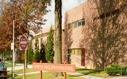
Havre de Grace High School is a four-year public high school in Havre de Grace in Harford County, Maryland, United States. The school is located near the southeast corner of Harford County where the Susquehanna River meets the Chesapeake Bay. The school motto is "Enter to Learn — Leave to Serve."

Norrisville is an unincorporated community in Harford County, Maryland, United States, located just south of the Pennsylvania state line in the extreme northwest section of the county. It is primarily a farming community full of rolling hills and small valleys, and is part of the Deer Creek watershed. The area is served by two state roads, Maryland routes 23 and 136. A demographic profile estimates that the Norrisville area had a population of 2,931 as of 2000. It lies at an elevation of 741 feet (226 m). Norrisville is part of the White Hall zip code 21161, whose post office is located just over the Baltimore County line.
Berkley is an unincorporated community in Harford County, Maryland, United States. Rigbie House was listed on the National Register of Historic Places in 1973.
Creswell is an unincorporated community in Harford County, Maryland, United States. Fair Meadows was listed on the National Register of Historic Places in 1980.
Emmorton is an unincorporated community in Harford County, Maryland, United States. St. Mary's Church was listed on the National Register of Historic Places in 1973.
Kalmia is an unincorporated community in Harford County, Maryland, United States. The Husband Flint Mill Site was listed on the National Register of Historic Places in 1975.
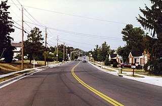
Whiteford is an unincorporated community in Harford County, Maryland, United States. The community has historically had a strong Welsh heritage, which is reflected in the local architecture.
Fairview is an unincorporated community in Harford County, Maryland, United States.
Hopewell Village is an unincorporated community in Harford County, Maryland, United States. It lies at an elevation of 449 feet.
Winters Run is a 14.6-mile-long (23.5 km) river in Harford County, Maryland. The river begins north of the community of Fallston at the confluence of the West and East Branches, and flows southeast about 11 miles (18 km) to Atkisson Dam in Bel Air. The dam and reservoir were built by the U.S. Army in 1942 to provide an auxiliary fresh water source for nearby Edgewood Arsenal. Upon reaching the tidal line, the river is renamed Otter Point Creek, which empties to Bush River and the Chesapeake Bay. The watershed area of Winters Run is about 56 square miles (150 km2).

Bush River is a tidal estuary in Harford County, Maryland, located about 15 mi (24 km) northeast of Baltimore. The estuary extends from the community of Riverside, south for about 9 mi (14 km), to the Chesapeake Bay. The watershed area of tidal Bush River is 125 mi2 (320 km2), and includes Aberdeen Proving Ground, a military facility.
Wrights Fork is an unincorporated community in Caroline County, in the U.S. state of Virginia. The community is the home of NRHP-listed Green Falls home.

Baker is an unincorporated community in Cass Township, Sullivan County, in the U.S. state of Indiana.
References
- ↑ U.S. Geological Survey Geographic Names Information System: Constant Friendship, Maryland
- ↑ Writers' Program of the Work Projects Administration in the State of Maryland (1940). Maryland: A Guide to the Old Line State. WPA. p. 325. ISBN 978-0-403-02171-0.
- ↑ Marsh, Clifton E. (1996). Harford County, Maryland, Homeless and Shelter Survey: Housing and Shelter in a Community in Transition. University Press of America. p. 15. ISBN 978-0-7618-0123-8.
Municipalities and communities of Harford County, Maryland, United States | ||
|---|---|---|
| Cities |  | |
| Town | ||
| CDPs | ||
| Other communities | ||
39°28′13″N76°18′39″W / 39.47028°N 76.31083°W