El Paso, Wisconsin

Last updated

El Paso, Wisconsin
WIMap-doton-El Paso.png
Location of El Paso, Wisconsin
Coordinates: 44°43′50″N92°19′30″W / 44.73056°N 92.32500°W / 44.73056; -92.32500
Country Flag of the United States.svg  United States
State Flag of Wisconsin.svg  Wisconsin
County Pierce
Area
  Total35.1 sq mi (90.8 km2)
  Land35.1 sq mi (90.8 km2)
  Water0.0 sq mi (0.0 km2)
Elevation
[1]
807 ft (246 m)
Population
 (2000)
  Total690
  Density19.7/sq mi (7.6/km2)
Time zone UTC-6 (Central (CST))
  Summer (DST) UTC-5 (CDT)
Area code(s) 715 & 534
FIPS code 55-23775 [2]
GNIS feature ID1583160 [1]

El Paso is a town in Pierce County, Wisconsin, United States. The population was 690 at the 2000 census. The unincorporated community of El Paso is located in the town. The unincorporated community of Waverly is also located partially in the town.

Contents

Geography

According to the United States Census Bureau, the town has a total area of 35.1 square miles (90.8 km2), all of it land.

Demographics

As of the census [2] of 2000, there were 690 people, 233 households, and 181 families residing in the town. The population density was 19.7 inhabitants per square mile (7.6/km2). There were 239 housing units at an average density of 6.8 per square mile (2.6/km2). The racial makeup of the town was 99.13% White, 0.43% Native American, and 0.43% from two or more races. Hispanic or Latino of any race were 1.74% of the population.

There were 233 households, out of which 39.1% had children under the age of 18 living with them, 66.5% were married couples living together, 7.3% had a female householder with no husband present, and 21.9% were non-families. 18.5% of all households were made up of individuals, and 9.9% had someone living alone who was 65 years of age or older. The average household size was 2.96 and the average family size was 3.40.

In the town, the population was spread out, with 29.3% under the age of 18, 8.1% from 18 to 24, 29.9% from 25 to 44, 22.0% from 45 to 64, and 10.7% who were 65 years of age or older. The median age was 36 years. For every 100 females, there were 109.7 males. For every 100 females age 18 and over, there were 115.0 males.

The median income for a household in the town was $49,375, and the median income for a family was $52,143. Males had a median income of $32,368 versus $25,625 for females. The per capita income for the town was $19,441. About 3.3% of families and 4.9% of the population were below the poverty line, including 1.9% of those under age 18 and 25.4% of those age 65 or over.

44°46′11″N92°20′39″W / 44.76972°N 92.34417°W / 44.76972; -92.34417

Related Research Articles

<span class="mw-page-title-main">Primrose, Alaska</span> Census-designated place in Alaska, United States

Primrose is a census-designated place (CDP) in Kenai Peninsula Borough, Alaska, United States. The population was 78 at the 2010 census, down from 93 at the 2000 census. Primrose is one of a number of small communities located north of Seward along the Seward Highway.

<span class="mw-page-title-main">Atlanta, Indiana</span> Town in Indiana, United States

Atlanta is a town in Jackson Township, Hamilton County, Indiana, United States. The population was 725 at the 2010 census.

<span class="mw-page-title-main">Hartwick, Iowa</span> City in Iowa, United States

Hartwick is a city in Poweshiek County, Iowa, United States. The population was 92 at the time of the 2020 census.

<span class="mw-page-title-main">Chapman, Maine</span> Town in the state of Maine, United States

Chapman is a town in Aroostook County, Maine, United States. The population was 491 at the 2020 census.

<span class="mw-page-title-main">Hammond, Maine</span> Town in the state of Maine, United States

Hammond is a town in Aroostook County, Maine, United States. The population was 91 at the 2020 census.

Orland is a town in Hancock County, Maine, United States. The population was 2,221 at the 2020 census.

<span class="mw-page-title-main">Fayette, Maine</span> Town in the state of Maine, United States

Fayette is a town in Kennebec County, Maine, United States. The population was 1,160 as of the 2020 census. A popular recreation spot in central Maine, Fayette is part of the Winthrop Lakes Region.

<span class="mw-page-title-main">Pittston, Maine</span> Town in the state of Maine, United States

Pittston is a town in Kennebec County, Maine, United States. The population was 2,875 at the 2020 census. The town was named after the family of John Pitt, who were early settlers. Pittston is included in the Augusta, Maine micropolitan New England City and Town Area.

<span class="mw-page-title-main">Abbot, Maine</span> Town in the state of Maine, United States

Abbot is a town in Piscataquis County, Maine, United States. The population was 650 at the 2020 census. It was named for the treasurer of Bowdoin College, John Abbot.

<span class="mw-page-title-main">Calumet, Minnesota</span> City in Minnesota, United States

Calumet is a city in Itasca County, Minnesota, United States. The population was 367 at the 2010 census.

<span class="mw-page-title-main">De Kalb, Mississippi</span> Town in Mississippi, United States

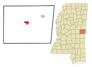
De Kalb is a town in and the county seat of Kemper County, Mississippi, United States. The population was 1,164 at the 2010 census. De Kalb is named after General Johann de Kalb, a Franconian-French military officer who served as a major general in the Continental Army during the American Revolutionary War.

Port Leyden is a village in Lewis County, New York, United States. The population was 672 at the 2010 census. The name is derived from the village's early history as a port on the Black River Canal.

<span class="mw-page-title-main">Camden-on-Gauley, West Virginia</span> Town in West Virginia, United States

Camden-on-Gauley is a town in Webster County, West Virginia, United States, along the Gauley River. The population was 126 at the 2020 census.

<span class="mw-page-title-main">Arland, Wisconsin</span> Town in Wisconsin, United States

Arland is a town in Barron County in the U.S. state of Wisconsin. The population was 789 at the 2010 census. The unincorporated community of Twin Town is located partially in the town.

<span class="mw-page-title-main">Longwood, Wisconsin</span> Town in Wisconsin, United States

Longwood is a town in Clark County in the U.S. state of Wisconsin. The population was 698 at the 2000 census.

<span class="mw-page-title-main">Mentor, Wisconsin</span> Town in Wisconsin, United States

Mentor is a town in Clark County in the U.S. state of Wisconsin. The population was 570 at the 2000 census. The unincorporated community of Humbird is located in the town.

<span class="mw-page-title-main">Weston, Dunn County, Wisconsin</span> Town in Wisconsin, United States

Weston is a town in Dunn County, Wisconsin, United States. The population was 630 at the 2000 census. The unincorporated communities of Comfort and Weston are located in the town. The unincorporated community of Hatchville is also located partially in the town.

<span class="mw-page-title-main">Vilas, Wisconsin</span> Town in the U.S. state of Wisconsin

Vilas is a town in Langlade County, Wisconsin, United States. The population was 233 at the 2010 census.

<span class="mw-page-title-main">Oakdale (town), Wisconsin</span> Town in Wisconsin, United States

Oakdale is a town in Monroe County, Wisconsin, United States. The population was 679 at the 2000 census. The Village of Oakdale is located within the town.

Maiden Rock is a town in Pierce County, Wisconsin, United States. The population was 589 at the 2000 census. The Village of Maiden Rock is located within the town. The unincorporated communities of Nerike and Warrentown are located in the town. The unincorporated community of Lund is also partially located within the town.

References

  1. 1 2 "US Board on Geographic Names". United States Geological Survey. October 25, 2007. Retrieved January 31, 2008.
  2. 1 2 "U.S. Census website". United States Census Bureau . Retrieved January 31, 2008.