Union, Pierce County, Wisconsin

Last updated

Union, Wisconsin
WIMap-doton-Union d.png
Location of Union, Wisconsin
Coordinates: 44°39′13″N92°11′19″W / 44.65361°N 92.18861°W / 44.65361; -92.18861
Country Flag of the United States.svg  United States
State Flag of Wisconsin.svg  Wisconsin
County Pierce
Area
  Total35.1 sq mi (90.9 km2)
  Land34.9 sq mi (90.4 km2)
  Water0.2 sq mi (0.5 km2)
Elevation
[1]
1,106 ft (337 m)
Population
 (2000)
  Total618
  Density17.7/sq mi (6.8/km2)
Time zone UTC-6 (Central (CST))
  Summer (DST) UTC-5 (CDT)
Area code(s) 715 & 534
FIPS code 55-81600 [2]
GNIS feature ID1584312 [1]

Union is a town in Pierce County, Wisconsin, United States. The population was 618 at the 2000 census. The unincorporated community of Ono is located partially in the town.

Contents

Geography

According to the United States Census Bureau, the town has a total area of 35.1 square miles (90.9 km2), of which, 34.9 square miles (90.4 km2) of it is land and 0.2 square miles (0.5 km2) of it (0.51%) is water.

Demographics

As of the census [2] of 2000, there were 618 people, 212 households, and 168 families residing in the town. The population density was 17.7 people per square mile (6.8/km2). There were 215 housing units at an average density of 6.2 per square mile (2.4/km2). The racial makeup of the town was 99.51% White, and 0.49% from two or more races.

There were 212 households, out of which 40.6% had children under the age of 18 living with them, 67.0% were married couples living together, 4.7% had a female householder with no husband present, and 20.3% were non-families. 17.0% of all households were made up of individuals, and 5.7% had someone living alone who was 65 years of age or older. The average household size was 2.92 and the average family size was 3.30.

In the town, the population was spread out, with 30.1% under the age of 18, 7.1% from 18 to 24, 27.7% from 25 to 44, 24.6% from 45 to 64, and 10.5% who were 65 years of age or older. The median age was 37 years. For every 100 females, there were 116.8 males. For every 100 females age 18 and over, there were 117.1 males.

The median income for a household in the town was $35,375, and the median income for a family was $38,125. Males had a median income of $25,441 versus $24,583 for females. The per capita income for the town was $14,892. About 8.9% of families and 9.9% of the population were below the poverty line, including 10.3% of those under age 18 and 8.5% of those age 65 or over.

Related Research Articles

<span class="mw-page-title-main">Zanesville, Indiana</span> Town in Indiana, United States

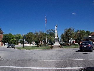
Zanesville is a town in Wells and Allen counties in the U.S. state of Indiana, southwest of Fort Wayne. The population was 580 at the 2020 Census, down from 600 at the 2010 census.

<span class="mw-page-title-main">Whiteland, Indiana</span> Town in Indiana, United States

Whiteland is a town in Pleasant, Franklin and Clark townships, Johnson County, Indiana, United States. The population was 4,599 at the 2020 census.

<span class="mw-page-title-main">Hudson, Indiana</span> Town in Indiana, United States

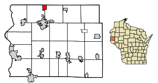
Hudson is a town in Salem and Steuben townships, Steuben County, in the U.S. state of Indiana. The population was 518 at the 2010 census.

<span class="mw-page-title-main">Uniondale, Indiana</span> Town in Indiana, United States

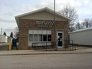
Uniondale is a town in Union and Rockcreek townships, Wells County, in the U.S. state of Indiana. The population was 310 at the 2010 census, down from 271 at the 2020 Census.

Beals is a town in Washington County, Maine, United States, located on an island opposite Jonesport. The town was named after Manwarren Beal, an early settler. The population was 443 at the 2020 census.

<span class="mw-page-title-main">Lewis and Clark Village, Missouri</span> Village in Missouri, United States

Lewis and Clark Village is a village in Buchanan County, Missouri, United States. The population was 96 at the 2020 census. It is part of the St. Joseph, MO–KS Metropolitan Statistical Area.

<span class="mw-page-title-main">Homestown, Missouri</span> City in Missouri, United States

Homestown is a city in Pemiscot County, Missouri, United States. The population was 73 at the 2020 census.

<span class="mw-page-title-main">LaGrange, Ohio</span> Village in Ohio, United States

LaGrange is a village in Lorain County, Ohio, United States. The population was 2,595 at the 2020 census.

<span class="mw-page-title-main">Canton, Oklahoma</span> Town in Oklahoma, United States

Canton is a town in Blaine County, Oklahoma, United States. The population was 625 at the 2010 census.

<span class="mw-page-title-main">White, South Dakota</span> City in South Dakota, United States

White is a city in Brookings County, South Dakota, United States. The population was 537 at the 2020 census.

<span class="mw-page-title-main">Gilbert, West Virginia</span> Town in West Virginia, United States

Gilbert is a town in Mingo County, West Virginia, United States, along the Guyandotte River. The population was 333 at the 2020 census. Gilbert was incorporated in 1918 and named for Gilbert Creek, which derives its name from the name of an early traveler in the area who was killed by Native Americans. Gilbert is known nationwide for the Hatfield-McCoy ATV Trails that are located in the area. There are a number of lodges and restaurants in Gilbert.

<span class="mw-page-title-main">Pennsboro, West Virginia</span> City in West Virginia, United States

Pennsboro is a city in Ritchie County, West Virginia, United States. The population was 1,050 at the 2020 census. The city is located at the junction of U.S. Route 50 and West Virginia Route 74; the North Bend Rail Trail also passes through the city.

<span class="mw-page-title-main">Sand Lake, Burnett County, Wisconsin</span> Town in Wisconsin, United States

Sand Lake is a town in Burnett County in the U.S. state of Wisconsin. The population was 531 at the 2010 census.

<span class="mw-page-title-main">Seif, Wisconsin</span> Town in Wisconsin, United States

Seif is a town in Clark County in the U.S. state of Wisconsin. The population was 212 at the 2000 census.

<span class="mw-page-title-main">Otsego, Wisconsin</span> Town in Wisconsin, United States

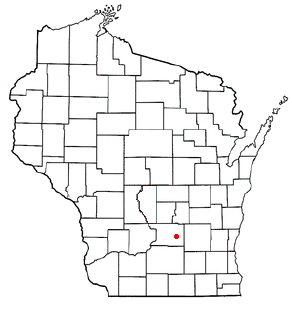
The Town of Otsego is located in Columbia County, Wisconsin, United States. The population was 757 at the 2000 census. The unincorporated community of Otsego is located in the town. The villages of Rio and Doylestown lie in the geographic area of the town of Otsego.

<span class="mw-page-title-main">Franzen, Wisconsin</span> Town in Wisconsin, United States

Franzen is a town in Marathon County, Wisconsin, United States. It is part of the Wausau, Wisconsin Metropolitan Statistical Area. The population was 578 at the 2010 census. The unincorporated communities of Galloway and Holt are located in the town.

<span class="mw-page-title-main">Richwood, Wisconsin</span> Town in Wisconsin, United States

Richwood is a town in Richland County, Wisconsin, United States. The population was 618 at the 2000 census. The unincorporated communities of Byrds Creek, Excelsior, Port Andrew, Sand Prairie, Tavera, Westport, and Wild Rose are located in the town.

<span class="mw-page-title-main">Wynnedale, Indiana</span> Town in Indiana, United States

Wynnedale is a town in Washington Township, Marion County, Indiana, United States. The population was 215 at the 2020 census. It has existed as an "included town" since 1970, when it was incorporated into Indianapolis as part of Unigov. It is part of Indianapolis, but retains a functioning town government under IC 36-3-1-11.

<span class="mw-page-title-main">Aniwa (town), Wisconsin</span>

Aniwa is a town in Shawano County, Wisconsin, United States. The population was 586 at the 2000 census. The Village of Aniwa is located within the town.

<span class="mw-page-title-main">Star Prairie, Wisconsin</span> Village in Wisconsin, United States

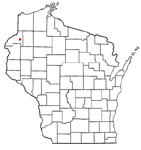
Star Prairie is a village in St. Croix County in the U.S. state of Wisconsin. The population was 561 at the 2010 census. The village is located along the Apple River on the boundary between the Town of Star Prairie and the Town of Stanton.

References

  1. 1 2 "US Board on Geographic Names". United States Geological Survey. October 25, 2007. Retrieved January 31, 2008.
  2. 1 2 "U.S. Census website". United States Census Bureau . Retrieved January 31, 2008.