
Parole, a suburb of Annapolis, is a census-designated place (CDP) in Anne Arundel County, Maryland, United States. The population was 15,922 at the 2010 census. It has several major roads intersect at the western edge of the state capital, Annapolis, and it contains the Annapolis Mall, a number of other large shopping centers, and the Anne Arundel Medical Center. It is generally considered to be part of Annapolis, rather than a separate town. The neighborhood was named because it was a parole camp, where Union and Confederate prisoners of war were brought for mutual exchange and eventual return to their respective homes.

The Baltimore–Washington Parkway is a controlled-access parkway in the U.S. state of Maryland, running southwest from Baltimore to Washington, D.C. The road begins at an interchange with U.S. Route 50 (US 50) near Cheverly in Prince George's County at the Washington, D.C. border, and continues northeast as a parkway maintained by the National Park Service (NPS) to MD 175 near Fort Meade, serving many federal institutions. This portion of the parkway is dedicated to Gladys Noon Spellman, a representative of Maryland's 5th congressional district, and has the unsigned Maryland Route 295 (MD 295) designation. Commercial vehicles, including trucks, are prohibited within this stretch. This section is administered by the NPS's Greenbelt Park unit. After leaving park service boundaries the highway is maintained by the state and signed with the MD 295 designation. This section of the parkway passes near Baltimore–Washington International Thurgood Marshall Airport.

College Park–University of Maryland station is a Washington Metro station in Prince George's County, Maryland, on the Green Line. It also serves MARC's Camden Line, though only select trains stop at the station.

The Capital Beltway is a 64-mile (103 km) auxiliary Interstate Highway in the Washington metropolitan area that surrounds Washington, D.C., the capital of the United States, and its inner suburbs in adjacent Maryland and Virginia. It is the basis of the phrase "inside the Beltway", used when referring to issues dealing with US federal government and politics. The highway is signed as Interstate 495 (I-495) for its entire length, and its southern and eastern half runs concurrently with I-95.

Maryland Route 100 is a major east–west highway connecting U.S. Route 29 in Ellicott City and MD 177 in Pasadena. MD 100 also connects to Interstate 95 (I-95), US 1, the Baltimore–Washington Parkway, and I-97. The highway connects Howard County to the west with Anne Arundel County and the Chesapeake Bay to the east. MD 100 also provides access to the Baltimore–Washington International Airport (BWI) and the Arundel Mills shopping mall.

Maryland Route 450 is a state highway in the U.S. state of Maryland. The state highway runs 30.19 miles (48.59 km) from U.S. Route 1 Alternate in Bladensburg east to US 50/US 301 and MD 2 near Arnold. MD 450 forms a local complement to US 50 from near Washington, D.C. through Annapolis. In Prince George's County, the highway is a four- to six-lane divided highway that serves Bladensburg, Landover Hills, New Carrollton, Lanham, and Bowie. In Anne Arundel County, MD 450 connects Crofton with Parole and Annapolis with the portion of the county east of the Severn River. The highway serves as one of the main streets of Annapolis, including the state capital's historic core, and is the primary vehicular access to the U.S. Naval Academy.
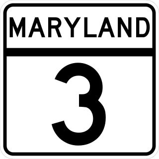
Maryland Route 3, part of the Robert Crain Highway, is the designation given to the former alignment of U.S. Route 301 from Bowie, Maryland, United States, to Baltimore. It is named for Robert Crain of Baltimore. It is unique in Maryland in that it has a business route and a truck route which do not connect to their parent; however, the business route is also a part of the Robert Crain Highway. MD 3's current orientation is vestigial from the construction of Maryland's freeway system.

Maryland Route 648 is a collection of state highways in the U.S. state of Maryland. These nine highways are current or former sections of the Baltimore–Annapolis Boulevard between Annapolis and Baltimore via Glen Burnie. There are five signed mainline segments of MD 648 through Arnold, Severna Park, Pasadena, Glen Burnie, Ferndale, and Pumphrey in northern Anne Arundel County; Baltimore Highlands in southern Baltimore County; and the independent city of Baltimore. MD 648 mainly serves local traffic along its meandering route, with long-distance traffic intended to use the parallel and straighter MD 2 south of Glen Burnie and freeway-grade Interstate 97 (I-97), I-695, and MD 295 between Glen Burnie and Baltimore.
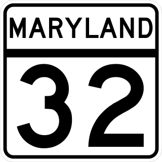
Maryland Route 32 (MD 32) is a state highway in the U.S. state of Maryland. The road runs 51.79 miles (83.35 km) from Interstate 97 (I-97) and MD 3 in Millersville west and north to Washington Road in Westminster. The 30 mile four- to six-lane freeway portion of MD 32 is the Patuxent Freeway between I-97 and I-70 in West Friendship. The freeway passes through Odenton and Fort Meade, the site of Fort George G. Meade and the National Security Agency (NSA), in western Anne Arundel County and along the southern part of Columbia in Howard County. Via I-97, MD 32 connects those communities with U.S. Route 50 (US 50)/US 301 in Annapolis. MD 32 also intersects the four primary highways connecting Baltimore and Washington: the Baltimore–Washington Parkway, US 1, I-95, and US 29. MD 32's north–south section, Sykesville Road, connects West Friendship and Westminster by way of Sykesville and Eldersburg in southern Carroll County.
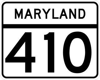
Maryland Route 410 (MD 410) is a state highway in the U.S. state of Maryland and known for most of its length as East–West Highway. The highway runs east to west for 13.92 miles (22.40 km) from MD 355 in Bethesda east to Pennsy Drive in Landover Hills. MD 410 serves as a major east–west commuter route through the inner northern suburbs of Washington, D.C., connecting the commercial districts of Bethesda, Silver Spring, and Hyattsville. In addition, the highway serves the industrial area of Landover Hills and the residential suburbs of Chevy Chase, Takoma Park, Chillum, Riverdale, and East Riverdale. The road also connects many of the arterial highways and freeways that head out of Washington. Additionally, it provides a highway connection to transit and commercial hubs centered around Washington Metro subway stations in Bethesda, Takoma Park, Hyattsville, Silver Spring, and New Carrollton–the latter two of which provide additional connections to MARC and Amtrak trains.

Maryland Route 197 is a state highway in the U.S. state of Maryland. Known for most of its length as Laurel Bowie Road, the state highway runs 14.64 miles (23.56 km) from U.S. Route 301 in Bowie north to MD 198 in Laurel. MD 197 serves as the main connection between Bowie and Laurel in northern Prince George's County. The highway also provides access to Patuxent Wildlife Research Center and Bowie State University. MD 197 also connects US 50 in Bowie and the Baltimore–Washington Parkway in South Laurel with the Bowie State MARC station.

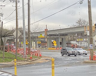
Long Branch is a light rail station that is currently under construction in the Long Branch neighborhood of Silver Spring, Maryland. It will be part of the Purple Line in Maryland. The station will be located at Arliss Street and Piney Branch Road, adjacent to the Long Branch Library.

Piney Branch Road is a light rail station that is currently under construction. It will be part of the Purple Line in Maryland. The station will be located at the intersection of Piney Branch Road and University Boulevard.
Riggs Road is a light rail station that is currently under construction. It will be part of the Purple Line in Maryland. The station will be located at the intersection of Riggs Road and University Boulevard.
Adelphi Road–UMGC–UMD is a light rail station that is currently under construction. It will be part of the Purple Line in Maryland. The station will be located on the west border of the University of Maryland at the intersection of Adelphi Road and Campus Drive.

Campus Drive–UMD is a light rail station that is currently under construction. It will be part of the Purple Line in Maryland. The station will be located at the intersection of Campus Drive and Library Lane on the campus of the University of Maryland.
Baltimore Avenue–College Park–UMD is a light rail station that is currently under construction. It will be part of the Purple Line in Maryland. The station will be located at the intersection of Baltimore Avenue and Rossborough Lane on the eastern campus of the University of Maryland.
Riverdale Park North–UMD is a light rail station that is currently under construction. It will be part of the Purple Line in Maryland. The station will be located at the intersection of River Road and Haig Drive on the eastern campus of the University of Maryland in the M Square Research Park.
Riverdale Park–Kenilworth is a light rail station that is currently under construction. It will be part of the Purple Line in Maryland. The station will be located southeast of the intersection of East West Highway and Kenilworth Avenue.
Beacon Heights–East Pines is a light rail station that is currently under construction. It will be part of the Purple Line in Maryland. The station will be located east of the intersection of Riverdale Road and 67th Avenue.
