Granby, Massachusetts

Last updated

Granby, Massachusetts
Kellogg Hall, Granby MA.jpg
Kellogg Hall
Flag of Granby, Massachusetts.svg
Seal of Granby, Massachusetts.svg
Hampshire County Massachusetts incorporated and unincorporated areas Granby highlighted.svg
Location in Hampshire County in Massachusetts
Coordinates: 42°15′23″N72°31′00″W / 42.25639°N 72.51667°W / 42.25639; -72.51667
Country United States
State Massachusetts
County Hampshire
Settled1727
IncorporatedJune 11, 1768
Government
  Type Open Town Meeting
Area
  Total28.09 sq mi (72.75 km2)
  Land27.83 sq mi (72.08 km2)
  Water0.26 sq mi (0.67 km2)
Elevation
[1]
269 ft (82 m)
Population
 (2020)
  Total6,110
  Density220/sq mi (84/km2)
Time zone UTC−5 (Eastern)
  Summer (DST) UTC−4 (Eastern)
ZIP Code
01033
Area code 413
FIPS code 25-26535
GNIS feature ID0618200 [1]
Website www.granby-ma.gov

Granby is a town in Hampshire County, Massachusetts, United States. The population was 6,110 at the 2020 census. [2] It is part of the Springfield, Massachusetts Metropolitan Statistical Area. The census-designated place of Granby corresponds to the main village of Granby in the center of the town.

Contents

Etymology

The town is named in honor of John Manners, Marquess of Granby, [3] a hero of the Seven Years' War. The place name, Granby, refers to a village in Nottinghamshire, taking its name from the personal name Gráni and the Old English suffix , denoting a farmstead or settlement. [4]

History

Settlement

Granby was once part of Hadley, as were other towns, as part of Hadley Equivalent Lands. Old Hadley was first settled in 1659 by people from Hartford and Wethersfield, Connecticut. These settlers left Connecticut because of religious differences within their communities.

John Pynchon was commissioned to buy wilderness land for their new community. In 1658, Pynchon negotiated a deed with three Norwottuck sachems: Chickwalloppe (alias Wawhillowa), Umpanchela (alias Womscom), and Quonquont (alias Wompshaw). The deed reserved land for a cornfield for the Norwottuck and promised rights to hunt, fish and set up wigwams within the negotiated land. [5] Ownership was transferred to the settlers and confirmed by the General Court. These original boundaries include part of present-day Granby.

In August 1662, Pynchon negotiated a deed with Awonunsk, her husband Wequagon, and her son Squomp, for land also in present-day Granby, South Hadley and Belchertown. Ownership was transferred to the settlers and Awonunsk and her family were paid in 150 fathoms of wampum (approximately 54,000 wampum beads), [6] 10 coats, and 2 yards of cloth, among other items. The deed also promised rights for the Norwottuck to hunt, fish, collect wood, and set up wigwams on the commons. [7]

Separation from Hadley and South Hadley

Granby was settled in 1727. [8] In November 1727, residents of what are now South Hadley and Granby petitioned the General Court to form a precinct within the Town of Hadley. [9] This petition was granted on July 4, 1732, creating Hadley's South Precinct. [10] In 1753, the precinct was granted district status. From 1751 through 1761, the district was deadlocked over whether to build a new meetinghouse west of Cold Hill, in present-day South Hadley, or to its east, in present-day Granby. [11] In the Summer of 1761, the district's west side began constructing a meetinghouse without town meeting approval. In response, a group of 27 east side residents and three west side residents tore down the partially constructed meetinghouse. [12]

In 1762, the General Court split the district into an east and west parish, each with its own meetinghouse. With tensions between the parishes still high, the General Court set off the east parish as the Town of Granby, being incorporated on June 11, 1768. [13] [8]

20th century

Granby is one of only three towns in Massachusetts whose local telephone service is not furnished by the former Bell System as Granby has maintained its own service, Granby Telephone & Telegraph, since 1903. The other two such towns are Richmond and Hancock, both in Berkshire County.

Geography

View of Five Corners in Granby Grangby MA 5 Corners.JPG
View of Five Corners in Granby

According to the United States Census Bureau, the town has a total area of 28.1 square miles (72.7 km2), of which 27.8 square miles (72.1 km2) are land and 0.27 square miles (0.7 km2), or 0.92%, is water. [14] Granby is bordered by South Hadley to the west, Amherst to the north, Belchertown to the east, and Ludlow and Chicopee to the south. Two highways pass through the town: U.S. Route 202 runs eastward though town from South Hadley to Belchertown on East State Street and West State Street, while Route 116 runs northeastward from South Hadley to Amherst along Amherst Road. Granby is 13 miles (21 km) north of Springfield, the largest city in western Massachusetts.

The Holyoke Range is in the northern part of Granby. Major peaks within the town are Long Mountain and Mount Norwottuck. Norwottuck is the highest point in town at 1,106 feet (337 m) above sea level. The Metacomet-Monadnock Trail runs along this mountain range as it passes through Granby. The Horse Caves are geological ledges along this trail.

Demographics

Historical population
YearPop.±%
1850 1,104    
1860 907−17.8%
1870 863−4.9%
1880 753−12.7%
1890 765+1.6%
1900 761−0.5%
1910 761+0.0%
1920 779+2.4%
1930 891+14.4%
1940 1,085+21.8%
1950 1,861+71.5%
1960 4,221+126.8%
1970 5,473+29.7%
1980 5,380−1.7%
1990 5,565+3.4%
2000 6,132+10.2%
2010 6,240+1.8%
2020 6,110−2.1%
2022*6,055−0.9%
* = population estimate. [15]

As of the census [16] of 2000, there were 6,132 people, 2,247 households, and 1,662 families residing in the town. The population density was 220.1 inhabitants per square mile (85.0/km2). There were 2,295 housing units at an average density of 82.4 per square mile (31.8/km2). The racial makeup of the town was 96.77% White, 0.51% Black or African American, 0.13% Native American, 0.96% Asian, 0.02% Pacific Islander, 0.52% from other races, and 1.09% from two or more races. Hispanic or Latino of any race were 1.21% of the population.

There were 2,247 households, out of which 34.5% had children under the age of 18 living with them, 62.8% were married couples living together, 8.2% had a female householder with no husband present, and 26.0% were non-families. Of all households, 20.1% were made up of individuals, and 7.9% had someone living alone who was 65 years of age or older. The average household size was 2.71 and the average family size was 3.15.

In the town, the population was spread out, with 25.5% under the age of 18, 7.0% from 18 to 24, 30.6% from 25 to 44, 25.2% from 45 to 64, and 11.7% who were 65 years of age or older. The median age was 38 years. For every 100 females, there were 96.0 males. For every 100 females age 18 and over, there were 94.3 males.

The median income for a household in the town was $54,293, and the median income for a family was $57,632. Males had a median income of $40,833 versus $30,597 for females. The per capita income for the town was $23,209. About 1.0% of families and 2.2% of the population were below the poverty line, including 2.8% of those under age 18 and 2.0% of those age 65 or over.

Education

Granby has one public elementary school serving K–6, the East Meadow School. Middle/High School students attend Granby Junior Senior High School. The MacDuffie School, a private preparatory school, is also located in Granby.

Natural features

Notable people

Related Research Articles

<span class="mw-page-title-main">Amherst, Massachusetts</span> City in Massachusetts, United States

Amherst is a city in Hampshire County, Massachusetts, United States, in the Connecticut River valley. Amherst has a council–manager form of government, and is considered a city under Massachusetts state law. Amherst is one of several Massachusetts municipalities that have city forms of government but retain "The Town of" in their official names. At the 2020 census, the population was 39,263, making it the highest populated municipality in Hampshire County. The town is home to Amherst College, Hampshire College, and the University of Massachusetts Amherst, three of the Five Colleges.

<span class="mw-page-title-main">Hampden County, Massachusetts</span> County in Massachusetts, United States

Hampden County is a non-governmental county located in the Pioneer Valley of the U.S. state of Massachusetts, in the United States. As of the 2020 census, Hampden County's population was 465,825. Its traditional county seat is Springfield, the Connecticut River Valley's largest city, and economic and cultural capital; with an estimated population of 154,758, approximately one-third of Hampden County residents live in Springfield.

<span class="mw-page-title-main">Hampshire County, Massachusetts</span> County in Massachusetts, United States

Hampshire County is a historical and judicial county located in the U.S. state of Massachusetts. As of the 2020 census, the population was 162,308. Its most populous municipality is Amherst, its largest town in terms of landmass is Belchertown, and its traditional county seat is Northampton. The county is named after the county Hampshire, in England. Hampshire County is part of the Springfield, MA Metropolitan Statistical Area. Together with Hampden County, Hampshire County municipalities belong to the Pioneer Valley Planning Commission.

<span class="mw-page-title-main">New Salem, Massachusetts</span> Town in Massachusetts, United States

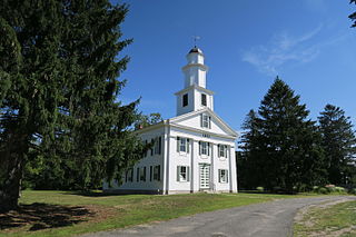
New Salem is a town in Franklin County, Massachusetts, United States. The population was 983 at the 2020 census. It is part of the Springfield, Massachusetts Metropolitan Statistical Area.

<span class="mw-page-title-main">Shutesbury, Massachusetts</span> Town in Massachusetts, United States

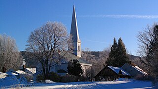
Shutesbury is a town in Franklin County, Massachusetts, United States. The population was 1,717 at the 2020 census. It is part of the Springfield, Massachusetts Metropolitan Statistical Area.

<span class="mw-page-title-main">Sunderland, Massachusetts</span> Town in Massachusetts, United States

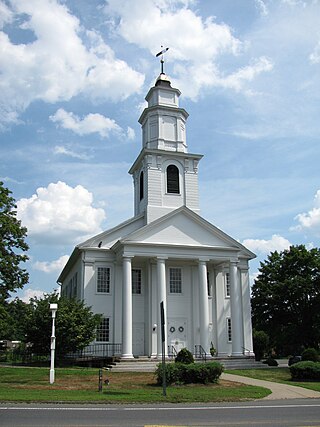
Sunderland is a town in Franklin County, Massachusetts, United States, part of the Pioneer Valley. The population was 3,663 at the 2020 census. It is part of the Springfield, Massachusetts Metropolitan Statistical Area.

<span class="mw-page-title-main">Southwick, Massachusetts</span> Town in Massachusetts, United States

Southwick is a town in Hampden County, Massachusetts, United States. The population was 9,232 at the 2020 census, down from 9,502 at the 2010 census. It is part of the Springfield, Massachusetts Metropolitan Statistical Area.

<span class="mw-page-title-main">Amherst Center, Massachusetts</span> Census-designated place in Massachusetts, United States

Amherst Center is a census-designated place (CDP) in the City of Amherst in Hampshire County, Massachusetts, United States. The CDP covers the primary village in town. The population was 19,065 at the 2010 census, out of a total town population of 37,819. It is part of the Springfield, Massachusetts Metropolitan Statistical Area.

<span class="mw-page-title-main">Chesterfield, Massachusetts</span> Town in Massachusetts, United States

Chesterfield is a rural hill town in Hampshire County, Massachusetts, United States, 26 miles (42 km) east of Pittsfield and 90 miles (140 km) west of Boston. The population was 1,186 at the 2020 census. It is part of the Springfield, Massachusetts Metropolitan Statistical Area.

<span class="mw-page-title-main">Hadley, Massachusetts</span> Town in Massachusetts, United States

Hadley is a town in Hampshire County, Massachusetts, United States. The population was 5,325 at the 2020 census. It is part of the Springfield, Massachusetts Metropolitan Statistical Area. The area around the Hampshire and Mountain Farms Malls along Route 9 is a major shopping destination for the surrounding communities.

<span class="mw-page-title-main">Northampton, Massachusetts</span> City in Massachusetts, United States

The city of Northampton is the county seat of Hampshire County, Massachusetts, United States. As of the 2020 census, the population of Northampton was 29,571.

<span class="mw-page-title-main">South Hadley, Massachusetts</span> Town in Massachusetts, United States

South Hadley is a town in Hampshire County, Massachusetts, United States. The population was 18,150 at the 2020 census. It is part of the Springfield, Massachusetts Metropolitan Statistical Area.

<span class="mw-page-title-main">Williamsburg, Massachusetts</span> Town in Massachusetts, United States

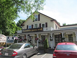
Williamsburg is a town in Hampshire County, Massachusetts, United States. The population was 2,504 at the 2020 census. It is part of the Springfield, Massachusetts Metropolitan Statistical Area.

<span class="mw-page-title-main">Hardwick, Massachusetts</span> Town in Massachusetts, United States

Hardwick is a town in Worcester County, Massachusetts, United States, about 20 miles (32 km) northwest of the city of Worcester. It had a population of 2,667 at the 2020 census. It includes the villages of Hardwick, Gilbertville, Wheelwright and Old Furnace.

<span class="mw-page-title-main">Wilbraham, Massachusetts</span> Town in Massachusetts, United States

Wilbraham is a town in Hampden County, Massachusetts, United States. It is a suburb of the City of Springfield, and part of the Springfield Metropolitan Statistical Area. The population was 14,613 at the 2020 census.

<span class="mw-page-title-main">Belchertown (CDP), Massachusetts</span> Census-designated place in Massachusetts, United States

Belchertown is a census-designated place (CDP) comprising the central village in the town of Belchertown in Hampshire County, Massachusetts, United States. The population was 2,899 at the 2010 census, out of a total town population of 14,649. It is part of the Springfield, Massachusetts Metropolitan Statistical Area.

<span class="mw-page-title-main">Belchertown, Massachusetts</span> Town in Massachusetts, United States

Belchertown is a town in Hampshire County, Massachusetts, United States. It is part of the Springfield, Massachusetts Metropolitan Statistical Area. The population was 15,350 at the 2020 census. The town includes the census-designated place of Belchertown. Belchertown was formerly the home of the Belchertown State School. The land on which the school sat is, as of 2016, being redeveloped for mixed uses including residential, commercial and recreational. This includes the 385-acre (156 ha) Lampson Brook Farm, used for community and sustainable agriculture, outdoor recreation, and wildlife preservation.

<span class="mw-page-title-main">Granby (CDP), Massachusetts</span> Census-designated place in Massachusetts, United States

Granby is a census-designated place (CDP) comprising the main village in the town of Granby in Hampshire County, Massachusetts, United States. The population of the CDP was 1,368 at the 2010 census, out of a total town population of 6,240. It is part of the Springfield, Massachusetts Metropolitan Statistical Area.

<span class="mw-page-title-main">Hatfield, Massachusetts</span> Town in Massachusetts, United States

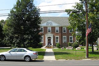
Hatfield is a town in Hampshire County, Massachusetts, United States. The population was 3,352 at the 2020 census. It is part of the Springfield, Massachusetts Metropolitan Statistical Area. The census-designated place of Hatfield consists of the town center and surrounding areas.

<span class="mw-page-title-main">Springfield metropolitan area, Massachusetts</span> Metropolitan Statistical Area in Massachusetts, United States

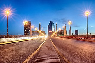
The Springfield metropolitan area, also known as Greater Springfield, is a region that is socio-economically and culturally tied to the City of Springfield, Massachusetts. The U.S. Office of Management and Budget defines the Springfield, MA Metropolitan Statistical Area (MSA) as consisting of three counties in Western Massachusetts. As of April 1, 2020, the metropolitan area's population was estimated at 699,162, making it the 88th-largest metropolitan area in the United States.

References

  1. 1 2 U.S. Geological Survey Geographic Names Information System: Granby, Massachusetts
  2. "Census - Geography Profile: Granby town, Hampshire County, Massachusetts". United States Census Bureau . Retrieved November 14, 2021.
  3. Gannett, Henry (1905). The Origin of Certain Place Names in the United States. Govt. Print. Off. pp.  141.
  4. J. Gover, A. Mawer and F. M. Stenton, eds., Place Names of Nottinghamshire (Cambridge, 1940), p. 225; A. D. Mills, Dictionary of English Place-Names (Oxford, 2002), p. 154; E. Ekwall, Concise Oxford Dictionary of English Place-names (Oxford, 1960), p. 202.
  5. "Extended biographies of native people". Historic Northampton. Retrieved May 7, 2023.
  6. Jordan, Louis. "Money Substututes in New Netherland and Early New York: Charts Illustrating Wampum Value Depreciation". The Coins of Colonial and Early America. University of Notre Dame, Department of Special Collections. Retrieved May 8, 2023.
  7. Wright, Harry Andrew (1905). Indian deeds of Hampden County. Springfield, Mass. pp. 52–53. Retrieved May 8, 2023.{{cite book}}: CS1 maint: location missing publisher (link)
  8. 1 2 "Charter Day Committee". granby-ma.gov. Retrieved May 7, 2023.
  9. Judd, Sylvester (1905). History of Hadley (PDF). Springfield, Mass.: H.R. Hunting & Company. p. 187. Retrieved May 8, 2023.
  10. Judd, Sylvester (1905). History of Hadley (PDF). Springfield, Mass.: H.R. Hunting & Company. p. 388. Retrieved May 8, 2023.
  11. Noble, Gregory H. (1983). Divisions throughout the whole: Politics and society in Hampshire County, Massachusetts, 1740-1775. New York: Cambridge University Press. pp. 136–137, 139.
  12. Noble, Gregory H. (1983). Divisions throughout the whole: Politics and society in Hampshire County, Massachusetts, 1740-1775. New York: Cambridge University Press. pp. 140–141, 236.
  13. Noble, Gregory H. (1983). Divisions throughout the whole: Politics and society in Hampshire County, Massachusetts, 1740-1775. New York: Cambridge University Press. p. 143.
  14. "Geographic Identifiers: 2010 Census Summary File 1 (G001): Granby town, Hampshire County, Massachusetts". American Factfinder. U.S. Census Bureau. Archived from the original on February 13, 2020. Retrieved August 8, 2017.
  15. "City and Town Population Totals: 2020-2022". United States Census Bureau . Retrieved November 10, 2023.
  16. "U.S. Census website". United States Census Bureau . Retrieved January 31, 2008.