Hatfield, Massachusetts

Last updated

Hatfield, Massachusetts
Hatfield Memorial Town Hall, MA.jpg
Hatfield Memorial Town Hall
Flag of Hatfield, Massachusetts.png
Seal of Hatfield, Massachusetts.png
Motto(s): 
Industry, Prosperity
Hampshire County Massachusetts incorporated and unincorporated areas Hatfield highlighted.svg
Location in Hampshire County in Massachusetts
Coordinates: 42°22′15″N72°35′55″W / 42.37083°N 72.59861°W / 42.37083; -72.59861
Country United States
State Massachusetts
County Hampshire
Settled1661
Incorporated1670
Government
  Type Open town meeting
Area
  Total16.8 sq mi (43.6 km2)
  Land15.9 sq mi (41.2 km2)
  Water0.9 sq mi (2.4 km2)
Elevation
129 ft (39 m)
Population
 (2020)
  Total3,352
  Density200/sq mi (77/km2)
Time zone UTC−5 (Eastern)
  Summer (DST) UTC−4 (Eastern)
ZIP Codes
01038, 01066, 01088
Area code 413
FIPS code 25-29265
GNIS feature ID0618202
Website www.townofhatfield.org

Hatfield is a town in Hampshire County, Massachusetts, United States. The population was 3,352 at the 2020 census. [1] It is part of the Springfield, Massachusetts Metropolitan Statistical Area. The census-designated place of Hatfield consists of the town center and surrounding areas.

Contents

History

Cornelia Billings House, Hatfield Cornelia Billings House Hatfield Massachusetts.jpg
Cornelia Billings House, Hatfield

Hatfield was founded in 1660 on land granted to General Daniel Dennison and Governor William Bradford. It was formally incorporated as a town in 1670 and has a board of selectmen and an annual town meeting.

One of the theories of Hatfield's incorporation in 1670 was that during that time it was a colony of Hadley and Hadley's church was located across the Connecticut River on what is now West Street in present-day Hadley. The citizens living in what is now Hatfield asked the officials if they could build the church on the west side of the river, so that they could go to church and not have to cross the river, which was hard to cross every week, especially during the winter season when the river would freeze. When the citizens asked main Hadley, Hadley said "No." Enraged, they held a vote on whether Hatfield would still remain territory of Hadley, or secede into its own town. The vote for secession won. Many believed this was a good decision as during that time, travel was not easy, and it was very unusual for the already large Hadley, which had already claimed many of its surrounding towns, to have a spot on the west side of the river.

As a center for agriculture, the region produced cattle, sheep, corn, and tobacco. At first their relations with the local Native Americans were very welcoming on both sides. On October 16, 1675, a substantial part of the town was destroyed in King Philip's War, and surviving settlers sought refuge in Springfield. On September 19, 1677, another raid occurred, killing thirteen and resulting in seventeen hostages being taken to Canada. After nine months, the surviving hostages were ransomed and returned to Hatfield. [2]

During the American Revolution, Hatfield was an important source of supplies and men for the rebels. In 1786, the town was used as an assembly area for the discontented who became involved in Shays' Rebellion.

One family supplied many of Hatfield's physicians for generations. The Hastings family, descendants of English Puritan immigrant Thomas Hastings, was originally settled at Watertown, but within a generation members of the family had relocated to Hatfield, where they produced a succession of Hatfield physicians, including Dr. Thomas Hastings (16521712); Dr. Thomas Hastings (16791728); Dr. Waitstill Hastings (17141748); and Dr. John Hastings (17651845). [3] The first Thomas Hastings, aside from serving as physician to Hatfield and surrounding communities, was also the town's first schoolteacher. [4] He authored a contemporary account of the devastating 1704 Indian attack on nearby Deerfield.

Hatfield was the birthplace and hometown of Sophia Smith (1796–1870), the founder of both Smith Academy (the Hatfield public high school), and Smith College, the famous women's college in Northampton. Another notable resident was Rebecca Dickinson (1738–1812), a never-married gownmaker whose surviving diary, preserved in the collections of the Pocumtuck Valley Memorial Association in Deerfield, has served as the basis for scholarship in early American women's history. [5]

Geography

Hatfield is located on the west bank of the Connecticut River at the mouth of the Mill River, 25 miles (40 km) north of Springfield and about 100 miles (160 km) west of Boston. It is bordered to the west by Horse Mountain (a typical New England granite glacial remnant) and the town of Williamsburg, to the north by the town of Whately, to the east and south across the Connecticut River by the town of Hadley, and to the southwest by the city of Northampton. The village of Hatfield is in the southern part of the town, next to the Connecticut River, while the villages of Westbrook, North Hatfield, and Bradstreet are near the northern border. West Hatfield is in the southwest part of town, next to the Northampton border.

U.S. Route 5/Route 10 and Interstate 91 pass through the town, with access to I-91 from Exits 27 and 30, where it intersects with US 5/Route 10. The village of Hatfield is approximately 2 miles (3 km) east of Routes 5 and 91.

According to the United States Census Bureau, the town of Hatfield has a total area of 16.8 square miles (43.6 km2), of which 15.9 square miles (41.2 km2) are land and 0.93 square miles (2.4 km2), or 5.51%, are water. [6]

Demographics

As of the census [8] of 2000, there were 3,249 people, 1,381 households, and 871 families residing in the town. The population density was 202.8 inhabitants per square mile (78.3/km2). There were 1,431 housing units at an average density of 89.3 per square mile (34.5/km2). The racial makeup of the town was 98.03% White, 0.22% Black or African American, 0.12% Native American, 0.49% Asian, 0.06% Pacific Islander, 0.58% from other races, and 0.49% from two or more races. Hispanic or Latino of any race were 1.05% of the population.

There were 1,381 households, out of which 27.6% had children under the age of 18 living with them, 53.1% were married couples living together, 7.5% had a female householder with no husband present, and 36.9% were non-families. 29.3% of all households were made up of individuals, and 13.8% had someone living alone who was 65 years of age or older. The average household size was 2.35 and the average family size was 2.96.

In the town, the population was spread out, with 20.7% under the age of 18, 5.4% from 18 to 24, 27.2% from 25 to 44, 29.9% from 45 to 64, and 16.7% who were 65 years of age or older. The median age was 43 years. For every 100 females, there were 95.0 males. For every 100 females age 18 and over, there were 90.7 males.

The median income for a household in the town was $50,238, and the median income for a family was $61,607. Males had a median income of $39,414 versus $35,042 for females. The per capita income for the town was $24,813. About 1.4% of families and 2.8% of the population were below the poverty line, including 1.2% of those under age 18 and 6.1% of those age 65 or over.

School system

Hatfield has two public schools: an elementary school and a high school. Hatfield Elementary school ranges from grades Pre-K to 6. The high school, Smith Academy, is grades 7–12; with just over 130 students, it is the smallest public school in the state of Massachusetts. [9]

Points of interest

Related Research Articles

<span class="mw-page-title-main">Hampden County, Massachusetts</span> County in Massachusetts, United States

Hampden County is a non-governmental county located in the Pioneer Valley of the U.S. state of Massachusetts, in the United States. As of the 2020 census, Hampden County's population was 465,825. Its traditional county seat is Springfield, the Connecticut River Valley's largest city, and economic and cultural capital; with an estimated population of 154,758, approximately one-third of Hampden County residents live in Springfield.

<span class="mw-page-title-main">Hampshire County, Massachusetts</span> County in Massachusetts, United States

Hampshire County is a historical and judicial county located in the U.S. state of Massachusetts. As of the 2020 census, the population was 162,308. Its most populous municipality is Amherst, its largest town in terms of landmass is Belchertown, and its traditional county seat is Northampton. The county is named after the county Hampshire, in England. Hampshire County is part of the Springfield, MA Metropolitan Statistical Area. Together with Hampden County, Hampshire County municipalities belong to the Pioneer Valley Planning Commission.

<span class="mw-page-title-main">Suffield, Connecticut</span> Town in Connecticut, United States

Suffield is a town in Hartford County, Connecticut, United States. The town is part of the Capitol Planning Region, and located in the Connecticut River Valley. As of the 2020 census, the population was 15,752. The town center is a census-designated place listed as Suffield Depot.

<span class="mw-page-title-main">Somers, Connecticut</span> Town in Connecticut, United States

Somers is a town in Tolland County, Connecticut. The town is part of the Capitol Planning Region. The population was 10,255 at the 2020 census. The town center is listed by the U.S. Census Bureau as a census-designated place (CDP). In 2007, Money Magazine listed Somers 53rd on its "100 Best Places to Live", based on "economic opportunity, good schools, safe streets, things to do and a real sense of community."

<span class="mw-page-title-main">Sandisfield, Massachusetts</span> Town in Massachusetts, United States

Sandisfield is a town in Berkshire County, Massachusetts, United States. It is part of the Pittsfield, Massachusetts Metropolitan Statistical Area. The population was 989 at the 2020 census.

<span class="mw-page-title-main">Hawley, Massachusetts</span> Town in Massachusetts, United States

Hawley is a town in Franklin County, Massachusetts, United States. The population was 353 at the 2020 census. It is part of the Springfield, Massachusetts Metropolitan Statistical Area.

<span class="mw-page-title-main">Sunderland, Massachusetts</span> Town in Massachusetts, United States

Sunderland is a town in Franklin County, Massachusetts, United States, part of the Pioneer Valley. The population was 3,663 at the 2020 census. It is part of the Springfield, Massachusetts Metropolitan Statistical Area.

<span class="mw-page-title-main">Whately, Massachusetts</span> Town in Massachusetts, United States

Whately is a town in Franklin County, Massachusetts, United States. The population was 1,607 at the 2020 census. It is part of the Springfield, Massachusetts Metropolitan Statistical Area.

<span class="mw-page-title-main">Southwick, Massachusetts</span> Town in Massachusetts, United States

Southwick is a town in Hampden County, Massachusetts, United States. The population was 9,232 at the 2020 census, down from 9,502 at the 2010 census. It is part of the Springfield, Massachusetts Metropolitan Statistical Area.

<span class="mw-page-title-main">Amherst Center, Massachusetts</span> Census-designated place in Massachusetts, United States

Amherst Center is a census-designated place (CDP) in the City of Amherst in Hampshire County, Massachusetts, United States. The CDP covers the primary village in town. The population was 19,065 at the 2010 census, out of a total town population of 37,819. It is part of the Springfield, Massachusetts Metropolitan Statistical Area.

<span class="mw-page-title-main">Chesterfield, Massachusetts</span> Town in Massachusetts, United States

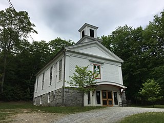
Chesterfield is a rural hill town in Hampshire County, Massachusetts, United States, 26 miles (42 km) east of Pittsfield and 90 miles (140 km) west of Boston. The population was 1,186 at the 2020 census. It is part of the Springfield, Massachusetts Metropolitan Statistical Area.

<span class="mw-page-title-main">Hadley, Massachusetts</span> Town in Massachusetts, United States

Hadley is a town in Hampshire County, Massachusetts, United States. The population was 5,325 at the 2020 census. It is part of the Springfield, Massachusetts Metropolitan Statistical Area. The area around the Hampshire and Mountain Farms Malls along Route 9 is a major shopping destination for the surrounding communities.

<span class="mw-page-title-main">Northampton, Massachusetts</span> City in Massachusetts, United States

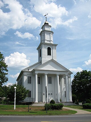
The city of Northampton is the county seat of Hampshire County, Massachusetts, United States. As of the 2020 census, the population of Northampton was 29,571.

<span class="mw-page-title-main">Pelham, Massachusetts</span> Town in Massachusetts, United States

Pelham is a town in Hampshire County, Massachusetts, United States. The population was 1,280 at the 2020 census. Its ZIP Code is shared with Amherst.

<span class="mw-page-title-main">Williamsburg, Massachusetts</span> Town in Massachusetts, United States

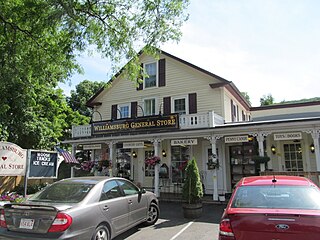
Williamsburg is a town in Hampshire County, Massachusetts, United States. The population was 2,504 at the 2020 census. It is part of the Springfield, Massachusetts Metropolitan Statistical Area.

<span class="mw-page-title-main">Waterford, Vermont</span> Town in Vermont, United States

Waterford is a town in Caledonia County, Vermont, United States. The population was 1,268 at the 2020 census.

<span class="mw-page-title-main">Granby (CDP), Massachusetts</span> Census-designated place in Massachusetts, United States

Granby is a census-designated place (CDP) comprising the main village in the town of Granby in Hampshire County, Massachusetts, United States. The population of the CDP was 1,368 at the 2010 census, out of a total town population of 6,240. It is part of the Springfield, Massachusetts Metropolitan Statistical Area.

<span class="mw-page-title-main">Granby, Massachusetts</span> Town in Massachusetts, United States

Granby is a town in Hampshire County, Massachusetts, United States. The population was 6,110 at the 2020 census. It is part of the Springfield, Massachusetts Metropolitan Statistical Area. The census-designated place of Granby corresponds to the main village of Granby in the center of the town.

<span class="mw-page-title-main">Hatfield (CDP), Massachusetts</span> Census-designated place in Massachusetts, United States

Hatfield is a census-designated place (CDP) comprising the main village in the town of Hatfield in Hampshire County, Massachusetts, United States. The population of the CDP was 1,318 at the 2010 census, out of a total town population of 3,279. It is part of the Springfield, Massachusetts Metropolitan Statistical Area.

<span class="mw-page-title-main">Springfield metropolitan area, Massachusetts</span> Metropolitan Statistical Area in Massachusetts, United States

The Springfield metropolitan area, also known as Greater Springfield, is a region that is socio-economically and culturally tied to the City of Springfield, Massachusetts. The U.S. Office of Management and Budget defines the Springfield, MA Metropolitan Statistical Area (MSA) as consisting of three counties in Western Massachusetts. As of April 1, 2020, the metropolitan area's population was estimated at 699,162, making it the 88th-largest metropolitan area in the United States.

References

  1. "Census - Geography Profile: Hatfield town, Hampshire County, Massachusetts". United States Census Bureau . Retrieved November 14, 2021.
  2. Hodge, Orlando John (1900). Hodge Genealogy from the First of the Name in this Country to the Present Time: With a Number of Allied Families and Many Historical Facts. Boston: Rockwell and Churchill Press. p. 400.
  3. Daniel White Wells, Reuben Field Wells, A History of Hatfield, Massachusetts, in Three Parts, published by F. C. H. Gibbons, Springfield, Massachusetts, 1910.
  4. Herbert B. Adams: Tributes of Friends, with a Bibliography of the Department of History, Politics and Economics of the Johns Hopkins University, Johns Hopkins Press, Baltimore, 1902.
  5. Works include Miller, Marla (2013). Rebecca Dickinson: Independence for a New England Woman. Boulder, CO: Westview Press. ISBN   9780813347660.
  6. "Geographic Identifiers: 2010 Census Summary File 1 (G001): Hatfield town, Hampshire County, Massachusetts". American Factfinder. U.S. Census Bureau. Archived from the original on February 13, 2020. Retrieved August 8, 2017.
  7. "City and Town Population Totals: 2020−2022". United States Census Bureau . Retrieved November 24, 2023.
  8. "U.S. Census website". United States Census Bureau . Retrieved January 31, 2008.
  9. "Smith Academy (01270505)". Massachusetts Department of Elementary and Secondary Education.