Thetford, Vermont

Last updated

Thetford, Vermont
Town
Church in Thetford, Vermont.jpg
United Church of Thetford
Thetford vt highlight.png
Located in Orange County, Vermont
Map of USA VT.svg
Location of Vermont with the U.S.A.
Coordinates: 43°49′36″N72°14′44″W / 43.82667°N 72.24556°W / 43.82667; -72.24556
Country United States
State Vermont
County Orange
Chartered1761
CommunitiesEast Thetford
North Thetford
Post Mills
Thetford Center
Thetford Hill
Union Village
Area
  Total44.2 sq mi (114.4 km2)
  Land43.6 sq mi (112.8 km2)
  Water0.6 sq mi (1.6 km2)
Elevation
600 ft (184 m)
Population
 (2020)
  Total2,775
  Density64/sq mi (24.6/km2)
  Households
1,155
  Families
707
Time zone UTC-5 (EST)
  Summer (DST) UTC-4 (EDT)
ZIP code
05074
Area code 802
FIPS code 50-72400 [1]
GNIS feature ID1462226 [2]
Website Thetford Official Website

Thetford is a town in Orange County, Vermont, United States in the Connecticut River Valley. The population was 2,775 at the 2020 census. [3] Villages within the town include East Thetford, North Thetford, Thetford Hill, Thetford Center, Rices Mills, Union Village, and Post Mills. The town office is in Thetford Center.

Contents

Thetford is home to Thetford Academy, Vermont's oldest secondary school. Girl Scouts of the Green and White Mountains, formerly Swift Water Girl Scout Council, also has a summer residential camp here called Camp Farnsworth. Camp Farnsworth originally started under private ownership by Chelebe and Madama Farnsworth in 1909 when it was called Camp Hanoum.[ citation needed ] [4]

History

Thetford in 1912 View of Thetford, VT.jpg
Thetford in 1912

The town was created on August 12, 1761 by way of a royal charter which King George III of Great Britain issued to Governor Benning Wentworth of New Hampshire. Wentworth named it for Augustus Henry Fitzroy, 3rd Duke of Grafton, 4th Earl of Arlington and 4th Viscount Thetford, who in 1768 became prime minister. It was first settled in 1764 by John Chamberlin, who lived at East Thetford beside the Connecticut River. He was an agent for one of 62 proprietors (51 from Hebron, Connecticut).[ citation needed ]

In 1910, the Camp Fire Girls were founded locally. This became a national organization within two years. [5] [6]

Gove Hill Retreat, a nonprofit Christian Retreat center, was founded in 1966 in Thetford Center. The center supplied hospitality to religious, educational and other non-profit organizations. The retreat was sited on property originally owned by John Gove, the first farmer and name sake of Gove Hill.[ citation needed ] It was closed December 31, 2013 after the American Baptist Churches of Vermont and New Hampshire (ABCVNH) decided the yearly upkeep was not worth it.[ citation needed ] The retreat center had run a deficit for a number of years.[ citation needed ] The Pastor's larger salary were both believed to be factors in the closing of the doors.[ citation needed ]

Geography

According to the United States Census Bureau, the town has a total area of 44.2 square miles (114.4 km2), of which 43.6 square miles (112.8 km2) is land and 0.6 square mile (1.6 km2) (1.36%) is water. It is bordered on the east by the Connecticut River, and the Ompompanoosuc River flows through the town. I-91.svg Interstate Highway 91 traverses it. [7]

The town has six active, unincorporated villages: Thetford Hill, Thetford Center, East Thetford, North Thetford, Rice Mills, and Post Mills. [8] [9]

Demographics

Historical population
CensusPop.Note
1790 862
1800 1,47871.5%
1810 1,78520.8%
1820 1,9157.3%
1830 2,11310.3%
1840 2,065−2.3%
1850 2,016−2.4%
1860 1,876−6.9%
1870 1,613−14.0%
1880 1,529−5.2%
1890 1,287−15.8%
1900 1,249−3.0%
1910 1,182−5.4%
1920 1,089−7.9%
1930 1,052−3.4%
1940 1,043−0.9%
1950 1,0460.3%
1960 1,0490.3%
1970 1,42235.6%
1980 2,18853.9%
1990 2,43811.4%
2000 2,6177.3%
2010 2,588−1.1%
2020 2,7757.2%
U.S. Decennial Census [10]

As of the census [1] of 2000, there were 2,617 people, 1,032 households and 730 families residing in the town. The population density was 60.1 people per square mile (23.2/km2). There were 1,193 housing units at an average density of 27.4 per square mile (10.6/km2). The racial makeup of the town was 97.44% White, 0.46% African American, 0.23% Native American, 0.57% Asian, 0.19% from other races, and 1.11% from two or more races. Hispanic or Latino of any race were 0.46% of the population.

There were 1,032 households, out of which 36.8% had children under the age of 18 living with them, 59.4% were married couples living together, 7.1% had a female householder with no husband present, and 29.2% were non-families. 23.2% of all households were made up of individuals, and 6.6% had someone living alone who was 65 years of age or older. The average household size was 2.54 and the average family size was 3.00.

In the town, the population was spread out, with 26.9% under the age of 18, 5.5% from 18 to 24, 29.8% from 25 to 44, 27.4% from 45 to 64, and 10.3% who were 65 years of age or older. The median age was 39 years. For every 100 females, there were 94.6 males. For every 100 females age 18 and over, there were 90.5 males.

The average annual household income in Thetford is $97,359, while the median household income sits at $72,292 per year. Residents aged 25 to 44 earn $75,833, while those between 45 and 64 years old have a median wage of $76,964. In contrast, people younger than 25 and those older than 65 earn less, at $75,250 and $61,451, respectively. (per https://www.point2homes.com/US/Neighborhood/VT/Thetford-Demographics.html). About 4.0% of families and 5.7% of the population were below the poverty line, including 8.8% of those under age 18 and 6.9% of those age 65 or over.

Educational and cultural institutions

Thetford Elementary School on Thetford Hill serves town resident students from Kindergarten through 6th grade. The town then sends its middle and high school students primarily to Thetford Academy, a privately owned and publicly funded secondary school, in lieu of a public high school.

Open Fields School on Thetford Hill is an independent and alternative elementary school that serves children from kindergarten through 6th grade.

The Post Mills Church and the Vermontasaurus are cultural attractions in Post Mills.

Notable people

Related Research Articles

<span class="mw-page-title-main">Suffield, Connecticut</span> Town in Connecticut, United States

Suffield is a town in Hartford County, Connecticut, United States. The town is part of the Capitol Planning Region, and located in the Connecticut River Valley. As of the 2020 census, the population was 15,752. The town center is a census-designated place listed as Suffield Depot.

<span class="mw-page-title-main">Madison, Connecticut</span> Town in Connecticut, United States

Madison is a town in the southeastern corner of New Haven County, Connecticut, United States, occupying a central location on Connecticut's Long Island Sound shoreline. The town is part of the South Central Connecticut Planning Region. The population was 17,691 at the 2020 census.

<span class="mw-page-title-main">Mansfield, Connecticut</span> Town in Connecticut, United States

Mansfield is a town in Tolland County, Connecticut, United States. The town is part of the Capitol Planning Region. The population was 25,892 at the 2020 census.

<span class="mw-page-title-main">Ashford, Connecticut</span> Town in Connecticut, United States

Ashford is a town in Windham County, Connecticut, United States. The town is part of the Northeastern Connecticut Planning Region. The population was 4,191 at the 2020 census. It was founded in 1714. Eastford was a part of Ashford until 1847, when the former split off to organize its own town. For this reason North Ashford is located in northeast Eastford.

<span class="mw-page-title-main">Sterling, Connecticut</span> Town in Connecticut, United States

Sterling is a town in Windham County, Connecticut, United States. The town is part of the Northeastern Connecticut Planning Region. The population was 3,578 at the 2020 census. The rural town is home to two villages: Oneco and Sterling village. Each contains a post office, a church, and a fire station. The town hall and public library are located in Oneco, and the town's one public school is in Sterling village.

<span class="mw-page-title-main">Pittsburg, New Hampshire</span> Town in New Hampshire, United States

Pittsburg is a town in Coös County, New Hampshire, United States. The population was 800 at the 2020 census. It is the northernmost town in New Hampshire and the largest town by area in New England. U.S. Route 3 is the only major highway in the town, although the northern terminus of New Hampshire Route 145 also lies within Pittsburg.

<span class="mw-page-title-main">Lyme, New Hampshire</span> Town in New Hampshire, United States

Lyme is a town along the Connecticut River in Grafton County, New Hampshire, United States. The population was 1,745 as of the 2020 census. Lyme is home to the Chaffee Natural Conservation Area. The Dartmouth Skiway is in the eastern part of town, near the village of Lyme Center. The Appalachian Trail passes through the town's heavily wooded eastern end.

<span class="mw-page-title-main">Windsor, New Hampshire</span> Town in New Hampshire, United States

Windsor is a town in Hillsborough County, New Hampshire, United States. The population was 262 at the 2020 census. It is the location of the Wediko Children's Services Summer Program and of Windsor Mountain International, a summer adventure and travel camp founded in 1961. It is also the home of Windsor Hills Camp and Retreat Center, a ministry of the Church of the Nazarene.

<span class="mw-page-title-main">North East, New York</span> Town in New York, United States

North East is a town in Dutchess County, New York, United States. The population was 3,031 at the 2020 census. The town is in the northeastern corner of the county. U.S. Route 44 crosses the town.

<span class="mw-page-title-main">Barnet, Vermont</span> Town in Vermont, United States

Barnet is a town in Caledonia County, Vermont, United States. The population was 1,663 at the 2020 census. Barnet contains the locations of Barnet Center, East Barnet, McIndoe Falls, Mosquitoville, Passumpsic and West Barnet. The main settlement of Barnet is recorded as a census-designated place by the U.S. Census Bureau, with a population of 127 at the 2020 census.

<span class="mw-page-title-main">Groton, Vermont</span> Town in Vermont, United States

Groton is a town in Caledonia County, Vermont, United States. The population was 984 at the 2020 census. It contains the places Groton Pond, Rickers Mills, Rickers and West Groton. The unincorporated village of Groton in the southeast corner of town is recorded as the Groton census-designated place (CDP), with a population of 419 at the 2020 census.

<span class="mw-page-title-main">Canaan, Vermont</span> Town in Vermont, United States

Canaan is a town in Essex County, Vermont, United States. The population was 896 at the 2020 census. Canaan contains the village of Beecher Falls, located at the confluence of the Connecticut River and Halls Stream. It is part of the Berlin, NH–VT Micropolitan Statistical Area.

<span class="mw-page-title-main">Lunenburg, Vermont</span> Town in Vermont, United States

Lunenburg is a town in Essex County, Vermont, United States. The population was 1,246 at the 2020 census, the most populous in Essex County. Lunenburg contains the villages of Lunenburg and Gilman and hamlets of West Lunenburg, South Lunenburg, and Mill Village, and is part of the Berlin, NH–VT Micropolitan Statistical Area.

<span class="mw-page-title-main">Washington, Vermont</span> Town in Vermont, United States

Washington is a town in Orange County, Vermont, in the United States. The population was 1,032 at the 2020 census. The town is believed to be named after George Washington, although the town may also be named after Washington, Connecticut, as there are records of individuals moving from that town in Connecticut to Vermont around 1766.

<span class="mw-page-title-main">Guilford, Vermont</span> Town in Vermont, United States

Guilford is a town in Windham County, Vermont, United States. The town was named for Francis North, 1st Earl of Guilford. The population was 2,120 at the 2020 census.

<span class="mw-page-title-main">Rockingham, Vermont</span> Town in Vermont, United States

Rockingham is a town along the Connecticut River in Windham County, Vermont, United States. As of the 2020 census, the population was 4,832. Rockingham includes the incorporated villages of Bellows Falls and Saxtons River, as well as a large rural area west of Interstate 91.

<span class="mw-page-title-main">Windsor, Vermont</span> Town in Vermont, United States

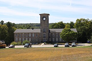
Windsor is a town in Windsor County, Vermont, United States. As the "Birthplace of Vermont", the town is where the Constitution of Vermont was adopted in 1777, thus marking the founding of the Vermont Republic, a sovereign state until 1791, when Vermont joined the United States. Over much of its history, Windsor was home to a variety of manufacturing enterprises. Its population was 3,559 at the 2020 census.

<span class="mw-page-title-main">Springfield, Vermont</span> Town in Vermont, United States

Springfield is a town in Windsor County, Vermont, United States. As of the 2020 census, the population was 9,062.

<span class="mw-page-title-main">Newbury (town), Vermont</span> Town in Vermont, United States

Newbury is a town in Orange County, Vermont, United States. The population was 2,293 at the 2020 census. Newbury includes the villages of Newbury, Center Newbury, West Newbury, South Newbury, Boltonville, Peach Four Corners, and Wells River.

<span class="mw-page-title-main">Clinton, Connecticut</span> Town in Connecticut, United States

Clinton is a town in Middlesex County, Connecticut, United States. The town is part of the Lower Connecticut River Valley Planning Region. The population of the town was 13,185 at the 2020 census. The town center along the shore line was listed as a census-designated place (CDP) by the U.S. Census Bureau in the 2020 census.

References

  1. 1 2 "U.S. Census website". United States Census Bureau . Retrieved January 31, 2008.
  2. "US Board on Geographic Names". United States Geological Survey. October 25, 2007. Retrieved January 31, 2008.
  3. "Census - Geography Profile: Thetford town, Orange County, Vermont" . Retrieved January 6, 2022.
  4. ISBN   1-16-503931-1 Summer in the girls camp, Anna Worthington Coale, Pg. 179-180
  5. The Story of Camp Fire Girls, 1910–1960; Helen Buckler, Mary F. Fiedler, Martha F. Allen; Holt, Rinehart and Winston; 1961
  6. Marshall, Edward (March 17, 1912). "Girls Take Up the Boy Scout Idea and Band Together" (PDF). New York Times. Retrieved January 29, 2009.
  7. DeLorme (1996). Vermont Atlas & Gazetteer. Yarmouth, Maine: DeLorme. ISBN   0-89933-016-9
  8. Town web site mentions six villages
  9. official map names villages
  10. "U.S. Decennial Census". United States Census Bureau. Retrieved May 16, 2015.
  11. "International Genealogical Index (IGI)," database, FamilySearch: accessed 2014-02-17, entry for Mills Olcott Burnham]

Further reading