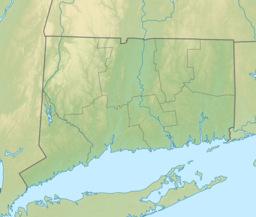
East Haddam is a town in Middlesex County, Connecticut. The town is part of the Lower Connecticut River Valley Planning Region. The population was 8,875 at the time of the 2020 census.

Moodus is a village in the town of East Haddam, Connecticut, United States. The village is the basis of a census-designated place (CDP) of the same name. The population of the CDP was 1,982 as of the census of 2020.

Colchester is a town in New London County, Connecticut, United States. The town is part of the Southeastern Connecticut Planning Region. The population was 15,555 at the 2020 census. In 2010 Colchester became the first town in Connecticut, and the 36th in the country, to be certified with the National Wildlife Federation as a Community Wildlife Habitat.
Summit Metro Parks is a Metroparks system serving the citizens of Summit County, Ohio by managing 14,000 acres (5,700 ha) in 16 developed parks, six conservation areas and more than 150 miles (240 km) of trails, with 22.4 miles (36.0 km) of the Ohio & Erie Canal Towpath Trail.
Swartswood State Park is a 3,460-acre (14.0 km2) protected area located in the Swartswood section of Stillwater and Hampton townships in Sussex County, New Jersey, in the United States. Established in 1915 by the state's Forest Park Reservation Commission, it was the first state park established by the state of New Jersey for the purposes of recreation at the state's third-largest freshwater lake. Today, Swartswood State Park is operated and maintained by the New Jersey Division of Parks and Forestry.

Lake Wawasee is a large, natural, freshwater lake southeast of Syracuse in Kosciusko County, Indiana. It is the largest natural lake within Indiana's borders.

The source of the Eightmile River is a swampy, undeveloped region in the town of East Haddam, Connecticut, centered between Ackley Road, Hall Kilbourne Road, Usher Swamp Road, and Miles Standish Road. The Eightmile River runs for 13.4 miles (21.6 km) to Hamburg Cove near Hamburg, Connecticut.

The Salmon River is formed at the confluence of the Blackledge and Jeremy rivers about one mile west of North Westchester, Connecticut. It drains 96,000 acres and courses for 10.4 miles (16.7 km) to Salmon Cove near Moodus where it flows into the Connecticut River. The Salmon River is probably the largest stream and watershed whose sources and mouth are entirely within the limits of Connecticut.

The Jeremy River, named after Jeremy Adams, begins at a drainage just north of Holbrook Pond about 1.5 miles (2.4 km) east of Gilead, Connecticut and runs for 10.7 miles (17.2 km) to the Salmon River in Colchester, Connecticut. There are many swamps and marshes along the banks of its northern end, the largest of which is 1.5 miles (2.4 km) long.

Besek Mountain also known as Black Mountain, est. 840 feet (260 m), is a traprock mountain ridge located 4.75 miles (7.6 km) southeast of Meriden, Connecticut. It is part of the narrow, linear Metacomet Ridge that extends from Long Island Sound near New Haven, Connecticut, north through the Connecticut River Valley of Massachusetts to the Vermont border. Besek Mountain is known for its 3-mile (4.8 km) long line of open cliffs, unique microclimate ecosystems, and rare plant communities. The mountain is traversed by the 51-mile (82 km) Mattabesett Trail, and is home to the Powder Ridge Ski Area.

Saltonstall Mountain, also known as Saltonstall Ridge, with a high point of (est.) 320 feet (98 m) above sea level, is a traprock mountain ridge located 3 miles (5 km) east of New Haven, Connecticut and 1.75 miles (2.8 km) north of Long Island Sound. It is part of the Metacomet Ridge that extends from Long Island Sound near New Haven, Connecticut, north through the Connecticut River Valley of Massachusetts to the Vermont border. Saltonstall Mountain is known for its 100 foot (30 m) scenic cliff faces and sharp ridgeline, unique microclimate ecosystems, rare plant communities, and for Lake Saltonstall, a 3 miles (5 km) long by 0.3 miles (400 m) wide municipal reservoir nearly enclosed by the mountain. Saltonstall Mountain is traversed by a number of hiking trails managed by the South Central Connecticut Regional Water Authority (SCCRWA) and Branford Land Trust.

Lake Sunapee is located within Sullivan County and Merrimack County in western New Hampshire, the United States. It is the fifth-largest lake located entirely in New Hampshire.
Hidden Lake is one of five villages located within the town of Haddam, Connecticut. It is governed by the bylaws of the Hidden Lake Association.

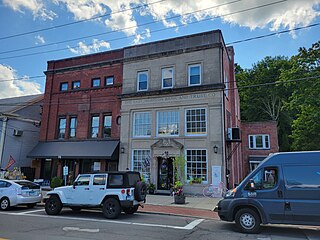
The Hayward House is a historic house at 9 Hayward Avenue in Colchester, Connecticut. Built in 1775 and embellished in the late 19th century, it is a well-preserved 18th-century house, which has seen a number of locally prominent residents, as well as the nationally known inventor Nathaniel Hayward, who developed the process of vulcanizing rubber. The house was listed on the National Register of Historic Places in 1972.

The New York Belting and Packing Co. complex, also known locally for its main 20th-century occupant, the Fabric Fire Hose Company, is a historic industrial complex at 45–71, 79-89 Glen Road in Newtown, Connecticut. Its centerpiece is a four-story brick mill building with an Italianate tower, built in 1856. The property also includes a dam impounding the adjacent Pootatuck River, a mill pond, and a hydroelectric power generation facility.
Pinewood Lake is a natural lake located northwest of 330 feet (100 m) tall Mischa Hill in the Nichols Farms Historic District section of Trumbull, Connecticut.

Colchester Rubber Co. was a footwear brand manufactured by the Colchester Rubber Company.
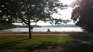
East Hampton is a town in Middlesex County, Connecticut, United States. The town is part of the Lower Connecticut River Valley Planning Region. The population was 12,717 at the 2020 census. The town center village is listed as a census-designated place (CDP). East Hampton includes the communities of Cobalt, Middle Haddam, and Lake Pocotopaug.

Nathaniel Manley Hayward was a US businessman and inventor best known for selling a patent to Charles Goodyear that Goodyear later used to develop the process of vulcanization.

Hopeville Pond State Park is a public recreation area located on Hopeville Pond, an impoundment of the Pachaug River, in the town of Griswold, Connecticut. A portion of the 554-acre (224 ha) state park occupies the site of the lost village of Hopeville. The park manager's house occupies Avery House, which is listed on the National Register of Historic Places. The park offers fishing, swimming, camping, and trails for hiking and biking. It is managed by the Connecticut Department of Energy and Environmental Protection.