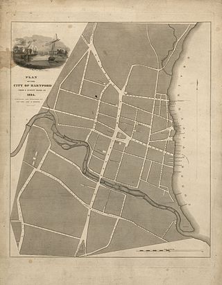
Hartford County is a county located in the north central part of the U.S. state of Connecticut. According to the 2020 census, the population was 899,498, making it the second-most populous county in Connecticut. Hartford County contains the city of Hartford, the state capital of Connecticut and the county's most populous city, with 121,054 residents at the 2020 census. Hartford County is included in the Hartford-East Hartford-Middletown metropolitan statistical area.

East Windsor is a town in Hartford County, Connecticut, United States. The town is part of the Capitol Planning Region. The population was 11,190 at the 2020 census. The town has five villages: Broad Brook, Melrose, Scantic, Warehouse Point and Windsorville.

Hampden is a town in Hampden County, Massachusetts, United States. The population was 4,966 at the 2020 census. It is part of the Springfield, Massachusetts Metropolitan Statistical Area. The namesake of Hampden is John Hampden, an English patriot.

Monson is a town in Hampden County, Massachusetts, United States. The population was 8,150 at the 2020 census. It is part of the Springfield, Massachusetts Metropolitan Statistical Area.

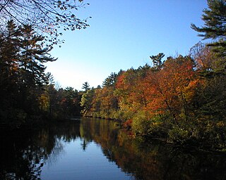
The Connecticut River is the longest river in the New England region of the United States, flowing roughly southward for 406 miles (653 km) through four states. It rises 300 yards south of the U.S. border with Quebec, Canada, and discharges at Long Island Sound. Its watershed encompasses 11,260 square miles (29,200 km2), covering parts of five U.S. states and one Canadian province, via 148 tributaries, 38 of which are major rivers. It produces 70% of Long Island Sound's fresh water, discharging at 18,400 cubic feet (520 m3) per second.


The Farmington River is a river, 46.7 miles (75.2 km) in length along its main stem, located in northwest Connecticut with major tributaries extending into southwest Massachusetts. The longest route of the river, from the origin of its West Branch, is 80.4 miles (129.4 km) long, making it the Connecticut River's longest tributary by 2.3 miles (3.7 km) over the major river directly to its north, the Westfield River. The Farmington River's watershed covers 609 square miles (1,580 km2). Historically, the river played an important role in small-scale manufacturing in towns along its course, but it is now mainly used for recreation and drinking water.

The Saxtons River is a 22.9-mile-long (36.9 km) river in the U.S. state of Vermont, a tributary of the Connecticut River. Its watershed covers 78 square miles (200 km2) and a range in altitude of 1,800 feet (550 m); land use is about 80% forested and 3% agricultural, and the upper river supports wild brook trout and brown trout, while Atlantic salmon occur but are usually limited to the area below Twin Falls on the lower river.
Ipswich River is a small river in northeastern Massachusetts, United States. It held significant importance in early colonial migrations inland from the ocean port of Ipswich. The river provided safe harborage at offshore Plum Island Sound to early Massachusetts subsistence farmers, who were also fishermen. A part of the river forms town boundaries and divides Essex County, Massachusetts on the coast from the more inland Middlesex County. It is 35 miles (56 km) long, and its watershed is approximately 155 square miles (401 km2), with an estimated population in the area of 160,000 people.
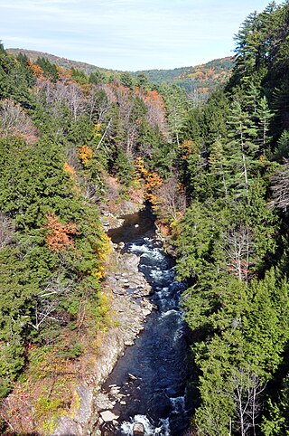
The Ottauquechee River is a 41.4-mile-long (66.6 km) river in eastern Vermont in the United States. It is a tributary of the Connecticut River, which flows to Long Island Sound.
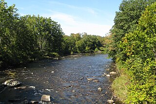
The Westfield River is a major tributary of the Connecticut River located in the Berkshires and Pioneer Valley regions of western Massachusetts. With four major tributary branches that converge west of the city of Westfield, it flows 78.1 miles (125.7 km) before its confluence with the Connecticut River at Agawam, across from the city of Springfield's Metro Center district. Known for its whitewater rapids and scenery, the Westfield River provides over 50 miles (80 km) of whitewater canoeing and kayaking, in addition to one of the largest roadless wilderness areas remaining in the Commonwealth.

The Millers River is a 52.1-mile-long (83.8 km) river in northern Massachusetts, originating in Ashburnham and joining the Connecticut River just downstream from Millers Falls, Massachusetts. Sections of the river are used for whitewater kayaking, and a section upriver is popular with flatwater racers, and the river is known locally as a good place for pike fishing.
The Burnshirt River is a 12.9-mile-long (20.8 km) stream in Worcester County, Massachusetts. It is a tributary of the Ware River, draining ultimately into the Connecticut River and thence the Long Island Sound.
The Quinebaug River is a river in south-central Massachusetts and eastern Connecticut, with watershed extending into western Rhode Island. The name "Quinebaug" comes from the southern New England Native American term, spelled variously Qunnubbâgge, Quinibauge, etc., meaning "long pond", from qunni-, "long", and -paug, "pond". The river is one of the namesake rivers in the Quinebaug and Shetucket Rivers Valley National Heritage Corridor.

The Black River is a 40.8-mile-long (65.7 km) river in the U.S. state of Vermont, and a tributary of the Connecticut River. The watershed, or drainage basin, consists of some 202 square miles (520 km2) in southeastern Vermont, almost all of which lies in Windsor County.

The Wood River is a river in the U.S. states of Connecticut and Rhode Island. It flows approximately 25 miles (40 km) and is a major tributary of the Pawcatuck River. There are 8 dams along the river's length.

The Williams River is a 27.0-mile (43.5 km) river in the US state of Vermont. It is a tributary of the Connecticut River. Its watershed covers 117 square miles; land use is about 80% forested and 4% agricultural, and the upper river supports wild brook trout and brown trout.

The Pequonnock River is a 16.7-mile-long (26.9 km) waterway in eastern Fairfield County, Connecticut. Its watershed is located in five communities, with the majority of it located within Monroe, Trumbull, and Bridgeport. The river has a penchant for flooding, particularly in spring since the removal of a retention dam in Trumbull in the 1950s. There seems to be a sharp difference of opinion among historians as to just what the Indian word Pequonnock signifies. Some insist it meant cleared field or open ground; others are sure it meant broken ground; while a third group is certain it meant place of slaughter or place of destruction.

The Green River is a tributary of the Deerfield River in southern Vermont and northwestern Massachusetts in the United States.