Rocky Hill, Connecticut

Last updated

Rocky Hill, Connecticut
Town of Rocky Hill
Dinosaur State Park (Rocky Hill, CT) - dome.JPG
RockyHillCTseal.JPG
Rocky Hill CT lg.PNG
Capitol Region incorporated and unincorporated areas Rocky Hill highlighted.svg
Rocky Hill, Connecticut
Coordinates: 41°39′26″N72°39′36″W / 41.65722°N 72.66000°W / 41.65722; -72.66000
CountryFlag of the United States.svg  United States
U.S. state Flag of Connecticut.svg  Connecticut
County Hartford
Region Capitol Region
Incorporated1843
Government
  Type Council-manager
  Town managerRaymond Carpentino
  Town CouncilMayor:
Lisa Marotta (R)
Deputy Mayor:
Allan Greenspan (R)
Town Councilors:
David Sevigny (R)
Jeffrey Levine (R)
Pankaj Prakash (R)
Francis Whelan III (R)
John Emmanuel (D)
William O'Sullivan (D)
Mimi Lifshitz-Theroux (D)
Area
  Total13.8 sq mi (35.8 km2)
  Land13.4 sq mi (34.8 km2)
  Water0.4 sq mi (1.0 km2)
Elevation
223 ft (68 m)
Population
 (2020)
  Total20,845
  Density1,500/sq mi (580/km2)
Time zone UTC−5 (Eastern)
  Summer (DST) UTC−4 (Eastern)
ZIP Code
06067
Area code(s) 860/959
FIPS code 09-65370
GNIS feature ID0213497
Interstates I-91.svg
U.S. Routes Connecticut Highway 3.svg Connecticut Highway 99.svg Connecticut Highway 160.svg
Website www.rockyhillct.gov

Rocky Hill is a town in Hartford County, Connecticut, United States. The town is part of the Capitol Planning Region. The population was 20,845 at the 2020 census. [1] It was originally land of the Wangunks (a tribe of Native Americans). Europeans began to settle the area of Rocky Hill in 1650, as part of Wethersfield, the neighboring town to the north. In 1722, the area became known as Stepney Parish, until it was independently incorporated in 1843. [2] Rocky Hill’s location on the Connecticut River made it a natural port for Wethersfield and an early center for shipbuilding, agriculture, and trade.

Contents

Rocky Hill is a typical bedroom community, as many residents commute to work in the larger urban centers of Hartford to the north and New Haven to the south.

Rocky Hill is the home to the Dinosaur State Park. Rocky Hill also was once the headquarters of Ames Department Stores, which ceased business operations in 2002.

Geography

According to the United States Census Bureau, the town has a total area of 13.8 square miles (35.8 km2), of which 13.4 square miles (34.8 km2) is land and 0.39 square miles (1.0 km2) (2.78%) is water. [3]

Bordering Rocky Hill to the north is Wethersfield, with Newington to the northwest, Berlin to the southwest, and Cromwell to the south. The Connecticut River forms the eastern border. Interstate 91 runs through the town with exits at the two main local highways, Route 3 at exit 23 and Route 99 at exit 24. Route 3 travels from Cromwell through Rocky Hill into Wethersfield, eventually crossing the Connecticut River into Glastonbury. The north-south Route 99 parallels the Connecticut River for the length of town.

The town of Rocky Hill is named after the ridge along the Connecticut River in the northeastern section that is now Rocky Hill Quarry Park.

Demographics

Historical population
YearPop.±%
18501,042    
18601,102+5.8%
1870971−11.9%
18801,108+14.1%
18901,069−3.5%
19001,026−4.0%
19101,187+15.7%
19201,633+37.6%
19302,021+23.8%
19402,679+32.6%
19505,108+90.7%
19607,404+44.9%
197011,103+50.0%
198014,559+31.1%
199016,554+13.7%
200017,966+8.5%
201019,709+9.7%
202020,845+5.8%
Source: [4]

As of the 2000 Census, Rocky Hill had a population of 17,966 in 7,557 households, with 4,519 families residing in the town. The population density was 1,335.4 inhabitants per square mile (515.6/km2). There were 7,962 housing units at an average density of 591.8 per square mile (228.5/km2). The racial makeup of the town was 90.20% White, 3.42% African American, 0.11% Native American, 3.97% Asian, 0.03% Pacific Islander, 1.01% from other races, and 1.27% from two or more races. Hispanic or Latino people of any race were 3.20% of the population.

There were 7,557 households, out of which 24.9% had children under the age of 18 living with them, 48.9% were married couples living together, 7.9% had a female householder with no husband present, and 40.2% were non-families. Of all households 32.5% were made up of individuals, and 9.7% had someone living alone who was 65 years of age or older. The average household size was 2.26 and the average family size was 2.93.

In terms of age, 19.7% of the population were under the age of 18, 6.1% were between 18 and 24, 31.9% were 25 to 44, 25.8% were 45 to 64, and 16.5% were 65 or older. The median age was 41 years. For every 100 females, there were 97.6 males. For every 100 females age 18 and over, there were 95.7 males.

The median household income in the town was $60,247, and the median income for a family was $72,726. Males had a median income of $48,555 versus $39,625 for females. The per capita income for the town was $29,701. About 1.2% of families and 2.9% of the population were below the poverty line, including 1.8% of those under age 18 and 3.0% of those age 65 or over.

Education

Rocky Hill High School has a student body of approximately 800 students. Albert D. Griswold Middle School enrolls about 600 students. Moser Intermediate School enrolls about 500 students. Stevens Elementary School enrolls about 500 students. West Hill Elementary School enrolls around 525 students.

Government

Rocky Hill is currently governed under the Council-Manager form of government. The Town Council is the legislative body for the Town of Rocky Hill, and eight members are elected to serve two year terms. The Mayor, elected separately, is a member and presiding official of the Council with the power to vote.

Rocky Hill town vote
by party in presidential elections [5]
Year Democratic Republican Third Parties
2020 55.89%6,11542.69% 4,6701.42% 155
2016 51.74%5,09044.02% 4,3314.24% 417
2012 55.57%5,17343.29% 4,0301.14% 106
2008 59.27%5,95739.31% 3,9511.42% 143
2004 56.21%5,48842.33% 4,1331.46% 143
2000 59.96%5,18437.51% 3,2432.53% 219
1996 56.19%4,64031.90% 2,63411.91% 983
1992 43.31%4,09134.60% 3,26922.09% 2,087
1988 50.46%4,05248.71% 3,9110.83% 67
1984 40.10% 3,15959.47%4,6850.43% 34
1980 42.91%3,18741.12% 3,05415.97% 1,186
1976 49.00% 3,35250.46% 3,4520.54% 37
1972 43.43% 2,49355.84%3,2060.73% 42
1968 53.53%2,61640.64% 1,9865.83% 285
1964 70.07%2,65729.93% 1,1350.00% 0
1960 54.22%1,89445.78% 1,5990.00% 0
1956 37.16% 1,07762.84%1,8210.00% 0
1952 42.59% 1,12657.26%1,5140.15% 4
1948 48.35% 83550.55%8731.10% 19
1944 47.21% 70252.79%7850.00% 0
1940 46.28% 59853.72%6940.00% 0
1936 45.52% 40654.48%4860.00% 0
1932 35.64% 25864.36%4660.00% 0
1928 30.55% 21668.74%4860.71% 5
1924 30.00% 12667.38%2832.62% 11
1920 30.55% 21668.74%4860.71% 5
1916 42.58% 10955.47%1421.95% 5
1912 38.71% 9643.55%10817.74% 44
1908 31.34% 6868.20%1480.46% 1
1904 35.65% 8263.48%1460.87% 2
1900 38.89% 9160.26%1410.85% 2

Federal

Congressional Representatives [6] [7]
RepresentativeChamberParty
Richard Blumenthal SenateDem
Chris Murphy SenateDem
John Larson House of RepresentativesDem

State

General Assembly Representatives [7]
RepresentativeChamberDistrictParty
Matthew Lesser Senate9thDem
Kerry Wood House of Representatives29thDem

Town Council

Members of the Rocky Hill Town Council [8]
NameSeatParty
Lisa J. MarottaMayorRep
John EmmanuelSeat 1Dem
Francis Whelan IIISeat 2Rep
Allan GreenspanSeat 3Rep
Jeffrey LevineSeat 4Rep
David SevignySeat 5Rep
William O'SullivanSeat 6Dem
Pankaj PrakashSeat 7Rep
Mimi TherouxSeat 8Dem

Economy

Top employers

Top employers in Rocky Hill according to the town's 2022 Comprehensive Annual Financial Report [9]

#Employer# of Employees
1Town of Rocky Hill534
2 SYSCO Food Services 500
3Henkel Corporation490
4State Veterans Home and Hospital422
5 Liberty Mutual 315
6AECOM Technical Services305
7Burris Logistics300
8 Meredith Corporation 200
9 Walmart 200
10 Sheraton Hotel 180

Points of interest

Related Research Articles

<span class="mw-page-title-main">Kent, Connecticut</span> Town in Connecticut, United States

Kent is a town in Litchfield County, Connecticut, United States. Located alongside the border with New York, the town's population was 3,019 according to the 2020 census. The town is part of the Northwest Hills Planning Region. Kent is home to three boarding schools: Kent School, the Marvelwood School, and South Kent School. The Schaghticoke Indian Reservation is also located within town borders. The town was also home to former U.S. Secretary of State Henry Kissinger.

<span class="mw-page-title-main">Hartford County, Connecticut</span> County in Connecticut, United States

Hartford County is a county located in the north central part of the U.S. state of Connecticut. According to the 2020 census, the population was 899,498, making it the second-most populous county in Connecticut. Hartford County contains the city of Hartford, the state capital of Connecticut and the county's most populous city, with 121,054 residents at the 2020 census. Hartford County is included in the Hartford-East Hartford-Middletown metropolitan statistical area.

<span class="mw-page-title-main">Berlin, Connecticut</span> Town in Connecticut, United States

Berlin is a town in the Capitol Planning Region, Connecticut, United States. The population was 20,175 at the 2020 census. It was incorporated in 1785. The geographic center of Connecticut is located in the town. Berlin is residential and industrial, and is served by the Amtrak station of the same name. Berlin also has two hamlets: Kensington and East Berlin.

<span class="mw-page-title-main">East Windsor, Connecticut</span> Town in Connecticut, United States

East Windsor is a town in Hartford County, Connecticut, United States. The town is part of the Capitol Planning Region. The population was 11,190 at the 2020 census. The town has five villages: Broad Brook, Melrose, Scantic, Warehouse Point and Windsorville.

<span class="mw-page-title-main">Glastonbury, Connecticut</span> Town in Connecticut, United States

Glastonbury is a town in the Capitol Planning Region, Connecticut, United States, formally founded in 1693 and first settled in 1636. It was named after Glastonbury in Somerset, England. Glastonbury is on the banks of the Connecticut River, 7 miles (11 km) southeast of Hartford. The town center is defined by the U.S. Census Bureau as a census-designated place (CDP). The population was 35,159 at the 2020 census.

<span class="mw-page-title-main">Marlborough, Connecticut</span> Town in Connecticut, United States

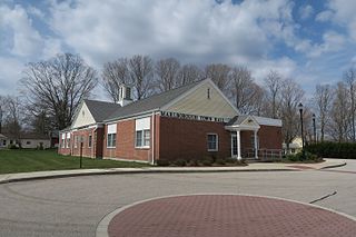
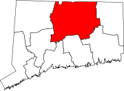
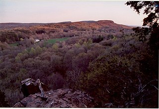
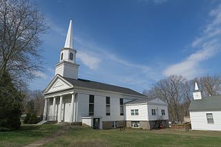
Marlborough is a town in Hartford County, Connecticut, United States. It contains the census-designated place (CDP) of Terramuggus. The town is part of the Capitol Planning Region. The town's population was 6,133 at the 2020 census. Marlborough is a suburban and rural community. The local high school is RHAM High School. In 2013, Marlborough ranked third in Connecticut Magazine's biannual ranking of Connecticut small towns. Educationally, RHAM High School, which serves Marlborough, Hebron, and Andover students, is one of the top-ranked regional high schools in the state on the SAT in 2017, and 11th highest-performing school in the state on the test. The town is home to Elmer Theines-Mary Hall elementary school which serves Pre-K through 6th grade. The school scores above state average on standardized testing and student progress.

<span class="mw-page-title-main">South Windsor, Connecticut</span> Town in Connecticut, United States

South Windsor is a town in Hartford County, Connecticut, United States. The town is part of the Capitol Planning Region. The population was 26,918 at the 2020 census.

<span class="mw-page-title-main">Thompsonville, Connecticut</span> Census-designated place in Connecticut, United States

Thompsonville is a census-designated place (CDP) in the town of Enfield in Hartford County, Connecticut, United States. The population of the CDP was 8,577 at the 2010 census.

<span class="mw-page-title-main">Barkhamsted, Connecticut</span> Town in Connecticut, United States

Barkhamsted is a town in Litchfield County, Connecticut, United States. It contains seven villages: West Hill, Mallory, Barkhamsted Center, Center Hill, Washington Hill, Pleasant Valley, and Riverton. The population was 3,647 at the 2020 census, down from 3,799 at the 2010 census. The town is part of the Northwest Hills Planning Region. Barkhamsted was first incorporated in 1779, and named after Berkhamsted, Hertfordshire, England.

<span class="mw-page-title-main">Harwinton, Connecticut</span> Town in Connecticut, United States

Harwinton is a town in Litchfield County, Connecticut, United States. The population was 5,484 at the 2020 census. The town is part of the Northwest Hills Planning Region. The high school is Lewis S. Mills.

<span class="mw-page-title-main">New Hartford, Connecticut</span> Town in Connecticut, United States

New Hartford is a town in Litchfield County, Connecticut, United States. The population was 6,658 at the 2020 census. The town is part of the Northwest Hills Planning Region. The town center is defined by the U.S. Census Bureau as the New Hartford Center census-designated place (CDP). The town is mainly a rural community consisting of farms, homes, and parks. Brodie Park and Ski Sundown are located in New Hartford.

<span class="mw-page-title-main">Watertown, Connecticut</span> Town in Connecticut, United States

Watertown is a town in Litchfield County, Connecticut, United States. The town is part of the Naugatuck Valley Planning Region. The population was 22,105 at the 2020 census. The ZIP Codes for Watertown are 06795 and 06779. It is a suburb of Waterbury. The urban center of the town is the Watertown census-designated place, with a population of 3,938 at the 2020 census.

<span class="mw-page-title-main">Winchester, Connecticut</span> Town in Connecticut, United States

Winchester is a town in Litchfield County, Connecticut, United States. The population was 10,224 at the 2020 census. The city of Winsted is located in Winchester. The town is part of the Northwest Hills Planning Region.

<span class="mw-page-title-main">Andover, Connecticut</span> Town in Connecticut, United States

Andover is a rural town in the Capitol Planning Region, Connecticut, United States, roughly 10 miles east of Hartford. The population was 3,151 at the 2020 census.

<span class="mw-page-title-main">Monson, Massachusetts</span> Town in Massachusetts, United States

Monson is a town in Hampden County, Massachusetts, United States. The population was 8,150 at the 2020 census. It is part of the Springfield, Massachusetts Metropolitan Statistical Area.

<span class="mw-page-title-main">Wethersfield, New York</span> Town in New York, United States

Wethersfield is an incorporated town in Wyoming County, New York. The population was 891 at the time of the 2000 census. The Town of Wethersfield is centrally located in the county.

<span class="mw-page-title-main">Wethersfield, Connecticut</span> Town in Connecticut, United States

Wethersfield is a town located in Hartford County, Connecticut, United States. It is located immediately south of Hartford along the Connecticut River. The town is part of the Capitol Planning Region. The population was 27,298 at the time of the 2020 census.

<span class="mw-page-title-main">Glastonbury Center, Connecticut</span> Census-designated place in Connecticut, United States

Glastonbury Center is a census-designated place (CDP) that constitutes the densely populated center of the town of Glastonbury in Hartford County, Connecticut, United States. The population was 7,387 at the 2010 census, out of a total town population of 34,427.

<span class="mw-page-title-main">Portland, Connecticut</span> Town in Connecticut, United States

Portland is a town in Middlesex County, Connecticut, United States. The town is part of the Lower Connecticut River Valley Planning Region. The population was 9,384 at the 2020 census. The town center is listed as a census-designated place (CDP). It is situated across the Connecticut River from Middletown.

<span class="mw-page-title-main">Manchester (CDP), Connecticut</span> Census-designated place in Connecticut, United States

Manchester is a census-designated place (CDP) in Hartford County, Connecticut, United States, comprising the urban center of the town of Manchester. As of the 2010 census, the population of the CDP was 30,577, out of 58,241 in the entire town.

References

  1. "Census - Geography Profile: Rocky Hill town, Hartford County, Connecticut". United States Census Bureau . Retrieved December 20, 2021.
  2. The Connecticut Magazine: An Illustrated Monthly. Connecticut Magazine Company. 1903. p. 334.
  3. "Geographic Identifiers: 2010 Demographic Profile Data (G001): Rocky Hill town, Hartford County, Connecticut". U.S. Census Bureau, American Factfinder. Archived from the original on February 12, 2020. Retrieved November 28, 2012.
  4. "Connecticut State Register & Manual". Archived from the original on September 13, 2005. Retrieved November 5, 2011.
  5. "Connecticut Election Results Archive" . Retrieved January 30, 2024.
  6. "Connecticut Senators". United States Senate. Retrieved January 30, 2024.
  7. 1 2 "Representative Districts by Town". CT General Assembly. Retrieved January 30, 2024.
  8. "List of Rocky Hill Town Council Members" . Retrieved January 30, 2024.
  9. "Town of Rocky Hill Comprehensive Annual Financial Report For the Fiscal Year Ended June 30, 2022". Town of Rocky Hill. Retrieved August 13, 2023.
  10. "History of Connecticut Veteran's Home"
  11. "Locations".